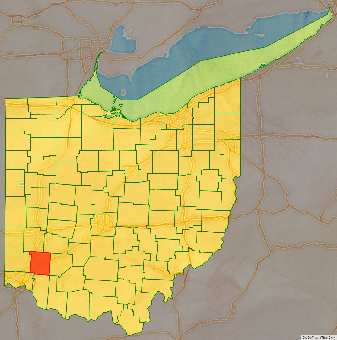
Warren County is a county located in the southwestern part of the U.S. state of Ohio. As of the 2020 census, the population was 242,337. Its county seat is Lebanon. The county is one of Ohio’s most affluent, with the county median income the highest of Ohio’s 88 counties. The county was established on May 1, 1803 from Hamilton County; it is named for Dr. Joseph Warren, a hero of the Revolution who sent Paul Revere and the overlooked William Dawes on their famous rides and who died at the Battle of Bunker Hill. Warren County is part of the Cincinnati, OH-KY-IN Metropolitan Statistical Area.
| Name: | Warren County |
|---|---|
| FIPS code: | 39-165 |
| State: | Ohio |
| Founded: | May 1, 1803 |
| Named for: | Dr. Joseph Warren |
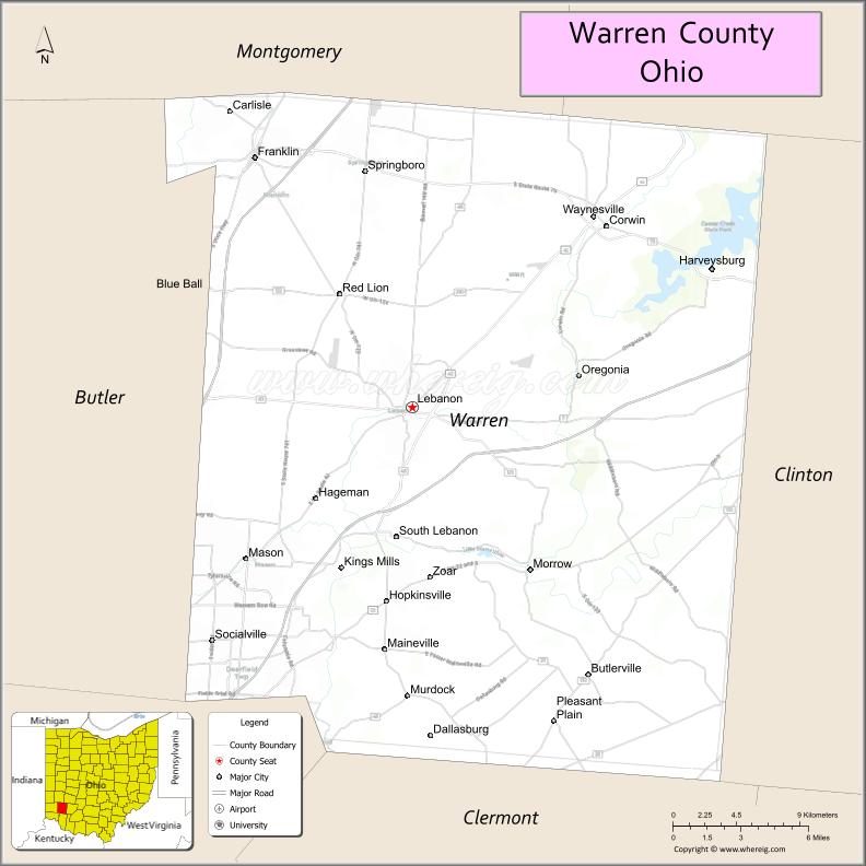
| Seat: | Lebanon |
| Largest city: | Mason |
| Total Area: | 407 sq mi (1,050 km²) |
| Land Area: | 401 sq mi (1,040 km²) |
| Total Population: | 242,337 |
| Population Density: | 600/sq mi (230/km²) |
| Time zone: | UTC−5 (Eastern) |
| Summer Time Zone (DST): | UTC−4 (EDT) |
| Website: | www.co.warren.oh.us |
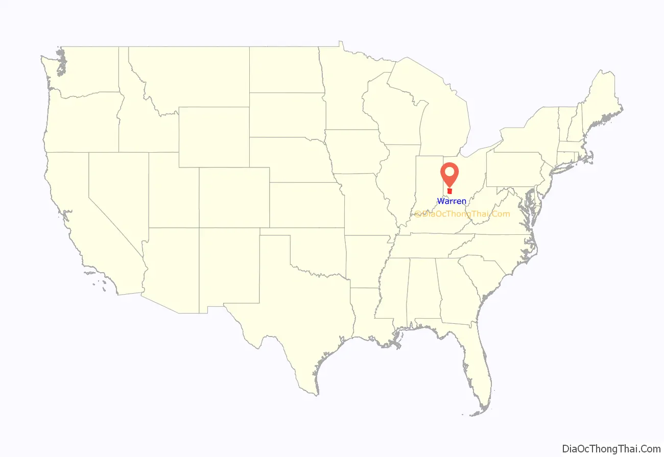
Warren County location map. Where is Warren County?
History
Warren County was established in 1803. The first non-Native American settlers were migrants from New England. During the election of 1860 Abraham Lincoln received 60% of the vote in Warren County, and in 1864 he was reelected with 70% of the vote in the county. From that time on the county was a stronghold of the Republican party, with Ulysses S. Grant going on to carry the county by large margins in both 1868 and 1872.
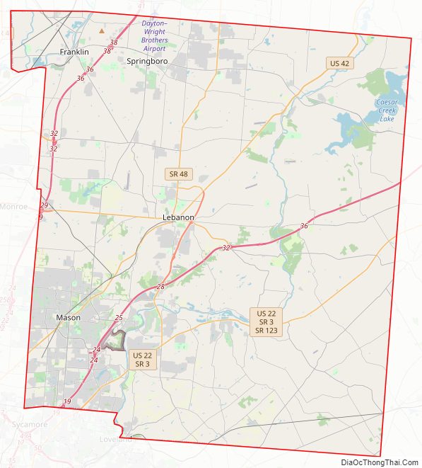
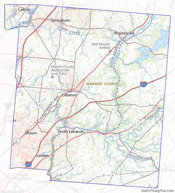
Warren County Road Map
Geography
According to the United States Census Bureau, the county has a total area of 407 square miles (1,050 km), of which 401 square miles (1,040 km) is land and 6.0 square miles (16 km) (1.5%) is water. The county is a rough square with the sides roughly 20 miles (30 km) long.
Adjacent counties
- Montgomery County (northwest)
- Greene County (northeast)
- Clinton County (east)
- Clermont County (south)
- Hamilton County (southwest)
- Butler County (west)
Boundaries
Warren County was created by the first Ohio General Assembly in the Act of March 24, 1803, which also created Butler and Montgomery Counties. The act defined Warren County as “all that part of the county of Hamilton included within the following bounds, viz.: Beginning at the northeast corner of the county of Clermont, running thence west with the line of said county to the Little Miami; thence up the same with the meanders thereof to the north boundary of the first tier of sections in the second entire range of townships in the Miami Purchase; thence west to the northeast corner of Section No. 7 in the third township of the aforesaid range; thence north to the Great Miami; thence up the same to the middle of the fifth range of townships; thence east to the County line; thence with same south to the place of beginning.” Originally this included land now in Clinton County as far east as Wilmington.
Clinton County proved a continuing headache to the legislature. The Ohio Constitution requires that every county have an area of at least four hundred square miles (1,036 km). Clinton County’s boundaries were several times adjusted in an effort to comply with that clause of the constitution. One of them, the Act of January 30, 1815, detached a strip of land from the eastern side to give to Clinton. That would have left Warren under four hundred square miles (1,036 km), so a portion of Butler County (the part of Franklin Township where Carlisle is now located) was attached to Warren in compensation. The 1815 act was as follows:
- Section 1—That all that part of the county of Butler lying and being within the first and second fractional townships in the fifth range, and adjoining the south line of Montgomery County, shall be and the same is hereby attached to and made part of the county of Warren.
- Section 2—That eleven square miles 28 km of the territory of the county of Warren and extending parallel to the said eastern boundary of Warren County, along the whole length of such eastern boundary from north to south, shall be and the same is hereby attached to and made a part of the county of Clinton.”
Except for the sections formed by the Great and Little Miamis, the sides are all straight lines.
Lakes and rivers
The major rivers of the county are the Great Miami River, which flows through the northwest corner of the county in Franklin Township, and the Little Miami River which zig-zags across the county from north to south. There is one sizable lake, the Caesars Creek Reservoir, created by a U.S. Army Corps of Engineers dam on Caesars Creek in the northeast part of the county in Massie Township.
Warren County Topographic Map
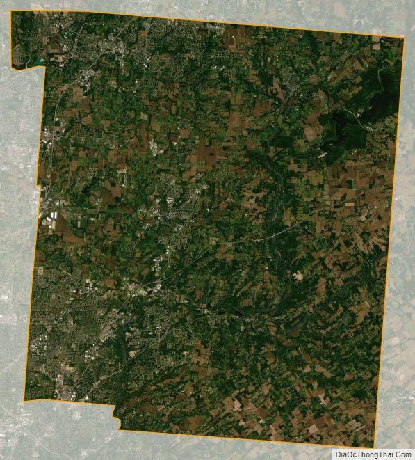
Warren County Satellite Map
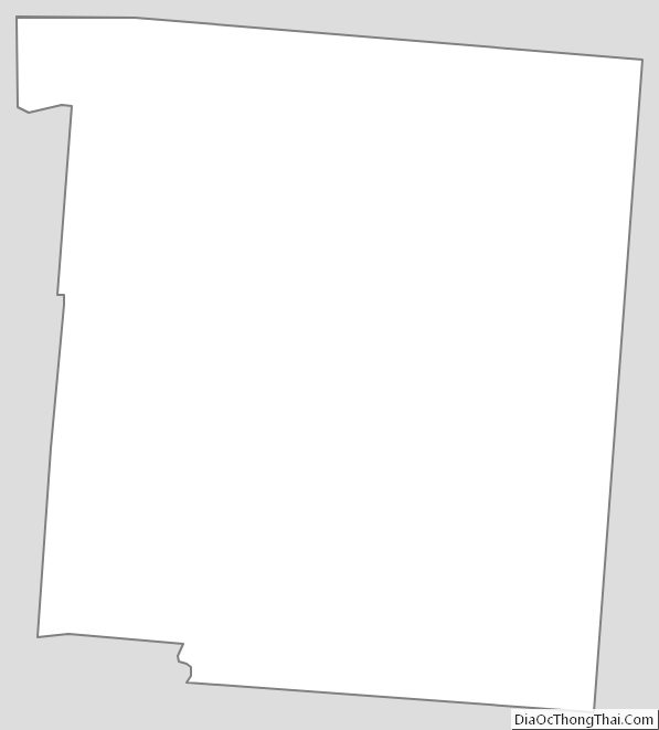
Warren County Outline Map
See also
Map of Ohio State and its subdivision:- Adams
- Allen
- Ashland
- Ashtabula
- Athens
- Auglaize
- Belmont
- Brown
- Butler
- Carroll
- Champaign
- Clark
- Clermont
- Clinton
- Columbiana
- Coshocton
- Crawford
- Cuyahoga
- Darke
- Defiance
- Delaware
- Erie
- Fairfield
- Fayette
- Franklin
- Fulton
- Gallia
- Geauga
- Greene
- Guernsey
- Hamilton
- Hancock
- Hardin
- Harrison
- Henry
- Highland
- Hocking
- Holmes
- Huron
- Jackson
- Jefferson
- Knox
- Lake
- Lake Erie
- Lawrence
- Licking
- Logan
- Lorain
- Lucas
- Madison
- Mahoning
- Marion
- Medina
- Meigs
- Mercer
- Miami
- Monroe
- Montgomery
- Morgan
- Morrow
- Muskingum
- Noble
- Ottawa
- Paulding
- Perry
- Pickaway
- Pike
- Portage
- Preble
- Putnam
- Richland
- Ross
- Sandusky
- Scioto
- Seneca
- Shelby
- Stark
- Summit
- Trumbull
- Tuscarawas
- Union
- Van Wert
- Vinton
- Warren
- Washington
- Wayne
- Williams
- Wood
- Wyandot
- Alabama
- Alaska
- Arizona
- Arkansas
- California
- Colorado
- Connecticut
- Delaware
- District of Columbia
- Florida
- Georgia
- Hawaii
- Idaho
- Illinois
- Indiana
- Iowa
- Kansas
- Kentucky
- Louisiana
- Maine
- Maryland
- Massachusetts
- Michigan
- Minnesota
- Mississippi
- Missouri
- Montana
- Nebraska
- Nevada
- New Hampshire
- New Jersey
- New Mexico
- New York
- North Carolina
- North Dakota
- Ohio
- Oklahoma
- Oregon
- Pennsylvania
- Rhode Island
- South Carolina
- South Dakota
- Tennessee
- Texas
- Utah
- Vermont
- Virginia
- Washington
- West Virginia
- Wisconsin
- Wyoming