Waseca County (/wəˈsiːkə/) is a county in the U.S. state of Minnesota. As of the 2020 census, the population was 18,968. Its county seat is Waseca.
| Name: | Waseca County |
|---|---|
| FIPS code: | 27-161 |
| State: | Minnesota |
| Founded: | February 27, 1857 |
| Named for: | Waseca (settlement) |
| Seat: | Waseca |
| Largest city: | Waseca |
| Total Area: | 433 sq mi (1,120 km²) |
| Land Area: | 423 sq mi (1,100 km²) |
| Total Population: | 18,968 |
| Population Density: | 44.8/sq mi (17.3/km²) |
| Time zone: | UTC−6 (Central) |
| Summer Time Zone (DST): | UTC−5 (CDT) |
| Website: | www.co.waseca.mn.us |
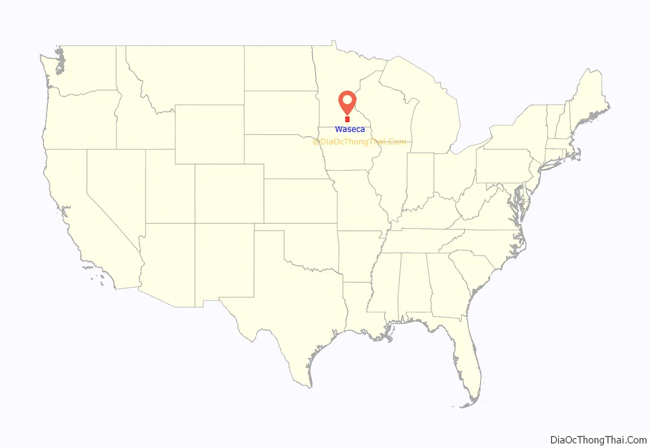
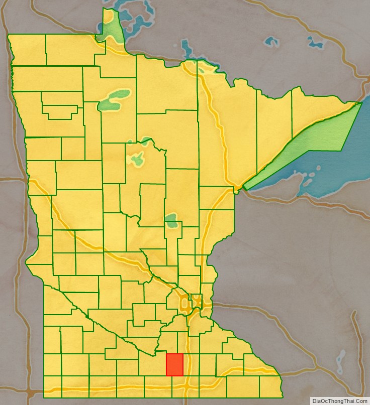
Waseca County location map. Where is Waseca County?
History
In 1849, the newly organized Minnesota Territory legislature authorized nine counties across the territory. One of those, Dakota, was partially subdivided in 1853 to create Blue Earth, Le Sueur, and Rice counties. In 1855, parts of those counties were partitioned to create Steele. On February 27, 1857, the territorial legislature authorized partitioning western Steele County to create Waseca County, with its seat at Wilton, a settlement which began in 1854. The county name was taken from the area’s first farming settlement, started in 1855, near the present location of the city of Waseca. That settlement name came from the Dakota word meaning “rich,” a reference to the fertile soil in the area.
The Winona and Saint Peter Railroad line past the town of Waseca was completed in the latter half of the 1860s, causing the town to bloom. By 1870 the vote was taken to relocate the county seat to that settlement.
Waseca County’s boundaries have not changed since its creation.
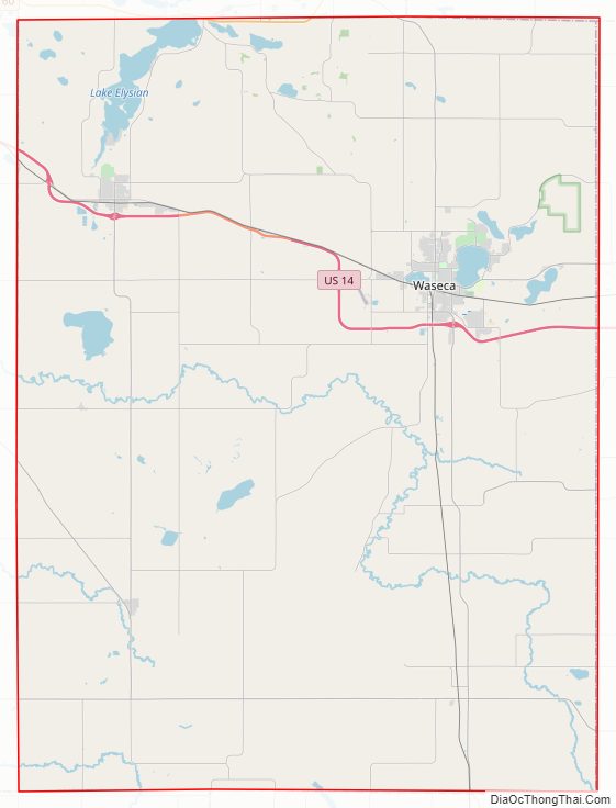
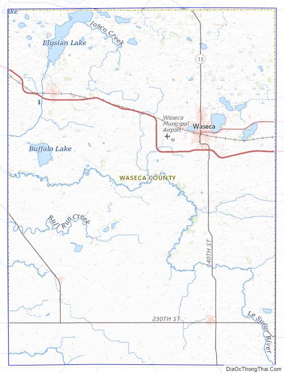
Waseca County Road Map
Geography
The Le Sueur River flows westward through the county toward its confluence with the Blue Earth River in Blue Earth County. It is augmented by the Little Le Sueur, which drains the southeast part of the county. Bull Run Creek flows westward from Silver Lake through the lower central part of the county into Blue Earth County; the Little Cobb River rises in southern Waseca County and flows westward into Blue Earth County to its confluence with the Cobb River.
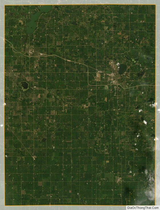
The county terrain consists of low rolling hills, carved by drainages and dotted with lakes. The area is devoted to agriculture wherever possible. The terrain slopes to the north and west, with its highest point near its southeast corner, at 1,240′ (378m) ASL. The county has an area of 433 square miles (1,120 km), of which 423 square miles (1,100 km) is land and 9.6 square miles (25 km) (2.2%) is water.
Waseca is one of seven southern Minnesota counties that have no forest ecosystems, only prairie and savanna soils.
Major highways
- U.S. Highway 14
- Minnesota State Highway 13
- Minnesota State Highway 30
- Minnesota State Highway 60 (runs along north border of county only)
- Minnesota State Highway 83
- Minnesota State Highway 230
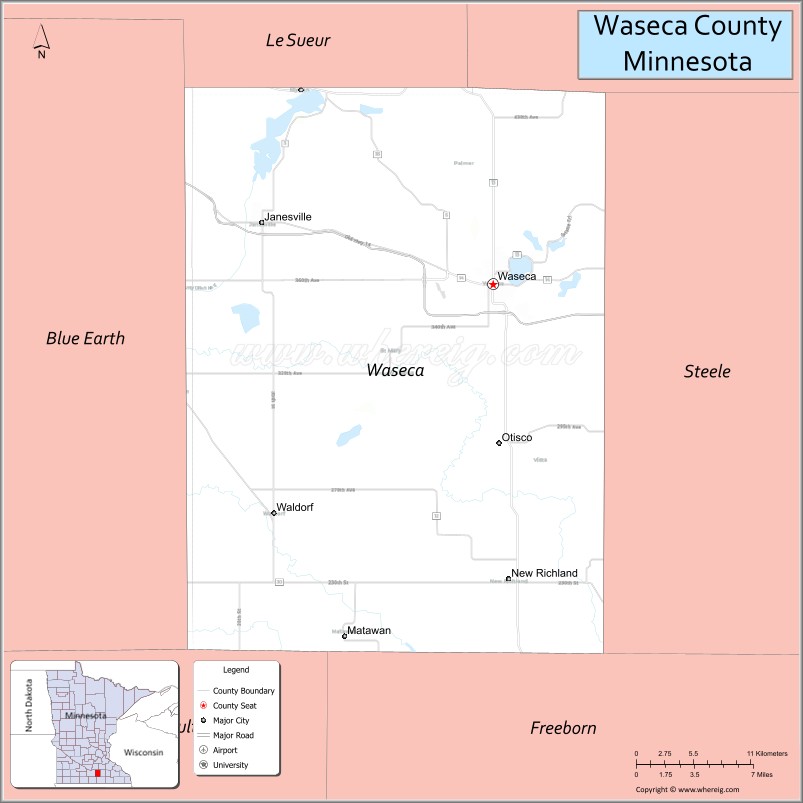
Adjacent counties
- Rice County – northeast
- Steele County – east
- Freeborn County – southeast
- Faribault County – southwest
- Blue Earth County – west
- Le Sueur County – northwest
Protected areas
- Findley State Wildlife Management Area
- Kanne State Wildlife Management Area
- Moonan State Wildlife Management Area
- Mueller State Wildlife Management Area
- Senn-Rich State Wildlife Management Area
- Teal State Wildlife Management Area
- Waseca State Wildlife Management Area
Lakes
- Buffalo Lake
- Clear Lake
- Everson Lake
- Goose Lake
- Hayes Lake
- Knutsen Lake
- Lake Elysian (part)
- Lilly Lake
- Lily Lake (part)
- Loon Lake
- Mott Lake
- Reeds Lake
- Reese Lake
- Rice Lake (Janesville Township)
- Rice Lake (Woodville Township)
- Saint Olaf Lake
- Sibert Lake
- Silver Lake
- Toners Lake
- Trenton Lake (part)
- Watkins Lake
Waseca County Topographic Map
Waseca County Satellite Map
Waseca County Outline Map

See also
Map of Minnesota State and its subdivision:- Aitkin
- Anoka
- Becker
- Beltrami
- Benton
- Big Stone
- Blue Earth
- Brown
- Carlton
- Carver
- Cass
- Chippewa
- Chisago
- Clay
- Clearwater
- Cook
- Cottonwood
- Crow Wing
- Dakota
- Dodge
- Douglas
- Faribault
- Fillmore
- Freeborn
- Goodhue
- Grant
- Hennepin
- Houston
- Hubbard
- Isanti
- Itasca
- Jackson
- Kanabec
- Kandiyohi
- Kittson
- Koochiching
- Lac qui Parle
- Lake
- Lake of the Woods
- Lake Superior
- Le Sueur
- Lincoln
- Lyon
- Mahnomen
- Marshall
- Martin
- McLeod
- Meeker
- Mille Lacs
- Morrison
- Mower
- Murray
- Nicollet
- Nobles
- Norman
- Olmsted
- Otter Tail
- Pennington
- Pine
- Pipestone
- Polk
- Pope
- Ramsey
- Red Lake
- Redwood
- Renville
- Rice
- Rock
- Roseau
- Saint Louis
- Scott
- Sherburne
- Sibley
- Stearns
- Steele
- Stevens
- Swift
- Todd
- Traverse
- Wabasha
- Wadena
- Waseca
- Washington
- Watonwan
- Wilkin
- Winona
- Wright
- Yellow Medicine
- Alabama
- Alaska
- Arizona
- Arkansas
- California
- Colorado
- Connecticut
- Delaware
- District of Columbia
- Florida
- Georgia
- Hawaii
- Idaho
- Illinois
- Indiana
- Iowa
- Kansas
- Kentucky
- Louisiana
- Maine
- Maryland
- Massachusetts
- Michigan
- Minnesota
- Mississippi
- Missouri
- Montana
- Nebraska
- Nevada
- New Hampshire
- New Jersey
- New Mexico
- New York
- North Carolina
- North Dakota
- Ohio
- Oklahoma
- Oregon
- Pennsylvania
- Rhode Island
- South Carolina
- South Dakota
- Tennessee
- Texas
- Utah
- Vermont
- Virginia
- Washington
- West Virginia
- Wisconsin
- Wyoming