Washington County is a regional economic, educational, and cultural hub in the Northwest Arkansas region. Created as Arkansas’s 17th county on November 30, 1848, Washington County has 13 incorporated municipalities, including Fayetteville, the county seat, and Springdale. The county is also the site of small towns, bedroom communities, and unincorporated places. The county is named for George Washington, the first President of the United States.
Located within the Ozark Mountains, the county is roughly divided into two halves: the rolling Springfield Plateau in the more populous north of the county and the steeper, forested Boston Mountains in the much less populated south. It contains three segments of the Ozark National Forest, two state parks, two Wildlife Management Areas, the Garrett Hollow Natural Area, and dozens of city parks. Other historical features such as Civil War battlefields, log cabins, one-room school houses, community centers, and museums describe the history and culture of Washington County.
Washington County occupies 951.72 square miles (243,220 ha) and contained a population of 245,871 people in 89,249 households as of the 2020 Census, ranking it 4th in size and 3rd in population among the state’s 75 counties. The economy is largely based on the business/management, education, sales, office/administration, and poultry production industries. Poverty rates, median household income, and unemployment rates best state averages, but lag national trends. Politically, Washington County has transitioned from reliably Democratic to steadily Republican in national and state elections since the mid-20th century, with local offices following suit toward the end of the 20th century.
Washington County has long had a reputation for education in the state. The University of Arkansas, the largest four-year college in the state, was established in Fayetteville in 1871. A Washington County campus of the Northwest Arkansas Community College was opened in 2019. Today, Washington County contains eight public school districts, including two of the largest districts in the state (Springdale Public Schools and Fayetteville Public Schools) and two private schools.
It is included in the Fayetteville–Springdale–Rogers Metropolitan Statistical Area.
| Name: | Washington County |
|---|---|
| FIPS code: | 05-143 |
| State: | Arkansas |
| Founded: | October 17, 1828 |
| Named for: | George Washington |
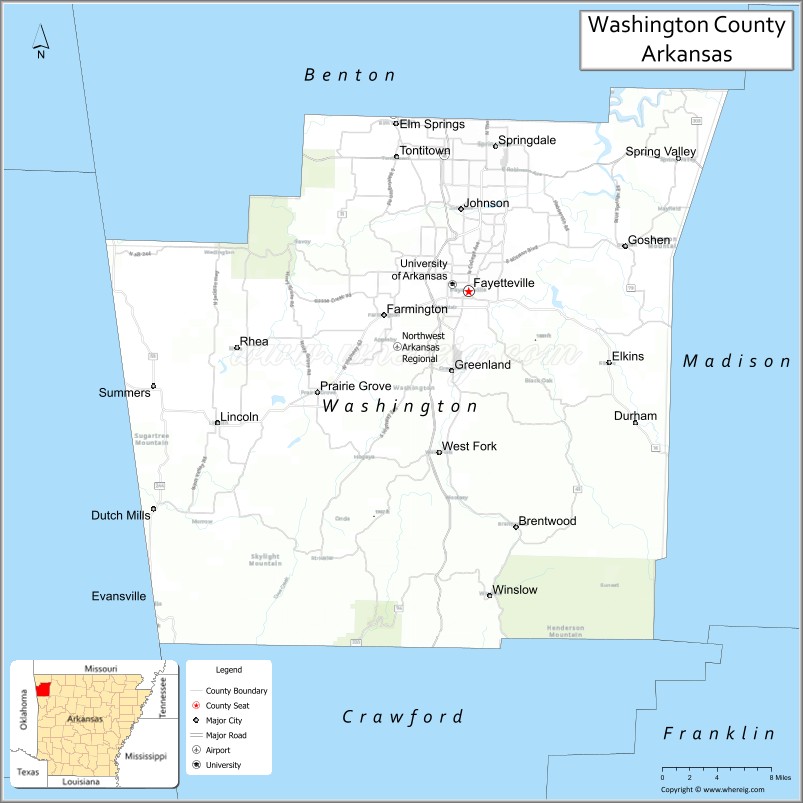
| Seat: | Fayetteville |
| Largest city: | Fayetteville |
| Total Area: | 951.72 sq mi (2,464.9 km²) |
| Land Area: | 945.43 sq mi (2,448.7 km²) |
| Total Population: | 245,871 |
| Population Density: | 260/sq mi (100/km²) |
| Time zone: | UTC−6 (Central) |
| Summer Time Zone (DST): | UTC−5 (CDT) |
| Website: | www.co.washington.ar.us |
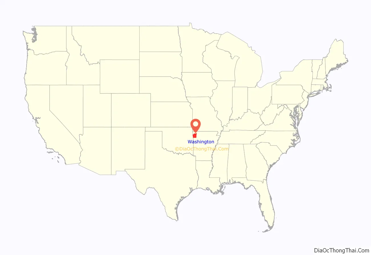
Washington County location map. Where is Washington County?
History
Washington County began as part of the Cherokee Territory, following an 1817 treaty. The area was next known as Lovely County, and one year later Washington County was created after another Cherokee treaty. The court house was centrally located in the city of Washington, modern-day Fayetteville (renamed to avoid confusion with Washington, Arkansas in South Arkansas). The Lee Creek Valley in southern Washington County contained many of the county’s early settlements, including Cane Hill and Evansville.
Arkansas College and Cane Hill College were both founded in Washington County within a day of each other in 1834, with the University of Arkansas being founded in Fayetteville in 1871. The county witnessed major battles during the American Civil War, including the Battle of Fayetteville, the Battle of Prairie Grove, and the Battle of Cane Hill. The county then was sparsely settled and the residents were divided in their allegiance, since it had few enslaved people, plantations almost nonexistent, and political news came by White River travelers, not from the pro-Confederate southern part of the state. A Butterfield Overland Mail route was established through the county in 1858, causing more families to settle there.
In 1856, what appears to be an act of vengeance, prompted by a Black woman killing, in self-defense, a white man who sexually assaulted her, led to the lynching of two Black men and the hanging of another.
The economy of Washington County was based on apples in the late 19th century. A mixture of wet weather, altitude, and loamy soils provided a good environment for apple orchards. First planted in areas around Lincoln, Evansville, and Cane Hill in the 1830s, apple orchards began all across the county. The United States Census reported a crop of 614,924 bushels of apples produced by the county in 1900, the highest in the state. Several varieties of apple were discovered in the area including Shannon Pippin, Wilson June, and most notably the Arkansas Black. The Ben Davis became the apple of choice in the area for sale and shipment across the region. Corn became the dominant crop, outselling apples by almost $500,000 in 1900.
Arkansas Industrial University was founded in the growing community of Fayetteville in 1871 after William McIlroy a donated farmland for the site. The university changed its name in 1899 to the University of Arkansas. Railroads came to Washington County after the St. Louis – San Francisco Railway (Frisco) decided to build a line to Texas through Fort Smith. Two possible routes were proposed, one passing through Prairie Grove, the other through Fayetteville. Many Fayetteville residents and farmers sold or donated land for the right of way to influence the choice. They were successful and in 1881 the first passenger train arrived at Fayetteville. The county continued to grow with more churches and schools after the railroad’s completion. Rural parts of the county began losing population in the 1920s during the Great Depression, when high taxes compelled residents to move to Fayetteville or west to Oklahoma. The rural areas later became the Ozark National Forest and Devil’s Den State Park.
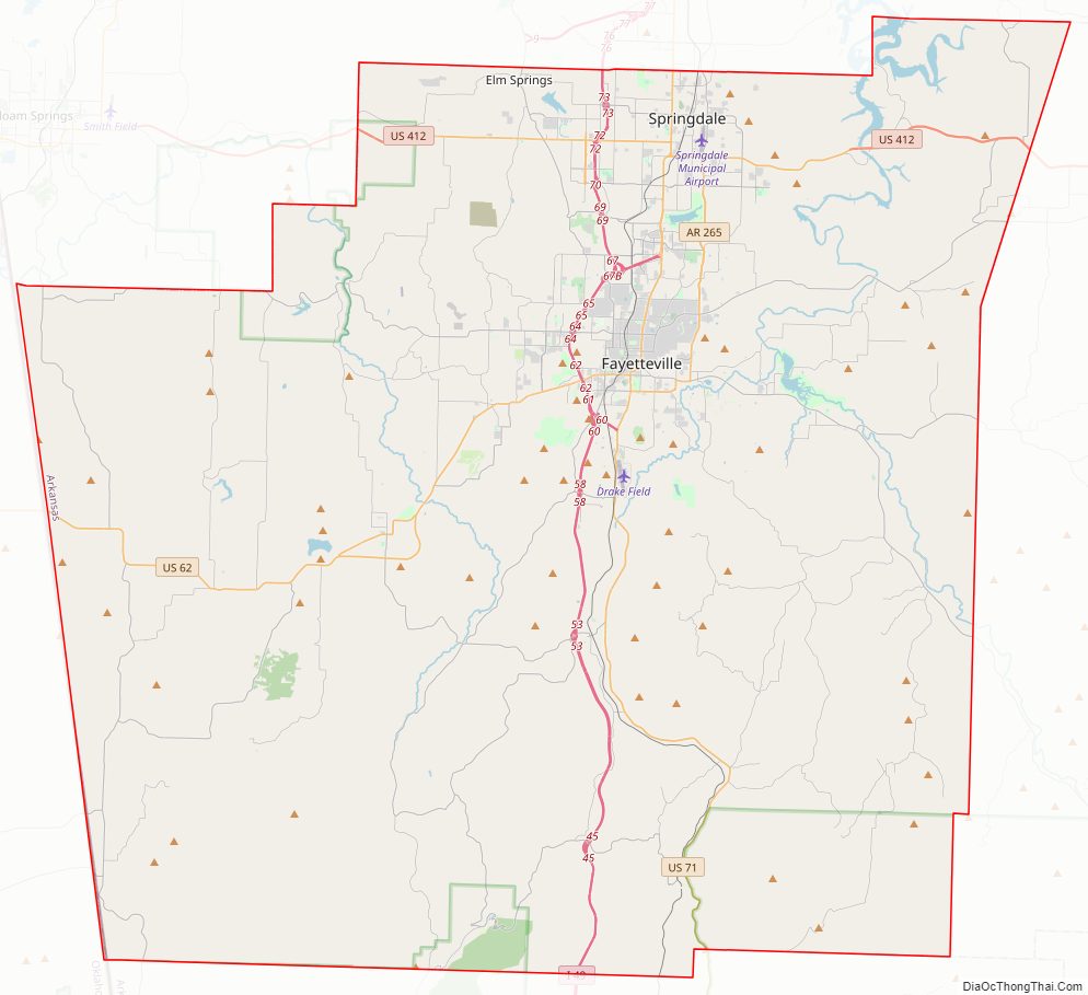
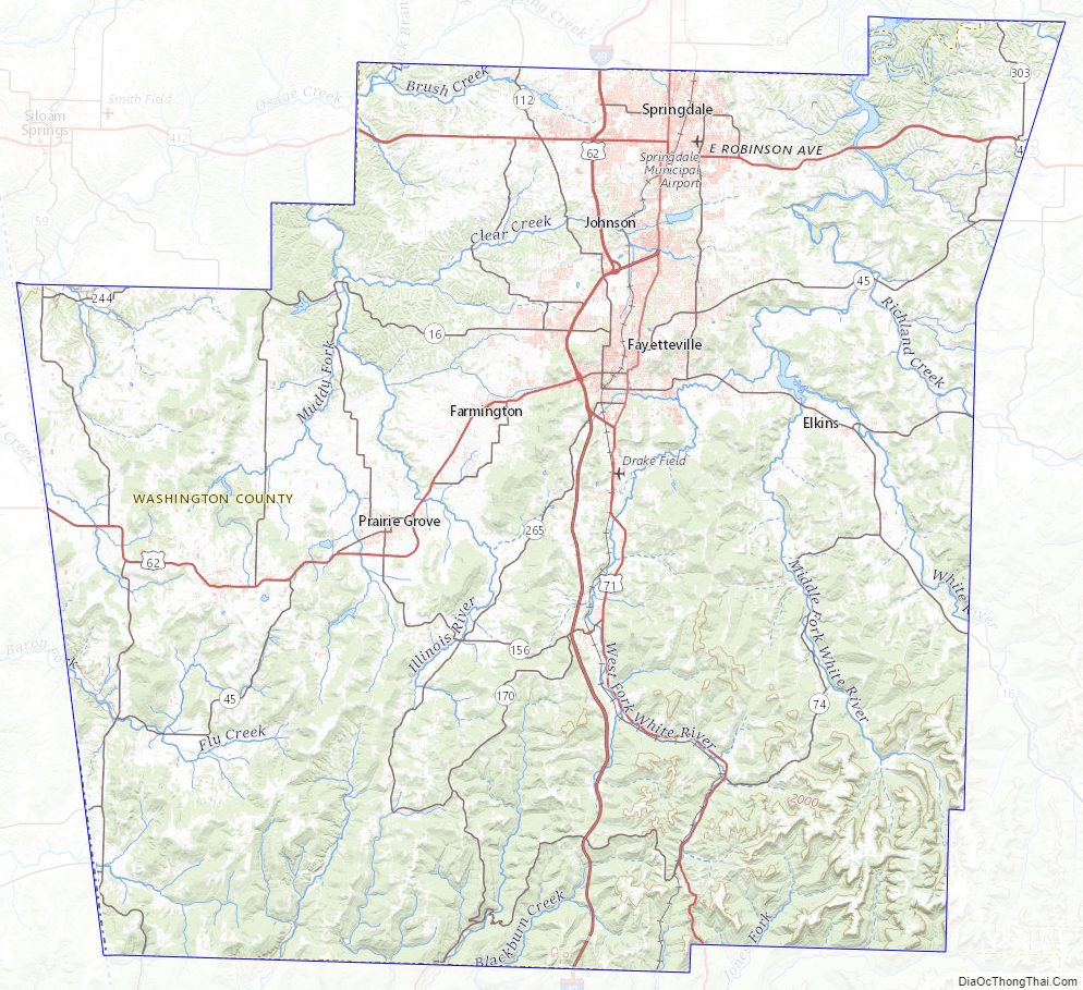
Washington County Road Map
Geography
The county is located in the Ozark Mountains, a small mountain region between the Appalachians and the Rocky Mountains with distinct settlement patterns, history, and culture from surrounding agrarian regions (the Interior Plains of the Midwest United States and Mississippi Delta to the southeast), and the flat ranchlands of the Great Plains to the west. In the Ozarks, population density is low; recreation, logging, and poultry and livestock farming are the primary land uses. Pastureland or hayland occur on nearly level ridgetops, benches, and valley floors. Water quality in streams is generally exceptional. Most of the county is within the mountainous, forested Boston Mountains, with the north and west portions made up of the nearly level to rolling Springfield Plateau. Karst features such as springs, losing streams, sinkholes and caves are common.
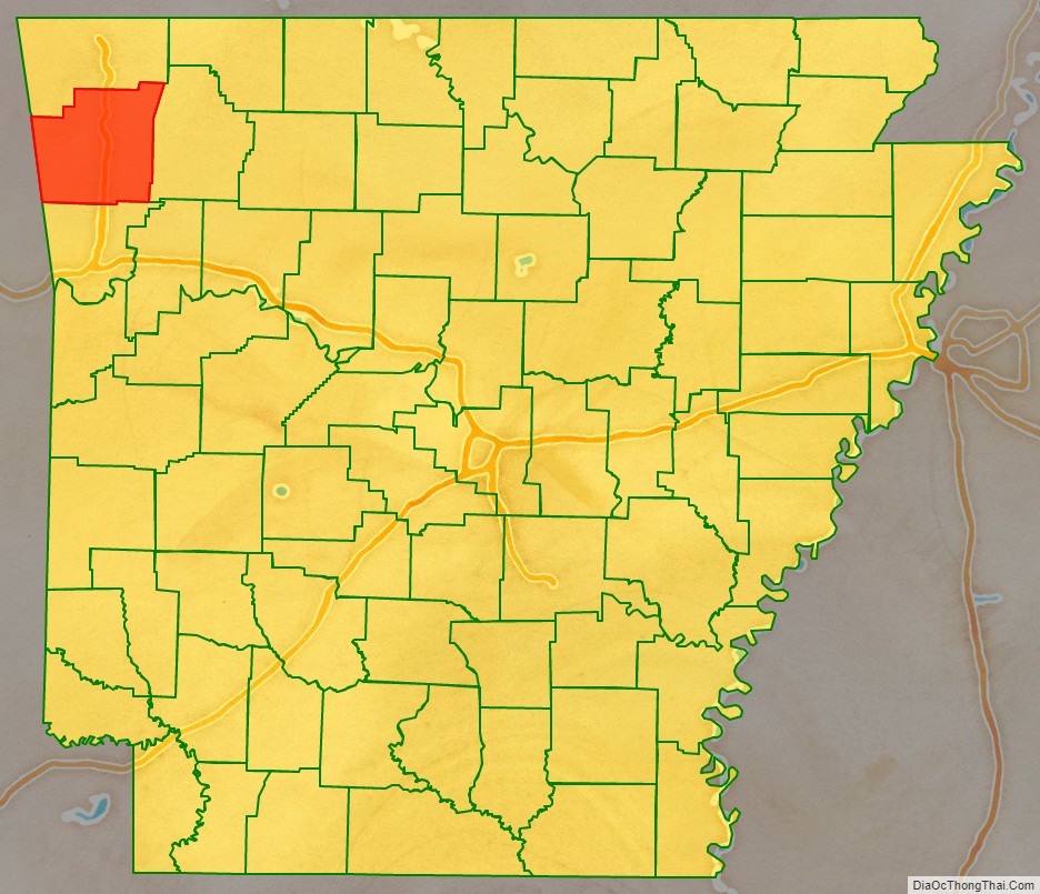
Washington County has a total area of 951.72 square miles (2,464.9 km), of which 945.43 square miles (2,448.7 km) is land and 6.29 square miles (16.3 km) (0.6%) is water. It is the fourth-largest county by area in Arkansas.
The county is located approximately 112 miles (180 km) east of Tulsa, Oklahoma, 192 miles (309 km) northwest of Little Rock, 233 miles (375 km) south of Kansas City, and 335 miles (539 km) northeast of the Dallas–Fort Worth metroplex. Washington County is surrounded by Benton County to the north, rural Madison County to the east, the rural Crawford County to the south, and Adair County, Oklahoma to the west.
Geology
Washington County sits on a basement of Precambrian granite and rhyolite, as most of the continental interior of the United States does. Much of the county’s geologic history must be inferred from nearby Oklahoma and Missouri research, due to the steepness of the more recently formed mountains that did not form in the neighboring states. This igneous material was eroded until the Paleozoic, when oceans covered the now-low-lying area. These oceans came and retreated for 300 million years, depositing various different sediments during that time. This created fossiliferous limestone and ripple marked-sandstone, both present throughout the north part of the county as evidence of ancient oceans.
Sediments were deposited from the Devonian, Mississippian, and Pennsylvanian periods. During this deposition period, the county had a climate similar to that of the present-day Bahamas, as the equator was north of Washington County. The Devonian brought mostly shales, the Mississippian brought the limestones and chert visible in the bluffs. This chert is present throughout most of the county. The county is also home to the Boone Formation (red soils), white limestones, the Wedington Sandstone, the Bastesville Sandstone, the Pitkin formation (ocean-fossil limestone), and the Fayetteville Shale.
Settlers were attracted to the area by its numerous streams, used to power gristmills, sandstones and clays for use in construction, lime-sweetened soil, and chert for road construction.
Today, Washington County consists of two main formations, the Boston Mountains and the Springfield Plateau. During the late Pennsylvanian, sediments were deposited on top of the Springfield Plateau. The area was uplifted during the Ouachita orogeny and subsequent erosion formed the rugged Boston Mountains. Erosion of these sediments causes the Boston Mountains to be carved steeply in the south, while in the north of the county, the Boston Mountain sediments are almost entirely eroded, exposing the older rocks of the Springfield Plateau.
Hydrology
Washington County fits within three regional watersheds: the eastern half drains to the White River (or Beaver Lake) and the west drains to the Illinois River, with a small segment in the south draining to the Arkansas River via the Lee Creek watershed. Within the county, Clear Creek, Moore’s Creek, Richland Creek, and Spring Creek are important watercourses. The county also contains eleven natural springs listed by the United States Geological Survey Board on Geographic Names, including Elkhorn Springs, Elm Springs, and Greathouse Spring in Johnson.
As a mountainous county, it contains only one natural lake and several reservoirs. Most of these reservoirs, such as Lake Prairie Grove and Lincoln Lake were created for flood control or water supplies in the 20th century. Beaver Lake, located mostly in Benton County with reaches extending into Washington and Madison counties, is the sixth-largest lake in Arkansas, and a source of recreation, tourism, and drinking water for the Northwest Arkansas region. Washington County also contains Lake Wedington, located in the Ozark National Forest west of Fayetteville on Highway 16.
Protected areas
Washington County contains three discontinuous segments of the Ozark National Forest, two state parks, two Wildlife Management Areas (WMAs) under Arkansas Game and Fish Commission jurisdiction, the Garrett Hollow Natural Area, and dozens of city parks.
The Wedington WMA is a hardwood forest owned by the United States Forest Service known for archery, deer hunting, fishing, and boating on Lake Wedington. The southeast corner of Washington County contains part of the White Rock WMA, an expansive section of the Ozark National Forest containing some of the steepest segments of the Boston Mountains covered in a mix of shortleaf pine and hardwood forest. White Rock WMA has six camping areas, four lakes, and numerous trails. Public hunting for squirrels, deer, wild turkeys, and black bear is available during certain seasons
Devil’s Den State Park in southern Washington County is known for its picturesque views and mountain vistas. Prairie Grove Battlefield State Park was the site of the Battle of Prairie Grove, fought December 7, 1862, in the American Civil War. The park offers tours of the battlefield and period structures and contains the Hindman Museum, which preserves artifacts and interprets the history of the battle. Arkansas’s largest Civil War battle reenactment takes place on t he battlefield in December of even numbered years.
Washington County Topographic Map
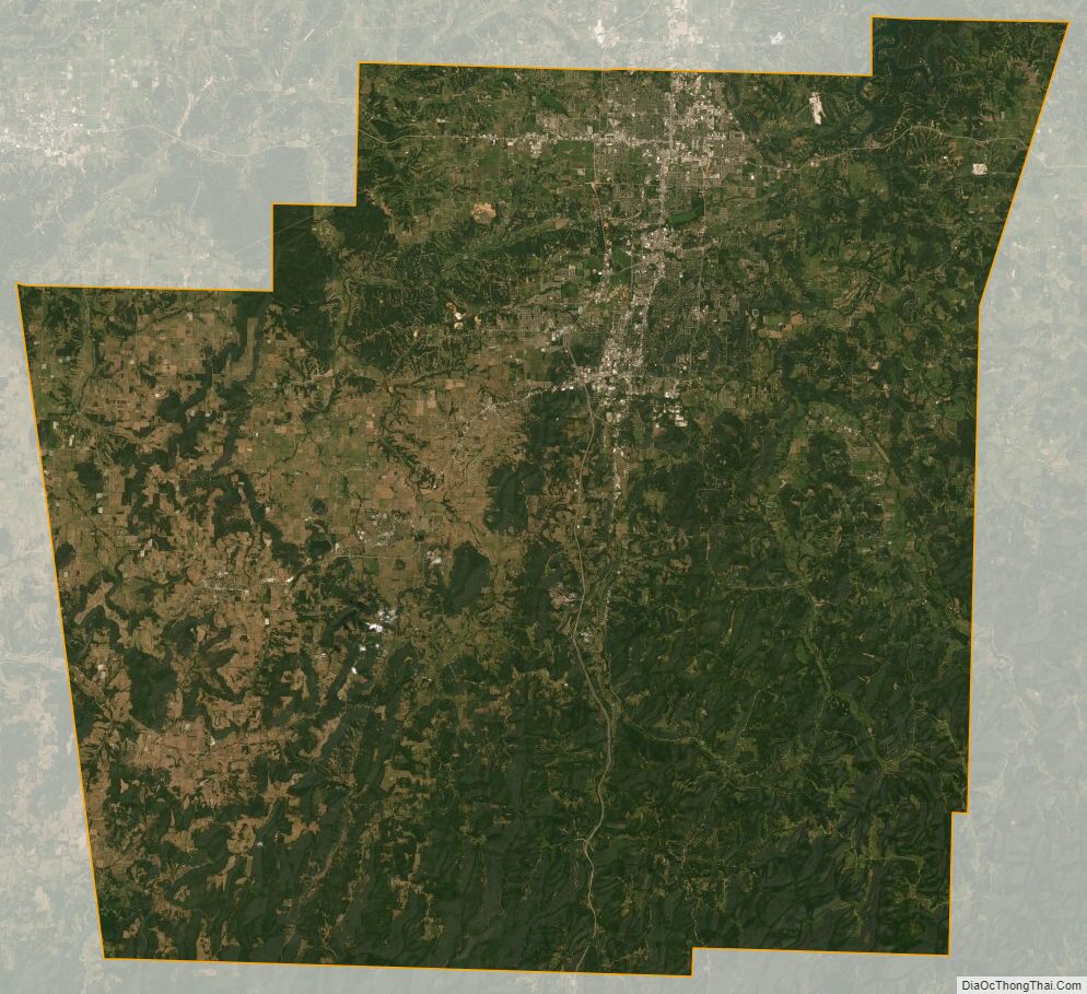
Washington County Satellite Map
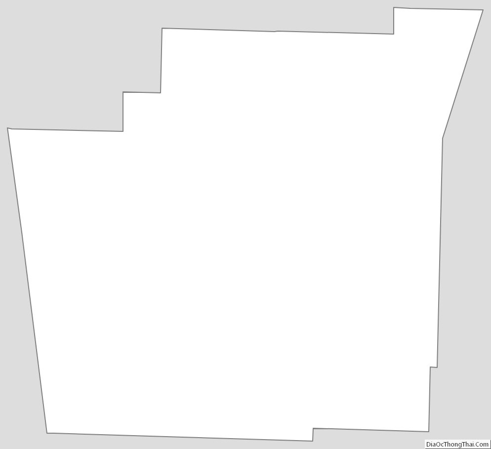
Washington County Outline Map
See also
Map of Arkansas State and its subdivision:- Arkansas
- Ashley
- Baxter
- Benton
- Boone
- Bradley
- Calhoun
- Carroll
- Chicot
- Clark
- Clay
- Cleburne
- Cleveland
- Columbia
- Conway
- Craighead
- Crawford
- Crittenden
- Cross
- Dallas
- Desha
- Drew
- Faulkner
- Franklin
- Fulton
- Garland
- Grant
- Greene
- Hempstead
- Hot Spring
- Howard
- Independence
- Izard
- Jackson
- Jefferson
- Johnson
- Lafayette
- Lawrence
- Lee
- Lincoln
- Little River
- Logan
- Lonoke
- Madison
- Marion
- Miller
- Mississippi
- Monroe
- Montgomery
- Nevada
- Newton
- Ouachita
- Perry
- Phillips
- Pike
- Poinsett
- Polk
- Pope
- Prairie
- Pulaski
- Randolph
- Saint Francis
- Saline
- Scott
- Searcy
- Sebastian
- Sevier
- Sharp
- Stone
- Union
- Van Buren
- Washington
- White
- Woodruff
- Yell
- Alabama
- Alaska
- Arizona
- Arkansas
- California
- Colorado
- Connecticut
- Delaware
- District of Columbia
- Florida
- Georgia
- Hawaii
- Idaho
- Illinois
- Indiana
- Iowa
- Kansas
- Kentucky
- Louisiana
- Maine
- Maryland
- Massachusetts
- Michigan
- Minnesota
- Mississippi
- Missouri
- Montana
- Nebraska
- Nevada
- New Hampshire
- New Jersey
- New Mexico
- New York
- North Carolina
- North Dakota
- Ohio
- Oklahoma
- Oregon
- Pennsylvania
- Rhode Island
- South Carolina
- South Dakota
- Tennessee
- Texas
- Utah
- Vermont
- Virginia
- Washington
- West Virginia
- Wisconsin
- Wyoming