Washington County is a county in the U.S. state of Minnesota. As of the 2020 census, the population was 267,568, making it the fifth-most populous county in Minnesota. Its county seat is Stillwater. The largest city in the county is Woodbury, the eighth-largest city in Minnesota and the fourth-largest Twin Cities suburb.
Washington County is included in the Minneapolis–St. Paul–Bloomington, MN-WI Metropolitan Statistical Area.
| Name: | Washington County |
|---|---|
| FIPS code: | 27-163 |
| State: | Minnesota |
| Founded: | October 27, 1849 |
| Named for: | George Washington |
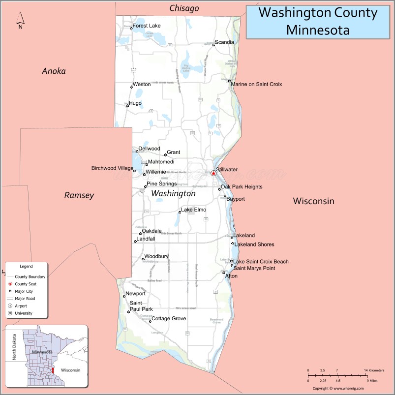
| Seat: | Stillwater |
| Largest city: | Woodbury |
| Total Area: | 423 sq mi (1,100 km²) |
| Land Area: | 384 sq mi (990 km²) |
| Total Population: | 267,568 |
| Population Density: | 696.8/sq mi (269.0/km²) |
| Time zone: | UTC−6 (Central) |
| Summer Time Zone (DST): | UTC−5 (CDT) |
| Website: | www.co.washington.mn.us |
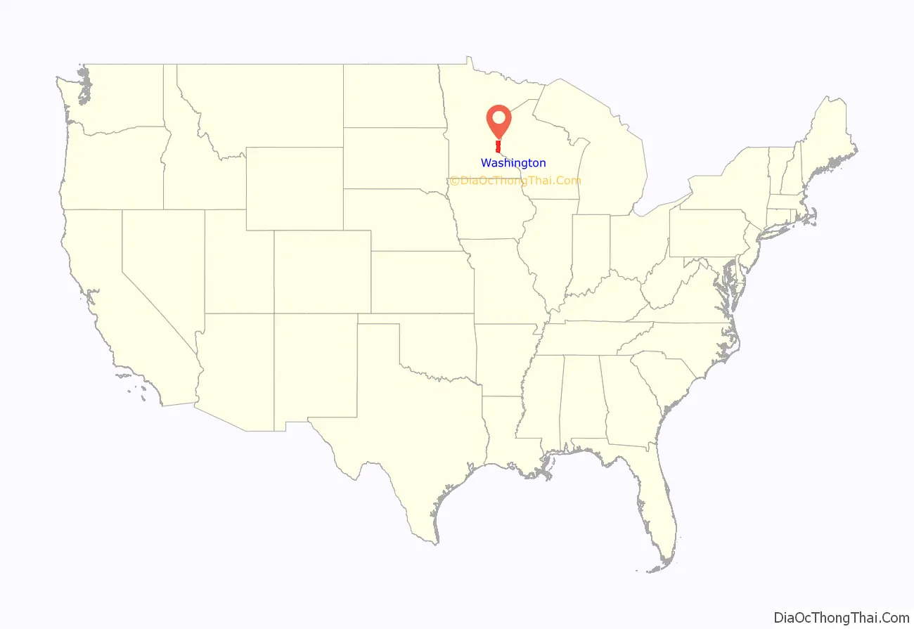
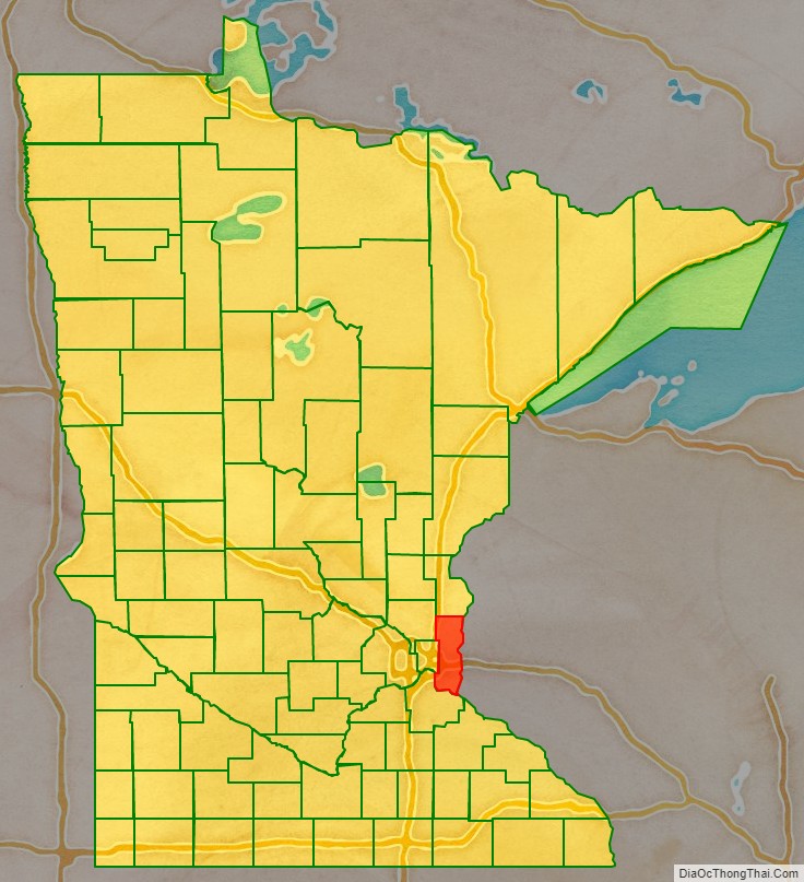
Washington County location map. Where is Washington County?
History
Early development in the area was on the St. Croix River, which now forms the boundary with Wisconsin on the county’s eastern side. The river provided a waterway to move settlers upstream and to transport logs downstream. The heavily forested area fostered an early logging and lumber economy. The area’s first settlers arrived at the future Afton in 1837. In 1838 settlers started Dacotah, at the north edge of present Stillwater, at the junction of Brown’s Creek and the St. Croix. The creek’s name is from the founder of this settlement, Joseph Renshaw Brown. However, a sawmill was built at Marine-on-St.-Croix in 1839, and another was built in the current location of downtown Stillwater in 1844. The success of these soon attracted the settlers from Dacotah, and that community declined.
This area was part of Wisconsin Territory until the eastern part of that territory achieved statehood in 1848. Brown and other leaders called a meeting (the “Stillwater Convention”) on August 26, 1848. The convention drafted a Memorial to Congress that a new territory be created with the name “Minnesota,” and elected Henry Hastings Sibley to deliver this citizens’ petition to the U.S. Congress. Because of this convention, Stillwater calls itself the “Birthplace of Minnesota.” Congress responded by creating Minnesota Territory effective March 3, 1849.
The newly established territorial legislature created nine counties across the territory in October 1849. Washington County was one of the nine, named for George Washington, with Stillwater named as county seat. The county’s first sheriff was appointed in 1849, and the county’s school district began in 1850.
After the forests were depleted, the economy of Washington County became primarily agricultural. With the growth of neighboring Ramsey County and St. Paul, some of Washington County developed based on tourism and recreation, as with Mahtomedi and Landfall. Late in the 20th century, the population greatly increased with the suburban expansion of St. Paul.
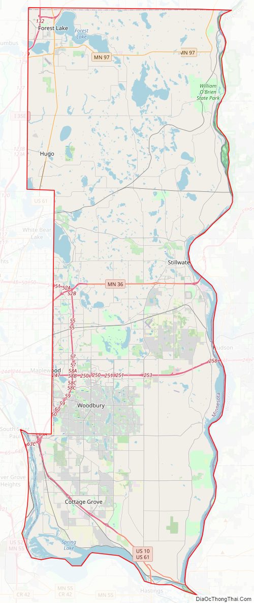
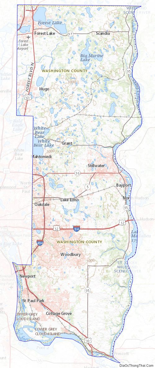
Washington County Road Map
Geography
Washington County lies on the east side of Minnesota. Its east border abuts the west border of the state of Wisconsin (across the St. Croix River). The Mississippi River flows south-southeastward west of Washington County, and forms the southwest border of the county as it flows toward its confluence with the St. Croix (at the county’s southernmost point). Washington County terrain consists of low rolling hills, sloping to the south and east, with its highest point on the lower west border at 1,053′ (321m) ASL. The county has a total area of 423 square miles (1,100 km), of which 384 square miles (990 km) is land and 38 square miles (98 km) (9.1%) is water. It is the fourth-smallest county in Minnesota by land area and fifth-smallest by total area.
Major highways
- Interstate 35
- Interstate 94
- Interstate 494
- Interstate 694
- US Highway 8
- US Highway 10
- US Highway 12
- US Highway 61
- Minnesota State Highway 36
- Minnesota State Highway 95
- Minnesota State Highway 96
- Minnesota State Highway 97
- Minnesota State Highway 120
- Minnesota State Highway 244
- List of county roads
Airports
- Forest Lake Airport (25D) – south of Forest Lake
- Lake Elmo Airport (21D) – northeast of Lake Elmo
Adjacent counties
- Chisago County – north
- Polk County, Wisconsin – northeast
- St. Croix County, Wisconsin – east
- Pierce County, Wisconsin – southeast
- Dakota County – southwest
- Ramsey County – west
- Anoka County – northwest
Protected areas
- Afton State Park
- Big Marine Park Reserve
- Cottage Grove Ravine Regional Park
- Falls Creek Scientific and Natural Area
- Gateway State Trail
- Grey Cloud Dunes Scientific and Natural Area
- Hardwood Creek Wildlife Management Area
- Katherine Abbott Park
- Lake Elmo Park Reserve
- Lost Valley Scientific and Natural Area
- Mississippi National River and Recreation Area (part)
- Pine Point Regional Park
- Point Douglas Park
- Rutstrum State Wildlife Management Area
- Saint Croix Bluffs Regional Park
- Saint Croix National Scenic Riverway (part)
- Saint Croix Savanna Scientific and Natural Area
- Square Lake County Park
- Sunfish Lake Park
- William O’Brien State Park
Washington County Topographic Map
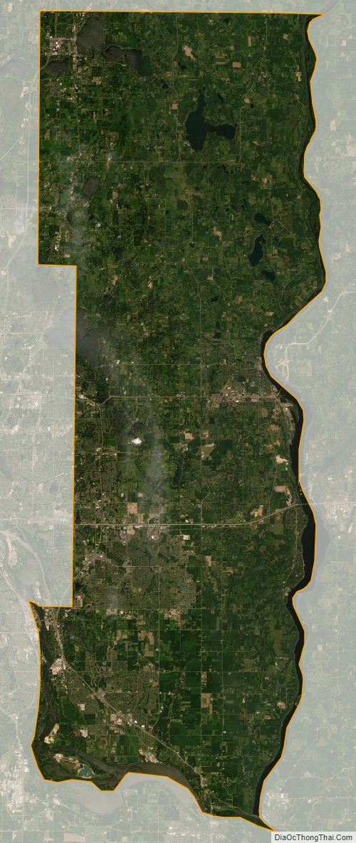
Washington County Satellite Map
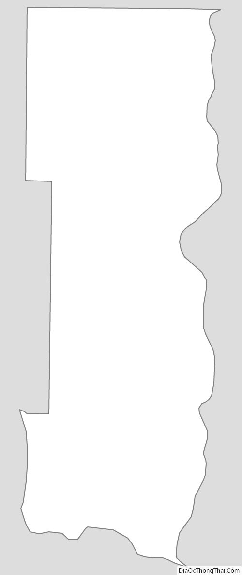
Washington County Outline Map
See also
Map of Minnesota State and its subdivision:- Aitkin
- Anoka
- Becker
- Beltrami
- Benton
- Big Stone
- Blue Earth
- Brown
- Carlton
- Carver
- Cass
- Chippewa
- Chisago
- Clay
- Clearwater
- Cook
- Cottonwood
- Crow Wing
- Dakota
- Dodge
- Douglas
- Faribault
- Fillmore
- Freeborn
- Goodhue
- Grant
- Hennepin
- Houston
- Hubbard
- Isanti
- Itasca
- Jackson
- Kanabec
- Kandiyohi
- Kittson
- Koochiching
- Lac qui Parle
- Lake
- Lake of the Woods
- Lake Superior
- Le Sueur
- Lincoln
- Lyon
- Mahnomen
- Marshall
- Martin
- McLeod
- Meeker
- Mille Lacs
- Morrison
- Mower
- Murray
- Nicollet
- Nobles
- Norman
- Olmsted
- Otter Tail
- Pennington
- Pine
- Pipestone
- Polk
- Pope
- Ramsey
- Red Lake
- Redwood
- Renville
- Rice
- Rock
- Roseau
- Saint Louis
- Scott
- Sherburne
- Sibley
- Stearns
- Steele
- Stevens
- Swift
- Todd
- Traverse
- Wabasha
- Wadena
- Waseca
- Washington
- Watonwan
- Wilkin
- Winona
- Wright
- Yellow Medicine
- Alabama
- Alaska
- Arizona
- Arkansas
- California
- Colorado
- Connecticut
- Delaware
- District of Columbia
- Florida
- Georgia
- Hawaii
- Idaho
- Illinois
- Indiana
- Iowa
- Kansas
- Kentucky
- Louisiana
- Maine
- Maryland
- Massachusetts
- Michigan
- Minnesota
- Mississippi
- Missouri
- Montana
- Nebraska
- Nevada
- New Hampshire
- New Jersey
- New Mexico
- New York
- North Carolina
- North Dakota
- Ohio
- Oklahoma
- Oregon
- Pennsylvania
- Rhode Island
- South Carolina
- South Dakota
- Tennessee
- Texas
- Utah
- Vermont
- Virginia
- Washington
- West Virginia
- Wisconsin
- Wyoming