Washita County is a county located in the U.S. state of Oklahoma. As of the 2010 census, the population was 11,629. Its county seat is New Cordell. The county seat was formerly located in Cloud Chief. The county was created in 1891.
| Name: | Washita County |
|---|---|
| FIPS code: | 40-149 |
| State: | Oklahoma |
| Founded: | 1891 |
| Named for: | Washita River |
| Seat: | New Cordell |
| Largest city: | New Cordell |
| Total Area: | 1,009 sq mi (2,610 km²) |
| Land Area: | 1,003 sq mi (2,600 km²) |
| Total Population: | 11,629 |
| Population Density: | 12/sq mi (5/km²) |
| Time zone: | UTC−6 (Central) |
| Summer Time Zone (DST): | UTC−5 (CDT) |
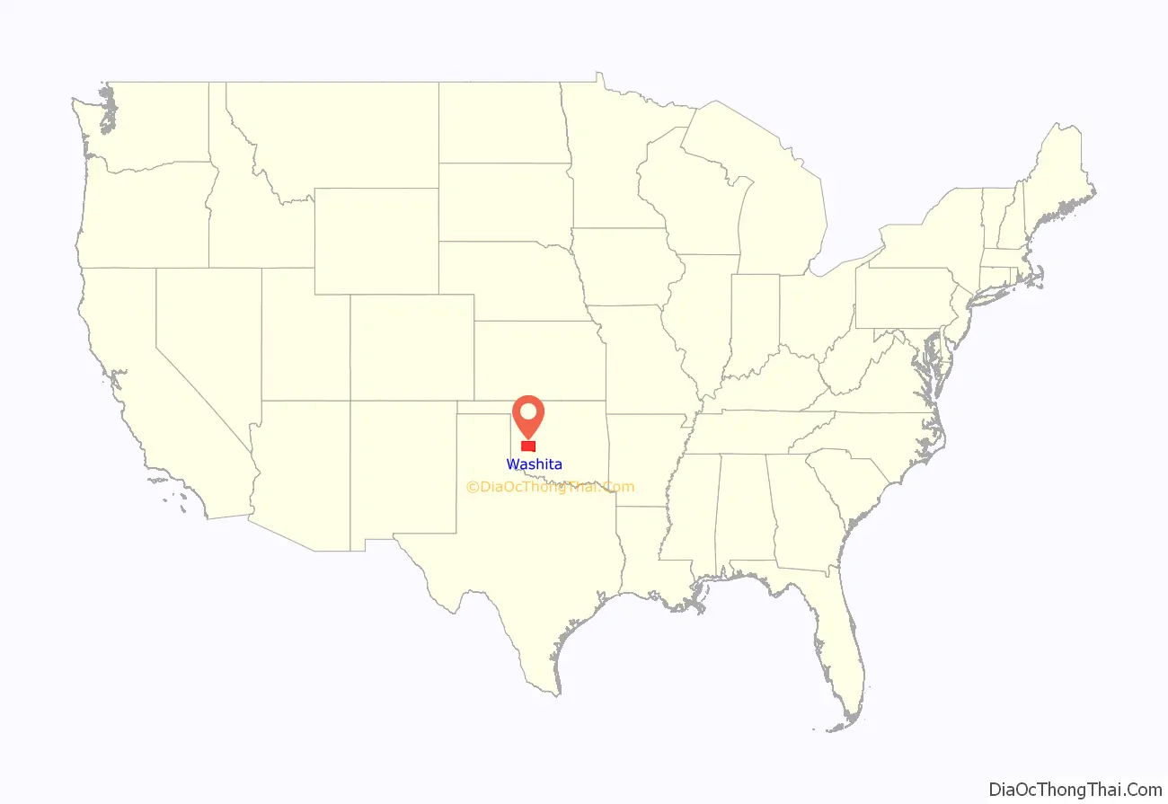
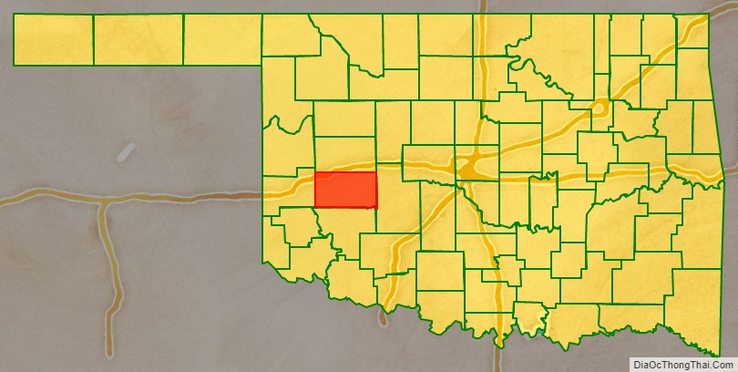
Washita County location map. Where is Washita County?
History
In 1883, John Miles leased 3,000,000 acres (12,000 km) of Cheyenne and Arapaho land to seven cattlemen. However, arguments soon developed between the cattlemen and the tribesmen. In 1885, the Federal government terminated all of the leases and ordered the cattlemen to remove their stock.
The area was settled in 1886, when John Seger established a colony along Cobb Creek. Seger convinced 120 Cheyenne and Arapaho to settle near the old ranch headquarters at Cobb Creek. The intent was that “Seger’s Colony” would teach these tribes how to farm, using modern agricultural methods. The name, Seger’s Colony, would be shortened and become the present day town of Colony, Oklahoma.
After the government declared the excess lands of the Cheyenne and Arapaho Indian Reservation available for non-Indian settlement, the Cheyenne-Arapaho Opening was made available to homesteading on April 19, 1892, in the Land Run of 1892. At that time, the town of Tacola, soon renamed to Cloud Chief, was designated by the Secretary of the Interior as the county seat.
Washita County is located in that part of western Oklahoma which was included in County H of the Territory of Oklahoma, an organized incorporated territory of the United States that existed from 2 May 1890, until 16 November 1907, when it was joined with the Indian territory and admitted to the Union as the State of Oklahoma. The county itself was renamed for the Washita River. The French had called the river “Faux Ouachita”, literally meaning “false Washita”, to distinguish it from the ‘true’ Ouachita in Arkansas and Louisiana. The spelling of the name of the Oklahoma Washita was changed by substituting “w” for “ou”.
An election in 1900 designated the town of Cordell as the county seat. It was favored by the majority because it was located in the center of the county. The election result was contested in court. The Oklahoma Territorial Supreme Court ruled in 1904 that the seat could not be moved without Federal authorization. The U. S. Congress moved the seat to Cordell in 1906. When the Oklahoma Constitution went into effect at statehood in 1907, it confirmed Cordell (by then relocated and renamed New Cordell) as the county seat.
In 1948, the nation’s first flood control dam under the authorization of the Flood Control Act of 1944 was completed in the Cloud Creek Watershed in Washita County.
The lyrics for 1968 hit song Wichita Lineman were inspired by Jimmy Webb’s driving through Washita County westward on a straight road into the setting sun past a seemingly endless line of telephone poles, each looking exactly the same as the last. In the distance he noticed the silhouette of a solitary lineman atop a pole, which he described as “the picture of loneliness”.
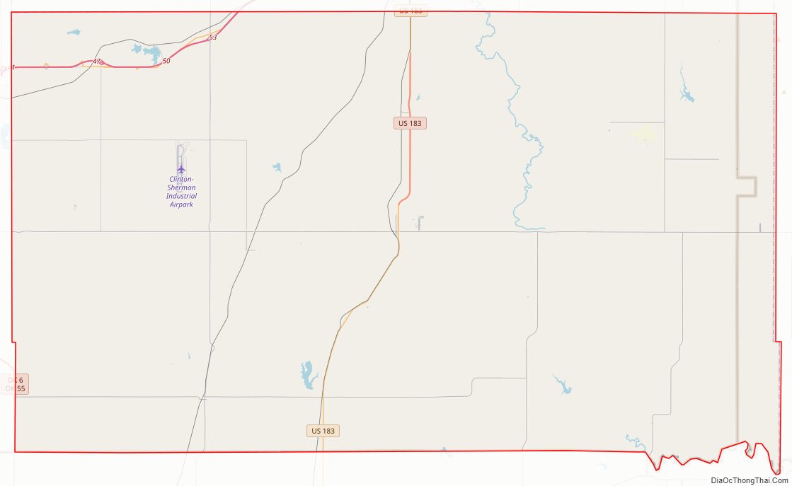
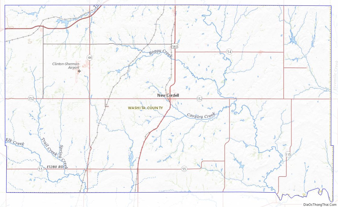
Washita County Road Map
Geography
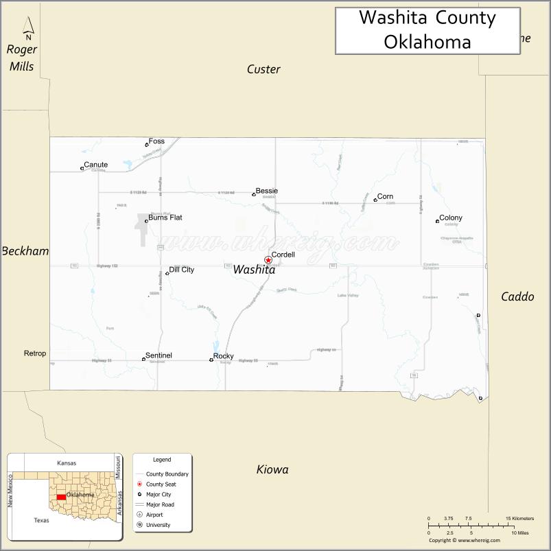
According to the U.S. Census Bureau, the county has a total area of 1,009 square miles (2,610 km), of which 1,006 square miles (2,610 km) is land and 5.6 square miles (15 km) (0.6%) is water. The county lies in the Western Redbeds Plains sub-region of the Osage Plains. The Washita River drains most of the county, except that the southwest corner drains into the North Fork of the Red River
Adjacent counties
- Custer County – north
- Caddo County – east
- Kiowa County – south
- Beckham County – west
Washita County Topographic Map
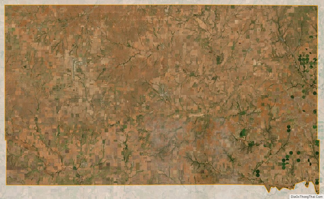
Washita County Satellite Map
Washita County Outline Map

See also
Map of Oklahoma State and its subdivision:- Adair
- Alfalfa
- Atoka
- Beaver
- Beckham
- Blaine
- Bryan
- Caddo
- Canadian
- Carter
- Cherokee
- Choctaw
- Cimarron
- Cleveland
- Coal
- Comanche
- Cotton
- Craig
- Creek
- Custer
- Delaware
- Dewey
- Ellis
- Garfield
- Garvin
- Grady
- Grant
- Greer
- Harmon
- Harper
- Haskell
- Hughes
- Jackson
- Jefferson
- Johnston
- Kay
- Kingfisher
- Kiowa
- Latimer
- Le Flore
- Lincoln
- Logan
- Love
- Major
- Marshall
- Mayes
- McClain
- McCurtain
- McIntosh
- Murray
- Muskogee
- Noble
- Nowata
- Okfuskee
- Oklahoma
- Okmulgee
- Osage
- Ottawa
- Pawnee
- Payne
- Pittsburg
- Pontotoc
- Pottawatomie
- Pushmataha
- Roger Mills
- Rogers
- Seminole
- Sequoyah
- Stephens
- Texas
- Tillman
- Tulsa
- Wagoner
- Washington
- Washita
- Woods
- Woodward
- Alabama
- Alaska
- Arizona
- Arkansas
- California
- Colorado
- Connecticut
- Delaware
- District of Columbia
- Florida
- Georgia
- Hawaii
- Idaho
- Illinois
- Indiana
- Iowa
- Kansas
- Kentucky
- Louisiana
- Maine
- Maryland
- Massachusetts
- Michigan
- Minnesota
- Mississippi
- Missouri
- Montana
- Nebraska
- Nevada
- New Hampshire
- New Jersey
- New Mexico
- New York
- North Carolina
- North Dakota
- Ohio
- Oklahoma
- Oregon
- Pennsylvania
- Rhode Island
- South Carolina
- South Dakota
- Tennessee
- Texas
- Utah
- Vermont
- Virginia
- Washington
- West Virginia
- Wisconsin
- Wyoming