Wayne County is a county located in the U.S. state of Iowa. As of the 2020 census, the population was 6,497, making it the sixth-least populous county in Iowa. The county seat is Corydon.
| Name: | Wayne County |
|---|---|
| FIPS code: | 19-185 |
| State: | Iowa |
| Founded: | 1846 |
| Named for: | Anthony Wayne |
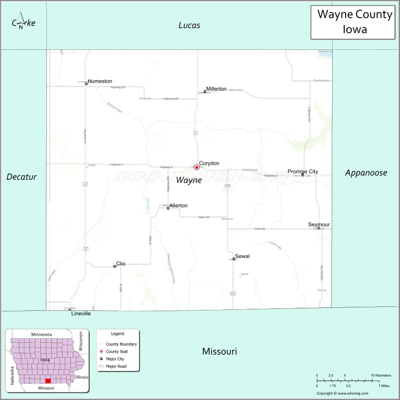
| Seat: | Corydon |
| Largest city: | Corydon |
| Total Area: | 527 sq mi (1,360 km²) |
| Land Area: | 525 sq mi (1,360 km²) |
| Total Population: | 6,497 |
| Population Density: | 12/sq mi (4.8/km²) |
| Time zone: | UTC−6 (Central) |
| Summer Time Zone (DST): | UTC−5 (CDT) |
| Website: | www.waynecountyia.com |
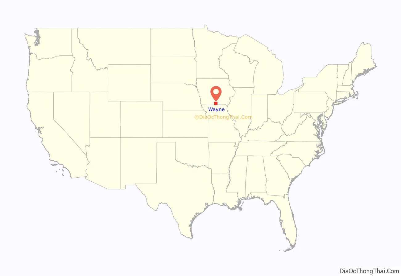
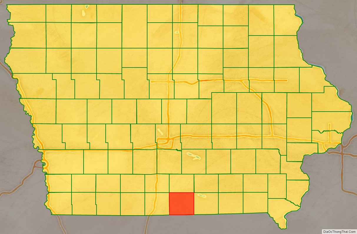
Wayne County location map. Where is Wayne County?
History
Wayne County was formed in 1846 but was still attached to other counties for governmental purposes. It was named after General Anthony Wayne.
Its southern border with Missouri was uncertain until the states got a decision from the US Supreme Court in 1848 which held the 1816 Sullivan line (re-marked in 1850), originally run as the northern boundary of an Osage Indian cession. This line is not a true east–west line so the county does not have an exactly rectangular shape.
There had been settlement in this county as early as 1841 by persons thinking they were in Missouri, but the first settlers intending to be in Iowa came about 1848. Its government was organized and the county seat selected in 1851.
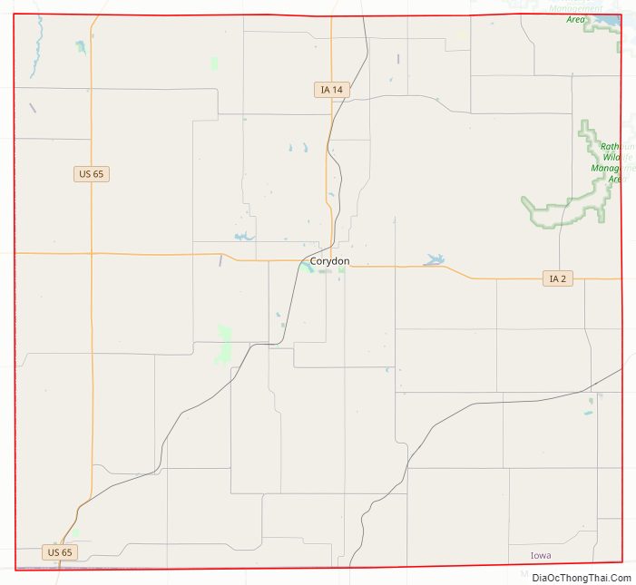
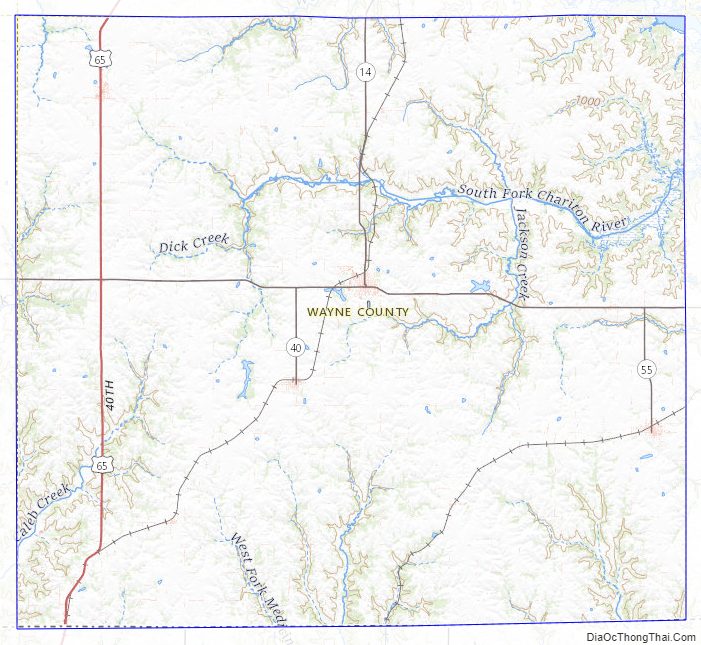
Wayne County Road Map
Geography
According to the U.S. Census Bureau, the county has a total area of 527 square miles (1,360 km), of which 525 square miles (1,360 km) is land and 1.7 square miles (4.4 km) (0.3%) is water.
Major highways
- U.S. Highway 65
- Iowa Highway 2
- Iowa Highway 14
Adjacent counties
- Lucas County (north)
- Appanoose County (east)
- Putnam County, Missouri (southeast)
- Mercer County, Missouri (southwest)
- Decatur County (west)
Wayne County Topographic Map
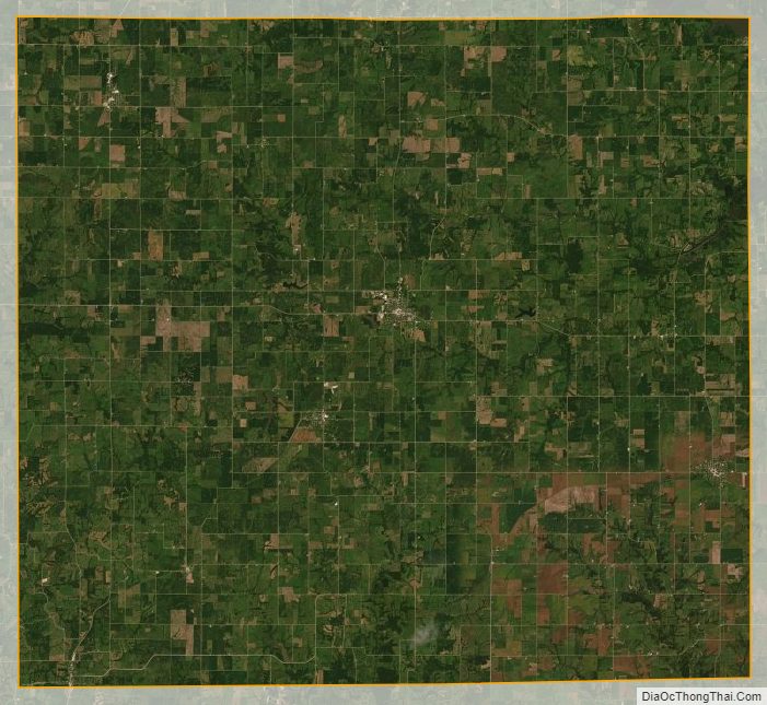
Wayne County Satellite Map
Wayne County Outline Map

See also
Map of Iowa State and its subdivision:- Adair
- Adams
- Allamakee
- Appanoose
- Audubon
- Benton
- Black Hawk
- Boone
- Bremer
- Buchanan
- Buena Vista
- Butler
- Calhoun
- Carroll
- Cass
- Cedar
- Cerro Gordo
- Cherokee
- Chickasaw
- Clarke
- Clay
- Clayton
- Clinton
- Crawford
- Dallas
- Davis
- Decatur
- Delaware
- Des Moines
- Dickinson
- Dubuque
- Emmet
- Fayette
- Floyd
- Franklin
- Fremont
- Greene
- Grundy
- Guthrie
- Hamilton
- Hancock
- Hardin
- Harrison
- Henry
- Howard
- Humboldt
- Ida
- Iowa
- Jackson
- Jasper
- Jefferson
- Johnson
- Jones
- Keokuk
- Kossuth
- Lee
- Linn
- Louisa
- Lucas
- Lyon
- Madison
- Mahaska
- Marion
- Marshall
- Mills
- Mitchell
- Monona
- Monroe
- Montgomery
- Muscatine
- O'Brien
- Osceola
- Page
- Palo Alto
- Plymouth
- Pocahontas
- Polk
- Pottawattamie
- Poweshiek
- Ringgold
- Sac
- Scott
- Shelby
- Sioux
- Story
- Tama
- Taylor
- Union
- Van Buren
- Wapello
- Warren
- Washington
- Wayne
- Webster
- Winnebago
- Winneshiek
- Woodbury
- Worth
- Wright
- Alabama
- Alaska
- Arizona
- Arkansas
- California
- Colorado
- Connecticut
- Delaware
- District of Columbia
- Florida
- Georgia
- Hawaii
- Idaho
- Illinois
- Indiana
- Iowa
- Kansas
- Kentucky
- Louisiana
- Maine
- Maryland
- Massachusetts
- Michigan
- Minnesota
- Mississippi
- Missouri
- Montana
- Nebraska
- Nevada
- New Hampshire
- New Jersey
- New Mexico
- New York
- North Carolina
- North Dakota
- Ohio
- Oklahoma
- Oregon
- Pennsylvania
- Rhode Island
- South Carolina
- South Dakota
- Tennessee
- Texas
- Utah
- Vermont
- Virginia
- Washington
- West Virginia
- Wisconsin
- Wyoming