Wayne County is a county located in the Ozark foothills in the U.S. state of Missouri. As of the 2020 census, the population was 10,974. The county seat is Greenville. The county was officially organized on December 11, 1818, and is named after General “Mad” Anthony Wayne, who served in the American Revolution.
| Name: | Wayne County |
|---|---|
| FIPS code: | 29-223 |
| State: | Missouri |
| Founded: | December 11, 1818 |
| Named for: | Anthony Wayne |
| Seat: | Greenville |
| Largest city: | Piedmont |
| Total Area: | 774 sq mi (2,000 km²) |
| Land Area: | 759 sq mi (1,970 km²) |
| Total Population: | 10,974 |
| Population Density: | 14/sq mi (5.5/km²) |
| Time zone: | UTC−6 (Central) |
| Summer Time Zone (DST): | UTC−5 (CDT) |
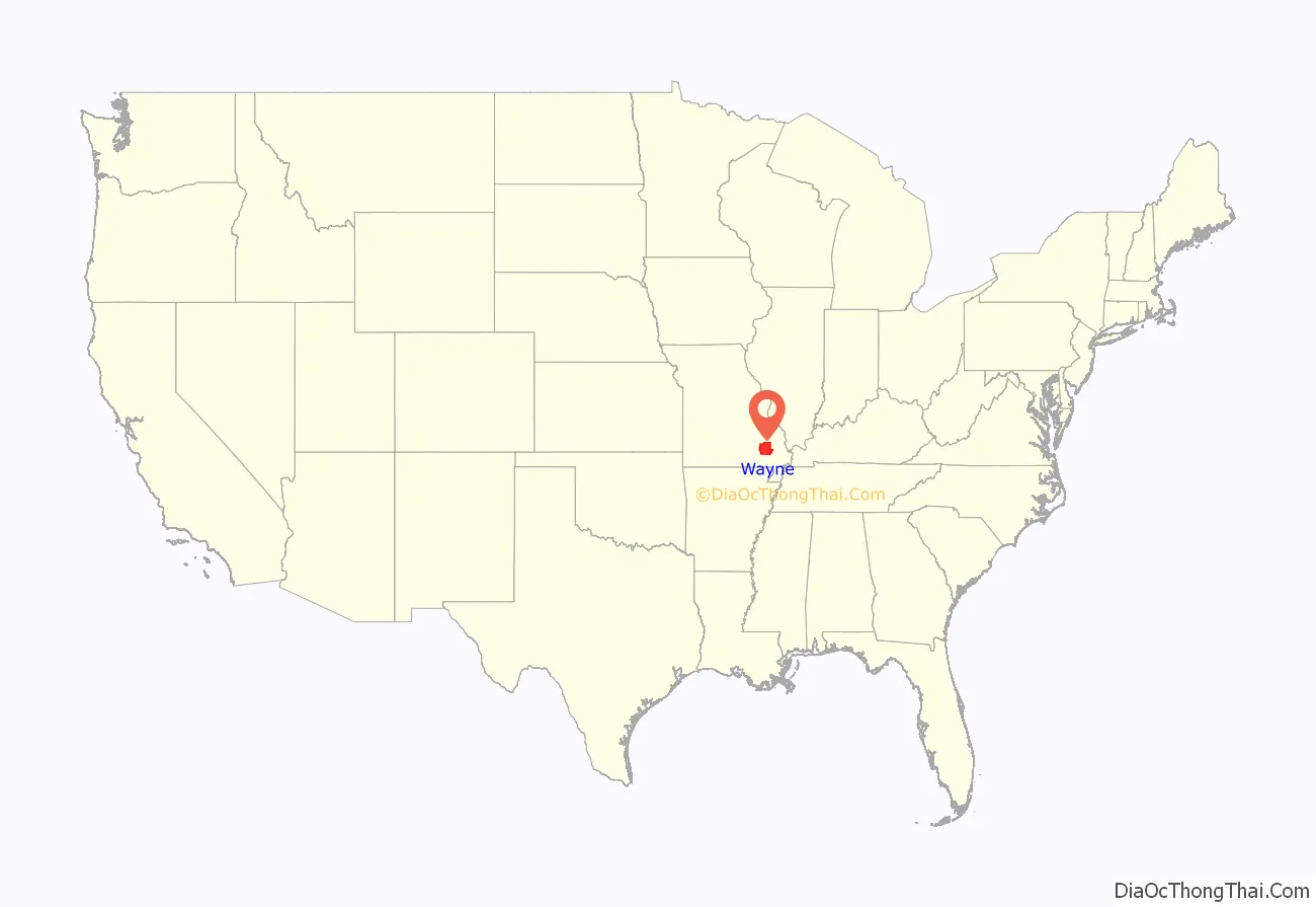
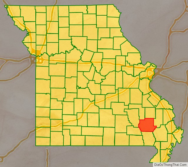
Wayne County location map. Where is Wayne County?
History
Wayne County was created in December 1818 by the last Missouri Territorial Legislature from portions of Cape Girardeau and Lawrence counties. Wayne County thus actually predates statehood. In March 1819, Congress established the Territory of Arkansas, and most of Lawrence County became Lawrence County, Arkansas Territory. The small strip that had been excluded was added to Wayne County by the Missouri State Constitution of 1820. The Osage Strip on the Kansas border was added in 1825. Between 1825 and 1831, Wayne County was actually larger than the states of Massachusetts, Connecticut, Rhode Island, and Delaware combined. All or part of 32 present Missouri counties once belonged to Wayne County. Despite its size, the Census of 1820 revealed that Wayne County had a total population of just 1,239 white inhabitants and 204 African American slaves.
When Wayne County was formed in 1818, the territorial legislature appointed five commissioners to govern it. They chose a small settlement called Cedar Cabin on the St. Francis River to be the county seat. Renamed Greenville, it had grown to about 1,000 by the turn of the 20th century. By 1940, however, the population had declined to 572. In 1941, the remaining inhabitants were forced to relocate because of the construction of Lake Wappapello. This new town’s population had fallen to 270 in 1950, but has now increased to about 563.
The Wayne County Courthouse was destroyed by a fire in 1854. In 1866, the records in new courthouse were stolen, and in 1892 the courthouse again burned down. Thus few county records survive from that time.
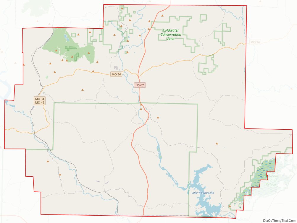
Wayne County Road Map

Geography
According to the U.S. Census Bureau, the county has a total area of 774 square miles (2,000 km), of which 759 square miles (1,970 km) is land and 15 square miles (39 km) (1.9%) is water.
The most populous community in Wayne County is Piedmont with a population of 2,401 people, followed by Greenville with 563 and Williamsville with 386.
Adjacent counties
- Madison County (north)
- Bollinger County (east)
- Stoddard County (southeast)
- Butler County (south)
- Carter County (southwest)
- Reynolds County (west)
- Iron County (northwest)
Major highways
- U.S. Route 67
- Route 34
- Route 49
National protected areas
- Mark Twain National Forest (part)
- Mingo National Wildlife Refuge (part)
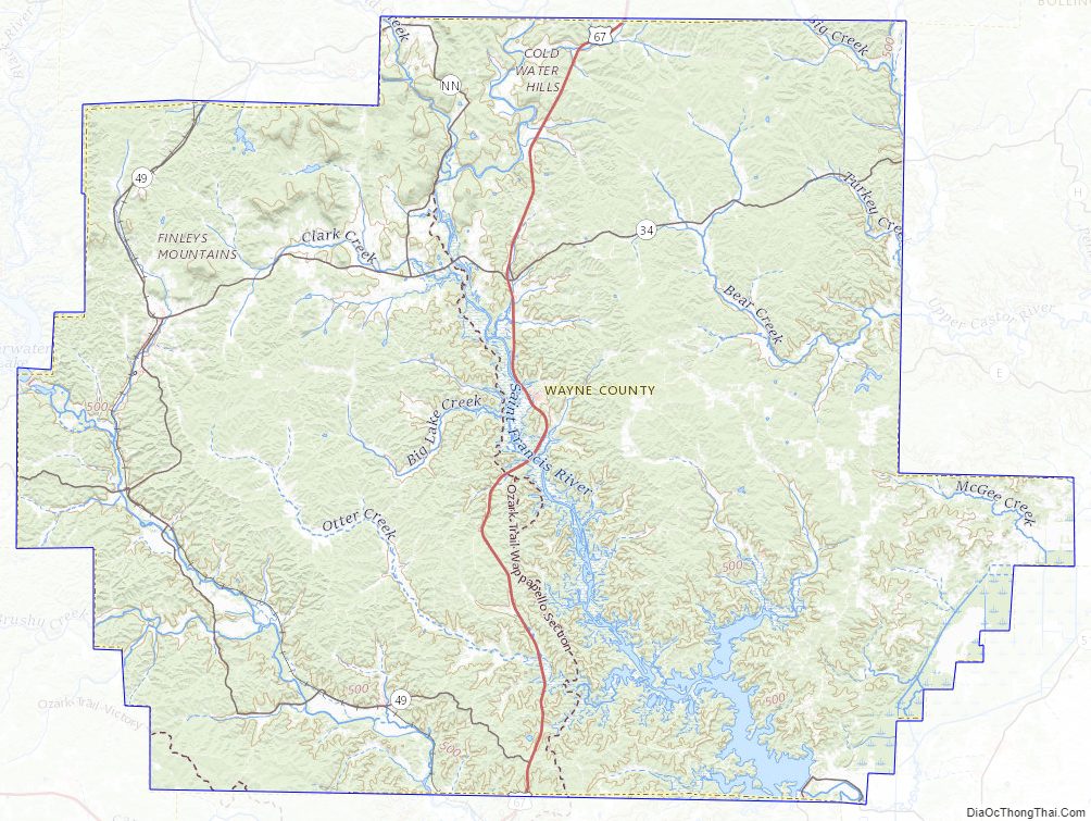
Wayne County Topographic Map
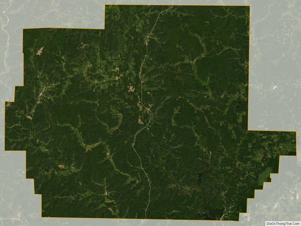
Wayne County Satellite Map
Wayne County Outline Map

See also
Map of Missouri State and its subdivision:- Adair
- Andrew
- Atchison
- Audrain
- Barry
- Barton
- Bates
- Benton
- Bollinger
- Boone
- Buchanan
- Butler
- Caldwell
- Callaway
- Camden
- Cape Girardeau
- Carroll
- Carter
- Cass
- Cedar
- Chariton
- Christian
- Clark
- Clay
- Clinton
- Cole
- Cooper
- Crawford
- Dade
- Dallas
- Daviess
- De Kalb
- Dent
- Douglas
- Dunklin
- Franklin
- Gasconade
- Gentry
- Greene
- Grundy
- Harrison
- Henry
- Hickory
- Holt
- Howard
- Howell
- Iron
- Jackson
- Jasper
- Jefferson
- Johnson
- Knox
- Laclede
- Lafayette
- Lawrence
- Lewis
- Lincoln
- Linn
- Livingston
- Macon
- Madison
- Maries
- Marion
- McDonald
- Mercer
- Miller
- Mississippi
- Moniteau
- Monroe
- Montgomery
- Morgan
- New Madrid
- Newton
- Nodaway
- Oregon
- Osage
- Ozark
- Pemiscot
- Perry
- Pettis
- Phelps
- Pike
- Platte
- Polk
- Pulaski
- Putnam
- Ralls
- Randolph
- Ray
- Reynolds
- Ripley
- Saint Charles
- Saint Clair
- Saint Francois
- Saint Louis
- Sainte Genevieve
- Saline
- Schuyler
- Scotland
- Scott
- Shannon
- Shelby
- Stoddard
- Stone
- Sullivan
- Taney
- Texas
- Vernon
- Warren
- Washington
- Wayne
- Webster
- Worth
- Wright
- Alabama
- Alaska
- Arizona
- Arkansas
- California
- Colorado
- Connecticut
- Delaware
- District of Columbia
- Florida
- Georgia
- Hawaii
- Idaho
- Illinois
- Indiana
- Iowa
- Kansas
- Kentucky
- Louisiana
- Maine
- Maryland
- Massachusetts
- Michigan
- Minnesota
- Mississippi
- Missouri
- Montana
- Nebraska
- Nevada
- New Hampshire
- New Jersey
- New Mexico
- New York
- North Carolina
- North Dakota
- Ohio
- Oklahoma
- Oregon
- Pennsylvania
- Rhode Island
- South Carolina
- South Dakota
- Tennessee
- Texas
- Utah
- Vermont
- Virginia
- Washington
- West Virginia
- Wisconsin
- Wyoming