Wayne County is a county in the U.S. state of Nebraska. As of the 2010 census, the population was 9,595. Its county seat is Wayne.
In the Nebraska license plate system, Wayne County is represented by the prefix 27 (it had the 27th-largest number of vehicles registered in the state when the license plate system was established in 1922).
| Name: | Wayne County |
|---|---|
| FIPS code: | 31-179 |
| State: | Nebraska |
| Founded: | 1870 |
| Named for: | Anthony Wayne |
| Seat: | Wayne |
| Largest city: | Wayne |
| Total Area: | 443 sq mi (1,150 km²) |
| Land Area: | 443 sq mi (1,150 km²) |
| Total Population: | 9,784 |
| Population Density: | 21.0/sq mi (8.1/km²) |
| Time zone: | UTC−6 (Central) |
| Summer Time Zone (DST): | UTC−5 (CDT) |
| Website: | www.waynecountyne.org |
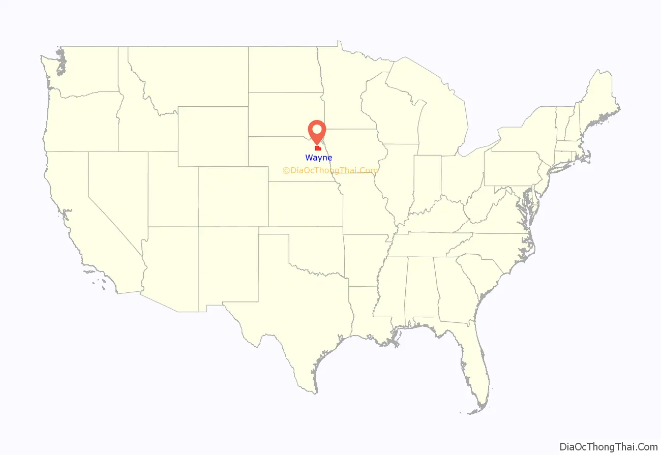
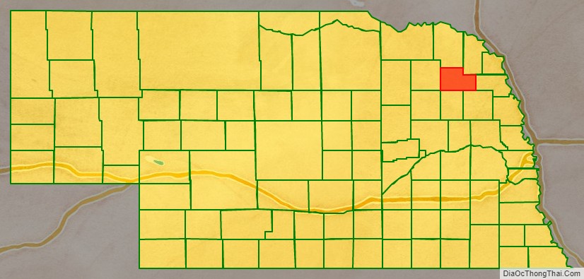
Wayne County location map. Where is Wayne County?
History
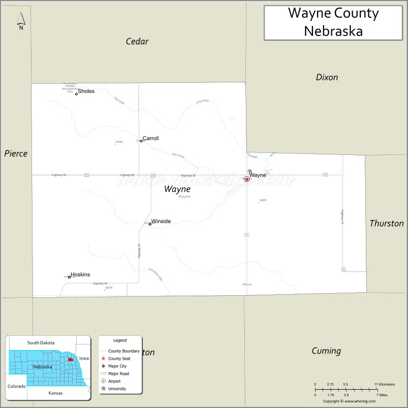
Wayne County was organized by a proclamation of Governor David Butler in the fall of 1870. As the county was settled, precincts were formed and boundaries defined. Precincts were named for officials, early settlers, and neighborhood creeks. There are 13 precincts in Wayne County.
Wayne County, like the City of Wayne, was named for Revolutionary War General Anthony Wayne.
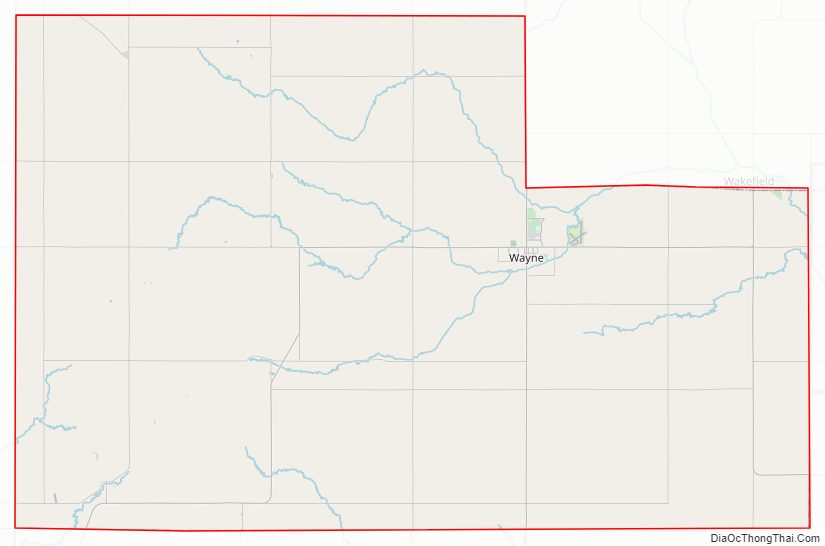
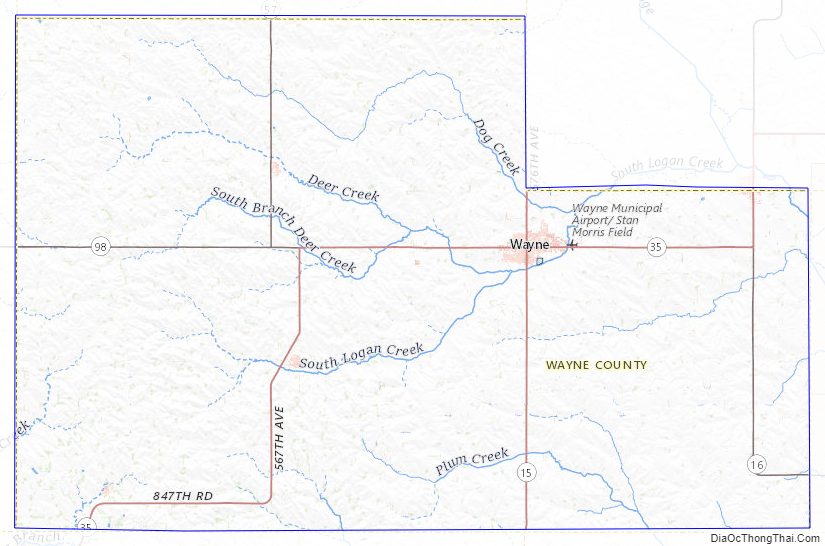
Wayne County Road Map
Geography
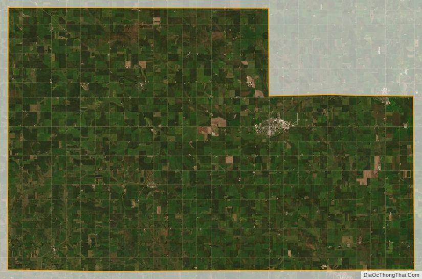
The terrain of Wayne County consists of low rolling hills; mostly devoted to agriculture. The ground slopes to the east-northeast. A small drainage, South Logan Creek, flows east-northeastward through the central part of the county and exits flowing northeastward.
The county has a total area of 443 square miles (1,150 km), of which 443 square miles (1,150 km) is land and 0.4 square miles (1.0 km) (0.09%) is water.
Major highways
- Nebraska Highway 15
- Nebraska Highway 16
- Nebraska Highway 35
- Nebraska Highway 57
- Nebraska Highway 98
Adjacent counties
- Dixon County – northeast
- Thurston County – east
- Cuming County – southeast
- Stanton County – south
- Madison County – southwest
- Pierce County – west
- Cedar County – north
Protected areas
- Sioux Strip State Wildlife Management Area
Wayne County Topographic Map
Wayne County Satellite Map
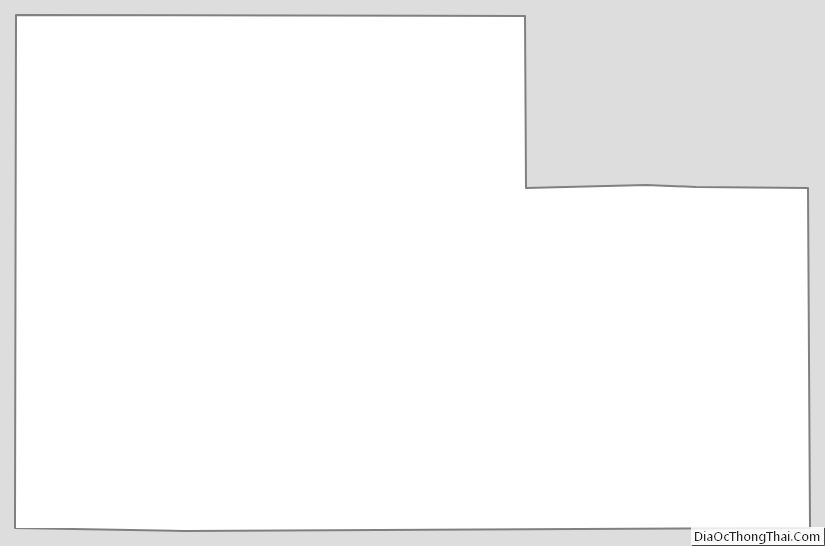
Wayne County Outline Map
See also
Map of Nebraska State and its subdivision:- Adams
- Antelope
- Arthur
- Banner
- Blaine
- Boone
- Box Butte
- Boyd
- Brown
- Buffalo
- Burt
- Butler
- Cass
- Cedar
- Chase
- Cherry
- Cheyenne
- Clay
- Colfax
- Cuming
- Custer
- Dakota
- Dawes
- Dawson
- Deuel
- Dixon
- Dodge
- Douglas
- Dundy
- Fillmore
- Franklin
- Frontier
- Furnas
- Gage
- Garden
- Garfield
- Gosper
- Grant
- Greeley
- Hall
- Hamilton
- Harlan
- Hayes
- Hitchcock
- Holt
- Hooker
- Howard
- Jefferson
- Johnson
- Kearney
- Keith
- Keya Paha
- Kimball
- Knox
- Lancaster
- Lincoln
- Logan
- Loup
- Madison
- McPherson
- Merrick
- Morrill
- Nance
- Nemaha
- Nuckolls
- Otoe
- Pawnee
- Perkins
- Phelps
- Pierce
- Platte
- Polk
- Red Willow
- Richardson
- Rock
- Saline
- Sarpy
- Saunders
- Scotts Bluff
- Seward
- Sheridan
- Sherman
- Sioux
- Stanton
- Thayer
- Thomas
- Thurston
- Valley
- Washington
- Wayne
- Webster
- Wheeler
- York
- Alabama
- Alaska
- Arizona
- Arkansas
- California
- Colorado
- Connecticut
- Delaware
- District of Columbia
- Florida
- Georgia
- Hawaii
- Idaho
- Illinois
- Indiana
- Iowa
- Kansas
- Kentucky
- Louisiana
- Maine
- Maryland
- Massachusetts
- Michigan
- Minnesota
- Mississippi
- Missouri
- Montana
- Nebraska
- Nevada
- New Hampshire
- New Jersey
- New Mexico
- New York
- North Carolina
- North Dakota
- Ohio
- Oklahoma
- Oregon
- Pennsylvania
- Rhode Island
- South Carolina
- South Dakota
- Tennessee
- Texas
- Utah
- Vermont
- Virginia
- Washington
- West Virginia
- Wisconsin
- Wyoming