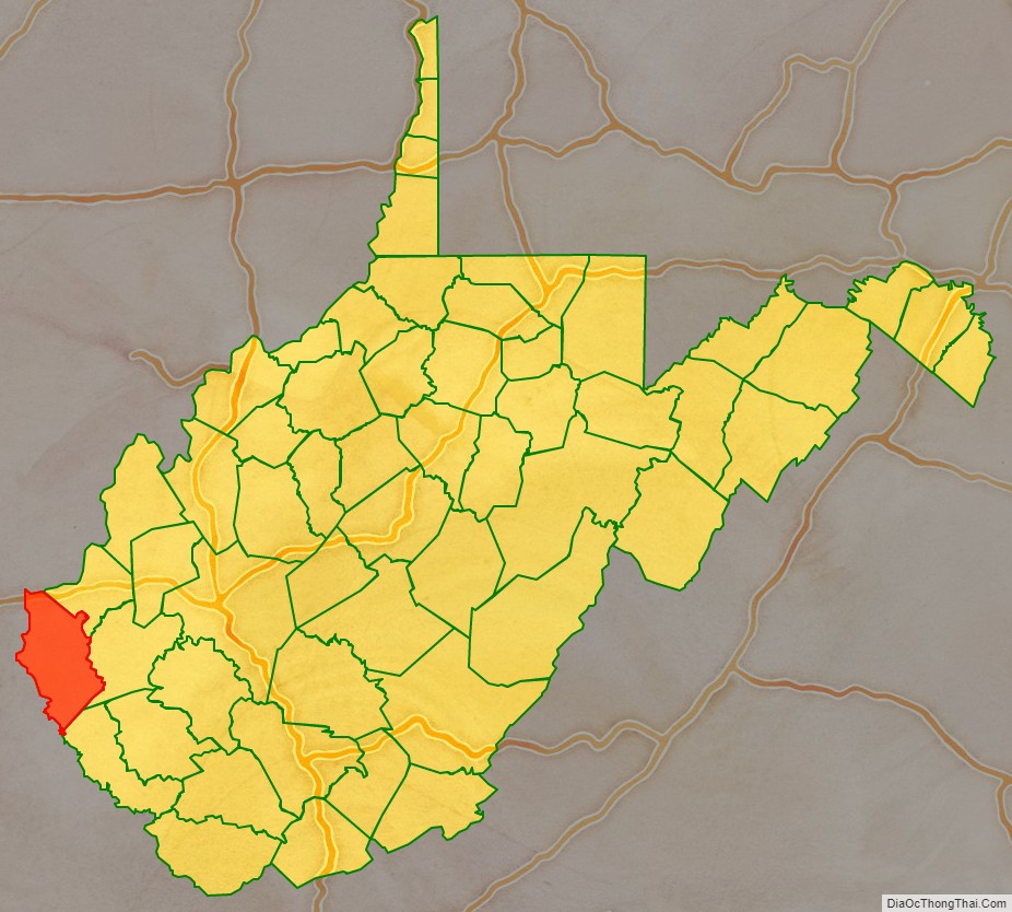
Wayne County is the westernmost county in the U.S. state of West Virginia. As of the 2020 census, the population was 38,982. Its county seat is Wayne. The county was founded in 1842 and named for General “Mad” Anthony Wayne.
Wayne County is part of the Huntington-Ashland, WV-KY-OH Metropolitan Statistical Area.
| Name: | Wayne County |
|---|---|
| FIPS code: | 54-099 |
| State: | West Virginia |
| Founded: | January 18, 1842 |
| Named for: | Anthony Wayne |
| Seat: | Wayne |
| Largest city: | Kenova |
| Total Area: | 512 sq mi (1,330 km²) |
| Land Area: | 506 sq mi (1,310 km²) |
| Total Population: | 38,982 |
| Population Density: | 76/sq mi (29/km²) |
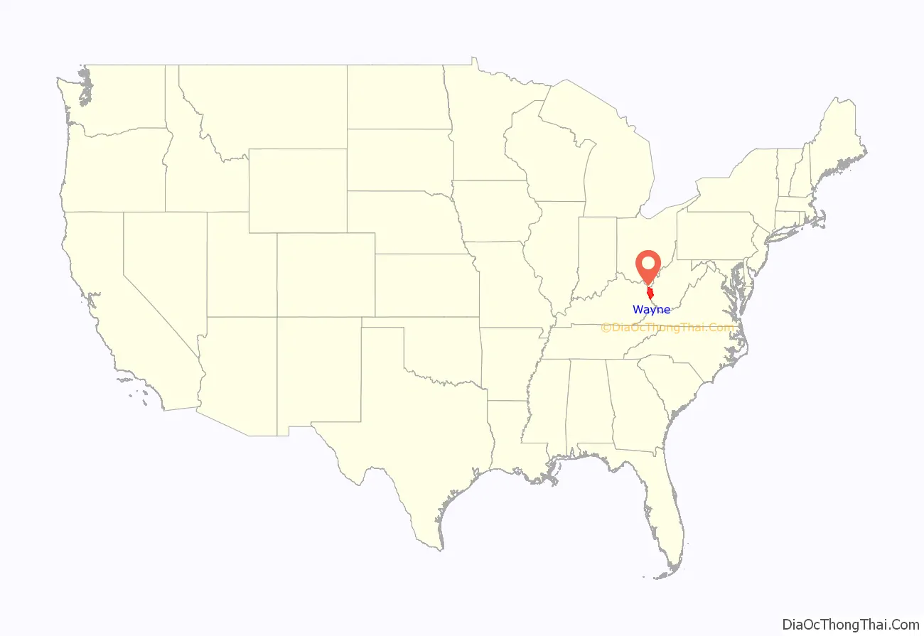
Wayne County location map. Where is Wayne County?
History
Wayne County, West Virginia was originally Wayne County, Virginia, which was created from part of Cabell County in 1842. The county was named for General “Mad” Anthony Wayne.
Settlement
There was no European settlers in the area that became Wayne County until after 1794, due to the constant threat of Indian attack. The area was made safe for European settlers in 1794 through the defeat of the Shawnee at the Battle of Fallen Timbers by General “Mad” Anthony Wayne.
When the first permanent European settlers came to Wayne County around the year 1800, the area was part of Kanawha County. Most of the original pioneer settlers were self-sufficient farmers. They raised their own food, sheep for wool clothing, and made their buildings, furnishings and tools out of the surrounding forest. A few trading posts provided the manufactured goods the pioneers could not make for themselves. Later, grist mills at Wayne, Dickson, south of East Lynn and at Lavalette ground their corn into meal and their wheat into flour.
On June 20, 1863, at the height of the Civil War, Wayne was one of fifty Virginia counties that were admitted to the Union as the state of West Virginia. Later that year, the counties were divided into civil townships, with the intention of encouraging local government. This proved impractical in the heavily rural state, and in 1872 the townships were converted into magisterial districts. Wayne County was divided into five districts: Butler, Ceredo, Grant, Lincoln, and Union. A sixth district, Stonewall, was formed from part of Grant District in 1878. In the 1920s, Westmoreland was created as the county’s seventh magisterial district. Grant District was discontinued between 1960 and 1970, followed by Lincoln in the 1980s.
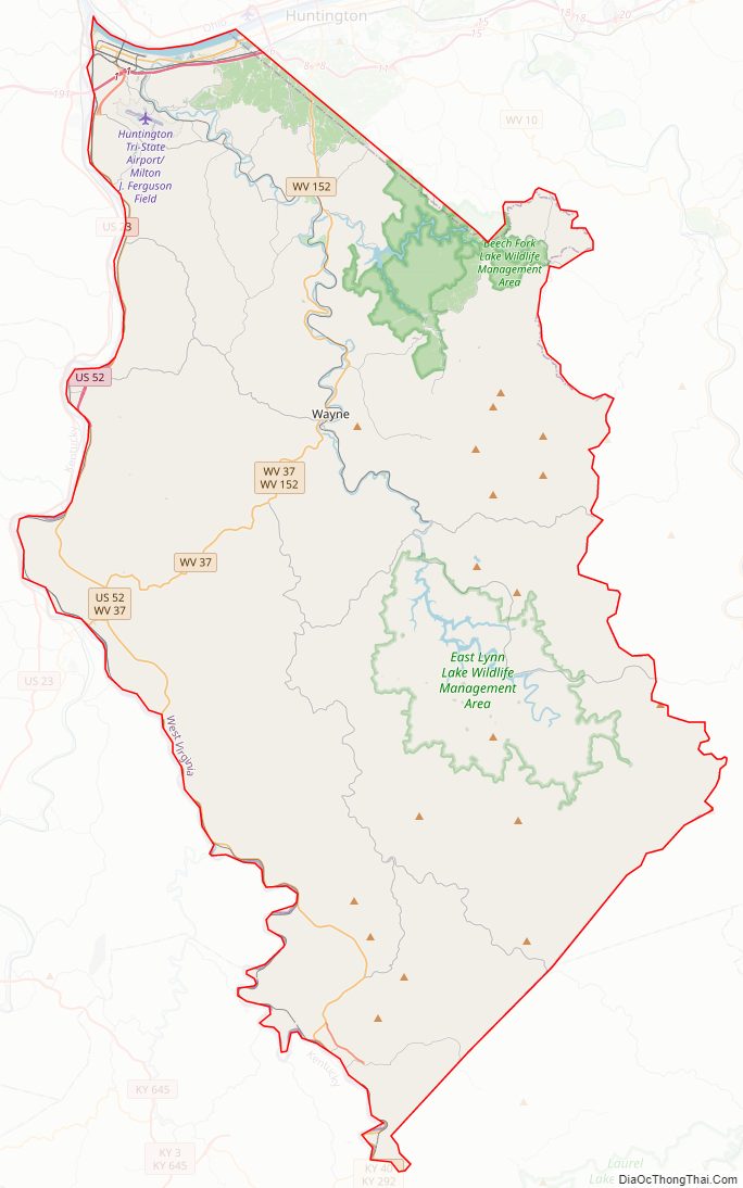
Wayne County Road Map
Geography
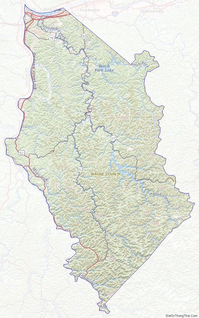
According to the United States Census Bureau, the county has a total area of 512 square miles (1,330 km), of which 506 square miles (1,310 km) is land and 6.1 square miles (16 km) (1.2%) is water.
Rivers and lakes
- Ohio River
- Big Sandy River
- Twelvepole Creek
- Beech Fork Lake
- East Lynn Lake
- Tug Fork
Major highways
- Interstate 64
- I-73 (future)
- I-74 (future)
- U.S. Route 52
- U.S. Route 60
- West Virginia Route 37
- West Virginia Route 152
- West Virginia Route 75
Adjacent counties
- Lawrence County, Ohio (north)
- Cabell County (northeast)
- Lincoln County (east)
- Mingo County (southeast)
- Martin County, Kentucky (south)
- Lawrence County, Kentucky (west)
- Boyd County, Kentucky (northwest)
Wayne County is one of three counties (along with Apache County, Arizona and Cook County, Illinois) to border two counties of the same name, neither of which are in the same state as the county itself (Lawrence County, Ohio and Lawrence County, Kentucky).
Wayne County Topographic Map
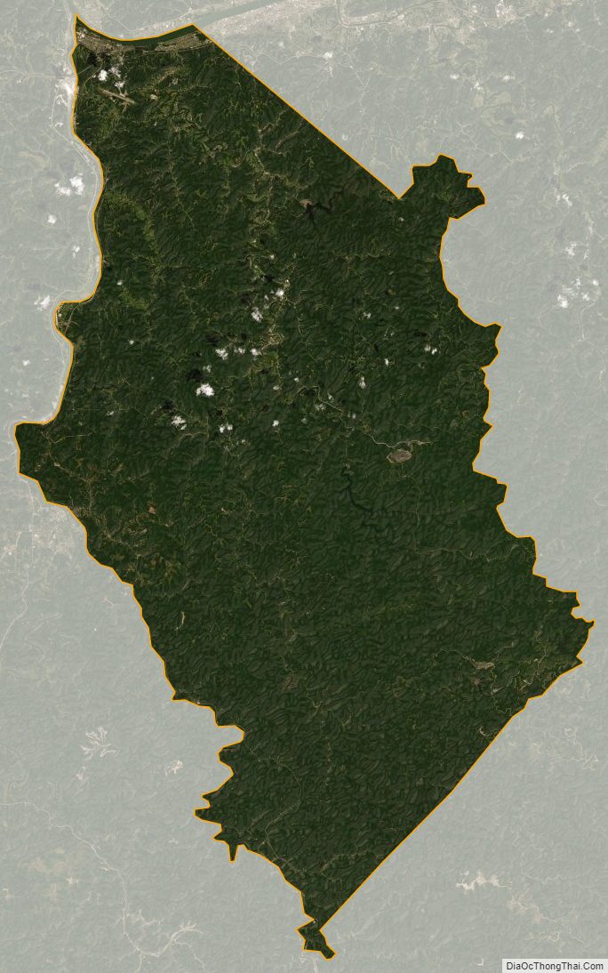
Wayne County Satellite Map
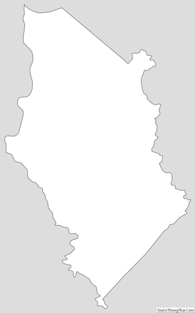
Wayne County Outline Map
See also
Map of West Virginia State and its subdivision:- Barbour
- Berkeley
- Boone
- Braxton
- Brooke
- Cabell
- Calhoun
- Clay
- Doddridge
- Fayette
- Gilmer
- Grant
- Greenbrier
- Hampshire
- Hancock
- Hardy
- Harrison
- Jackson
- Jefferson
- Kanawha
- Lewis
- Lincoln
- Logan
- Marion
- Marshall
- Mason
- McDowell
- Mercer
- Mineral
- Mingo
- Monongalia
- Monroe
- Morgan
- Nicholas
- Ohio
- Pendleton
- Pleasants
- Pocahontas
- Preston
- Putnam
- Raleigh
- Randolph
- Ritchie
- Roane
- Summers
- Taylor
- Tucker
- Tyler
- Upshur
- Wayne
- Webster
- Wetzel
- Wirt
- Wood
- Wyoming
- Alabama
- Alaska
- Arizona
- Arkansas
- California
- Colorado
- Connecticut
- Delaware
- District of Columbia
- Florida
- Georgia
- Hawaii
- Idaho
- Illinois
- Indiana
- Iowa
- Kansas
- Kentucky
- Louisiana
- Maine
- Maryland
- Massachusetts
- Michigan
- Minnesota
- Mississippi
- Missouri
- Montana
- Nebraska
- Nevada
- New Hampshire
- New Jersey
- New Mexico
- New York
- North Carolina
- North Dakota
- Ohio
- Oklahoma
- Oregon
- Pennsylvania
- Rhode Island
- South Carolina
- South Dakota
- Tennessee
- Texas
- Utah
- Vermont
- Virginia
- Washington
- West Virginia
- Wisconsin
- Wyoming