| Name: | Webb County |
|---|---|
| FIPS code: | 48-479 |
| State: | Texas |
| Founded: | 1848 |
| Named for: | James Webb |
| Seat: | Laredo |
| Largest city: | Laredo |
| Total Area: | 3,375 sq mi (8,740 km²) |
| Land Area: | 3,361 sq mi (8,700 km²) |
| Total Population: | 267,114 |
| Population Density: | 79/sq mi (31/km²) |
| Time zone: | UTC−6 (Central) |
| Summer Time Zone (DST): | UTC−5 (CDT) |
| Website: | www.webbcountytx.gov |
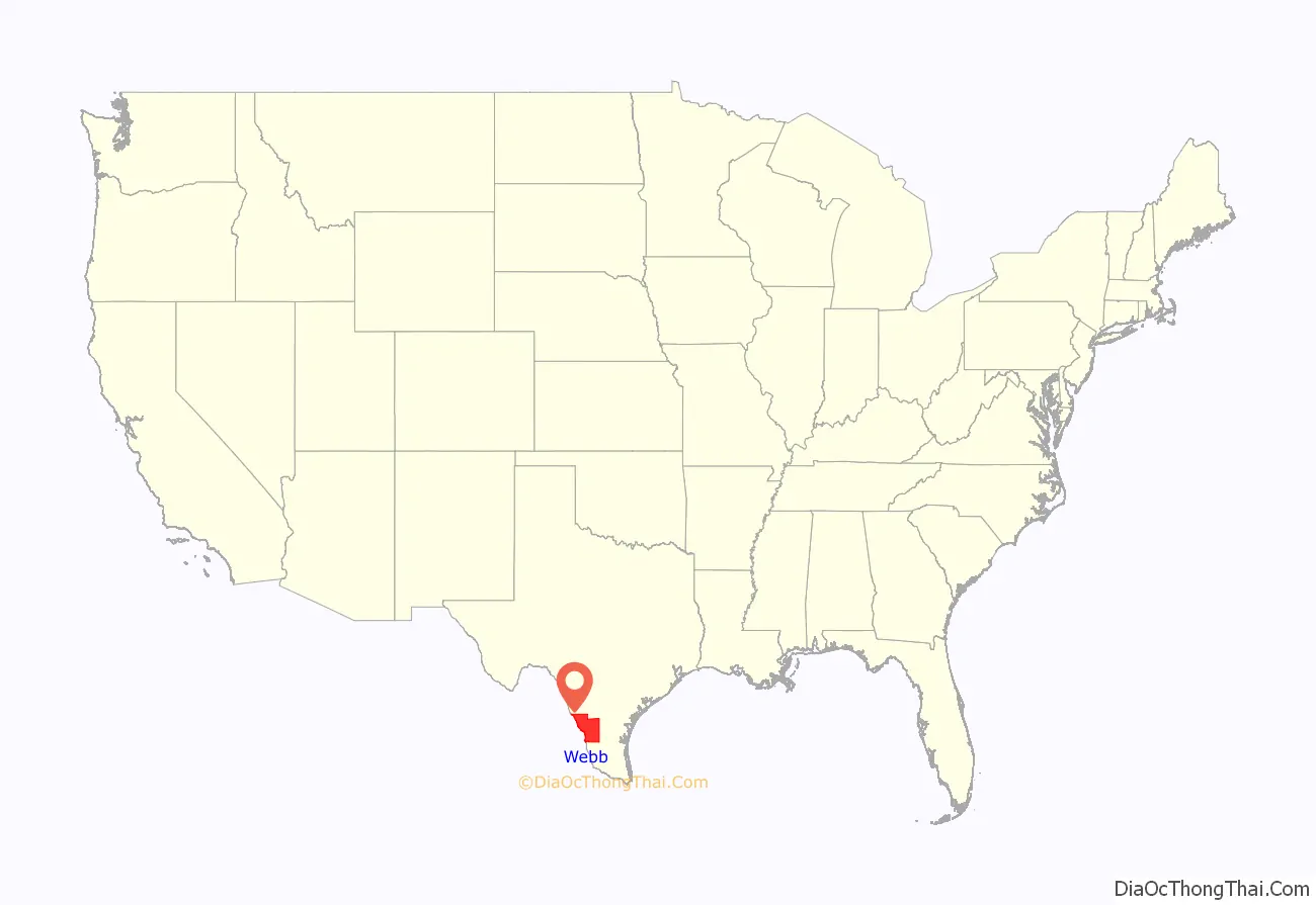
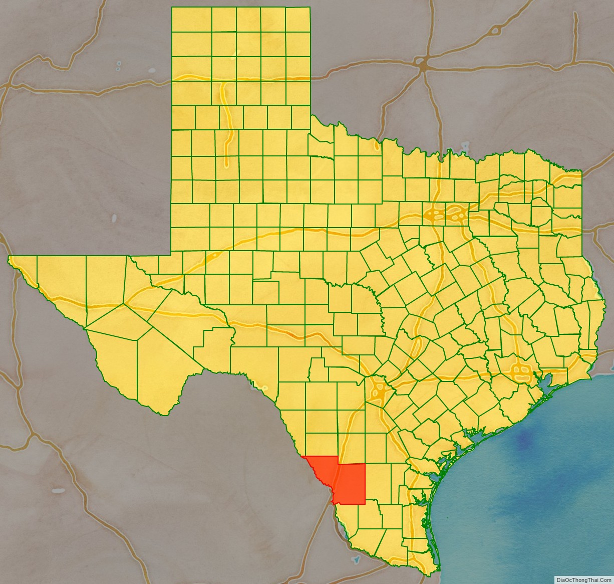
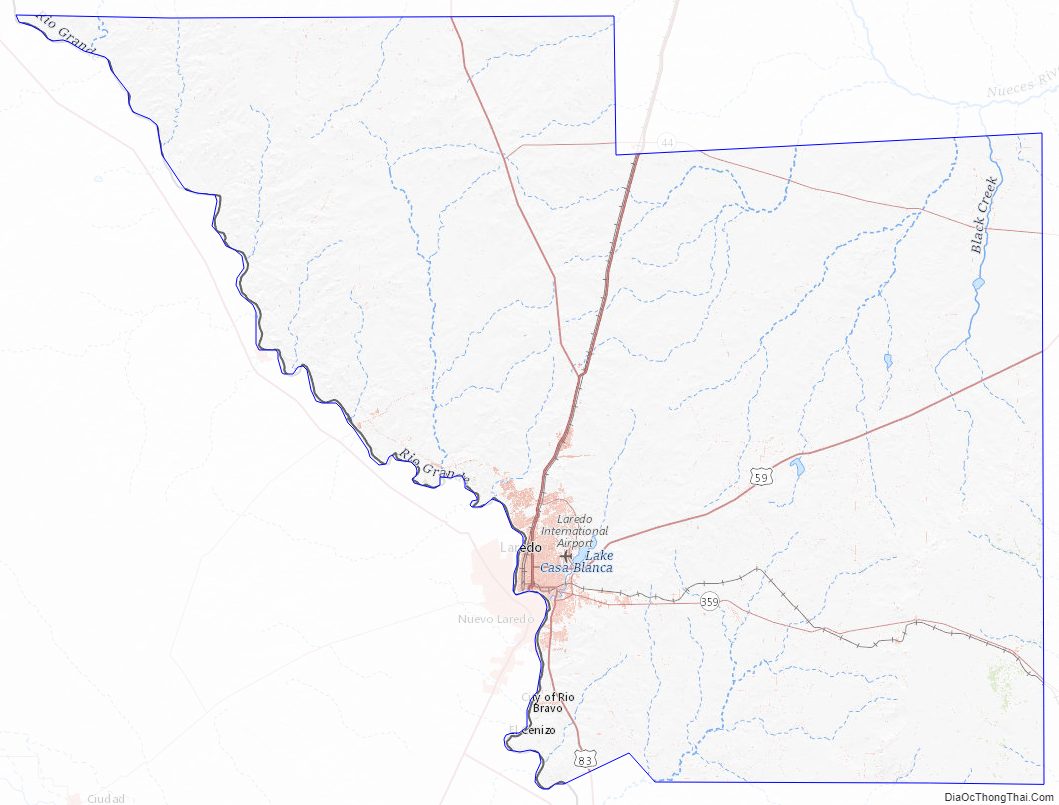
Webb County location map. Where is Webb County?
History
Webb County was split in 1856. Encinal County was established on February 1, 1856, and was to have consisted of the eastern portion of Webb County. However, Encinal County was never organized and was finally dissolved on March 12, 1899, with its territory returned as part of Webb County.
Much of Webb County history is based on the prevalence of ranching in the 19th century and continuing thereafter. The Webb County Heritage Foundation is a nonprofit organization that seeks to preserve documents and artifacts of the past to guarantee that the regional history is not lost to upcoming generations. In 2015, the foundation, headed by President James E. Moore, presented Heritage Awards to such local notables as the artist Janet Krueger, journalist Maria Eugenia Guerra, and Laredo Community College art instructor Martha F. Fenstermaker (1943-2014).
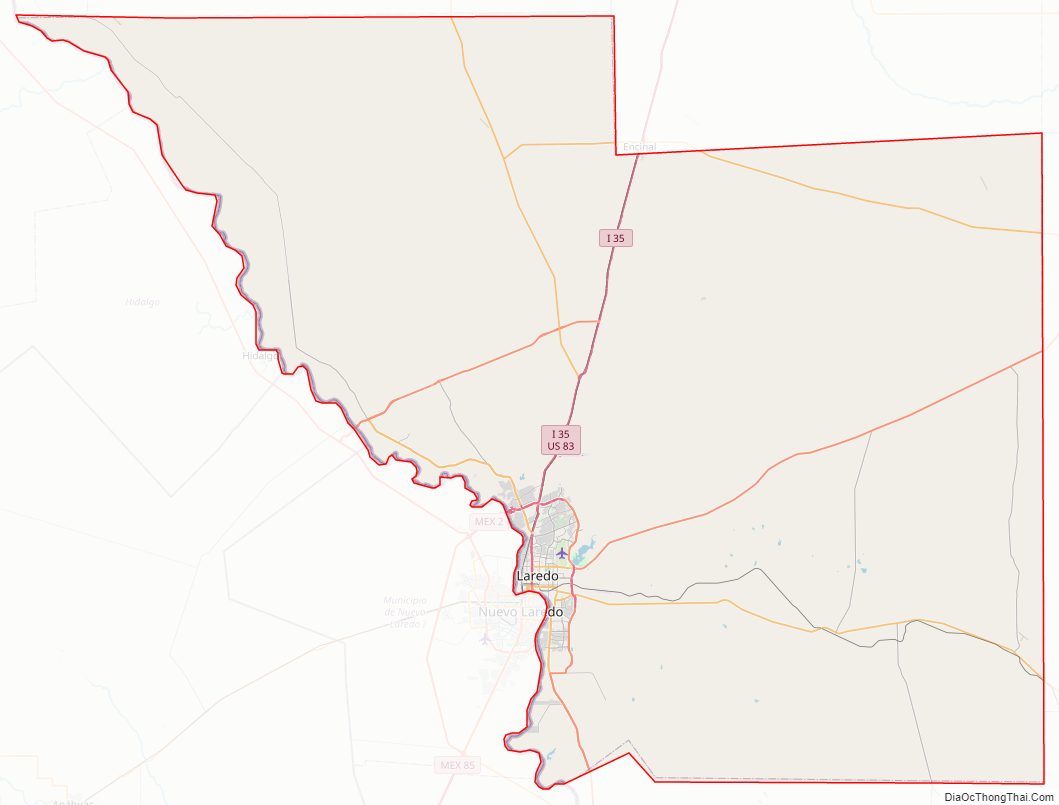
Webb County Road Map
Geography
According to the U.S. Census Bureau, the county has a total area of 3,376 square miles (8,740 km), of which 3,361 square miles (8,700 km) are land and 14 square miles (36 km) (0.4%) are covered by water.
Major highways
The Webb County – City of Laredo Regional Mobility Authority has responsibility for a comprehensive transport system in the region.
- I-35
- I-35 BL
- I-35 BS
- I-69W
- US 59
- Bus. US 59
- US 83
- SH 12
- Loop 20
- SH 44
- SH 255
- Spur 260
- SH 359
- FM 649
- FM 1472
- FM 1583
- FM 2050
- FM 2895
- FM 3338
- FM 3464
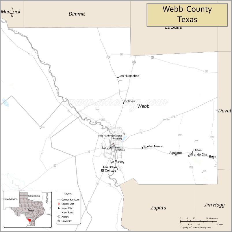
Adjacent counties and municipalities
- Dimmit County (north)
- La Salle County (north)
- Duval County (east)
- Jim Hogg County (southeast)
- Zapata County (south and southeast)
- Maverick County (northwest)
- McMullen County, Texas (northeast)
- Guerrero, Coahuila, Mexico (west)
- Hidalgo, Coahuila, Mexico (west)
- Anáhuac, Nuevo León, Mexico (west)
- Nuevo Laredo, Tamaulipas, Mexico (south)
- Guerrero, Tamaulipas, Mexico (southwest)
Webb County Topographic Map
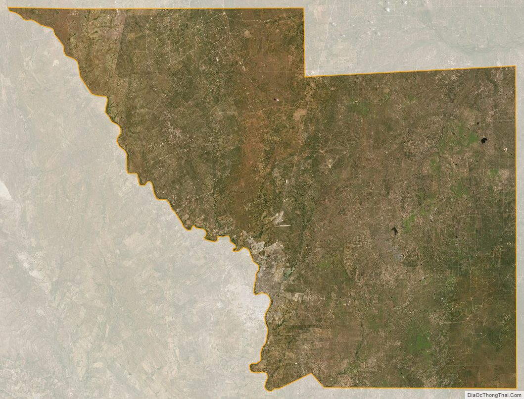
Webb County Satellite Map
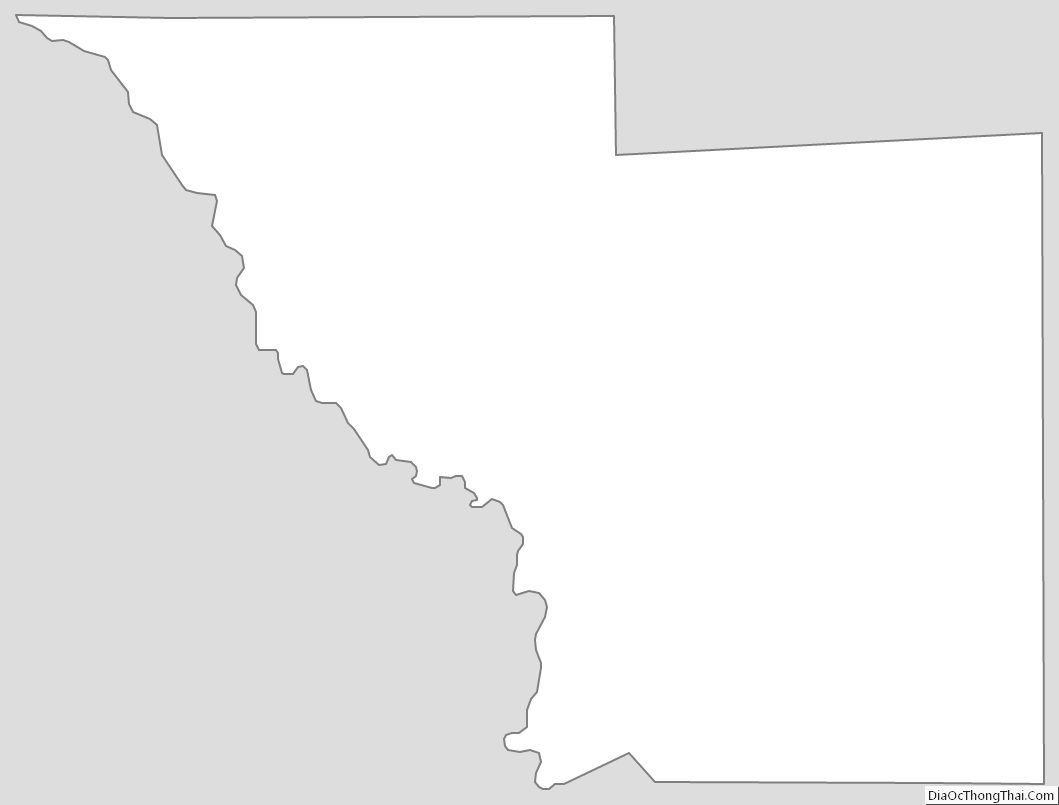
Webb County Outline Map
See also
Map of Texas State and its subdivision:- Anderson
- Andrews
- Angelina
- Aransas
- Archer
- Armstrong
- Atascosa
- Austin
- Bailey
- Bandera
- Bastrop
- Baylor
- Bee
- Bell
- Bexar
- Blanco
- Borden
- Bosque
- Bowie
- Brazoria
- Brazos
- Brewster
- Briscoe
- Brooks
- Brown
- Burleson
- Burnet
- Caldwell
- Calhoun
- Callahan
- Cameron
- Camp
- Carson
- Cass
- Castro
- Chambers
- Cherokee
- Childress
- Clay
- Cochran
- Coke
- Coleman
- Collin
- Collingsworth
- Colorado
- Comal
- Comanche
- Concho
- Cooke
- Coryell
- Cottle
- Crane
- Crockett
- Crosby
- Culberson
- Dallam
- Dallas
- Dawson
- Deaf Smith
- Delta
- Denton
- Dewitt
- Dickens
- Dimmit
- Donley
- Duval
- Eastland
- Ector
- Edwards
- El Paso
- Ellis
- Erath
- Falls
- Fannin
- Fayette
- Fisher
- Floyd
- Foard
- Fort Bend
- Franklin
- Freestone
- Frio
- Gaines
- Galveston
- Garza
- Gillespie
- Glasscock
- Goliad
- Gonzales
- Gray
- Grayson
- Gregg
- Grimes
- Guadalupe
- Hale
- Hall
- Hamilton
- Hansford
- Hardeman
- Hardin
- Harris
- Harrison
- Hartley
- Haskell
- Hays
- Hemphill
- Henderson
- Hidalgo
- Hill
- Hockley
- Hood
- Hopkins
- Houston
- Howard
- Hudspeth
- Hunt
- Hutchinson
- Irion
- Jack
- Jackson
- Jasper
- Jeff Davis
- Jefferson
- Jim Hogg
- Jim Wells
- Johnson
- Jones
- Karnes
- Kaufman
- Kendall
- Kenedy
- Kent
- Kerr
- Kimble
- King
- Kinney
- Kleberg
- Knox
- La Salle
- Lamar
- Lamb
- Lampasas
- Lavaca
- Lee
- Leon
- Liberty
- Limestone
- Lipscomb
- Live Oak
- Llano
- Loving
- Lubbock
- Lynn
- Madison
- Marion
- Martin
- Mason
- Matagorda
- Maverick
- McCulloch
- McLennan
- McMullen
- Medina
- Menard
- Midland
- Milam
- Mills
- Mitchell
- Montague
- Montgomery
- Moore
- Morris
- Motley
- Nacogdoches
- Navarro
- Newton
- Nolan
- Nueces
- Ochiltree
- Oldham
- Orange
- Palo Pinto
- Panola
- Parker
- Parmer
- Pecos
- Polk
- Potter
- Presidio
- Rains
- Randall
- Reagan
- Real
- Red River
- Reeves
- Refugio
- Roberts
- Robertson
- Rockwall
- Runnels
- Rusk
- Sabine
- San Augustine
- San Jacinto
- San Patricio
- San Saba
- Schleicher
- Scurry
- Shackelford
- Shelby
- Sherman
- Smith
- Somervell
- Starr
- Stephens
- Sterling
- Stonewall
- Sutton
- Swisher
- Tarrant
- Taylor
- Terrell
- Terry
- Throckmorton
- Titus
- Tom Green
- Travis
- Trinity
- Tyler
- Upshur
- Upton
- Uvalde
- Val Verde
- Van Zandt
- Victoria
- Walker
- Waller
- Ward
- Washington
- Webb
- Wharton
- Wheeler
- Wichita
- Wilbarger
- Willacy
- Williamson
- Wilson
- Winkler
- Wise
- Wood
- Yoakum
- Young
- Zapata
- Zavala
- Alabama
- Alaska
- Arizona
- Arkansas
- California
- Colorado
- Connecticut
- Delaware
- District of Columbia
- Florida
- Georgia
- Hawaii
- Idaho
- Illinois
- Indiana
- Iowa
- Kansas
- Kentucky
- Louisiana
- Maine
- Maryland
- Massachusetts
- Michigan
- Minnesota
- Mississippi
- Missouri
- Montana
- Nebraska
- Nevada
- New Hampshire
- New Jersey
- New Mexico
- New York
- North Carolina
- North Dakota
- Ohio
- Oklahoma
- Oregon
- Pennsylvania
- Rhode Island
- South Carolina
- South Dakota
- Tennessee
- Texas
- Utah
- Vermont
- Virginia
- Washington
- West Virginia
- Wisconsin
- Wyoming