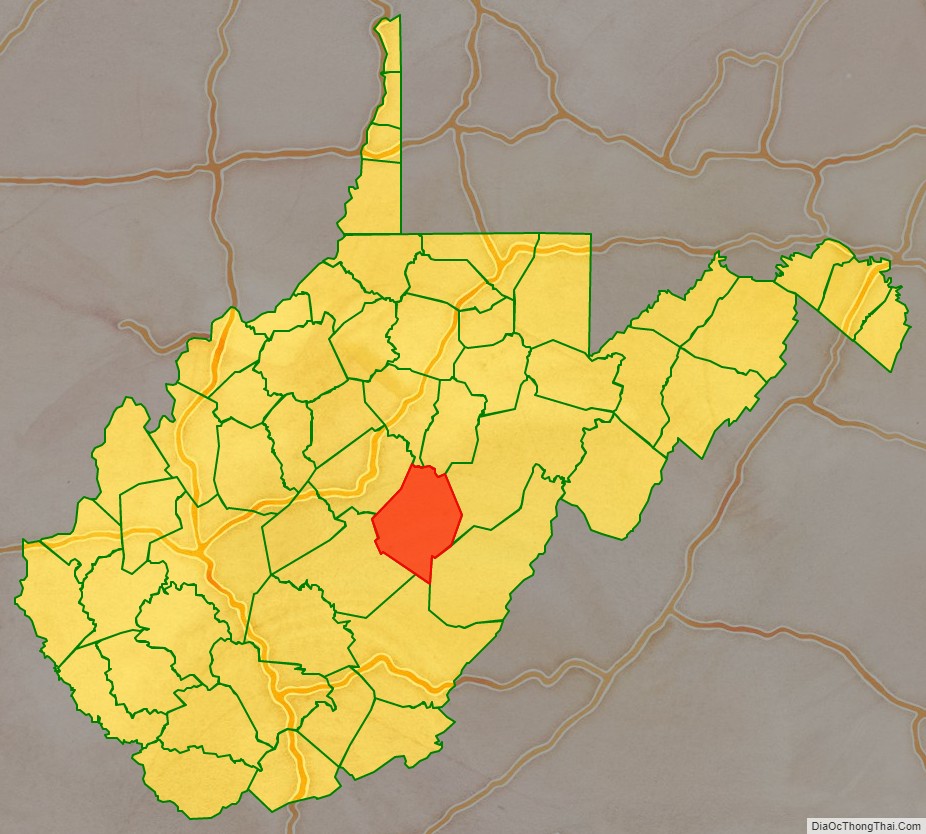
Webster County is a county in the U.S. state of West Virginia. As of the 2020 census, the population was 8,378. Its county seat is Webster Springs. The county was founded in 1860 and named for Daniel Webster.
| Name: | Webster County |
|---|---|
| FIPS code: | 54-101 |
| State: | West Virginia |
| Founded: | January 10, 1860 |
| Named for: | Daniel Webster |
| Seat: | Webster Springs |
| Largest town: | Webster Springs |
| Total Area: | 556 sq mi (1,440 km²) |
| Land Area: | 553 sq mi (1,430 km²) |
| Total Population: | 8,378 |
| Population Density: | 15/sq mi (5.8/km²) |
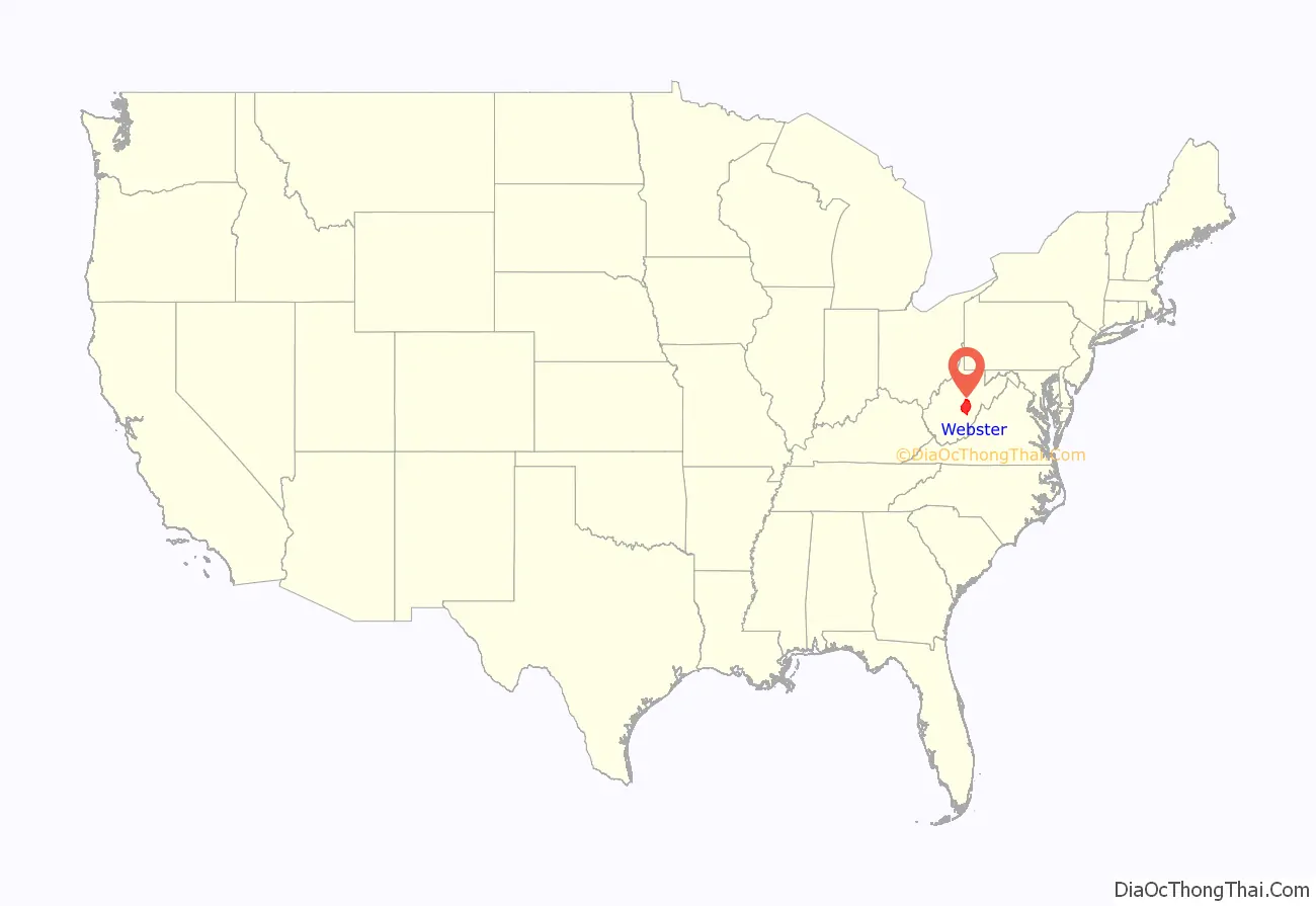
Webster County location map. Where is Webster County?
History
Webster County was formed from parts of Nicholas, Braxton, and Randolph counties in Virginia through the approval of an act of the Virginia General Assembly during its 1859-1860 session. Movement toward the formation of this county began in 1851.
Webster became part of West Virginia on June 20, 1863. When the state was formed, each county was divided into multiple civil townships, with the intention of encouraging local government. This proved impractical in the heavily rural state, so in 1872 the townships were converted into magisterial districts.
Webster County’s three original townships, subsequently magisterial districts, were Fork Lick, Glade, and Holly. A fourth district, Hacker Valley, was formed from part of Holly District in 1876. The four historic magisterial districts remained largely unchanged until the 1990s, when they were consolidated into three new districts: Central, Northern, and Southern.
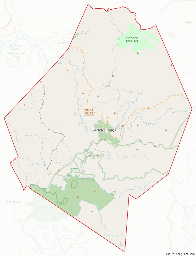
Webster County Road Map
Geography
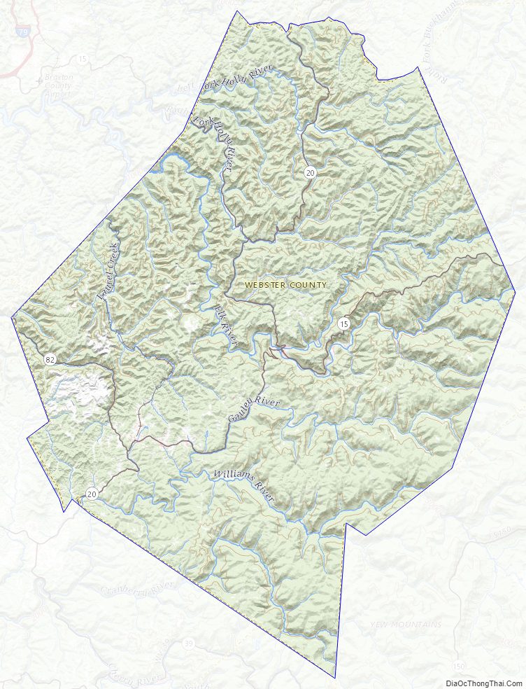
According to the United States Census Bureau, the county has a total area of 556 square miles (1,440 km), of which 553 square miles (1,430 km) is land and 2.8 square miles (7.3 km) (0.5%) is water.
Major highways
- West Virginia Route 15
- West Virginia Route 20
- West Virginia Route 82
Adjacent counties
- Lewis County (north)
- Upshur County (north)
- Randolph County (east)
- Pocahontas County (southeast)
- Greenbrier County (south)
- Nicholas County (southwest)
- Braxton County (west)
National protected area
- Monongahela National Forest (part)
Webster County Topographic Map
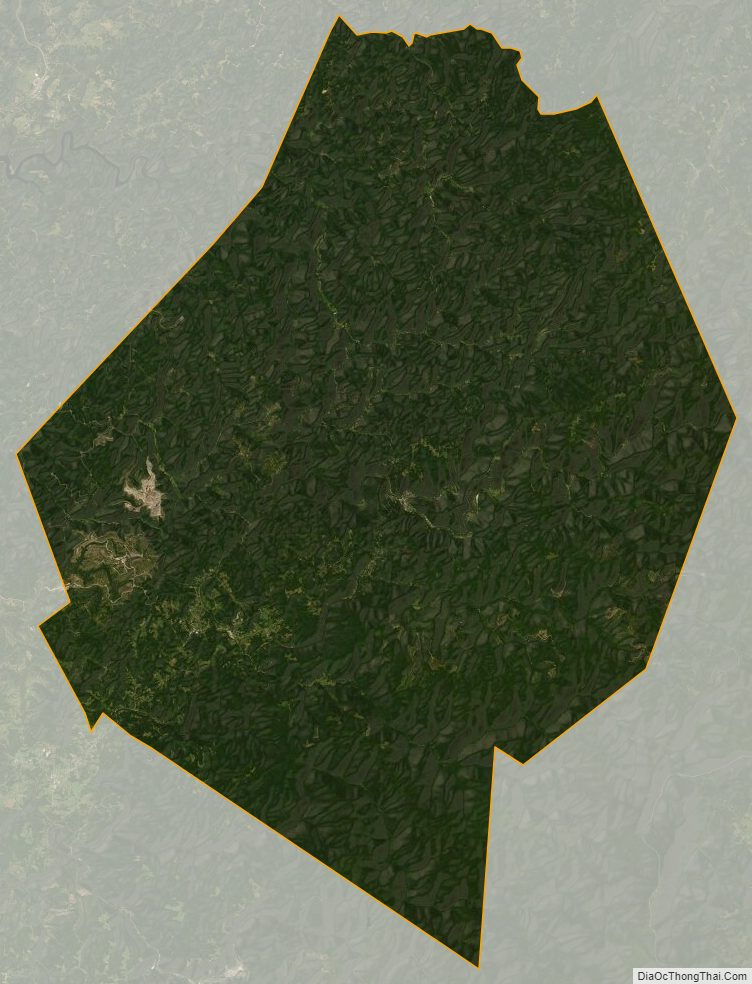
Webster County Satellite Map
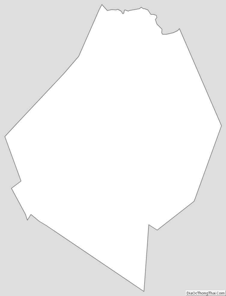
Webster County Outline Map
See also
Map of West Virginia State and its subdivision:- Barbour
- Berkeley
- Boone
- Braxton
- Brooke
- Cabell
- Calhoun
- Clay
- Doddridge
- Fayette
- Gilmer
- Grant
- Greenbrier
- Hampshire
- Hancock
- Hardy
- Harrison
- Jackson
- Jefferson
- Kanawha
- Lewis
- Lincoln
- Logan
- Marion
- Marshall
- Mason
- McDowell
- Mercer
- Mineral
- Mingo
- Monongalia
- Monroe
- Morgan
- Nicholas
- Ohio
- Pendleton
- Pleasants
- Pocahontas
- Preston
- Putnam
- Raleigh
- Randolph
- Ritchie
- Roane
- Summers
- Taylor
- Tucker
- Tyler
- Upshur
- Wayne
- Webster
- Wetzel
- Wirt
- Wood
- Wyoming
- Alabama
- Alaska
- Arizona
- Arkansas
- California
- Colorado
- Connecticut
- Delaware
- District of Columbia
- Florida
- Georgia
- Hawaii
- Idaho
- Illinois
- Indiana
- Iowa
- Kansas
- Kentucky
- Louisiana
- Maine
- Maryland
- Massachusetts
- Michigan
- Minnesota
- Mississippi
- Missouri
- Montana
- Nebraska
- Nevada
- New Hampshire
- New Jersey
- New Mexico
- New York
- North Carolina
- North Dakota
- Ohio
- Oklahoma
- Oregon
- Pennsylvania
- Rhode Island
- South Carolina
- South Dakota
- Tennessee
- Texas
- Utah
- Vermont
- Virginia
- Washington
- West Virginia
- Wisconsin
- Wyoming