Weld County is a county located in the U.S. state of Colorado. As of the 2020 census, the population was 328,981. The county seat is Greeley.
Weld County comprises the Greeley, CO Metropolitan Statistical Area, which is included in the Denver–Aurora, CO Combined Statistical Area.
| Name: | Weld County |
|---|---|
| FIPS code: | 08-123 |
| State: | Colorado |
| Founded: | November 3, 1861 |
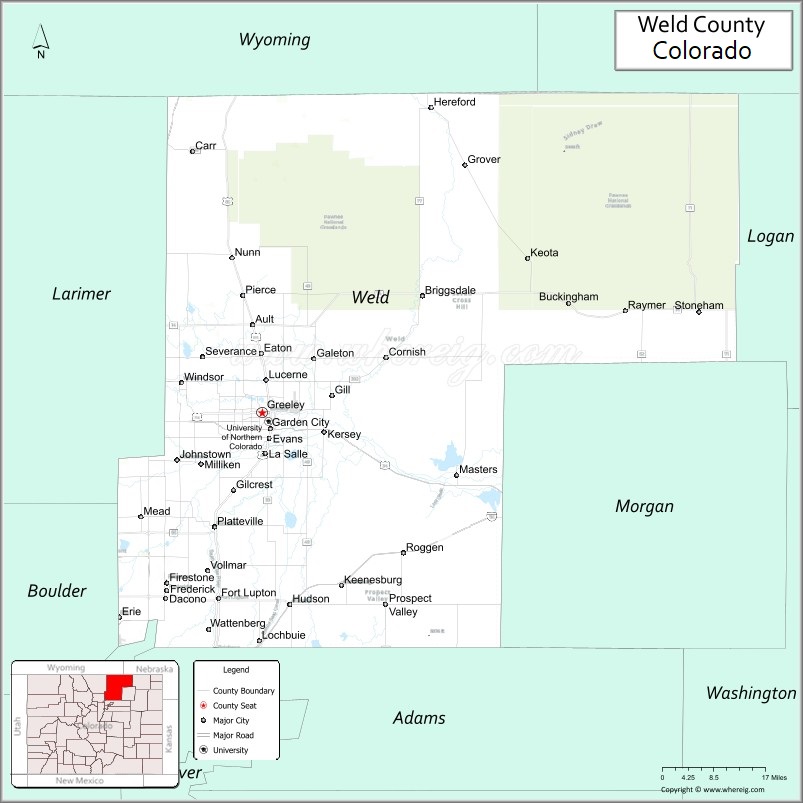
| Seat: | Greeley |
| Largest city: | Greeley |
| Total Area: | 4,017 sq mi (10,400 km²) |
| Land Area: | 3,987 sq mi (10,330 km²) |
| Total Population: | 340,036 |
| Population Density: | 83/sq mi (32/km²) |
| Time zone: | UTC−7 (Mountain) |
| Summer Time Zone (DST): | UTC−6 (MDT) |
| Website: | www.weldgov.com |
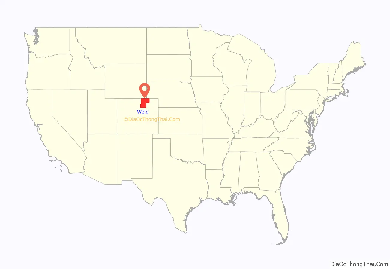
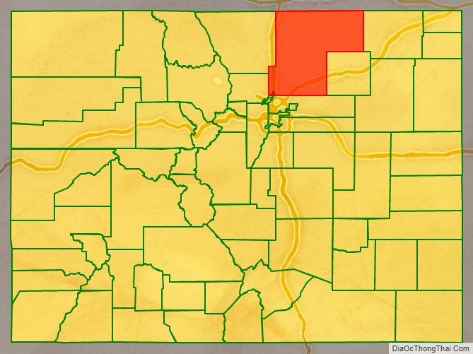
Weld County location map. Where is Weld County?
History
On May 30, 1854, the Kansas–Nebraska Act created the Nebraska Territory and the Kansas Territory, divided by the Parallel 40° North (Baseline Road or County Line Road or Weld County Road 2 in the future Weld County). Present-day Weld County, Colorado, lay in the southwestern portion of the Nebraska Territory, bordering the Kansas Territory.
In July 1858, gold was discovered along the South Platte River in Arapahoe County, Kansas Territory. This discovery precipitated the Pike’s Peak Gold Rush. Many residents of the mining region felt disconnected from the remote territorial governments of Kansas and Nebraska, so they voted to form their own Territory of Jefferson on October 24, 1859. The following month, the Jefferson Territorial Legislature organized 12 counties for the new territory, including St. Vrain County. St. Vrain County was named in honor of Ceran de Hault de Lassus de St. Vrain, the French trader who established the first trading post on the upper South Platte River. St. Vrain County encompassed much of what is today Weld County.
The Jefferson Territory never received federal sanction, but on February 28, 1861, U.S. President James Buchanan signed an act organizing the Territory of Colorado. On November 1, 1861, the Colorado General Assembly organized 17 counties, including Weld County, for the new Colorado Territory. Weld County was named for Lewis Ledyard Weld, a lawyer and territorial secretary. He died while serving in the Union Army during the Civil War. Until February 9, 1887, Weld County’s boundaries included the area now comprising Weld County, Washington County, Logan County, Morgan County, Yuma County, Phillips County, and Sedgwick County.
Weld County was thrust into the media spotlight on the evening of November 1, 1955, when United Airlines Flight 629, a Douglas DC-6B airliner flying from Denver to Portland, Oregon, exploded in midair and crashed, killing all 44 persons on board the plane and scattering bodies, wreckage and debris over a six-square-mile area of the county. The subsequent investigation of the accident revealed that Denver resident John Gilbert Graham had secretly placed a time bomb composed of 25 sticks of dynamite in a suitcase belonging to his mother, who was a passenger on the airplane. Graham was tried and convicted of the crime, and executed in 1957.
In northeastern Weld County, Minuteman III missile silo “N-8”, one of the many unmanned silos there, was the target of symbolic vandalism by Catholic peace activists in 2002.
Weld County also holds the distinction of having more confirmed tornado sightings than any other U.S. county from 1950 to 2011, with 252 confirmed reports.
On March 6, 2019, the county declared itself to be a Second Amendment sanctuary.
Secession proposals
In 2013, conservative Weld County commissioners began a campaign to secede from the State of Colorado to create a new state; a state ballot measure regarding the issue was put on the November 2013 ballot. The legality of this initiative has been questioned by local attorneys. On Nov 5th, 2013, 6 out of 11 Colorado counties voted no for secession, including Weld County. Elbert, Lincoln, Logan, Moffat, Sedgwick, and Weld counties voted no, while Cheyenne, Kit Carson, Phillips, Washington, and Yuma counties voted yes. “Weld County voters said this is an option we shouldn’t pursue and we won’t pursue it,” said Weld County Commissioner Sean Conway, “But we will continue to look at the problems of the urban and rural divide in this state.”
In 2021, a group known as “Weld County, WY” organized a petition to place a measure on the November 2021 ballot for the county to secede from Colorado to join Wyoming, due to a clash between the conservative politics of Weld County and the liberal government of Colorado. Mark Gordon, the Governor of Wyoming, said when asked about the topic, “We would love that.” In response to Gordon’s comment, Colorado Governor Jared Polis said, “Hands off Weld County.”
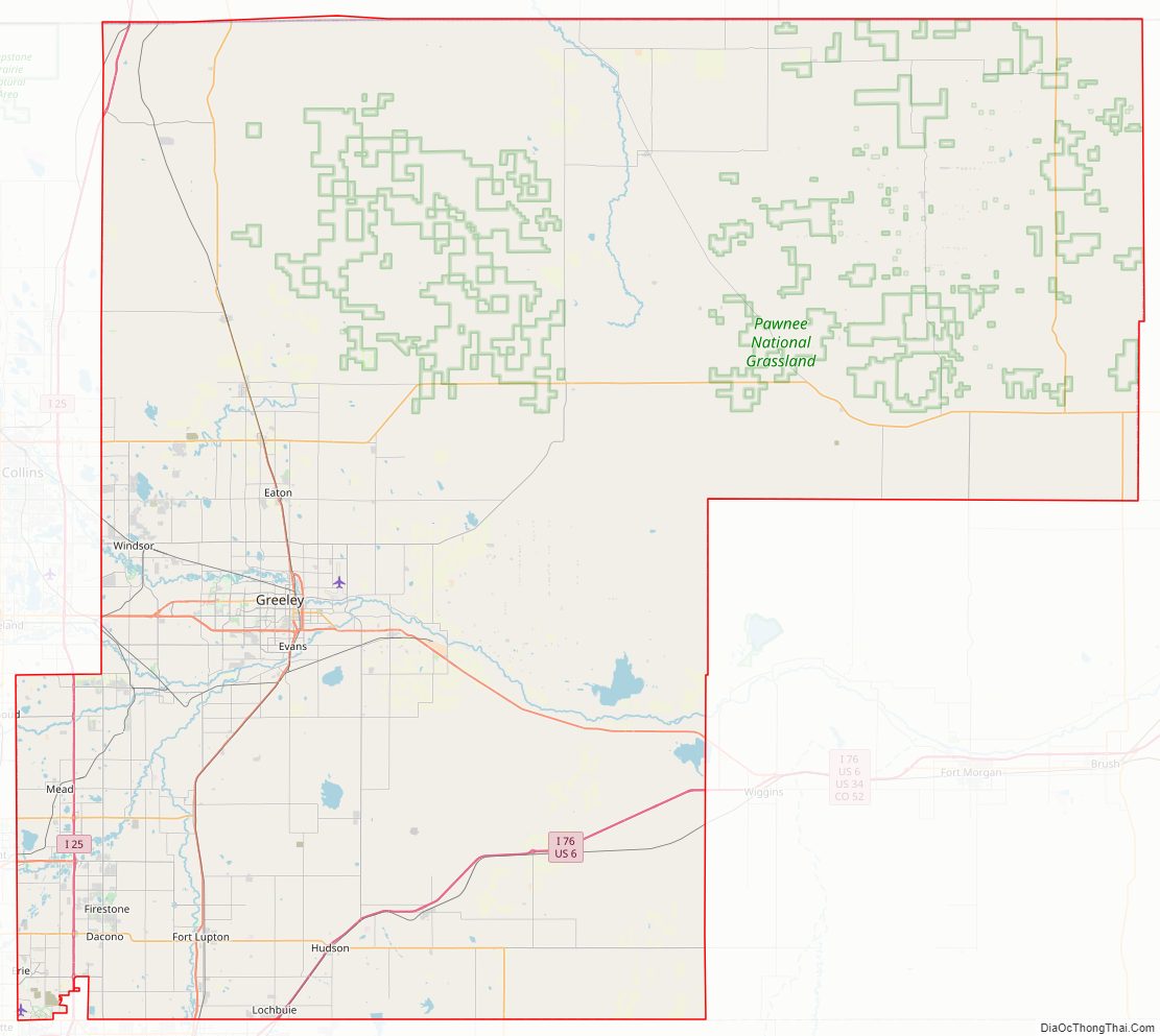
Weld County Road Map
Geography
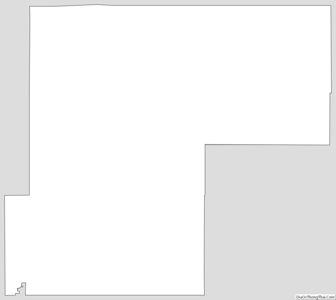
According to the U.S. Census Bureau, the county has a total area of 4,017 square miles (10,400 km), of which 3,987 square miles (10,330 km) are land and 30 square miles (78 km) (0.7%) are water. It is the third-largest county in Colorado by area.
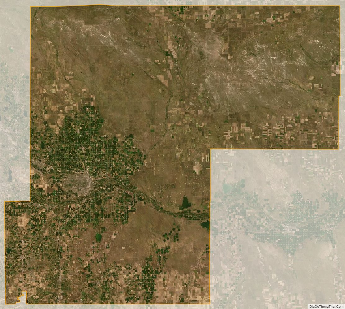
Weld County lies within the relatively flat eastern portion of Colorado; the northeastern portions of the county contain the extensive Pawnee National Grassland and the Pawnee Buttes, which jut 350 feet (110 m) above the surrounding terrain and are surrounded by many small canyons and outcroppings. Along the western border, hilly areas indicate the presence of the foothills of the Rocky Mountains further west.
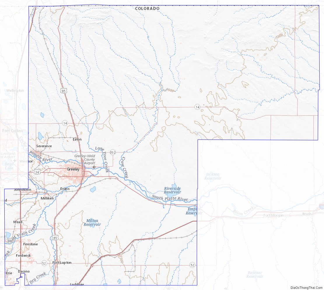
The county is served by two interstate highways: I-25 (US 87) runs through the southwestern corner and I-76 from the south central edge northeastward to the Morgan county border. Other major roads include US 85 and US 34, which intersect near Greeley, and State Highway 14, which runs through Ault.
Adjacent counties
- Kimball County, Nebraska – northeast
- Logan County – east
- Morgan County – east
- Adams County – south
- City and County of Broomfield – southwest
- Boulder County – west
- Larimer County – west
- Laramie County, Wyoming – northwest
Major Highways
- Interstate 25
- Interstate 76
- I-76 BS
- U.S. Highway 6
- U.S. Highway 34
- U.S. Highway 85
- U.S. Highway 87
- State Highway 7
- State Highway 14
- State Highway 37
- State Highway 52
- State Highway 56
- State Highway 60
- State Highway 66
- State Highway 71
- State Highway 79
- State Highway 257
- State Highway 263
- State Highway 392
National protected area
- Pawnee National Grassland
State protected area
- Fort Vasquez State History Museum
- St. Vrain State Park
Trails and byways
- American Discovery Trail
- Pawnee Pioneer Trails
- Poudre River National Recreation Trail
- South Platte Trail
Weld County Topographic Map
Weld County Satellite Map
Weld County Outline Map
See also
Map of Colorado State and its subdivision:- Adams
- Alamosa
- Arapahoe
- Archuleta
- Baca
- Bent
- Boulder
- Broomfield
- Chaffee
- Cheyenne
- Clear Creek
- Conejos
- Costilla
- Crowley
- Custer
- Delta
- Denver
- Dolores
- Douglas
- Eagle
- El Paso
- Elbert
- Fremont
- Garfield
- Gilpin
- Grand
- Gunnison
- Hinsdale
- Huerfano
- Jackson
- Jefferson
- Kiowa
- Kit Carson
- La Plata
- Lake
- Larimer
- Las Animas
- Lincoln
- Logan
- Mesa
- Mineral
- Moffat
- Montezuma
- Montrose
- Morgan
- Otero
- Ouray
- Park
- Phillips
- Pitkin
- Prowers
- Pueblo
- Rio Blanco
- Rio Grande
- Routt
- Saguache
- San Juan
- San Miguel
- Sedgwick
- Summit
- Teller
- Washington
- Weld
- Yuma
- Alabama
- Alaska
- Arizona
- Arkansas
- California
- Colorado
- Connecticut
- Delaware
- District of Columbia
- Florida
- Georgia
- Hawaii
- Idaho
- Illinois
- Indiana
- Iowa
- Kansas
- Kentucky
- Louisiana
- Maine
- Maryland
- Massachusetts
- Michigan
- Minnesota
- Mississippi
- Missouri
- Montana
- Nebraska
- Nevada
- New Hampshire
- New Jersey
- New Mexico
- New York
- North Carolina
- North Dakota
- Ohio
- Oklahoma
- Oregon
- Pennsylvania
- Rhode Island
- South Carolina
- South Dakota
- Tennessee
- Texas
- Utah
- Vermont
- Virginia
- Washington
- West Virginia
- Wisconsin
- Wyoming