White County is a county located in the U.S. state of Arkansas. As of the 2020 census, the population was 76,822. The county seat is Searcy. White County is Arkansas’s 31st county, formed on October 23, 1835, from portions of Independence, Jackson, and Pulaski counties and named for Hugh Lawson White, a Whig candidate for President of the United States. It is an alcohol prohibition or dry county, though a few private establishments (such as the Searcy Country Club, and Veterans of Foreign Wars posts in Searcy and Beebe) can serve alcohol.
White County comprises the Searcy, AR Micropolitan Statistical Area, which is also included in the Little Rock–North Little Rock, AR Combined Statistical Area.
| Name: | White County |
|---|---|
| FIPS code: | 05-145 |
| State: | Arkansas |
| Founded: | October 23, 1835 |
| Named for: | Hugh Lawson White |
| Seat: | Searcy |
| Largest city: | Searcy |
| Total Area: | 1,042 sq mi (2,700 km²) |
| Land Area: | 1,035 sq mi (2,680 km²) |
| Total Population: | 76,822 |
| Population Density: | 74/sq mi (28/km²) |
| Time zone: | UTC−6 (Central) |
| Summer Time Zone (DST): | UTC−5 (CDT) |
| Website: | www.whitecountyar.org |
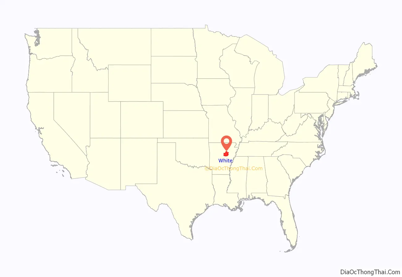
White County location map. Where is White County?
History
On May 17, 1862, White County was the site of the Little Red Skirmish between Union Major General Samuel J Curtis and a force of about 100 loosely-organized Confederates, followed by the battle at Whitney Lane in June. also known as The Skirmish at Searcy Landing.
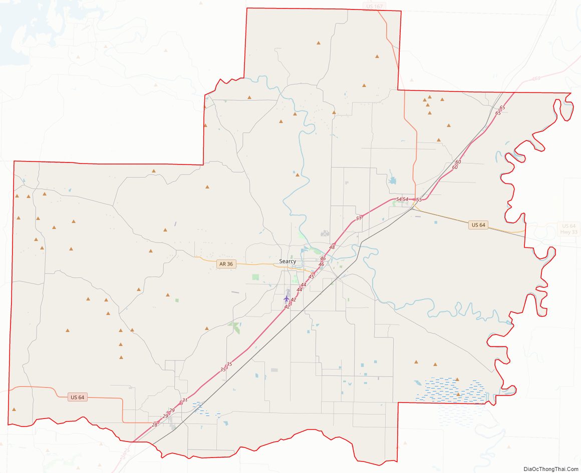
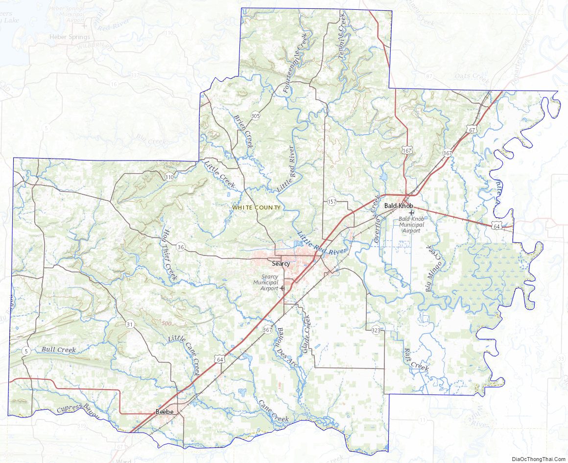
White County Road Map
Geography
According to the U.S. Census Bureau, the county has a total area of 1,042 square miles (2,700 km), of which 1,035 square miles (2,680 km) is land and 7.1 square miles (18 km) (0.7%) is water. It is the second-largest county by area in Arkansas.
Major highways
- Future Interstate 57
- U.S. Highway 64
- U.S. Highway 67
- U.S. Highway 167
- Highway 5
- Highway 11
- Highway 13
- Highway 16
- Highway 31
- Highway 36
- Highway 87
- Highway 110
- Highway 124
- Highway 157
- Highway 258
- Highway 267
- Highway 305
- Highway 310
- Highway 320
- Highway 321
- Highway 323
- Highway 367
- Highway 385
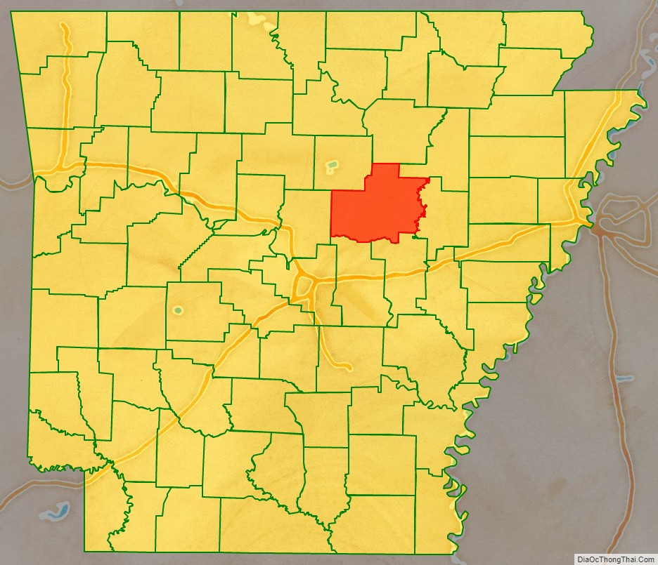
Adjacent counties
- Independence County (north)
- Jackson County (northeast)
- Woodruff County (east)
- Prairie County (southeast)
- Lonoke County (southwest)
- Faulkner County (west)
- Cleburne County (northwest)
National and state protected areas
- Bald Knob National Wildlife Refuge
- Henry Gray / Hurricane Lake Wildlife Management Area
White County Topographic Map
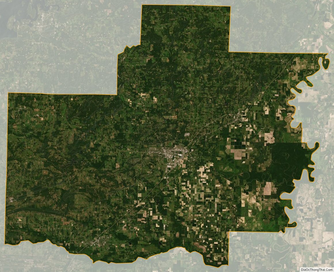
White County Satellite Map
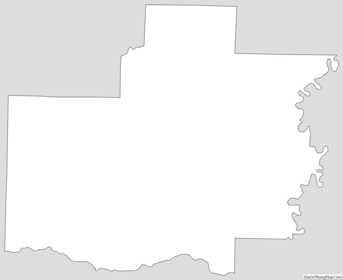
White County Outline Map
See also
Map of Arkansas State and its subdivision:- Arkansas
- Ashley
- Baxter
- Benton
- Boone
- Bradley
- Calhoun
- Carroll
- Chicot
- Clark
- Clay
- Cleburne
- Cleveland
- Columbia
- Conway
- Craighead
- Crawford
- Crittenden
- Cross
- Dallas
- Desha
- Drew
- Faulkner
- Franklin
- Fulton
- Garland
- Grant
- Greene
- Hempstead
- Hot Spring
- Howard
- Independence
- Izard
- Jackson
- Jefferson
- Johnson
- Lafayette
- Lawrence
- Lee
- Lincoln
- Little River
- Logan
- Lonoke
- Madison
- Marion
- Miller
- Mississippi
- Monroe
- Montgomery
- Nevada
- Newton
- Ouachita
- Perry
- Phillips
- Pike
- Poinsett
- Polk
- Pope
- Prairie
- Pulaski
- Randolph
- Saint Francis
- Saline
- Scott
- Searcy
- Sebastian
- Sevier
- Sharp
- Stone
- Union
- Van Buren
- Washington
- White
- Woodruff
- Yell
- Alabama
- Alaska
- Arizona
- Arkansas
- California
- Colorado
- Connecticut
- Delaware
- District of Columbia
- Florida
- Georgia
- Hawaii
- Idaho
- Illinois
- Indiana
- Iowa
- Kansas
- Kentucky
- Louisiana
- Maine
- Maryland
- Massachusetts
- Michigan
- Minnesota
- Mississippi
- Missouri
- Montana
- Nebraska
- Nevada
- New Hampshire
- New Jersey
- New Mexico
- New York
- North Carolina
- North Dakota
- Ohio
- Oklahoma
- Oregon
- Pennsylvania
- Rhode Island
- South Carolina
- South Dakota
- Tennessee
- Texas
- Utah
- Vermont
- Virginia
- Washington
- West Virginia
- Wisconsin
- Wyoming