| Name: | White Pine County |
|---|---|
| FIPS code: | 32-033 |
| State: | Nevada |
| Founded: | 1869 |
| Named for: | Rocky Mountain white pine |
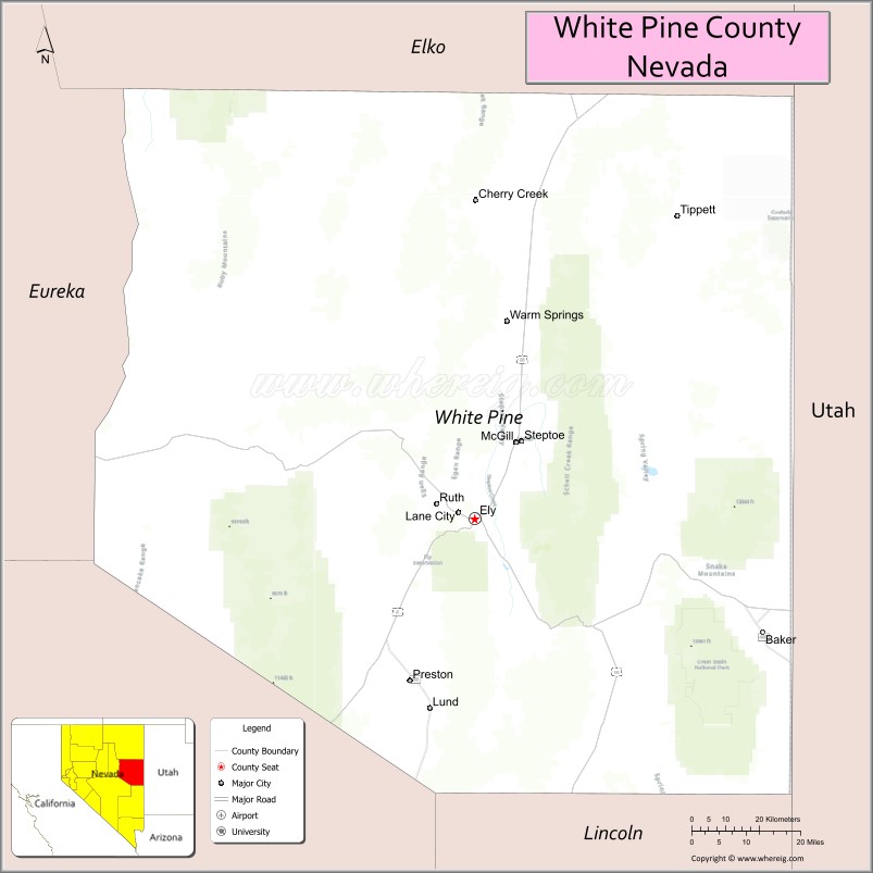
| Seat: | Ely |
| Largest city: | Ely |
| Total Area: | 8,897 sq mi (23,040 km²) |
| Land Area: | 8,876 sq mi (22,990 km²) |
| Total Population: | 9,080 |
| Population Density: | 1.0/sq mi (0.39/km²) |
| Time zone: | UTC−8 (Pacific) |
| Summer Time Zone (DST): | UTC−7 (PDT) |
| Website: | whitepinecounty.net |
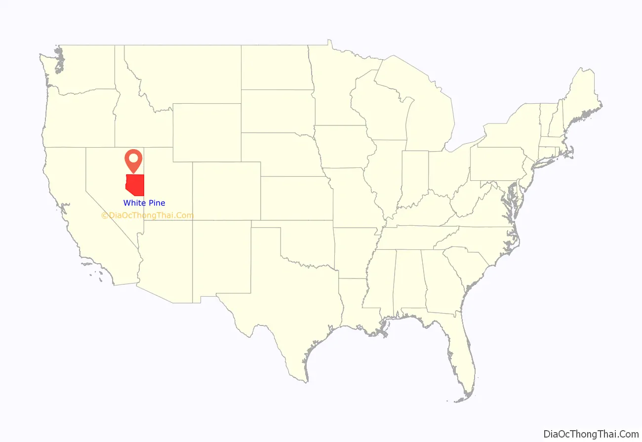
White Pine County location map. Where is White Pine County?
History
European settlement in White Pine County began with mining exploration, activity generated by the Pony Express Trail (which passes through the county), and farming.
The county was established by the Nevada legislature in 1869 from Lander County and named after the heavy growth of limber pine trees in the area, which were then called white pine. Hamilton was the first county seat from 1869 to 1887, when it was replaced by Ely after a fire.
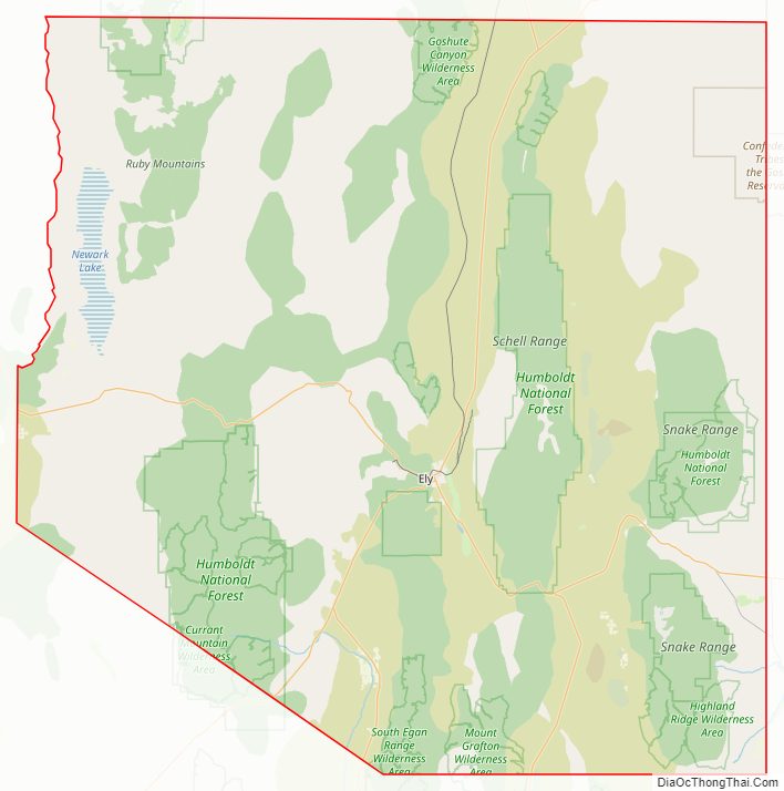
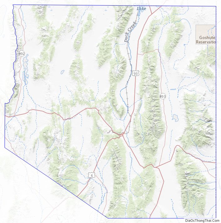
White Pine County Road Map
Geography
According to the U.S. Census Bureau, the county has a total area of 8,897 square miles (23,040 km), of which 8,876 square miles (22,990 km) is land and 21 square miles (54 km) (0.2%) is water.
Several sections of the Humboldt-Toiyabe National Forest exist within the county, within the Snake Range, Egan Range, White Pine Range, Ruby Mountains, and Schell Creek Range. The county also contains Ward Charcoal Ovens State Historic Park and Cave Lake State Park.
In the southeastern part of the county within Great Basin National Park lies 13,065 ft (3982 m) Wheeler Peak, the tallest independent mountain within Nevada and the second-highest point within the state (the highest point being Boundary Peak). It is also the most topographically prominent peak in the county and the second-most prominent peak in Nevada (after Mount Charleston).
Major highways
- U.S. Route 6
- U.S. Route 50
- U.S. Route 93
U.S. Route 93 Alternate- State Route 318
- State Route 487
- State Route 488
- State Route 490
- State Route 892
- State Route 893
- State Route 894
- State Route 895
Wilderness
White Pine County is home to a number of designated wilderness areas. They were created by Congress on December 20, 2006, by the “White Pine County Conservation, Recreation, and Development Act of 2006.” About half are integral parts of Humboldt National Forest. The rest are managed by the Bureau of Land Management. One is shared between the two agencies. Some extend into neighboring counties, as indicated.
- Bald Mountain Wilderness (Humboldt NF)
- Becky Peak Wilderness (BLM)
- Bristlecone Wilderness (BLM)
- Currant Mountain Wilderness (Humboldt NF) partly in Nye County, NV
- Goshute Canyon Wilderness (BLM)
- Government Peak Wilderness (BLM)
- High Schells Wilderness (Humboldt NF)
- Highland Ridge Wilderness (BLM)
- Mount Grafton Wilderness (BLM) partly in Lincoln County, NV
- Mount Moriah Wilderness (Humboldt NF / BLM)
- Red Mountain Wilderness (Humboldt NF) partly in Nye County, NV
- Shellback Wilderness (Humboldt NF)
- South Egan Range Wilderness (BLM) partly in Lincoln County, NV; Nye County, NV
- White Pine Range Wilderness (Humboldt NF)
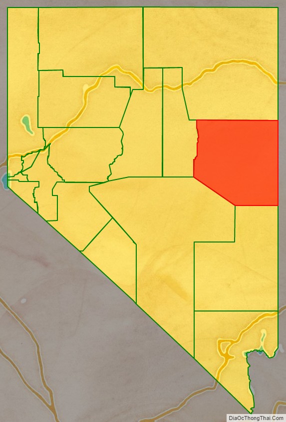
Adjacent counties
- Elko County – north
- Tooele County, Utah – northeast/Mountain Time Border
- Juab County, Utah – east/Mountain Time Border
- Millard County, Utah – southeast/Mountain Time Border
- Lincoln County – south
- Nye County – southwest
- Eureka County – west
National protected areas
- Great Basin National Park
- Humboldt-Toiyabe National Forest (part)
- Ruby Lake National Wildlife Refuge (part)
White Pine County Topographic Map
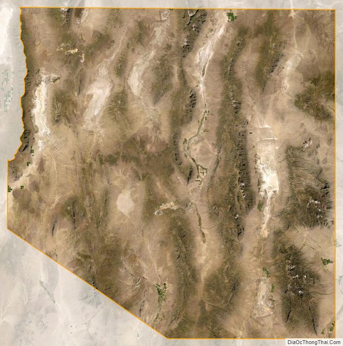
White Pine County Satellite Map
White Pine County Outline Map

See also
Map of Nevada State and its subdivision: Map of other states:- Alabama
- Alaska
- Arizona
- Arkansas
- California
- Colorado
- Connecticut
- Delaware
- District of Columbia
- Florida
- Georgia
- Hawaii
- Idaho
- Illinois
- Indiana
- Iowa
- Kansas
- Kentucky
- Louisiana
- Maine
- Maryland
- Massachusetts
- Michigan
- Minnesota
- Mississippi
- Missouri
- Montana
- Nebraska
- Nevada
- New Hampshire
- New Jersey
- New Mexico
- New York
- North Carolina
- North Dakota
- Ohio
- Oklahoma
- Oregon
- Pennsylvania
- Rhode Island
- South Carolina
- South Dakota
- Tennessee
- Texas
- Utah
- Vermont
- Virginia
- Washington
- West Virginia
- Wisconsin
- Wyoming