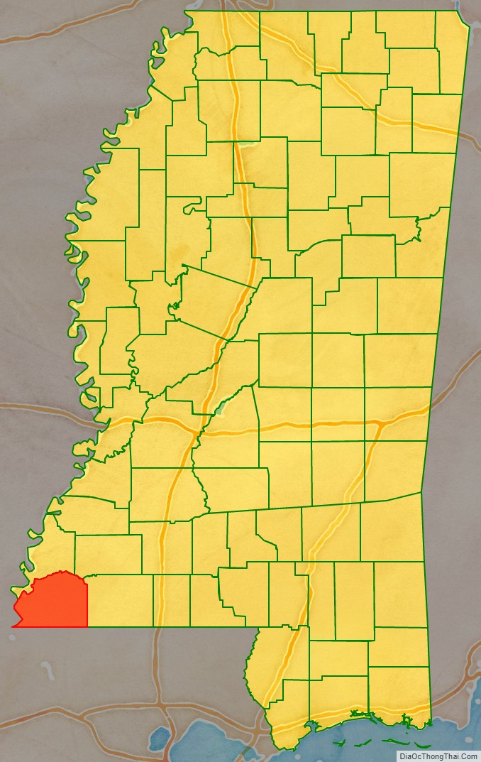
Wilkinson County is a county located in the southwest corner of the U.S. state of Mississippi. As of 2020, its population was 8,587. Its county seat is Woodville. Bordered by the Mississippi River on the west, the county is named for James Wilkinson, a Revolutionary War military leader and first governor of the Louisiana Territory after its acquisition by the United States in 1803.
| Name: | Wilkinson County |
|---|---|
| FIPS code: | 28-157 |
| State: | Mississippi |
| Founded: | 1802 |
| Named for: | James Wilkinson |
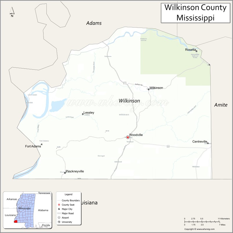
| Seat: | Woodville |
| Largest town: | Centreville |
| Total Area: | 688 sq mi (1,780 km²) |
| Land Area: | 678 sq mi (1,760 km²) |
| Total Population: | 8,587 |
| Population Density: | 12/sq mi (4.8/km²) |
| Time zone: | UTC−6 (Central) |
| Summer Time Zone (DST): | UTC−5 (CDT) |
| Website: | www.wilkinson.co.ms.gov |
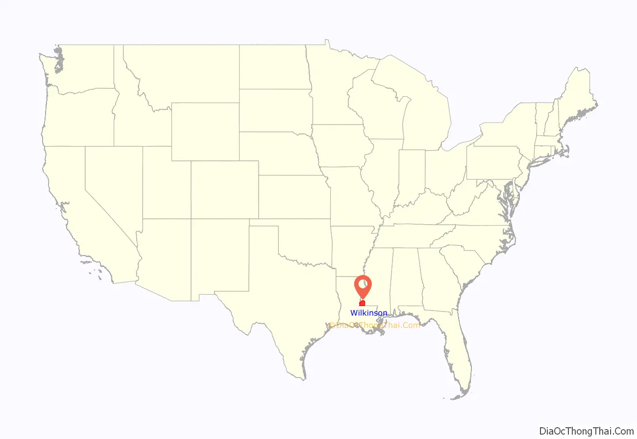
Wilkinson County location map. Where is Wilkinson County?
History
After Indian Removal in the 19th century, European-American settlers rapidly developed cotton plantations along the Mississippi River, which forms the western border. The intensive cultivation depended on the labor of numerous enslaved African Americans; in the early 19th century, more than a million slaves were relocated to the Deep South from the Upper South in a major forced migration. The population of this county quickly became majority black as enslaved workers were brought in to develop plantations. Much of the bottomlands and interior were undeveloped frontier until after the American Civil War.
The West Feliciana Railroad was later built to help get the cotton commodity crop to market. Some planters got wealthy during the antebellum years and built fine mansions in the county seat of Woodville, Mississippi. Jane and Samuel Emory Davis moved here in 1812 with their several children, and lived at a plantation near Woodville. Their youngest son, Jefferson Davis, attended the Wilkinson Academy in Woodville for two years before going to Kentucky to another school.
After the Civil War, freedmen and planters negotiated new working arrangements. Sharecropping became widespread. Although cotton continued as the commodity crop, a long agricultural depression kept prices low.
Following Reconstruction, white violence against blacks increased through the later decades of the 19th century and into the early 20th century. According to 2017 data compiled in Lynching in America (2015-2017), some nine lynchings of African Americans were recorded in Wilkinson County.
The peak of population in the county was reached in 1900, after which many blacks left in the Great Migration to the North and Midwest. The county has continued to have a black majority population.
In the early 20th century the boll weevil infestation destroyed much of the cotton crops, and mechanization caused a further loss of agricultural jobs. The exit of many African Americans from the state did not change the state’s exclusion of African Americans from politics. They were not enabled to vote until after passage of the federal Voting Rights Act in 1965 and its enforcement. Cotton cultivation was revived, but it is produced on a highly mechanized, industrial scale.
Southwest Mississippi was an area of continuing white violence against blacks during the Civil Rights Movement. In February 1964, the White Knights of the Ku Klux Klan officially formed. Clifton Walker, 37, a married father of five and employee of International Paper Company in Natchez, who was not politically active, was killed in an ambush on Poor House Road near his home. The evidence showed there had been a crowd of shooters on both sides of the road. This lynching cold case has never been solved, although it was among numerous ones that the FBI was investigating since 2007, before the Donald Trump administration ended the effort in 2018.
Timber has been harvested and processed in the county as a new commodity crop. The population of the rural county has continued to decline because of lack of jobs. It is still majority African American. Towns have started to develop heritage tourism to attract more visitors.
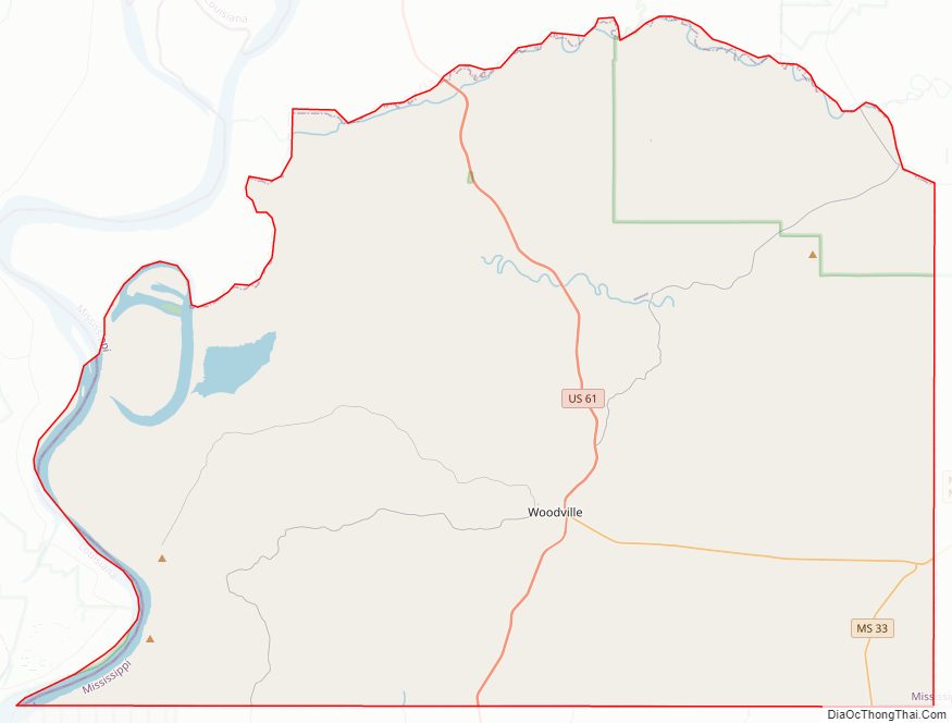
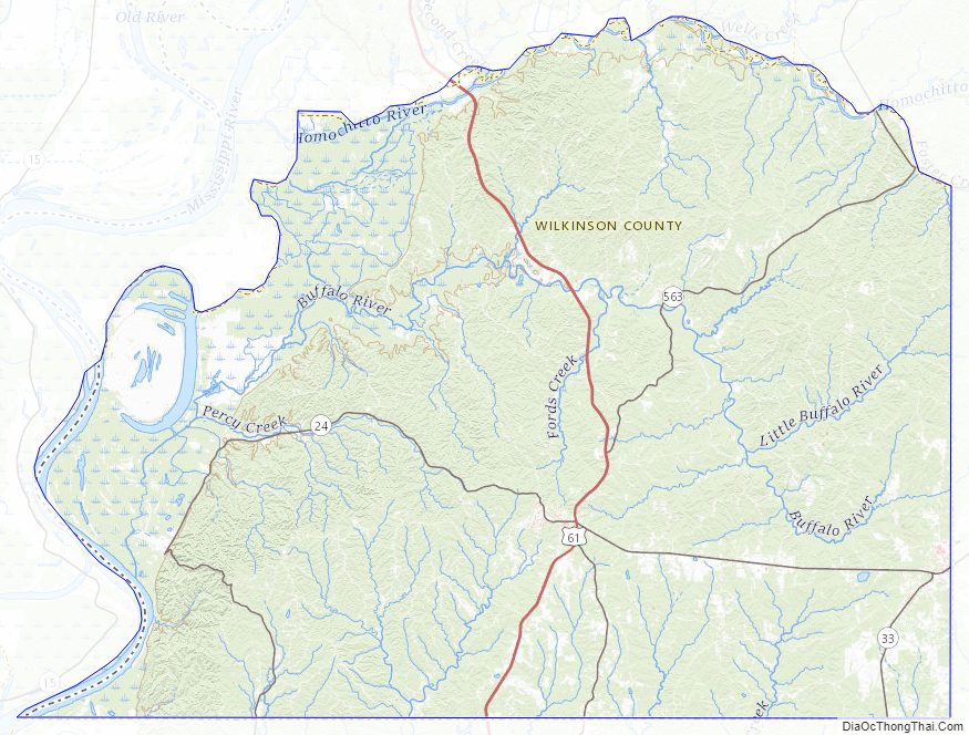
Wilkinson County Road Map
Geography
According to the U.S. Census Bureau, the county has a total area of 688 square miles (1,780 km), of which 678 square miles (1,760 km) is land and 9.7 square miles (25 km) (1.4%) is water.
Major highways
- U.S. Highway 61
- Mississippi Highway 24
- Mississippi Highway 33
Adjacent counties
- Adams County (north)
- Franklin County (northeast)
- Amite County (east)
- East Feliciana Parish, Louisiana (southeast)
- West Feliciana Parish, Louisiana (south)
- Concordia Parish, Louisiana (west)
National protected area
- Homochitto National Forest (part)
State protected area
- Clark Creek Natural Area
Wilkinson County Topographic Map
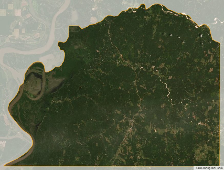
Wilkinson County Satellite Map
Wilkinson County Outline Map

See also
Map of Mississippi State and its subdivision:- Adams
- Alcorn
- Amite
- Attala
- Benton
- Bolivar
- Calhoun
- Carroll
- Chickasaw
- Choctaw
- Claiborne
- Clarke
- Clay
- Coahoma
- Copiah
- Covington
- Desoto
- Forrest
- Franklin
- George
- Greene
- Grenada
- Hancock
- Harrison
- Hinds
- Holmes
- Humphreys
- Issaquena
- Itawamba
- Jackson
- Jasper
- Jefferson
- Jefferson Davis
- Jones
- Kemper
- Lafayette
- Lamar
- Lauderdale
- Lawrence
- Leake
- Lee
- Leflore
- Lincoln
- Lowndes
- Madison
- Marion
- Marshall
- Monroe
- Montgomery
- Neshoba
- Newton
- Noxubee
- Oktibbeha
- Panola
- Pearl River
- Perry
- Pike
- Pontotoc
- Prentiss
- Quitman
- Rankin
- Scott
- Sharkey
- Simpson
- Smith
- Stone
- Sunflower
- Tallahatchie
- Tate
- Tippah
- Tishomingo
- Tunica
- Union
- Walthall
- Warren
- Washington
- Wayne
- Webster
- Wilkinson
- Winston
- Yalobusha
- Yazoo
- Alabama
- Alaska
- Arizona
- Arkansas
- California
- Colorado
- Connecticut
- Delaware
- District of Columbia
- Florida
- Georgia
- Hawaii
- Idaho
- Illinois
- Indiana
- Iowa
- Kansas
- Kentucky
- Louisiana
- Maine
- Maryland
- Massachusetts
- Michigan
- Minnesota
- Mississippi
- Missouri
- Montana
- Nebraska
- Nevada
- New Hampshire
- New Jersey
- New Mexico
- New York
- North Carolina
- North Dakota
- Ohio
- Oklahoma
- Oregon
- Pennsylvania
- Rhode Island
- South Carolina
- South Dakota
- Tennessee
- Texas
- Utah
- Vermont
- Virginia
- Washington
- West Virginia
- Wisconsin
- Wyoming