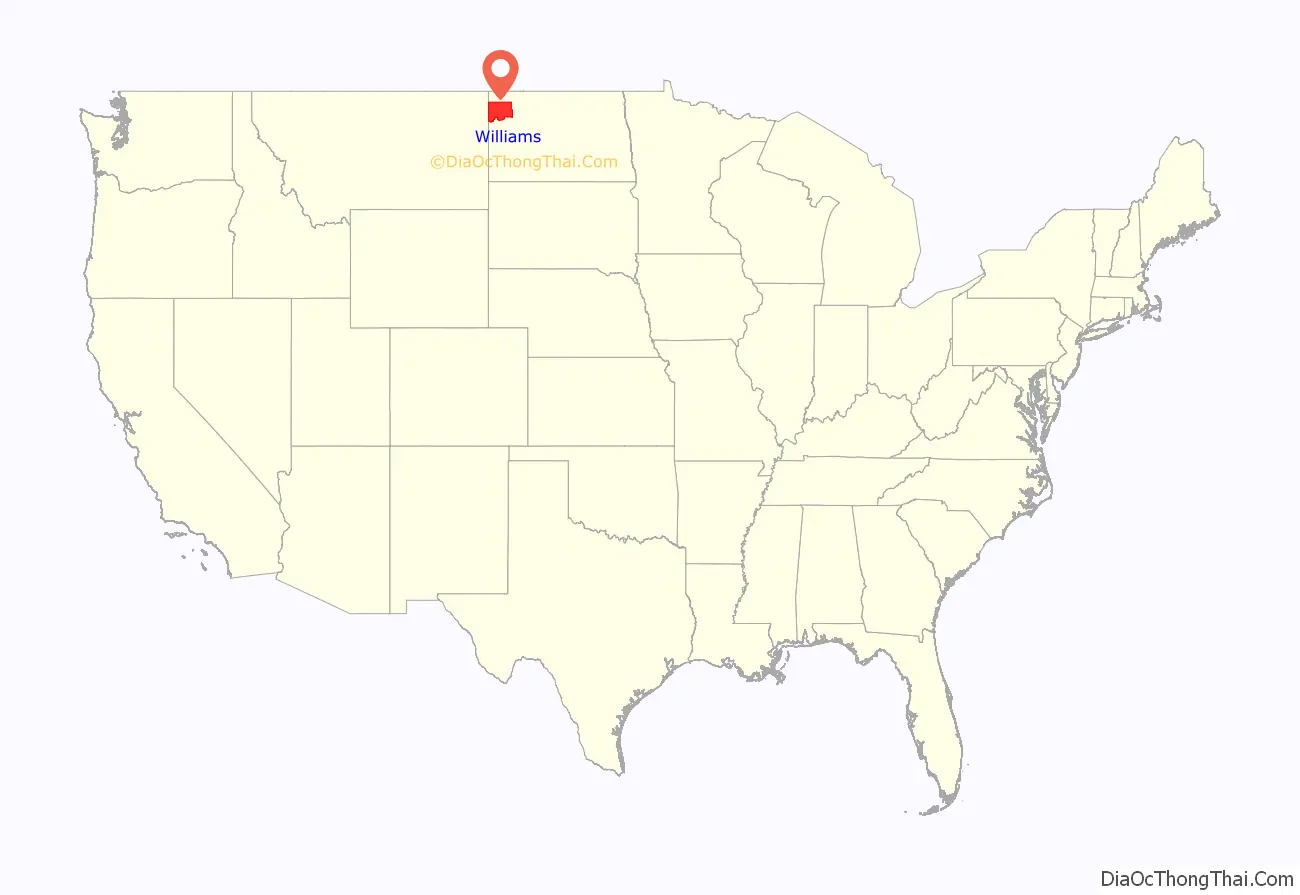
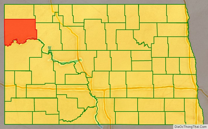
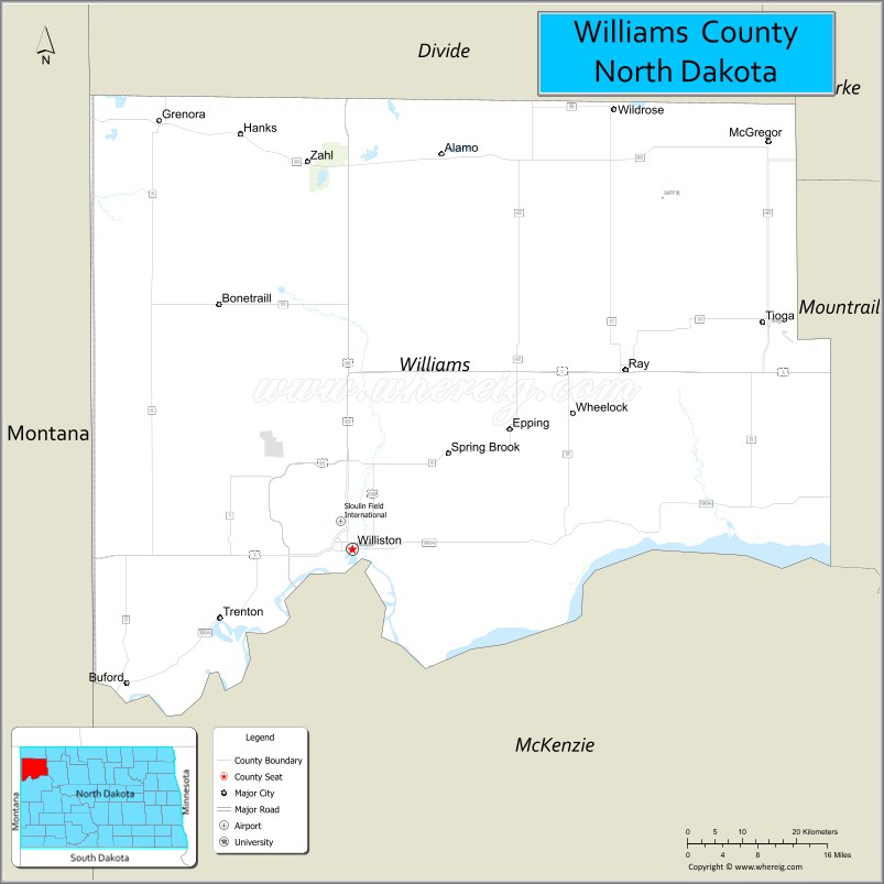
Williams County is located on the western border of the U.S. state of North Dakota, next to Montana. As of the 2020 census, the population was 40,950. Its county seat is Williston.
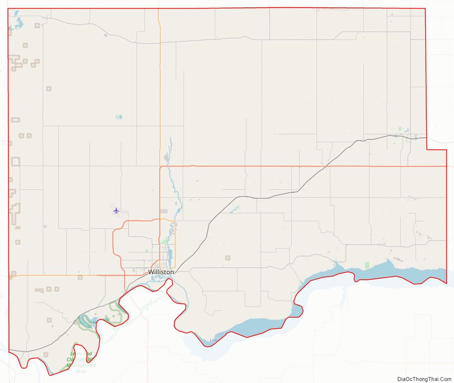
The Williston Micropolitan Statistical Area includes all of Williams County. It is bordered on the south by the upper Missouri River, whose confluence with its tributary Yellowstone River is located just east of the border with Montana.
| Name: | Williams County |
|---|---|
| FIPS code: | 38-105 |
| State: | North Dakota |
| Founded: | 1891 |
| Named for: | Erastus Appleman Williams |
| Seat: | Williston |
| Largest city: | Williston |
| Total Area: | 2,148 sq mi (5,560 km²) |
| Land Area: | 2,077 sq mi (5,380 km²) |
| Total Population: | 40,950 |
| Population Density: | 19/sq mi (7.4/km²) |
| Time zone: | UTC−6 (Central) |
| Summer Time Zone (DST): | UTC−5 (CDT) |
| Website: | www.williamsnd.com |
Williams County location map. Where is Williams County?
History
There have been two Williams counties in the history of North Dakota. The first, created in 1873, was located south of the Missouri River near where Dunn and Mercer counties are today. This county continued to exist through North Dakota statehood, and while the second Williams County was created in 1891. The first Williams County was extinguished by a county referendum on November 8, 1892; part of its territory was absorbed by Mercer County and the rest reverted to an unorganized territory.
The second Williams County was created by the North Dakota legislature on March 2, 1891, from the previous counties of Buford and Flannery, which were dissolved. The government of this county was organized on December 8, 1891. This county’s boundaries were altered in 1910, when a portion of its territory was annexed to create Divide County. Its boundaries have remained unchanged since then.
The county is named for Erastus Appleman Williams, a European-American settler who served in the Dakota Territory legislature and the North Dakota legislature.
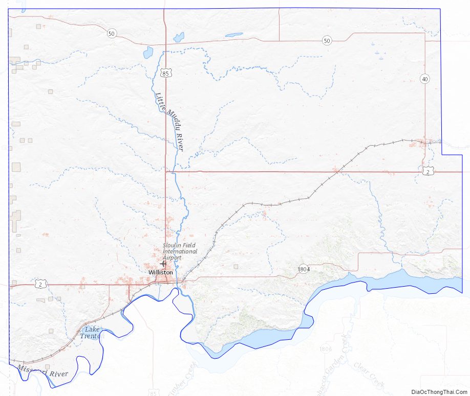
Williams County Road Map
Geography
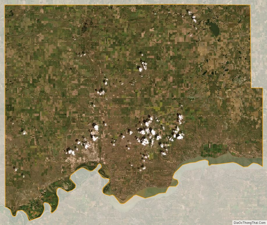
Williams County lies on the west edge of North Dakota. Its west boundary line abuts the east boundary line of the state of Montana. The Missouri River flows eastward along the county’s south boundary line from the confluence with its tributary Yellowstone River, located on the Dakota side of the state border with Montana. Horse Creek and Willow Creek flow to the west across the upper portion of the county. The terrain consists of isolated hills amid rolling, hilly, semi-arid stretches. The area is partly devoted to agriculture. The terrain is highest across its midpoint, and slopes to the NW and SE. Its highest point is a hill near the NE corner, at 2,470′ (753m) ASL. The county has a total area of 2,148 square miles (5,560 km), of which 2,077 square miles (5,380 km) is land and 70 square miles (180 km) (3.3%) is water. It is the fourth-largest county in North Dakota by area.
Lake Sakakawea, a reservoir on the Missouri River, is situated on the southern boundary of the county. Little Muddy Creek is entirely within Williams County. The confluence of the Yellowstone River with the Missouri is west of Williston.
The Fort Union Trading Post National Historic Site is located in Williams County along the Missouri River on the Montana border.
Williams County is one of several western North Dakota counties with significant exposure to the Bakken formation in the Williston Basin.
Major highways
- US 2
- US 85
- US 85B
- ND 40
- ND 42
- ND 50
- ND 1804
Adjacent counties
- Divide County (north)
- Burke County (northeast)
- Mountrail County (east)
- McKenzie County (south)
- Roosevelt County, Montana (southwest)
- Sheridan County, Montana (west)
Protected areas
- Fort Union Trading Post National Historic Site (part)
- Hofflund State Game Management Area
- Lewis & Clark State Park
- Lake Zahl National Wildlife Refuge
- North Tobacco Garden State Game Management Area
Lakes
- Alkali Lake
- Blacktail Lake
- Cottonwood Lake
- Epping Dam
- Green Lake
- Helle Slough
- Holm Lake
- Lake Trenton
- Lake Zahl
- McLeod Lake
- Shirley Lake
- Tioga River Dam
- Twin Lakes
KotaRay Dam
Williams County Topographic Map
Williams County Satellite Map
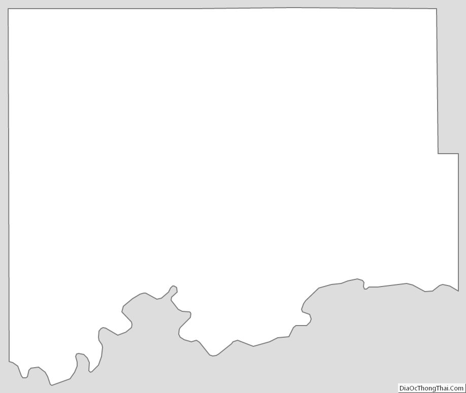
Williams County Outline Map
See also
Map of North Dakota State and its subdivision:- Adams
- Barnes
- Benson
- Billings
- Bottineau
- Bowman
- Burke
- Burleigh
- Cass
- Cavalier
- Dickey
- Divide
- Dunn
- Eddy
- Emmons
- Foster
- Golden Valley
- Grand Forks
- Grant
- Griggs
- Hettinger
- Kidder
- Lamoure
- Logan
- McHenry
- McIntosh
- McKenzie
- McLean
- Mercer
- Morton
- Mountrail
- Nelson
- Oliver
- Pembina
- Pierce
- Ramsey
- Ransom
- Renville
- Richland
- Rolette
- Sargent
- Sheridan
- Sioux
- Slope
- Stark
- Steele
- Stutsman
- Towner
- Traill
- Walsh
- Ward
- Wells
- Williams
- Alabama
- Alaska
- Arizona
- Arkansas
- California
- Colorado
- Connecticut
- Delaware
- District of Columbia
- Florida
- Georgia
- Hawaii
- Idaho
- Illinois
- Indiana
- Iowa
- Kansas
- Kentucky
- Louisiana
- Maine
- Maryland
- Massachusetts
- Michigan
- Minnesota
- Mississippi
- Missouri
- Montana
- Nebraska
- Nevada
- New Hampshire
- New Jersey
- New Mexico
- New York
- North Carolina
- North Dakota
- Ohio
- Oklahoma
- Oregon
- Pennsylvania
- Rhode Island
- South Carolina
- South Dakota
- Tennessee
- Texas
- Utah
- Vermont
- Virginia
- Washington
- West Virginia
- Wisconsin
- Wyoming