Williams County is a county located in the U.S. state of Ohio. As of the 2020 census, the population was 37,102. Its county seat is Bryan. The county was created in 1820 and later organized in 1824. It is named for David Williams, one of the captors of John André in the American Revolutionary War.
| Name: | Williams County |
|---|---|
| FIPS code: | 39-171 |
| State: | Ohio |
| Founded: | February 2, 1824 |
| Named for: | David Williams |
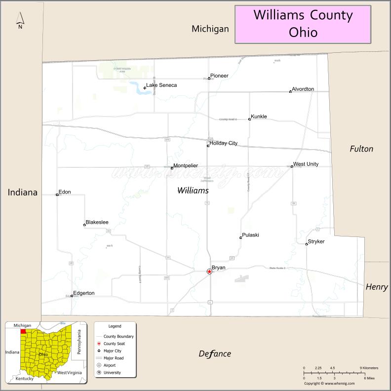
| Seat: | Bryan |
| Largest city: | Bryan |
| Total Area: | 423 sq mi (1,100 km²) |
| Land Area: | 421 sq mi (1,090 km²) |
| Total Population: | 37,102 |
| Population Density: | 88/sq mi (34/km²) |
| Time zone: | UTC−5 (Eastern) |
| Summer Time Zone (DST): | UTC−4 (EDT) |
| Website: | www.co.williams.oh.us |
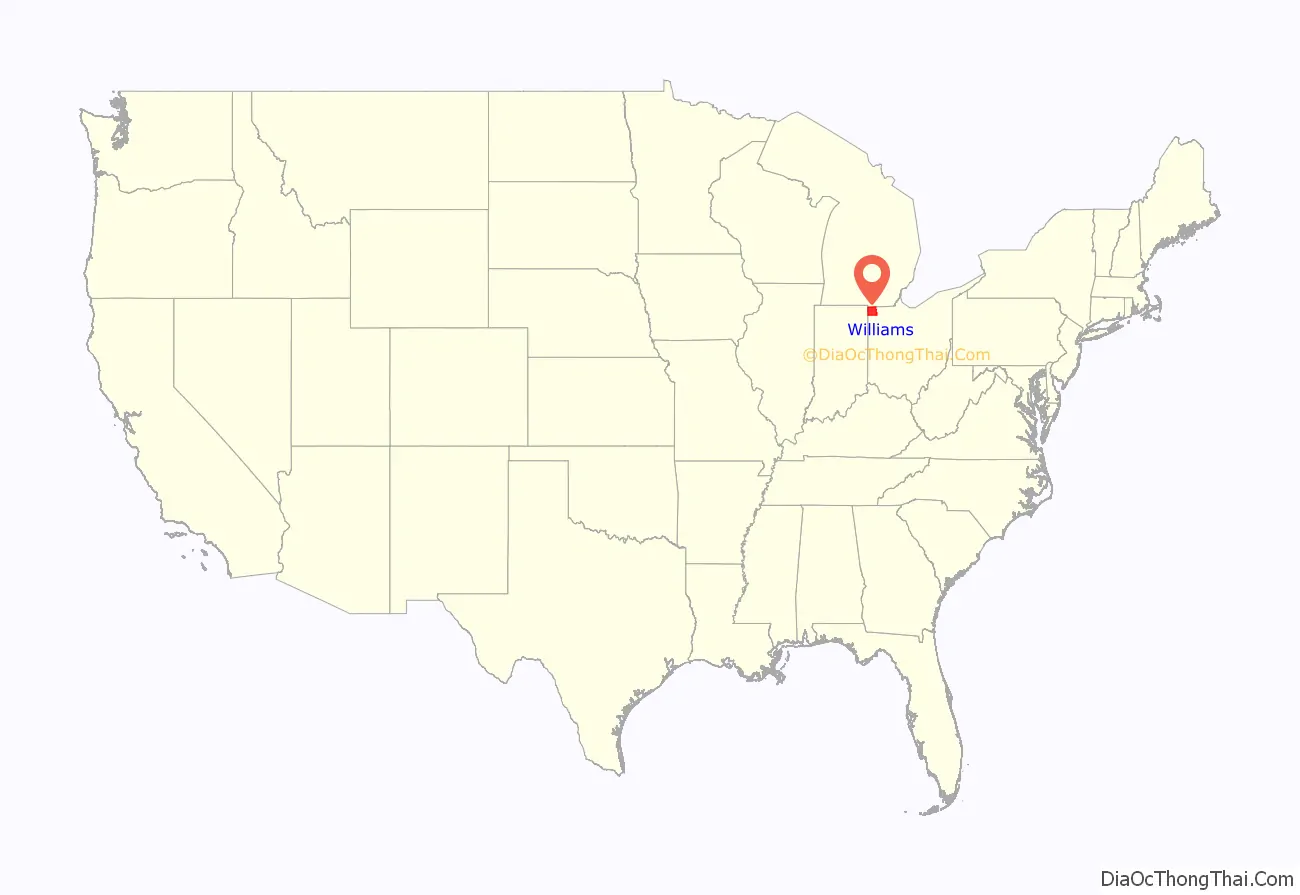
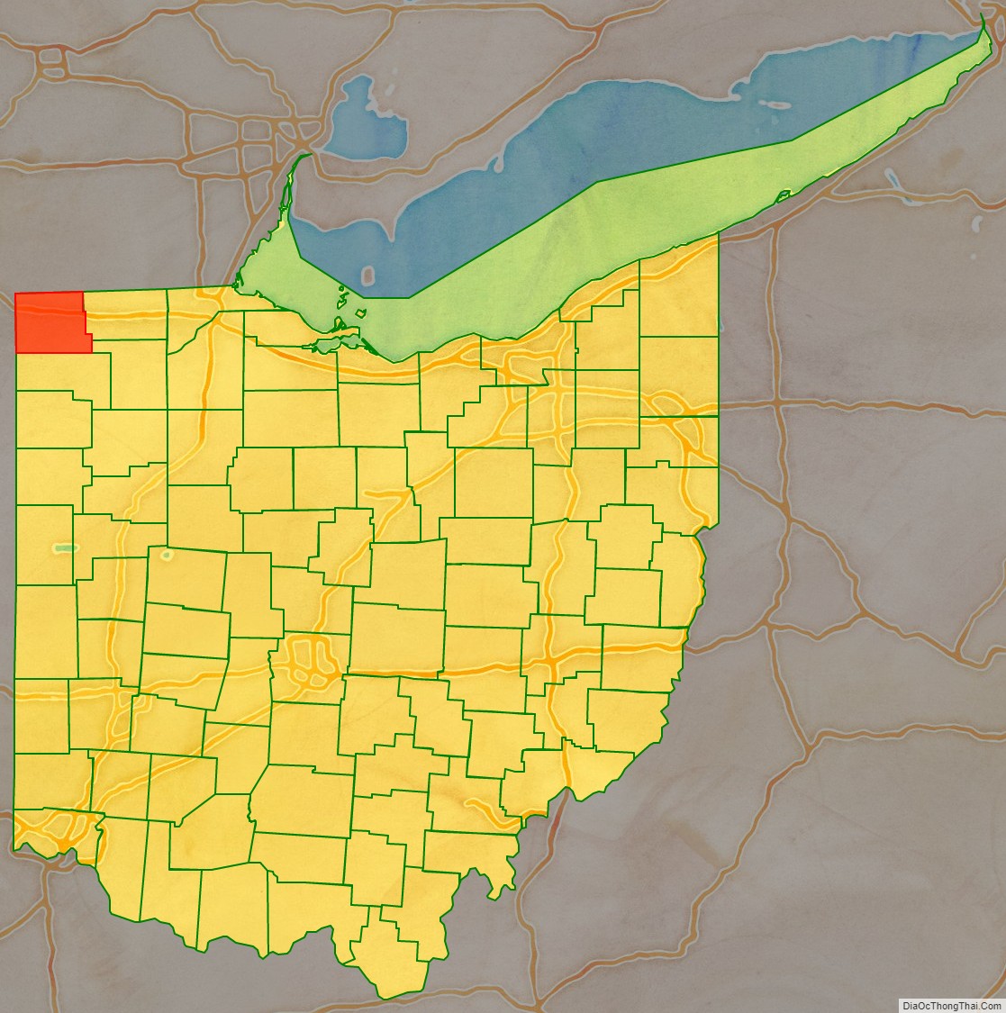
Williams County location map. Where is Williams County?
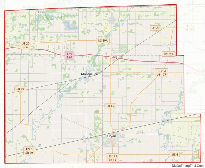
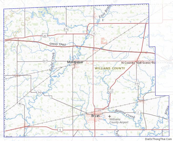
Williams County Road Map
Geography
According to the U.S. Census Bureau, the county has a total area of 423 square miles (1,100 km), of which 421 square miles (1,090 km) is land and 2.1 square miles (5.4 km) (0.5%) is water.
Adjacent counties
- Hillsdale County, Michigan (north)
- Fulton County (east)
- Henry County (southeast)
- Defiance County (south)
- DeKalb County, Indiana (southwest)
- Steuben County, Indiana (northwest)
Williams County Topographic Map
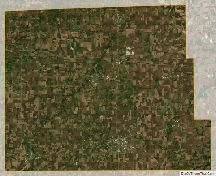
Williams County Satellite Map
Williams County Outline Map

See also
Map of Ohio State and its subdivision:- Adams
- Allen
- Ashland
- Ashtabula
- Athens
- Auglaize
- Belmont
- Brown
- Butler
- Carroll
- Champaign
- Clark
- Clermont
- Clinton
- Columbiana
- Coshocton
- Crawford
- Cuyahoga
- Darke
- Defiance
- Delaware
- Erie
- Fairfield
- Fayette
- Franklin
- Fulton
- Gallia
- Geauga
- Greene
- Guernsey
- Hamilton
- Hancock
- Hardin
- Harrison
- Henry
- Highland
- Hocking
- Holmes
- Huron
- Jackson
- Jefferson
- Knox
- Lake
- Lake Erie
- Lawrence
- Licking
- Logan
- Lorain
- Lucas
- Madison
- Mahoning
- Marion
- Medina
- Meigs
- Mercer
- Miami
- Monroe
- Montgomery
- Morgan
- Morrow
- Muskingum
- Noble
- Ottawa
- Paulding
- Perry
- Pickaway
- Pike
- Portage
- Preble
- Putnam
- Richland
- Ross
- Sandusky
- Scioto
- Seneca
- Shelby
- Stark
- Summit
- Trumbull
- Tuscarawas
- Union
- Van Wert
- Vinton
- Warren
- Washington
- Wayne
- Williams
- Wood
- Wyandot
- Alabama
- Alaska
- Arizona
- Arkansas
- California
- Colorado
- Connecticut
- Delaware
- District of Columbia
- Florida
- Georgia
- Hawaii
- Idaho
- Illinois
- Indiana
- Iowa
- Kansas
- Kentucky
- Louisiana
- Maine
- Maryland
- Massachusetts
- Michigan
- Minnesota
- Mississippi
- Missouri
- Montana
- Nebraska
- Nevada
- New Hampshire
- New Jersey
- New Mexico
- New York
- North Carolina
- North Dakota
- Ohio
- Oklahoma
- Oregon
- Pennsylvania
- Rhode Island
- South Carolina
- South Dakota
- Tennessee
- Texas
- Utah
- Vermont
- Virginia
- Washington
- West Virginia
- Wisconsin
- Wyoming