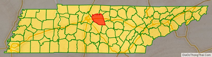
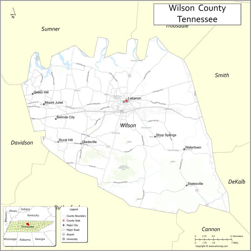
Wilson County is a county in the U.S. state of Tennessee. It is in Middle Tennessee. As of the 2020 census, the population was 147,737. Its county seat is Lebanon. The largest city is Mt. Juliet. Wilson County is part of the Nashville-Davidson–Murfreesboro–Franklin, TN Metropolitan Statistical Area.
| Name: | Wilson County |
|---|---|
| FIPS code: | 47-189 |
| State: | Tennessee |
| Founded: | October 26, 1799 |
| Named for: | David Wilson, early statesman |
| Seat: | Lebanon |
| Largest city: | Mt. Juliet |
| Total Area: | 583 sq mi (1,510 km²) |
| Land Area: | 571 sq mi (1,480 km²) |
| Total Population: | 147,737 |
| Population Density: | 258.73/sq mi (99.90/km²) |
| Time zone: | UTC−6 (Central) |
| Summer Time Zone (DST): | UTC−5 (CDT) |
| Website: | www.wilsoncountytn.gov |
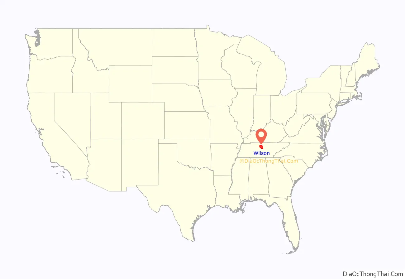
Wilson County location map. Where is Wilson County?
History
Wilson County was created in 1799 from a portion of Sumner County, and named for Major David Wilson, a Revolutionary War veteran and statesman. The county remained predominantly agrarian throughout the 19th century. The arrival of the railroad after the Civil War boosted the county’s timber sector, and several large factories were constructed in the county during the early 20th century.
Wilson County was the site of an important saltpeter mine. Saltpeter, the main ingredient of gunpowder, was obtained by leaching the earth from Valley Cave. Valley Cave is near Statesville. The many saltpeter hoppers still inside the cave indicate that this was a large mining operation. These saltpeter vats may date from the War of 1812 mining era or the Civil War mining era, or perhaps both. Further research is needed to determine when this mine was active.
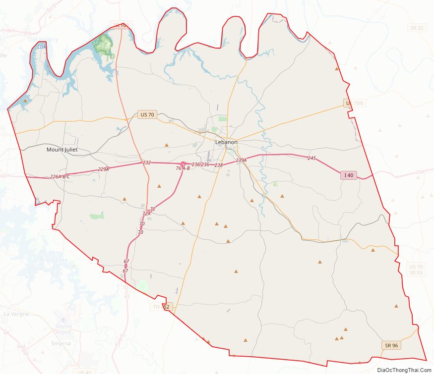
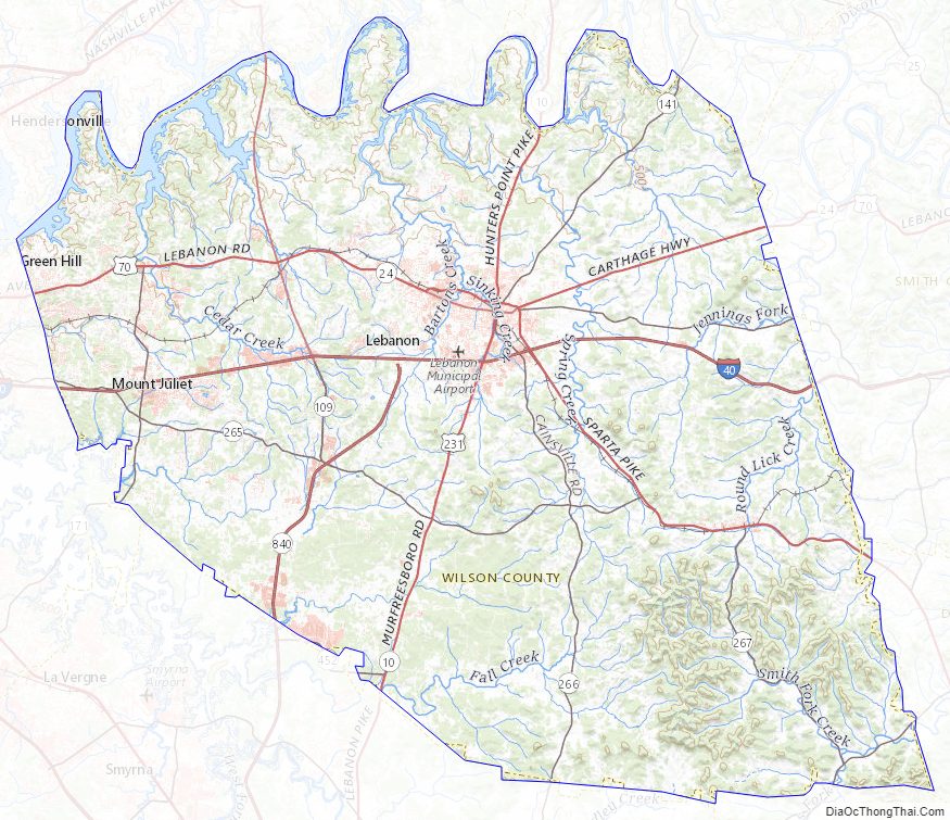
Wilson County Road Map
Geography
According to the U.S. Census Bureau, the county has a total area of 583 square miles (1,510 km), of which 571 square miles (1,480 km) is land and 12 square miles (31 km) (2.1%) is water. The Cumberland River flows along the county’s northern border with Trousdale and Sumner counties. This section of the river is part of Old Hickory Lake. Several streams in the western part of the county are part of the Stones River basin.
Wilson County is home to a large concentration of cedar glades, a unique ecosystem where the soil is too rocky or shallow for trees to grow. Many of these glades are found in Cedars of Lebanon State Park.
Adjacent counties
- Trousdale County (north)
- Smith County (northeast)
- DeKalb County (east)
- Cannon County (southeast)
- Rutherford County (south)
- Davidson County (west)
- Sumner County (northwest)
State protected areas
- Cedars of Lebanon State Forest
- Cedars of Lebanon State Park
- Couchville Cedar Glade State Natural Area (part)
- Gattinger’s Cedar Glade and Barrens State Natural Area (part)
- John and Hester Land Cedar Glades State Natural Area
- Old Hickory Wildlife Management Area (part)
- Percy Priest Wildlife Management Area (part)
- Vesta Cedar Glade State Natural Area
- Vine Cedar Glade State Natural Area
Major highways
- I-40
- I-840
- US 70
- US 70N
- US 70 Bus.
- US 231
- SR 96
- SR 109
- SR 141
- SR 171
- SR 265
- SR 266
- SR 267
- SR 452
Wilson County Topographic Map
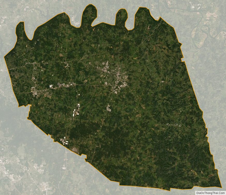
Wilson County Satellite Map
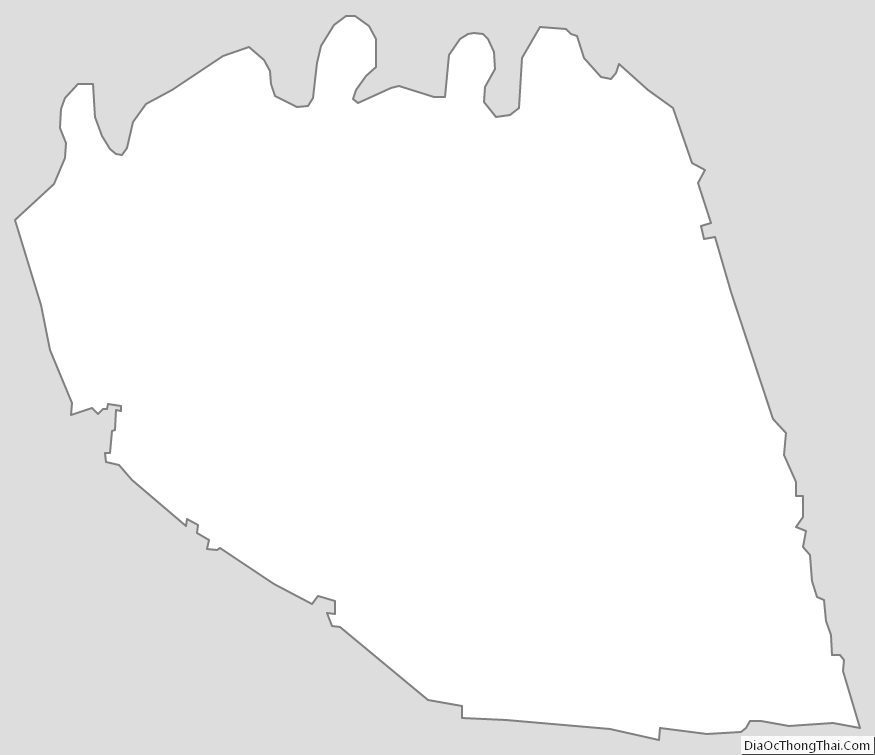
Wilson County Outline Map
See also
Map of Tennessee State and its subdivision:- Anderson
- Bedford
- Benton
- Bledsoe
- Blount
- Bradley
- Campbell
- Cannon
- Carroll
- Carter
- Cheatham
- Chester
- Claiborne
- Clay
- Cocke
- Coffee
- Crockett
- Cumberland
- Davidson
- Decatur
- DeKalb
- Dickson
- Dyer
- Fayette
- Fentress
- Franklin
- Gibson
- Giles
- Grainger
- Greene
- Grundy
- Hamblen
- Hamilton
- Hancock
- Hardeman
- Hardin
- Hawkins
- Haywood
- Henderson
- Henry
- Hickman
- Houston
- Humphreys
- Jackson
- Jefferson
- Johnson
- Knox
- Lake
- Lauderdale
- Lawrence
- Lewis
- Lincoln
- Loudon
- Macon
- Madison
- Marion
- Marshall
- Maury
- McMinn
- McNairy
- Meigs
- Monroe
- Montgomery
- Moore
- Morgan
- Obion
- Overton
- Perry
- Pickett
- Polk
- Putnam
- Rhea
- Roane
- Robertson
- Rutherford
- Scott
- Sequatchie
- Sevier
- Shelby
- Smith
- Stewart
- Sullivan
- Sumner
- Tipton
- Trousdale
- Unicoi
- Union
- Van Buren
- Warren
- Washington
- Wayne
- Weakley
- White
- Williamson
- Wilson
- Alabama
- Alaska
- Arizona
- Arkansas
- California
- Colorado
- Connecticut
- Delaware
- District of Columbia
- Florida
- Georgia
- Hawaii
- Idaho
- Illinois
- Indiana
- Iowa
- Kansas
- Kentucky
- Louisiana
- Maine
- Maryland
- Massachusetts
- Michigan
- Minnesota
- Mississippi
- Missouri
- Montana
- Nebraska
- Nevada
- New Hampshire
- New Jersey
- New Mexico
- New York
- North Carolina
- North Dakota
- Ohio
- Oklahoma
- Oregon
- Pennsylvania
- Rhode Island
- South Carolina
- South Dakota
- Tennessee
- Texas
- Utah
- Vermont
- Virginia
- Washington
- West Virginia
- Wisconsin
- Wyoming