| Name: | Windham County |
|---|---|
| FIPS code: | 09-015 |
| State: | Connecticut |
| Founded: | May 12, 1726 |
| Named for: | Windham, England |
| Seat: | none (1960-present)
Willimantic (1893-1960) Windham (1726-1893) |
| Largest town: | Windham |
| Total Area: | 521 sq mi (1,350 km²) |
| Land Area: | 513 sq mi (1,330 km²) |
| Total Population: | 116,418 |
| Population Density: | 223.5/sq mi (86.3/km²) |
| Time zone: | UTC−5 (Eastern) |
| Summer Time Zone (DST): | UTC−4 (EDT) |
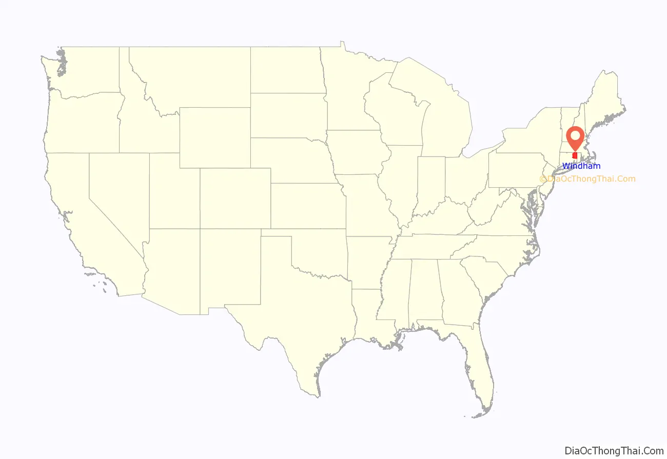
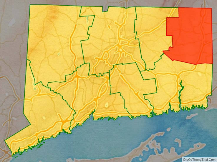
Windham County location map. Where is Windham County?
History
The area that is now Windham County became of interest to the English around 1635, but went unsettled for over fifty years due to its lack of access to the shore. John Winthrop the Younger took a strong interest to this land, purchased land from the Narragansetts, and was given permission by the court of Connecticut to settle in October 1671. In 1678, a tract of land, called Joshua’s Tract (Joshua was the son of Mohegan chief Uncas), was willed to Connecticut officials, and in February 1682, it was gifted to Samuel and Daniel Mason. In 1684, 1200 acres of land was sold to Jonathan Curtis, Thomas Dudley and Samuel Mason, among others, by the Nipmunks.
Windham County was created from Hartford and New London counties on May 12, 1726, by an act of the Connecticut General Court. The act establishing the county states:
In May 1749, the town of Woodstock (formerly New Roxbury), Worcester County, Province of Massachusetts Bay, was unilaterally annexed by Connecticut Colony and assigned to Windham County. In 1785, the town of Union (incorporated in 1734) was transferred to the newly formed Tolland County. Over the next century, Windham County would lose several towns to Tolland and New London counties: Coventry to Tolland in 1786, Lebanon to New London in 1824, Columbia and Mansfield to Tolland in 1827, and Voluntown to New London in 1881. New towns were formed over the years using land from the original towns of the county: Thompson in 1785, Brooklyn and Hampton in 1786, Sterling in 1794, Chaplin in 1822, Eastford in 1847, Putnam in 1855, and Scotland in 1857. The final boundary adjustment occurred on April 7, 1885, when the boundary dispute between the towns of Windham and Mansfield was resolved.
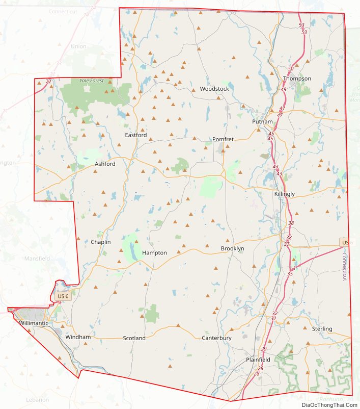
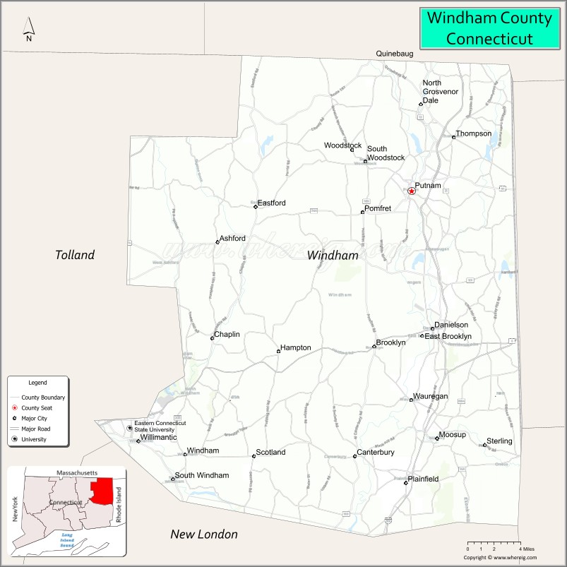
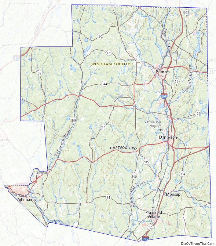
Windham County Road Map
Geography
According to the U.S. Census Bureau, the county has a total area of 521 square miles (1,350 km), of which 513 square miles (1,330 km) is land and 8.5 square miles (22 km) (1.6%) is water.
The highest point in Windham County is Snow Hill in Ashford at 1,210 feet.
Adjacent counties
- Worcester County, Massachusetts (north)
- Providence County, Rhode Island (east)
- Kent County, Rhode Island (southeast)
- New London County (south)
- Tolland County (west)
Climate
Windham County Topographic Map
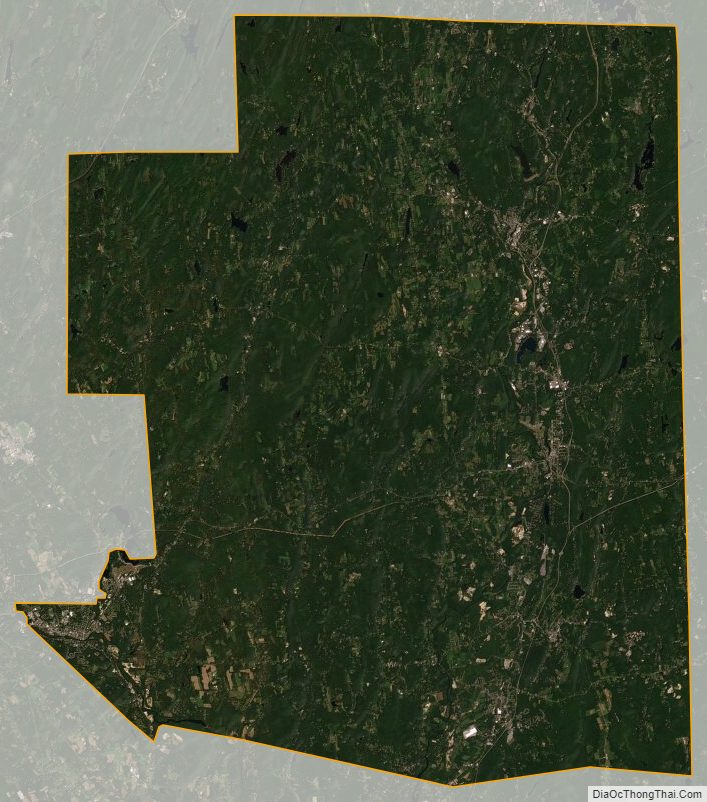
Windham County Satellite Map
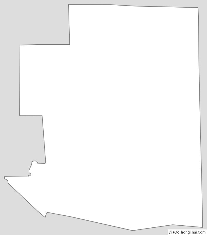
Windham County Outline Map
See also
Map of Connecticut State and its subdivision: Map of other states:- Alabama
- Alaska
- Arizona
- Arkansas
- California
- Colorado
- Connecticut
- Delaware
- District of Columbia
- Florida
- Georgia
- Hawaii
- Idaho
- Illinois
- Indiana
- Iowa
- Kansas
- Kentucky
- Louisiana
- Maine
- Maryland
- Massachusetts
- Michigan
- Minnesota
- Mississippi
- Missouri
- Montana
- Nebraska
- Nevada
- New Hampshire
- New Jersey
- New Mexico
- New York
- North Carolina
- North Dakota
- Ohio
- Oklahoma
- Oregon
- Pennsylvania
- Rhode Island
- South Carolina
- South Dakota
- Tennessee
- Texas
- Utah
- Vermont
- Virginia
- Washington
- West Virginia
- Wisconsin
- Wyoming