Wood County is a county located in the U.S. state of Wisconsin. As of the 2020 census, the population was 74,207. Its county seat is Wisconsin Rapids. The county is named after Joseph Wood, a member of the Wisconsin State Assembly. Wood County comprises the Wisconsin Rapids-Marshfield, WI Micropolitan Statistical Area and is included in the Wausau–Stevens Point-Wisconsin Rapids, WI Combined Statistical Area.
| Name: | Wood County |
|---|---|
| FIPS code: | 55-141 |
| State: | Wisconsin |
| Founded: | 1856 |
| Named for: | Joseph Wood |
| Seat: | Wisconsin Rapids |
| Largest city: | Marshfield |
| Total Area: | 809 sq mi (2,100 km²) |
| Land Area: | 793 sq mi (2,050 km²) |
| Total Population: | 74,207 |
| Population Density: | 93.6/sq mi (36.1/km²) |
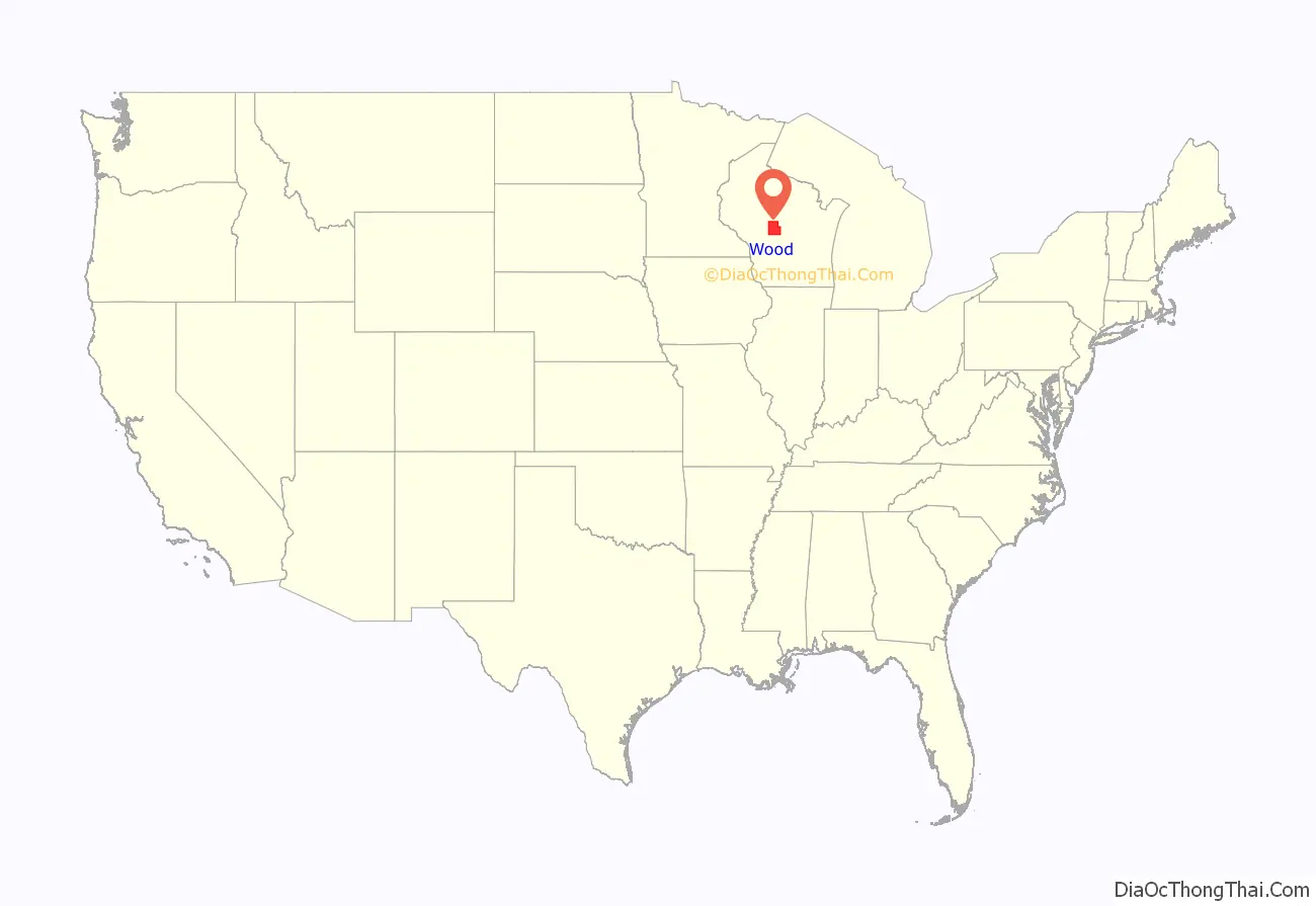
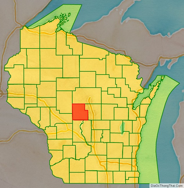
Wood County location map. Where is Wood County?
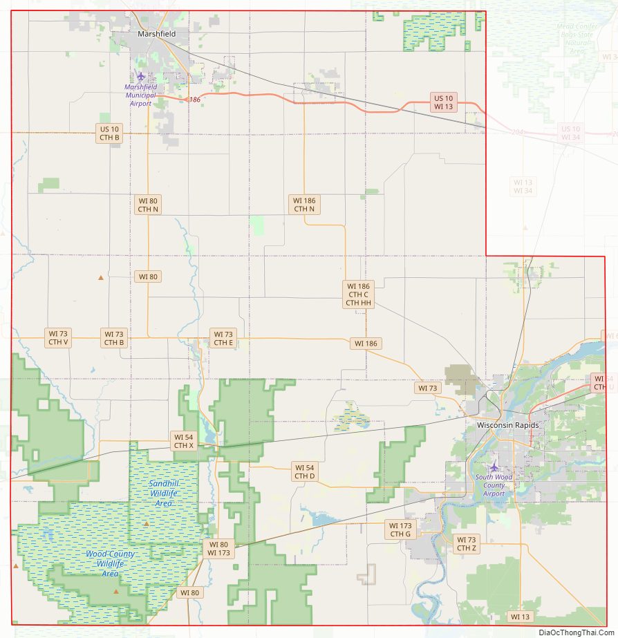
Wood County Road Map
Geography
According to the U.S. Census Bureau, the county has a total area of 809 square miles (2,100 km), of which 793 square miles (2,050 km) is land and 16 square miles (41 km) (2.0%) is water. The geographic center of Wisconsin is in Wood County, nine miles southeast of Marshfield.
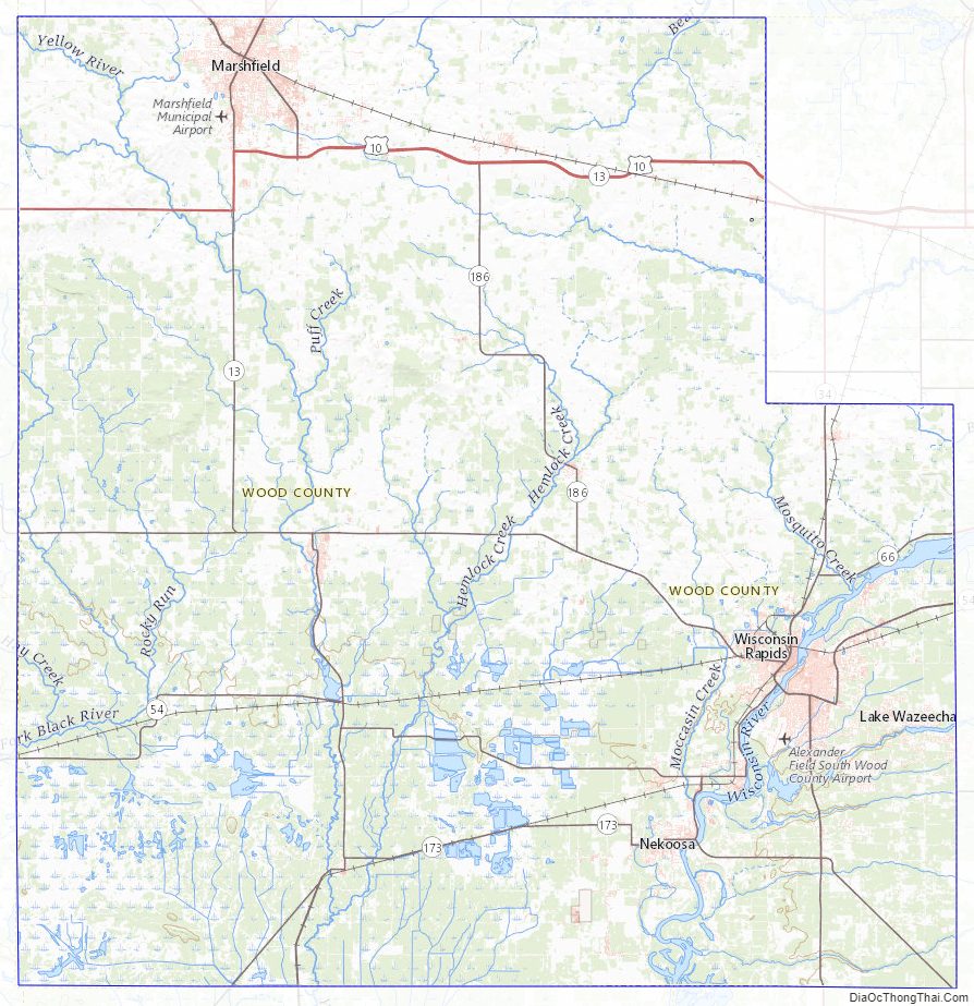
Wood County spans two of Wisconsin’s five geographical regions. The northern part of the county is in the Northern Highlands, with mostly rich cropland with heavy clay soil, used for corn, soybeans, hay and dairy. In the northwest corner the Marshfield moraine runs from Marathon County through Marshfield, Bakerville and Nasonville into Clark County. The south and central areas from Babcock through Cranmoor and Wisconsin Rapids are in the Central Plain, flat and marshy – one of the major cranberry-producing centers of the United States. The Wisconsin River cuts across the southeast corner, a corridor of sand flats, islands and oxbows. The river falls about 120 feet as it flows through the county, driving several power dams. The remainder of the county is drained by smaller streams and rivers, punctuated by isolated hills like Powers Bluff.
The flat, sandy southern third of the county was largely shaped by the last glacial advance. The ice didn’t reach Wood County, but it approached from the east into Portage County and butted up against the Baraboo Hills to the south. This blocked the Wisconsin River, damming it so that it backed up, forming Glacial Lake Wisconsin, a frigid lake that stretched from the Baraboo Hills north to the sites of Babcock and Wisconsin Rapids, submerging that part of the county. This area is generally flat and marshy now because meltwater rivers from the glacier and streams from land to the north carried sand and silt out into the glacial lake, where the sediment settled beneath its still waters. After the glacial dam melted enough to drain Glacial Lake Wisconsin around 13,000 years ago, the Wisconsin River cut new channels through the lake-bottom sands in the southeast corner of the county. In a later dry period, wind blew the sand into dunes. One dune in the town of Saratoga is eight meters thick. Later still, the area became wet and peat formed in places on top of the sand. The first surveyors in 1852 found a great marsh, like a Wisconsin Everglades. Here is their description of what is now Cranmoor:
The north of the county was shaped by earlier glaciers, which deposited glacial till, the basis for the heavy soil there. The Marshfield moraine in the northwest corner is probably a terminal moraine from one of these earlier glaciers, or from a series of them. Its age is unclear, but its relatively smooth surface indicates that it has eroded for a much longer time than the choppy terminal moraines left 13,000 years ago, like the Perkinstown moraine near Medford.
Much of the county except for the northeast corner is underlain by a layer of Cambrian sandstone, formed long before the last ice age. Most of the original sandstone layer has been eroded away and the remainder is usually buried under glacial till, but it can be seen in gravel pits and a few bluffs. The Lindsey bluffs (a.k.a. the Marshfield School Forest) and Birch Bluff and South Bluff in the Town of Remington are hard spots in this sandstone which have resisted erosion.
Powers Bluff is different from the sandstone bluffs, much older, with a hard core of Precambrian quartzite and a peak of chert. A marker on the bluff says it is a “worn down peak of an ancient mountain range which once covered northern Wisconsin.”
Adjacent counties
- Marathon County – north
- Portage County – east
- Adams County – southeast
- Juneau County – south
- Jackson County – southwest
- Clark County – northwest
Natural wildlife refuges
- Mead Wildlife Area
Wood County Topographic Map
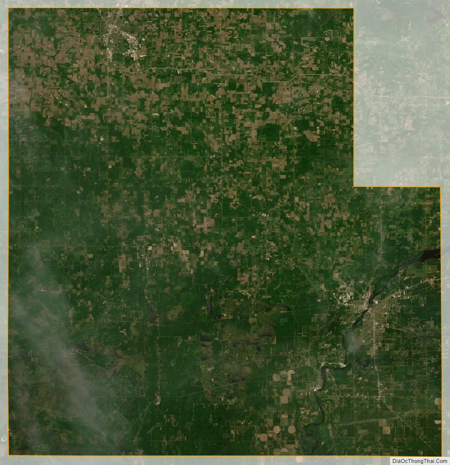
Wood County Satellite Map
Wood County Outline Map

See also
Map of Wisconsin State and its subdivision:- Adams
- Ashland
- Barron
- Bayfield
- Brown
- Buffalo
- Burnett
- Calumet
- Chippewa
- Clark
- Columbia
- Crawford
- Dane
- Dodge
- Door
- Douglas
- Dunn
- Eau Claire
- Florence
- Fond du Lac
- Forest
- Grant
- Green
- Green Lake
- Iowa
- Iron
- Jackson
- Jefferson
- Juneau
- Kenosha
- Kewaunee
- La Crosse
- Lafayette
- Lake Michigan
- Lake Superior
- Langlade
- Lincoln
- Manitowoc
- Marathon
- Marinette
- Marquette
- Menominee
- Milwaukee
- Monroe
- Oconto
- Oneida
- Outagamie
- Ozaukee
- Pepin
- Pierce
- Polk
- Portage
- Price
- Racine
- Richland
- Rock
- Rusk
- Saint Croix
- Sauk
- Sawyer
- Shawano
- Sheboygan
- Taylor
- Trempealeau
- Vernon
- Vilas
- Walworth
- Washburn
- Washington
- Waukesha
- Waupaca
- Waushara
- Winnebago
- Wood
- Alabama
- Alaska
- Arizona
- Arkansas
- California
- Colorado
- Connecticut
- Delaware
- District of Columbia
- Florida
- Georgia
- Hawaii
- Idaho
- Illinois
- Indiana
- Iowa
- Kansas
- Kentucky
- Louisiana
- Maine
- Maryland
- Massachusetts
- Michigan
- Minnesota
- Mississippi
- Missouri
- Montana
- Nebraska
- Nevada
- New Hampshire
- New Jersey
- New Mexico
- New York
- North Carolina
- North Dakota
- Ohio
- Oklahoma
- Oregon
- Pennsylvania
- Rhode Island
- South Carolina
- South Dakota
- Tennessee
- Texas
- Utah
- Vermont
- Virginia
- Washington
- West Virginia
- Wisconsin
- Wyoming