Wyandotte County (/ˈwaɪ.əndɒt/; county code WY) is a county in the U.S. state of Kansas. As of the 2020 census, the population was 169,245, making it Kansas’s fourth-most populous county. Its county seat and most populous city is Kansas City, with which it shares a unified government. Wyandotte County also includes the city of Bonner Springs. The County is directly north of Johnson County, Kansas, and west of Kansas City, Missouri.
| Name: | Wyandotte County |
|---|---|
| FIPS code: | 20-209 |
| State: | Kansas |
| Founded: | January 29, 1859 |
| Named for: | Wyandot people |
| Seat: | Kansas City |
| Largest city: | Kansas City |
| Total Area: | 156 sq mi (400 km²) |
| Land Area: | 152 sq mi (390 km²) |
| Total Population: | 169,245 |
| Population Density: | 1,039.0/sq mi (401.2/km²) |
| Time zone: | UTC−6 (Central) |
| Summer Time Zone (DST): | UTC−5 (CDT) |
| Website: | wycokck.org |
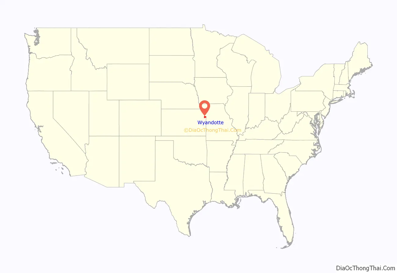
Wyandotte County location map. Where is Wyandotte County?
History
The Wyandot
The county is named after the Wyandot (also known as Wyandott or Wyandotte) Indians. They were called the Huron by the French in Canada, but called themselves Wendat. They were distantly related to the Iroquois, with whom they sometimes fought. They had hoped to keep white Americans out of their territory and to make the Ohio River the border between the United States and Canada.
One branch of the Wyandot moved to the area that is now the state of Ohio. They generally took the course of assimilation into Anglo-American society. Many of them embraced Christianity under the influence of missionaries. They were transported to the current Wyandotte County in 1843, where they set up a community and worked in cooperation with Anglo settlers. The Christian Munsee also influenced this area’s early settlement.
The Wyandot in Kansas set up a constitutional form of government they had devised in Ohio. They set up the territorial government for Kansas and Nebraska, and elected one of their own territorial governor.
Other historical facts
The county was organized in 1859. Tenskwatawa (Tecumseh’s brother), “the Prophet”, fought at the Battle of Tippecanoe in 1811. He was buried at Shawnee Native American historical site Whitefeather Spring, at 3818 Ruby Ave. Kansas City, which was added in 1975 to the National Register of Historic Places in 1975. The Kansas City Smelting and Refining Company employed over 250 men during the 1880s. The ore and base bullion is received from the mountains’ mining districts and is crushed, separated and refined.
The Delaware Crossing (or “Military Crossing”; sometimes “the Secondine”) was where the old Indian trail met the waters of the Kaw River. Circa 1831, Moses Grinter, one of the area’s earliest permanent white settlers, set up the Grinter Ferry on the Kansas River there. His house was known as the Grinter Place. The ferry was used by traders, freighters, and soldiers traveling between Fort Leavenworth and Fort Scott on the military road. Others crossed this area on their way to Santa Fe.
The Diocese of Leavenworth moved its see from Leavenworth, Kansas to Kansas City, Kansas on 10 May 1947. It became an archdiocese on 9 August 1952.
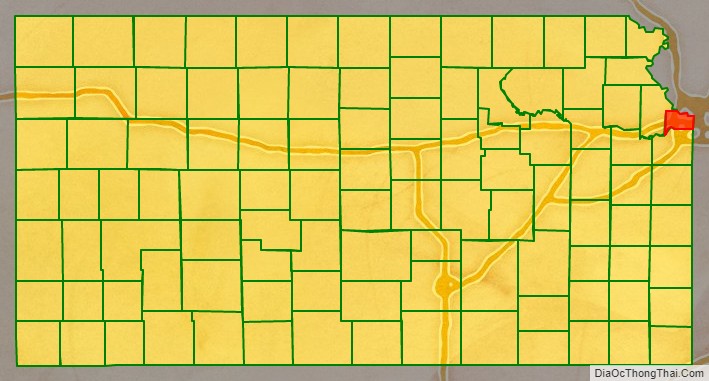
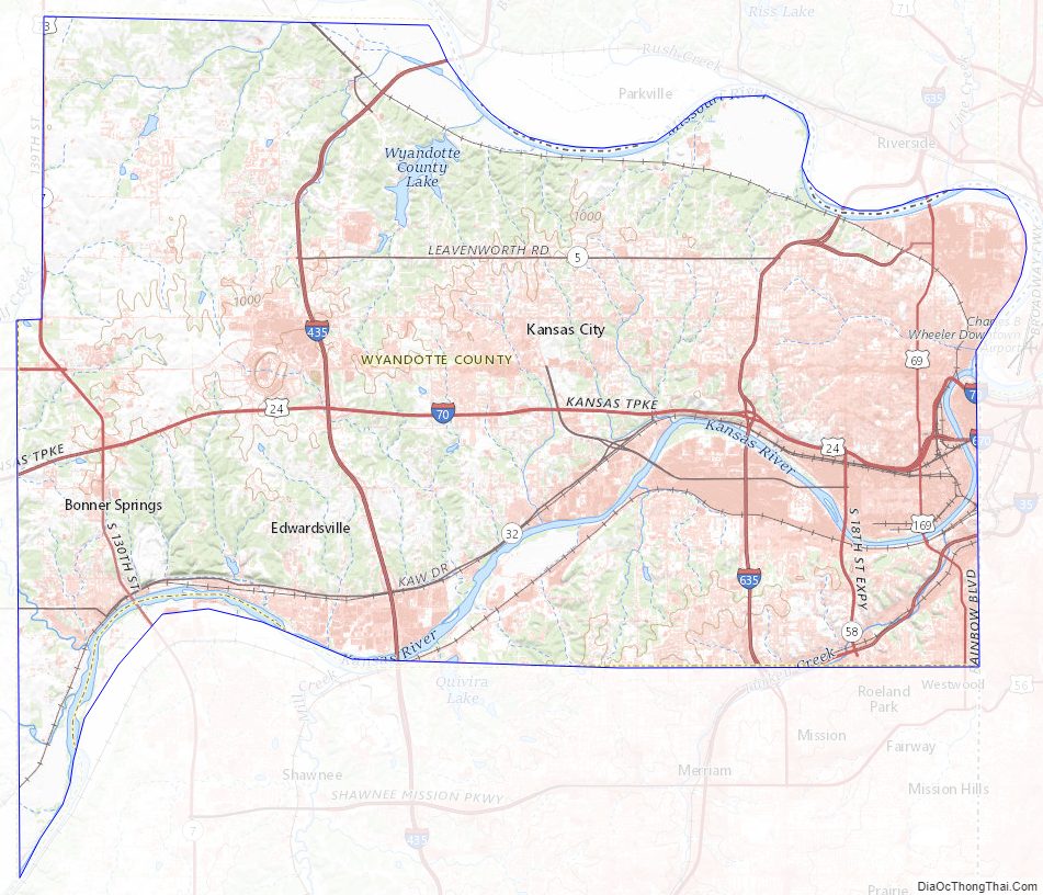
Wyandotte County Road Map
Geography
According to the United States Census Bureau, the county has an area of 156 square miles (400 km), of which 152 square miles (390 km) is land and 4.6 square miles (12 km) (2.9%) is water. It is Kansas’s smallest county by area.
Topography
The county’s natural topography consists of gently rolling terrain. The Kansas River forms part of the county’s southern boundary. The elevation generally increases from south to north as the distance from the Kansas River and Missouri River increases.
Watersheds and streams
The county is drained by the watersheds of the Kansas River, which is part of the Missouri River watershed. It receives plentiful rainfall.
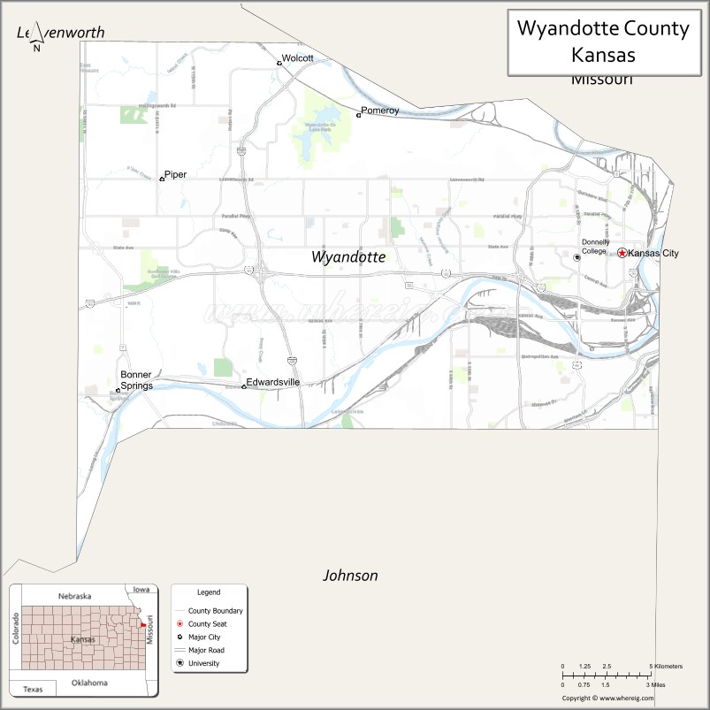
Adjacent counties
- Platte County, Missouri (north)
- Clay County, Missouri (northeast)
- Jackson County, Missouri (east)
- Johnson County (south)
- Leavenworth County (west)
Wyandotte County Topographic Map
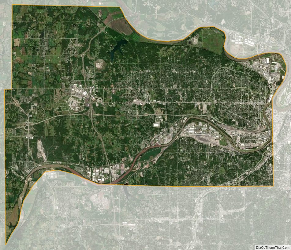
Wyandotte County Satellite Map
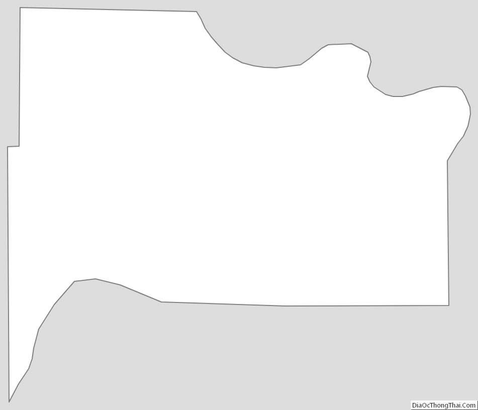
Wyandotte County Outline Map
See also
Map of Kansas State and its subdivision:- Allen
- Anderson
- Atchison
- Barber
- Barton
- Bourbon
- Brown
- Butler
- Chase
- Chautauqua
- Cherokee
- Cheyenne
- Clark
- Clay
- Cloud
- Coffey
- Comanche
- Cowley
- Crawford
- Decatur
- Dickinson
- Doniphan
- Douglas
- Edwards
- Elk
- Ellis
- Ellsworth
- Finney
- Ford
- Franklin
- Geary
- Gove
- Graham
- Grant
- Gray
- Greeley
- Greenwood
- Hamilton
- Harper
- Harvey
- Haskell
- Hodgeman
- Jackson
- Jefferson
- Jewell
- Johnson
- Kearny
- Kingman
- Kiowa
- Labette
- Lane
- Leavenworth
- Lincoln
- Linn
- Logan
- Lyon
- Marion
- Marshall
- McPherson
- Meade
- Miami
- Mitchell
- Montgomery
- Morris
- Morton
- Nemaha
- Neosho
- Ness
- Norton
- Osage
- Osborne
- Ottawa
- Pawnee
- Phillips
- Pottawatomie
- Pratt
- Rawlins
- Reno
- Republic
- Rice
- Riley
- Rooks
- Rush
- Russell
- Saline
- Scott
- Sedgwick
- Seward
- Shawnee
- Sheridan
- Sherman
- Smith
- Stafford
- Stanton
- Stevens
- Sumner
- Thomas
- Trego
- Wabaunsee
- Wallace
- Washington
- Wichita
- Wilson
- Woodson
- Wyandotte
- Alabama
- Alaska
- Arizona
- Arkansas
- California
- Colorado
- Connecticut
- Delaware
- District of Columbia
- Florida
- Georgia
- Hawaii
- Idaho
- Illinois
- Indiana
- Iowa
- Kansas
- Kentucky
- Louisiana
- Maine
- Maryland
- Massachusetts
- Michigan
- Minnesota
- Mississippi
- Missouri
- Montana
- Nebraska
- Nevada
- New Hampshire
- New Jersey
- New Mexico
- New York
- North Carolina
- North Dakota
- Ohio
- Oklahoma
- Oregon
- Pennsylvania
- Rhode Island
- South Carolina
- South Dakota
- Tennessee
- Texas
- Utah
- Vermont
- Virginia
- Washington
- West Virginia
- Wisconsin
- Wyoming