Yellow Medicine County is a county in the State of Minnesota. Its eastern border is formed by the Minnesota River. As of the 2020 census, the population was 9,528. Its county seat is Granite Falls.
The Upper Sioux Indian Reservation, related to the historical Yellow Medicine Agency that was located here, is entirely within the county. It was established under the Treaty of Traverse des Sioux in 1851, by which the Dakota ceded much territory in the region to the United States.
| Name: | Yellow Medicine County |
|---|---|
| FIPS code: | 27-173 |
| State: | Minnesota |
| Founded: | March 6, 1871 |
| Named for: | Yellow Medicine River |
| Seat: | Granite Falls |
| Largest city: | Granite Falls |
| Total Area: | 763 sq mi (1,980 km²) |
| Land Area: | 759 sq mi (1,970 km²) |
| Total Population: | 9,528 |
| Population Density: | 12.6/sq mi (4.9/km²) |
| Time zone: | UTC−6 (Central) |
| Summer Time Zone (DST): | UTC−5 (CDT) |
| Website: | www.co.ym.mn.gov |
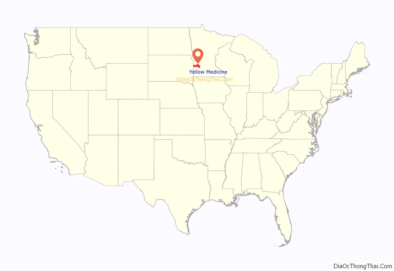
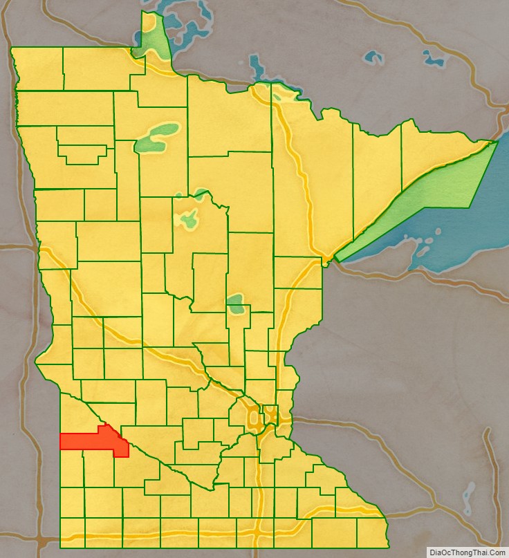
Yellow Medicine County location map. Where is Yellow Medicine County?
History
The county was established by the Minnesota legislature on March 6, 1871, with Granite Falls as the county seat. Its name comes from Yellow Medicine River, which runs through the eastern part of the county to the Minnesota. The river’s name derives from a plant whose yellow root the native Dakota people used for medicinal purposes.
It was proposed in 1878 to create a new county, taken from the western portions of Yellow Medicine, Lincoln, and Lac qui Parle counties. The state legislature approved the petition (subject to local voter approval), and Governor Pillsbury signed the act on February 27, 1879. However, the 1879 ballot proposal failed to garner a combined majority of voters in the three counties, and the proposed Canby County did not come into being.
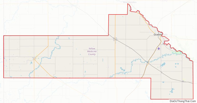
Yellow Medicine County Road Map

Geography
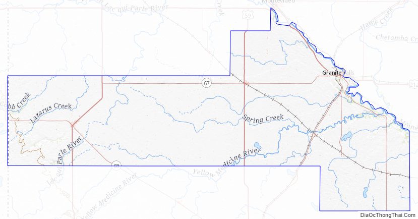
Yellow Medicine County lies on the west side of Minnesota. Its west border abuts the east border of the state of South Dakota. The Minnesota River flows east-southeasterly along the county’s northeast side on its way to discharge into the Mississippi River. The Yellow Medicine River flows northeastward through the eastern part of the county, discharging into the Minnesota near the midpoint of the county’s eastern border. The Stony Run Creek flows eastward through the upper east part of the county; the Florida Creek flows northeastward through the west end of the county, and the Lac qui Parle River also flows northeastward through the west central part of the county. The county terrain consists of rolling hills, carved by drainages. The area is devoted to agriculture. The terrain slopes to the east and slightly to the north; its highest point is on the west border, near its SW corner, at 1,732′ (528m) ASL. The county has a total area of 763 square miles (1,980 km), of which 759 square miles (1,970 km) is land and 4.1 square miles (11 km) (0.5%) is water.
Lakes
- Burton Lake
- Culver Lake (part)
- Curtis Lake
- Highbank Lake
- Kvistid Lake
- Lake Louie
- Lone Tree Lake
- Miedd Lake
- Miller Lake
- Mud Lake
- Spellman Lake
- Timm Lake
- Tyson Lake
- Wood Lake
Rivers and drainages
- Florida Creek
- Lac qui Parle River
- Minnesota River
- Spring Creek
- Stony Run Creek
- Yellow Medicine River
Major highways
- U.S. Highway 59
- U.S. Highway 75
- U.S. Highway 212
- Minnesota State Highway 23
- Minnesota State Highway 67
- Minnesota State Highway 68
- Minnesota State Highway 274
Adjacent counties
- Lac qui Parle County – north
- Chippewa County – northeast
- Renville County – east
- Redwood County – southeast
- Lyon County – south
- Lincoln County – southwest
- Deuel County, South Dakota – west
Protected areas
- Bigrock State Wildlife Management Area
- Christopherson State Wildlife Management Area
- Clawson State Wildlife Management Area
- Flinks State Wildlife Management Area
- Miller-Richter State Wildlife Management Area
- Mound Springs Prairie Scientific and Natural Area
- Omro State Wildlife Management Area
- Oshkosh State Wildlife Management Area
- Penthole State Wildlife Management Area
- Posen State Wildlife Management Area
- Saint Leo State Wildlife Management Area
- Sioux Nation State Wildlife Management Area
- Stokke State Wildlife Management Area
- Stony Run State Wildlife Management Area
- Swedes Forest Scientific and Natural Area (part)
- Upper Sioux Agency State Park
Yellow Medicine County Topographic Map
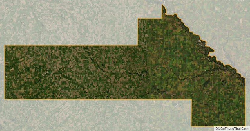
Yellow Medicine County Satellite Map
Yellow Medicine County Outline Map

See also
Map of Minnesota State and its subdivision:- Aitkin
- Anoka
- Becker
- Beltrami
- Benton
- Big Stone
- Blue Earth
- Brown
- Carlton
- Carver
- Cass
- Chippewa
- Chisago
- Clay
- Clearwater
- Cook
- Cottonwood
- Crow Wing
- Dakota
- Dodge
- Douglas
- Faribault
- Fillmore
- Freeborn
- Goodhue
- Grant
- Hennepin
- Houston
- Hubbard
- Isanti
- Itasca
- Jackson
- Kanabec
- Kandiyohi
- Kittson
- Koochiching
- Lac qui Parle
- Lake
- Lake of the Woods
- Lake Superior
- Le Sueur
- Lincoln
- Lyon
- Mahnomen
- Marshall
- Martin
- McLeod
- Meeker
- Mille Lacs
- Morrison
- Mower
- Murray
- Nicollet
- Nobles
- Norman
- Olmsted
- Otter Tail
- Pennington
- Pine
- Pipestone
- Polk
- Pope
- Ramsey
- Red Lake
- Redwood
- Renville
- Rice
- Rock
- Roseau
- Saint Louis
- Scott
- Sherburne
- Sibley
- Stearns
- Steele
- Stevens
- Swift
- Todd
- Traverse
- Wabasha
- Wadena
- Waseca
- Washington
- Watonwan
- Wilkin
- Winona
- Wright
- Yellow Medicine
- Alabama
- Alaska
- Arizona
- Arkansas
- California
- Colorado
- Connecticut
- Delaware
- District of Columbia
- Florida
- Georgia
- Hawaii
- Idaho
- Illinois
- Indiana
- Iowa
- Kansas
- Kentucky
- Louisiana
- Maine
- Maryland
- Massachusetts
- Michigan
- Minnesota
- Mississippi
- Missouri
- Montana
- Nebraska
- Nevada
- New Hampshire
- New Jersey
- New Mexico
- New York
- North Carolina
- North Dakota
- Ohio
- Oklahoma
- Oregon
- Pennsylvania
- Rhode Island
- South Carolina
- South Dakota
- Tennessee
- Texas
- Utah
- Vermont
- Virginia
- Washington
- West Virginia
- Wisconsin
- Wyoming