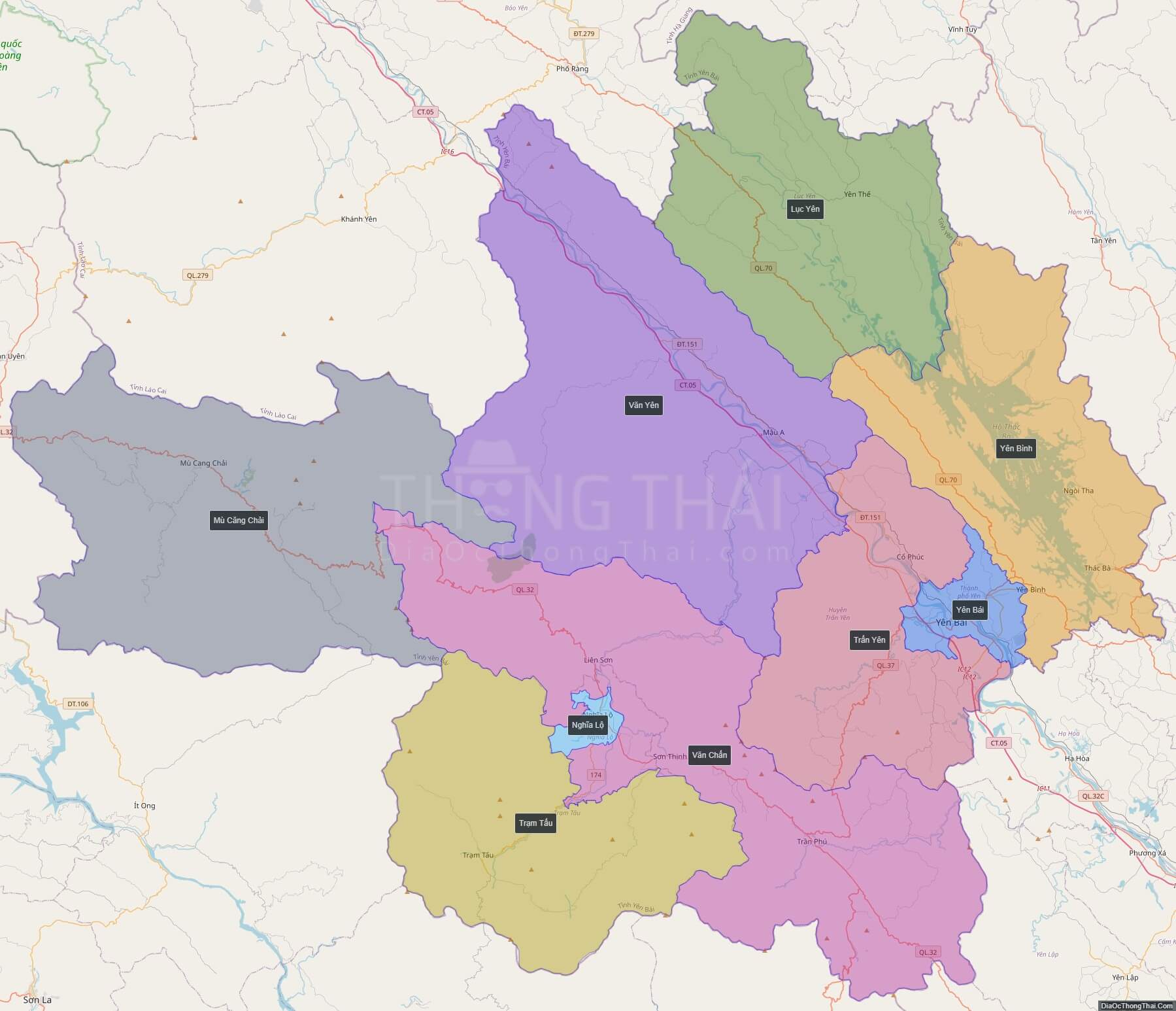
Yen Bai is an agricultural-based province located in Tay Bac, the northern part of northern-central Vietnam. It shares borders with six provinces which are Ha Giang Province, Lao Cai Province, Lai Chau Province, Son La Province, Phu Tho Province, and Tuyen Quang Province. The province covers an area of
6899.5 square kilometres and as of 2008 it had a population of 750,200 people.
Yen Bai’s history is important under the French colony, particularly the subsequent “Yen Bai mutiny”, an uprising of Vietnamese soldiers in the French colonial army on 10 February 1930 in collaboration with civilian supporters who were members of the Viet Nam Quoc Dan Dang (VNQDD, the Vietnamese Nationalist Party).
Forestry and farming are the main economic stay of the province. Thac Ba Lake is a natural asset of the country along with its Thac Ba Hydroelectric Plant. Dong Cuong Festival is an important festival of the province.
Political Map of Yen Bai province
Interactive online map of Yen Bai
Click on ![]() to view map in “full screen” mode.
to view map in “full screen” mode.
Base Map Layer: Open Street Map (OSM), Arcgisonline, Google Map, Wmflabs.
Large scale maps of Yen Bai
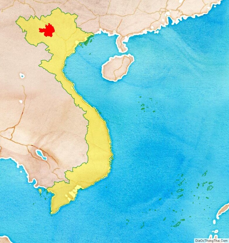
Yen Bai location map
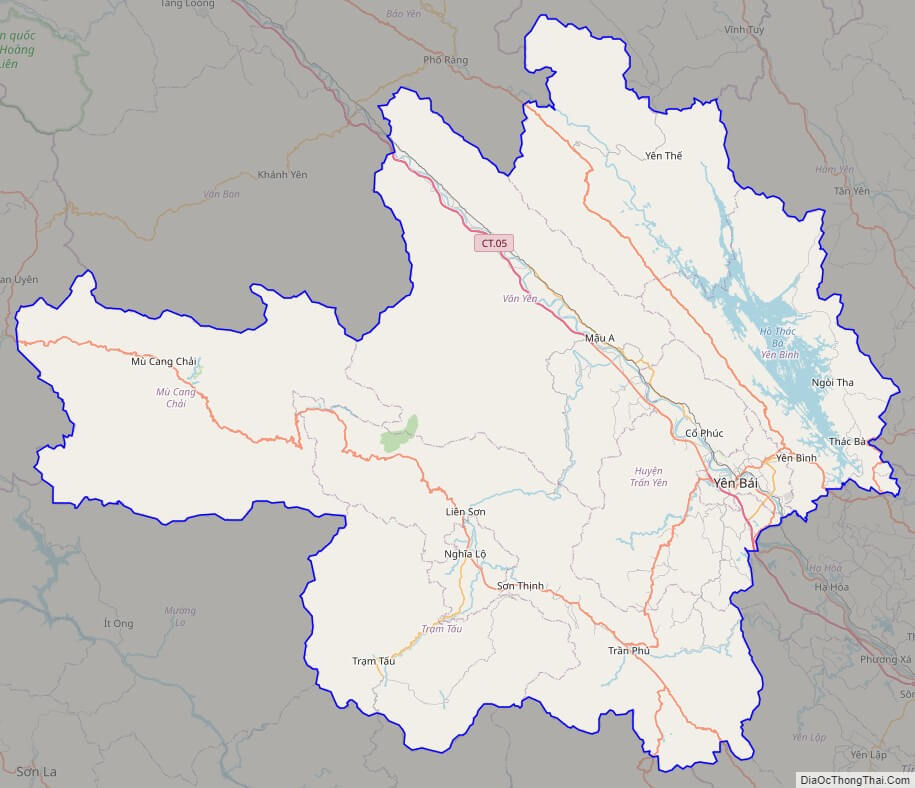
Yen Bai street map
Yen Bai satellite map

See also
See also map of Yen Bai province and district-level sub-divisions: Map of Vietnam provinces:- Ha Noi
- Ho Chi Minh
- Da Nang
- Can Tho
- Hai Phong
- An Giang
- Ba Ria-Vung Tau
- Bac Giang
- Bac Kan
- Bac Lieu
- Bac Ninh
- Ben Tre
- Binh Dinh
- Binh Duong
- Binh Phuoc
- Binh Thuan
- Ca Mau
- Cao Bang
- Dak Lak
- Dak Nong
- Dien Bien
- Dong Nai
- Dong Thap
- Gia Lai
- Ha Giang
- Ha Nam
- Ha Tinh
- Hai Duong
- Hau Giang
- Hoa Binh
- Hung Yen
- Khanh Hoa
- Kien Giang
- Kon Tum
- Lai Chau
- Lam Dong
- Lang Son
- Lao Cai
- Long An
- Nam Dinh
- Nghe An
- Ninh Binh
- Ninh Thuan
- Phu Tho
- Phu Yen
- Quang Binh
- Quang Nam
- Quang Ngai
- Quang Ninh
- Quang Tri
- Soc Trang
- Son La
- Tay Ninh
- Thai Binh
- Thai Nguyen
- Thanh Hoa
- Thua Thien-Hue
- Tien Giang
- Tra Vinh
- Tuyen Quang
- Vinh Long
- Vinh Phuc
- Yen Bai