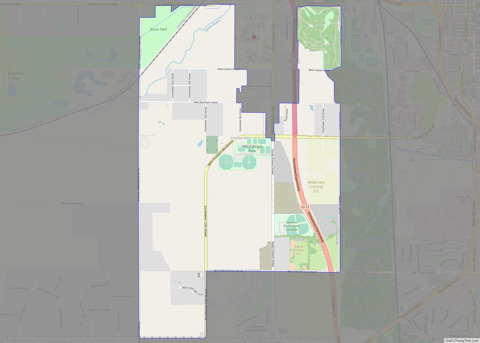
Map of Woodland Hills CDP, Nebraska

Map of Woodland Hills CDP, Nebraska

Woodland Hills is an unincorporated community and census-designated place in Otoe County, Nebraska, United States. Its population was 232 as of the 2020 census. Woodland Hills CDP overview: Name: Woodland Hills CDP LSAD Code: 57 LSAD Description: CDP (suffix) State: Nebraska County: Otoe County Elevation: 1,263 ft (385 m) Total Area: 0.37 sq mi (0.95 km²) Land Area: 0.36 sq mi (0.93 km²) … Read more

Map of Wood River city, Nebraska

Map of Wood River city, Nebraska

Wood River is a city in southwestern Hall County, Nebraska, United States. The population was 1,172 at the 2020 census. It is part of the Grand Island, Nebraska Metropolitan Statistical Area. Wood River city overview: Name: Wood River city LSAD Code: 25 LSAD Description: city (suffix) State: Nebraska County: Hall County Elevation: 1,965 ft (599 m) Total … Read more

Map of Wood Lake village, Nebraska

Map of Wood Lake village, Nebraska

Wood Lake is a village in Cherry County, Nebraska, United States. The population was 63 at the 2010 census. Wood Lake village overview: Name: Wood Lake village LSAD Code: 47 LSAD Description: village (suffix) State: Nebraska County: Cherry County Elevation: 2,694 ft (821 m) Total Area: 0.33 sq mi (0.85 km²) Land Area: 0.32 sq mi (0.82 km²) Water Area: 0.01 sq mi (0.03 km²) Total … Read more

Map of Wolbach village

Map of Wolbach village

Wolbach is a village in Greeley county, Nebraska. The population was 283 at the time of the 2010 census. Wolbach village overview: Name: Wolbach village LSAD Code: 47 LSAD Description: village (suffix) State: Nebraska County: Greeley County Elevation: 1,867 ft (569 m) Total Area: 0.70 sq mi (1.81 km²) Land Area: 0.69 sq mi (1.78 km²) Water Area: 0.01 sq mi (0.03 km²) Total Population: 224 … Read more