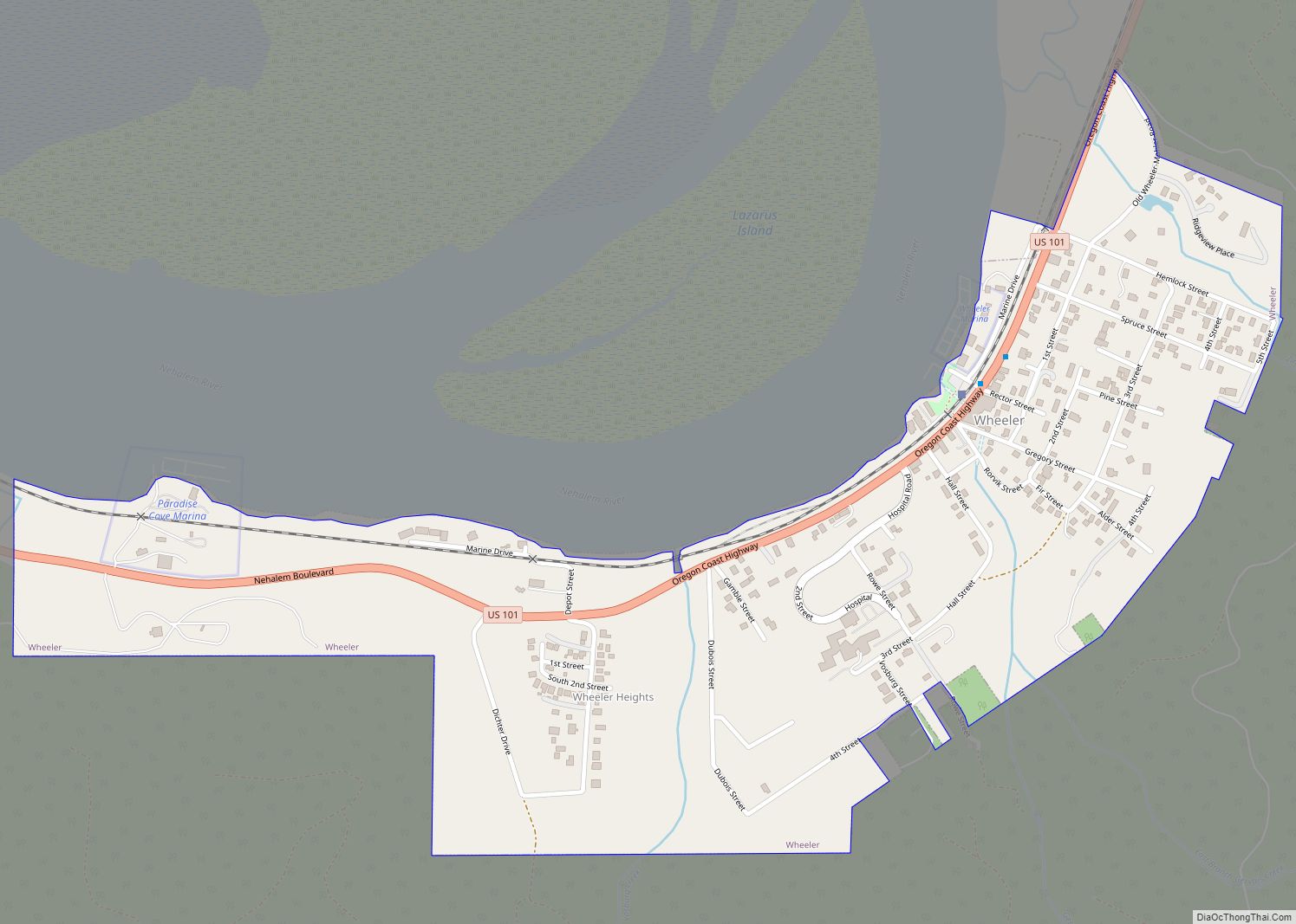
Map of Winchester Bay CDP

Map of Winchester Bay CDP

Winchester Bay, formerly Umpqua City, is an unincorporated community in Douglas County, Oregon, United States. For statistical purposes, the United States Census Bureau has defined Winchester Bay as a census-designated place (CDP). The census definition of the area may not precisely correspond to local understanding of the area with the same name. The population of … Read more

Map of Wimer CDP

Map of Wimer CDP

Wimer is an unincorporated community and census-designated place (CDP) in Jackson County, Oregon, United States. As of the 2010 census it had a population of 678. Wimer lies along Evans Creek north of the city of Rogue River. The community was named for a relative of William Wimer, who edited a newspaper in Grants Pass … Read more

Map of Yoncalla city

Map of Yoncalla city

Yoncalla is a city in Douglas County, Oregon, United States. The population was 1,047 at the 2010 census. Yoncalla city overview: Name: Yoncalla city LSAD Code: 25 LSAD Description: city (suffix) State: Oregon County: Douglas County Incorporated: February 27, 1901 Elevation: 390 ft (120 m) Total Area: 0.68 sq mi (1.76 km²) Land Area: 0.67 sq mi (1.74 km²) Water Area: 0.01 sq mi (0.02 km²) … Read more

Map of Yamhill city

Map of Yamhill city

Yamhill is a city in Yamhill County, Oregon, United States. Located in the northern part of the county, it is situated at the intersection of Oregon Route 47 and Oregon Route 240. The population was 1,147 at the 2020 census. Originally named North Yamhill, it was incorporated under that name by the Oregon Legislative Assembly … Read more

Map of Yachats city

Map of Yachats city

Yachats (/ˈjɑːhɑːts/ YAH-hahts) is a small coastal city in the southernmost area of Lincoln County, Oregon, United States. According to Oregon Geographic Names, the name comes from the Siletz language and means “dark water at the foot of the mountain”. There is a range of differing etymologies, however. William Bright says the name comes from … Read more

Map of Woodburn city, Oregon

Map of Woodburn city, Oregon

Woodburn is a city in Marion County, Oregon, United States. Incorporated in 1889, the community had been platted in 1871 after the arrival of the railroad. The city is located in the northern end of the Willamette Valley between Portland and Salem. Interstate 5 connects it to major cities to the north and south. Oregon … Read more