Map of Portland city, Oregon

Map of Portland city, Oregon

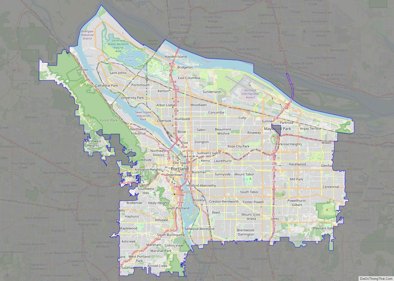
Portland (/ˈpɔːrtlənd/ PORT-lənd) is a port city in the Pacific Northwest and the largest city in the U.S. state of Oregon. Situated in the northwestern area of the state at the confluence of the Willamette and Columbia rivers, Portland is the county seat of Multnomah County, the most populous county in Oregon. As of 2020, … Read more

Map of Salem city, Oregon

Map of Salem city, Oregon

Salem (/ˈseɪləm/ SAY-ləm) is the capital of the U.S. state of Oregon, and the county seat of Marion County. It is located in the center of the Willamette Valley alongside the Willamette River, which runs north through the city. The river forms the boundary between Marion and Polk counties, and the city neighborhood of West … Read more

Map of Eugene city, Oregon

Map of Eugene city, Oregon

Eugene (/juːˈdʒiːn/ yoo-JEEN) is the second largest city in the U.S. state of Oregon and the seat of Lane County. It is located at the southern end of the Willamette Valley, near the confluence of the McKenzie and Willamette rivers, about 50 miles (80 km) east of the Oregon Coast. As of the 2020 United States … Read more

Map of Gresham city, Oregon

Map of Gresham city, Oregon

Gresham (/ˈɡrɛʃəm/ GRESH-əm) is a city located in Multnomah County, Oregon, in the United States of America, immediately east of Portland, Oregon. It is considered a suburb within the Greater Portland Metropolitan area. Though it began as a settlement in the mid-1800s, it was not officially incorporated as a city until 1905; it was named … Read more

Map of Hillsboro city, Oregon

Map of Hillsboro city, Oregon

Hillsboro (/ˈhɪlzbəroʊ/ HILZ-burr-oh) is the fifth-largest city in the U.S. state of Oregon and is the county seat of Washington County. Situated in the Tualatin Valley on the west side of the Portland metropolitan area, the city hosts many high-technology companies, such as Intel, locally known as the Silicon Forest. At the 2020 census, the … Read more

Map of Alpine CDP, Oregon

Map of Alpine CDP, Oregon

Alpine is an unincorporated rural community and census-designated place in Benton County, Oregon, United States. It is west of Monroe off Oregon Route 99W. As of the 2010 Census, the population was 171. Alpine CDP overview: Name: Alpine CDP LSAD Code: 57 LSAD Description: CDP (suffix) State: Oregon County: Benton County FIPS code: 4101700 Online … Read more

Map of Aloha CDP

Map of Aloha CDP

Aloha (/əˈloʊ.ə/, not /əˈloʊhɑː/) is a census-designated place and unincorporated community in Washington County, Oregon, United States. By road it is 10.9 miles (17.5 km) west of downtown Portland. As of the 2020 Census, the population was 53,828. Fire protection and EMS services are provided through Tualatin Valley Fire and Rescue. and Metro West Ambulance. Aloha … Read more

Map of Albany city, Oregon

Map of Albany city, Oregon

Albany is the county seat of Linn County, Oregon, and is the eleventh largest city in that state. Albany is located in the Willamette Valley at the confluence of the Calapooia River and the Willamette River in both Linn and Benton counties, just east of Corvallis and south of Salem. It is predominantly a farming … Read more

Map of Adrian city, Oregon

Map of Adrian city, Oregon

Adrian is a city in Malheur County, Oregon, United States, near the confluence of the Snake River and the Owyhee River. The population was 177 at the 2010 census. It is part of the Ontario, OR–ID Micropolitan Statistical Area. Adrian city overview: Name: Adrian city LSAD Code: 25 LSAD Description: city (suffix) State: Oregon County: … Read more

Map of Adams city, Oregon

Map of Adams city, Oregon

Adams is a city in Umatilla County, Oregon, United States, located about 13 miles (21 km) northeast of Pendleton on Oregon Route 11. The population was 350 at the 2010 census. It is part of the Pendleton–Hermiston Micropolitan Statistical Area. Adams city overview: Name: Adams city LSAD Code: 25 LSAD Description: city (suffix) State: Oregon County: … Read more

Map of Adair Village city

Map of Adair Village city

Adair Village is a city in Benton County, Oregon, United States. The population was 840 at the 2010 census. Adair Village city overview: Name: Adair Village city LSAD Code: 25 LSAD Description: city (suffix) State: Oregon County: Benton County Incorporated: 1976 Elevation: 328 ft (100 m) Total Area: 0.44 sq mi (1.15 km²) Land Area: 0.44 sq mi (1.15 km²) Water Area: 0.00 sq mi … Read more

Map of Amity city, Oregon

Map of Amity city, Oregon

Amity is a city in Yamhill County, Oregon, United States. As of the 2020 Census, the population was 1,757. Amity city overview: Name: Amity city LSAD Code: 25 LSAD Description: city (suffix) State: Oregon County: Yamhill County Incorporated: 1880 Elevation: 162 ft (49.38 m) Total Area: 0.60 sq mi (1.56 km²) Land Area: 0.59 sq mi (1.54 km²) Water Area: 0.01 sq mi (0.02 km²) Total … Read more