Map of Winthrop city

Map of Winthrop city, Arkansas

Winthrop is a city in Little River County, Arkansas, United States. The population was 192 at the 2010 census. The community was a backdrop for the Winthrop Rockefeller election campaigns in the 1960s. Winthrop city overview: Name: Winthrop city LSAD Code: 25 LSAD Description: city (suffix) State: Arkansas County: Little River County Elevation: 335 ft (102 m) … Read more

Map of Winslow city

Map of Winslow city, Arkansas

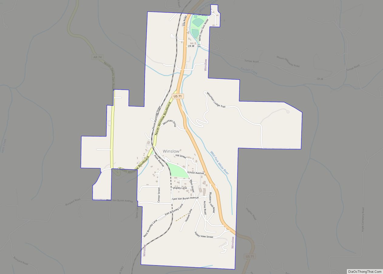
Winslow (formerly Summit Home) is a city in southern Washington County, Arkansas, United States. The population was 365 as of the 2020 census. It is part of the Northwest Arkansas region. Winslow city overview: Name: Winslow city LSAD Code: 25 LSAD Description: city (suffix) State: Arkansas County: Washington County Incorporated: February 27, 1905 Elevation: 1,867 ft … Read more

Map of Wrightsville city

Map of Wrightsville city, Arkansas

Wrightsville is a city in Pulaski County, Arkansas, United States. Its population was 1,542 at the 2020 census. It is part of the Little Rock–North Little Rock–Conway Metropolitan Statistical Area. Located on Highway 365, Wrightsville existed as an unincorporated community for more than a century before it was incorporated late in the 20th century. Since … Read more

Map of Wooster town

Map of Wooster town, Arkansas

Wooster is a city in Faulkner County, Arkansas, United States. The population was 860 at the 2010 census, up from 516 at the 2000 census. It is part of the Little Rock–North Little Rock–Conway Metropolitan Statistical Area. Wooster town overview: Name: Wooster town LSAD Code: 43 LSAD Description: town (suffix) State: Arkansas County: Faulkner County … Read more

Map of Woodson CDP

Map of Woodson CDP, Arkansas

Woodson is a census-designated place (CDP) in Pulaski County, Arkansas, United States. Its population was 403 at the 2010 census. It is part of the Little Rock–North Little Rock–Conway Metropolitan Statistical Area. Woodson and its accompanying Woodson Lake and Wood Hollow are the namesake for Ed Wood Sr., a prominent plantation owner, trader, and businessman … Read more

Map of Yellville city

Map of Yellville city

Yellville is a city and county seat in Marion County, Arkansas, United States. Yellville is located in the Ozark Mountains along the banks of Crooked Creek, and neighbors the small town of Summit to the north. The population was 1,178 at the 2020 census. The town’s original name is preserved in the Shawnee Town Branch, … Read more

Map of Yarborough Landing CDP

Map of Yarborough Landing CDP

Yarborough Landing is a census-designated place in Little River County, Arkansas, United States. Per the 2020 census, the population was 457. Yarborough Landing CDP overview: Name: Yarborough Landing CDP LSAD Code: 57 LSAD Description: CDP (suffix) State: Arkansas County: Little River County Elevation: 308 ft (94 m) Total Area: 2.18 sq mi (5.64 km²) Land Area: 2.17 sq mi (5.61 km²) Water Area: … Read more

Map of Wynne city

Map of Wynne city

Wynne is the county seat and largest city of Cross County, Arkansas, United States. The population was 8,314 at the 2020 Census. Nestled between the Arkansas Delta and Crowley’s Ridge, Wynne is the closest city to the second-largest state park in Arkansas, Village Creek State Park. Wynne city overview: Name: Wynne city LSAD Code: 25 … Read more

Map of Zinc town

Map of Zinc town

Zinc is a town near the east-central edge of Boone County, Arkansas, United States. The population was 92 at the 2020 census. It is part of the Harrison Micropolitan Statistical Area. A chapter of the Ku Klux Klan operates in Zinc. Zinc town overview: Name: Zinc town LSAD Code: 43 LSAD Description: town (suffix) State: … Read more