Map of Woodland city, Minnesota

Map of Woodland city, Minnesota

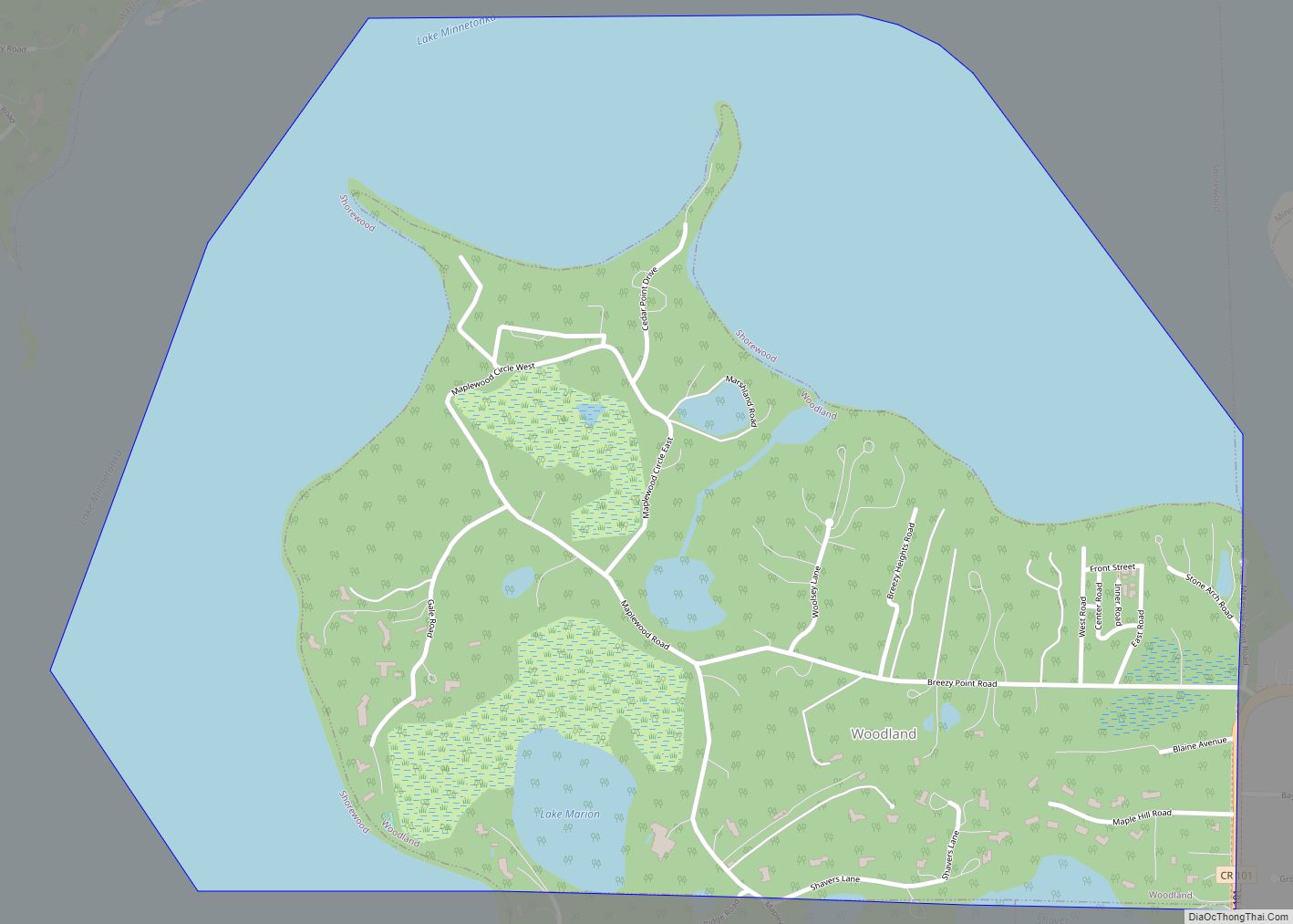
Woodland is a community in Hennepin County, Minnesota, United States, with lake shore property on Lake Minnetonka. The population was 437 at the 2010 census. The first settlers arrived in 1857, when Woodland was part of Minnetonka Township. The land was formally platted in 1882 and developed through the 1890s. Woodland was incorporated as the … Read more

Map of Wykoff city

Map of Wykoff city

Wykoff is a city in Fillmore County, Minnesota, United States. The population was 444 at the 2010 census. Wykoff city overview: Name: Wykoff city LSAD Code: 25 LSAD Description: city (suffix) State: Minnesota County: Fillmore County Elevation: 1,322 ft (403 m) Total Area: 0.93 sq mi (2.42 km²) Land Area: 0.93 sq mi (2.42 km²) Water Area: 0.00 sq mi (0.00 km²) Total Population: 432 Population … Read more

Map of Wright city, Minnesota

Map of Wright city, Minnesota

Wright is a city in Carlton County, Minnesota, United States. The population was 127 at the 2010 census. Minnesota State Highway 210 serves as a main route in Wright. Wright is located 28 miles west of Cloquet. Wright is located 6 miles west of Cromwell; and 47 miles west-southwest of Duluth. Wright city overview: Name: … Read more

Map of Wrenshall city

Map of Wrenshall city

Wrenshall is a city in Carlton County, Minnesota, United States. It was originally a brickyard. The population was 428 at the 2020 census. Wrenshall is located just south of Jay Cooke State Park. Wrenshall city overview: Name: Wrenshall city LSAD Code: 25 LSAD Description: city (suffix) State: Minnesota County: Carlton County Elevation: 1,040 ft (317 m) Total … Read more

Map of Zimmerman city

Map of Zimmerman city

Zimmerman is a city in Sherburne County, Minnesota, United States. The population was 5,228 at the 2010 census. Zimmerman is a predominantly rural community. U.S. Highway 169 serves as a main route in the area. The community is 42 miles north-northwest of Minneapolis and 33 miles east-southeast of St. Cloud. Zimmerman city overview: Name: Zimmerman … Read more

Map of Zemple city

Map of Zemple city

Zemple is a city in Itasca County, Minnesota, United States. The population was 93 at the 2010 census. Zemple city overview: Name: Zemple city LSAD Code: 25 LSAD Description: city (suffix) State: Minnesota County: Itasca County Elevation: 1,293 ft (394 m) Total Area: 0.65 sq mi (1.69 km²) Land Area: 0.65 sq mi (1.69 km²) Water Area: 0.00 sq mi (0.00 km²) Total Population: 78 Population … Read more

Map of Wyoming city, Minnesota

Map of Wyoming city, Minnesota

Wyoming is a city in Chisago County, Minnesota. The population was 7,791 at the time of the 2010 census. Wyoming city overview: Name: Wyoming city LSAD Code: 25 LSAD Description: city (suffix) State: Minnesota County: Chisago County Elevation: 899 ft (274 m) Total Area: 21.68 sq mi (56.16 km²) Land Area: 20.65 sq mi (53.49 km²) Water Area: 1.03 sq mi (2.67 km²) Total Population: 8,032 … Read more

Map of Zumbro Falls city

Map of Zumbro Falls city

Zumbro Falls is a city along the Zumbro River in Wabasha County, Minnesota, United States. The population was 207 at the 2010 census. U.S. Highway 63 and Minnesota 60 intersect in Zumbro Falls. Zumbro Falls city overview: Name: Zumbro Falls city LSAD Code: 25 LSAD Description: city (suffix) State: Minnesota County: Wabasha County Elevation: 843 ft … Read more

Map of Zumbrota city

Map of Zumbrota city

Zumbrota is a city in Goodhue County, Minnesota, United States, along the North Fork of the Zumbro River. The population was 3,252 at the 2010 census. It promotes itself as “the only Zumbrota in the world.” Zumbrota city overview: Name: Zumbrota city LSAD Code: 25 LSAD Description: city (suffix) State: Minnesota County: Goodhue County Elevation: … Read more