Map of Minneapolis city, Minnesota

Map of Minneapolis city, Minnesota

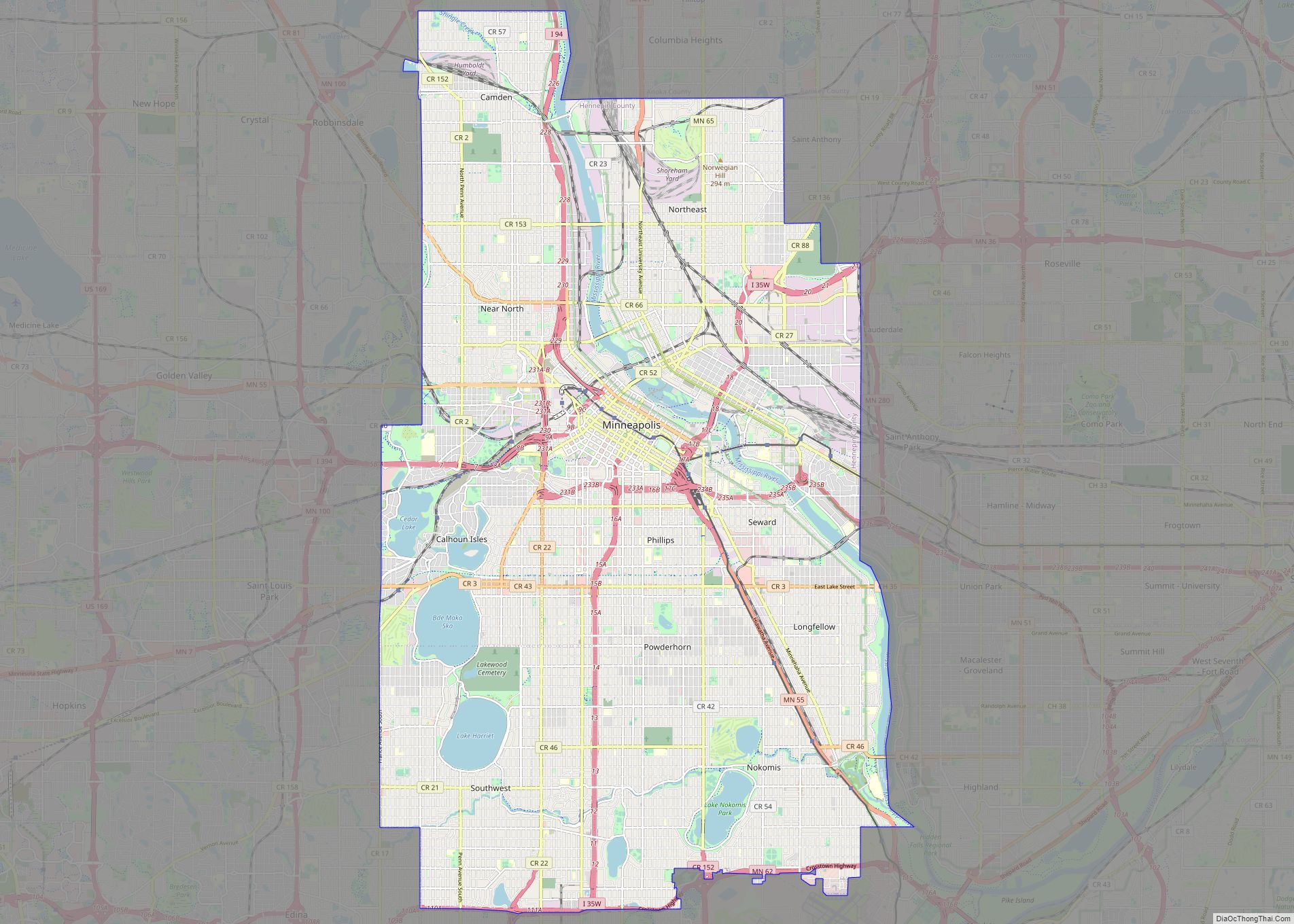
Minneapolis (/ˌmɪniˈæpəlɪs/ (listen) MIN-ee-AP-əl-iss), officially the City of Minneapolis, is a city in the state of Minnesota and the county seat of Hennepin County. As of the 2020 census the population was 429,954, making it the largest city in Minnesota and the 46th-most-populous in the United States. Nicknamed the “City of Lakes”, Minneapolis is abundant … Read more

Map of St. Paul city, Minnesota

Map of St. Paul city, Minnesota

Saint Paul (abbreviated St. Paul) is the capital of the U.S. state of Minnesota and the county seat of Ramsey County. Situated on high bluffs overlooking a bend in the Mississippi River, Saint Paul is a regional business hub and the center of Minnesota’s government. The Minnesota State Capitol and the state government offices all … Read more

Map of Bloomington city, Minnesota

Map of Bloomington city, Minnesota

Bloomington is a city in Hennepin County, Minnesota, United States, on the north bank of the Minnesota River, above its confluence with the Mississippi River, 10 miles (16 km) south of downtown Minneapolis. At the 2020 census, the city’s population was 89,987, making it Minnesota’s fourth-largest city. Bloomington was established as a post–World War II housing … Read more

Map of Duluth city, Minnesota

Map of Duluth city, Minnesota

Duluth (/dəˈluːθ/ (listen) də-LOOTH) is a port city in the U.S. state of Minnesota and the county seat of St. Louis County. Located on Lake Superior in Minnesota’s Arrowhead Region, the city is a hub for cargo shipping. Commodities shipped from the Port of Duluth include coal, iron ore, grain, limestone, cement, salt, wood pulp, … Read more

Map of Adrian city, Minnesota

Map of Adrian city, Minnesota

Adrian is a city in Nobles County, Minnesota, United States. The population was 1,209 at the 2010 census. Adrian city overview: Name: Adrian city LSAD Code: 25 LSAD Description: city (suffix) State: Minnesota County: Nobles County Elevation: 1,562 ft (476 m) Total Area: 1.17 sq mi (3.03 km²) Land Area: 1.17 sq mi (3.03 km²) Water Area: 0.00 sq mi (0.00 km²) Total Population: 1,194 Population … Read more

Map of Adams city, Minnesota

Map of Adams city, Minnesota

Adams is a city in Adams Township, Mower County, Minnesota, United States. The population was 787 at the 2010 census. Adams city overview: Name: Adams city LSAD Code: 25 LSAD Description: city (suffix) State: Minnesota County: Mower County Elevation: 1,286 ft (392 m) Total Area: 1.00 sq mi (2.60 km²) Land Area: 1.00 sq mi (2.60 km²) Water Area: 0.00 sq mi (0.00 km²) Total Population: … Read more

Map of Ada city, Minnesota

Map of Ada city, Minnesota

Ada (/ˈeɪdə/ AY-də) is a city in Norman County, Minnesota, United States. The population was 1,740 at the 2020 census. It is the county seat. Minnesota State Highways 9 and 200 are two of the main routes in the city. Ada city overview: Name: Ada city LSAD Code: 25 LSAD Description: city (suffix) State: Minnesota … Read more

Map of Albert Lea city

Map of Albert Lea city

Albert Lea is a city in Freeborn County, in southern Minnesota. It is the county seat. Its population was 18,492 at the 2020 census. The city is at the junction of Interstates 35 and 90, about 90 miles (140 km) south of the Twin Cities. It is on the shores of Fountain Lake, Pickerel Lake, Albert … Read more

Map of Albany city, Minnesota

Map of Albany city, Minnesota

Albany is a city in Stearns County, Minnesota, United States. The population was 2,561 at the 2010 census. It is part of the St. Cloud Metropolitan Statistical Area. Albany city overview: Name: Albany city LSAD Code: 25 LSAD Description: city (suffix) State: Minnesota County: Stearns County Elevation: 1,204 ft (367 m) Total Area: 2.28 sq mi (5.92 km²) Land Area: … Read more

Map of Akeley city

Map of Akeley city

Akeley (/ˈeɪkli/ AYK-lee) is a city in Hubbard County, Minnesota, United States. The population was 404 at the 2020 census. Akeley city overview: Name: Akeley city LSAD Code: 25 LSAD Description: city (suffix) State: Minnesota County: Hubbard County Elevation: 1,430 ft (436 m) Total Area: 1.49 sq mi (3.87 km²) Land Area: 1.47 sq mi (3.80 km²) Water Area: 0.03 sq mi (0.07 km²) Total Population: … Read more

Map of Aitkin city

Map of Aitkin city

Aitkin (/ˈeɪkɪn/ AY-kin) is a city in Aitkin County, Minnesota, United States. The population was 2,168 at the 2020 census. It is the county seat of Aitkin County. Aitkin city overview: Name: Aitkin city LSAD Code: 25 LSAD Description: city (suffix) State: Minnesota County: Aitkin County Incorporated: August 19, 1889 Elevation: 1,214 ft (370 m) Total Area: … Read more