Map of Arlee CDP

Map of Arlee CDP

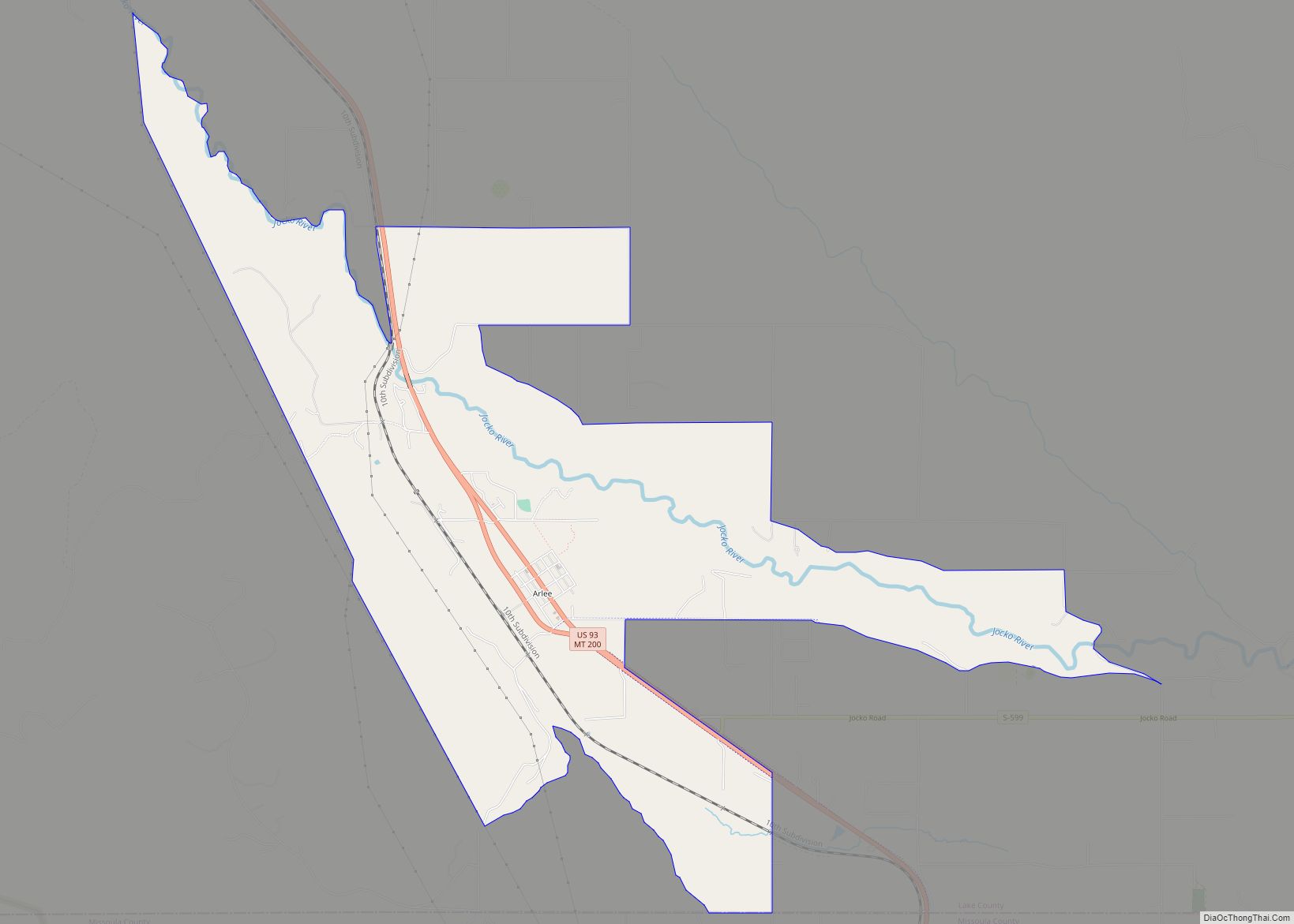
Arlee (Salish: nɫq̓alqʷ, nɫq̓a ) is an unincorporated community and census-designated place (CDP) in Lake County, Montana, United States. The population was 636 at the 2010 census. It is named after Alee, a Salish chief. The chief’s name has no “r”, as the Salish alphabet has no letter “r”. Arlee CDP overview: Name: Arlee CDP … Read more

Map of Antelope CDP, Montana

Map of Antelope CDP, Montana

Antelope is a census-designated place (CDP) in Sheridan County, Montana, United States. The population was 51 at the 2010 census. Antelope CDP overview: Name: Antelope CDP LSAD Code: 57 LSAD Description: CDP (suffix) State: Montana County: Sheridan County Elevation: 2,044 ft (623 m) Total Area: 0.20 sq mi (0.52 km²) Land Area: 0.20 sq mi (0.52 km²) Water Area: 0.00 sq mi (0.00 km²) Total Population: … Read more

Map of Anaconda-Deer Lodge County

Map of Anaconda-Deer Lodge County

Anaconda-Deer Lodge County overview: Name: Anaconda-Deer Lodge County LSAD Code: 00 LSAD Description: 0 State: Montana County: Deer Lodge County FIPS code: 3001675 Online Interactive Map Anaconda-Deer Lodge County online map. Source: Basemap layers from Google Map, Open Street Map (OSM), Arcgisonline, Wmflabs. Boundary Data from Database of Global Administrative Areas. Anaconda-Deer Lodge County location … Read more

Map of Baker city, Montana

Map of Baker city, Montana

Baker is a city in and the county seat of Fallon County, Montana, United States. The population was 1,802 at the 2020 census. It was named after A. G. Baker, an engineer with the Chicago, Milwaukee, St. Paul and Pacific Railroad. Baker city overview: Name: Baker city LSAD Code: 25 LSAD Description: city (suffix) State: … Read more

Map of Bainville town

Map of Bainville town

Bainville is a town in Roosevelt County, Montana, United States. The population was 271 at the 2020 census. It is named for Charles M. Bain, an early resident and the town’s first postmaster. Bainville celebrated its centennial on July 4, 2006. Bainville town overview: Name: Bainville town LSAD Code: 43 LSAD Description: town (suffix) State: … Read more

Map of Babb CDP

Map of Babb CDP

Babb (Blackfeet: Paahtomahksikimi, “Lakes Inside”, or Saiyapakaitapisko, “Cree Town”) is a small unincorporated farming and ranching community in Glacier County, Montana, United States, on the Blackfeet Indian Reservation. The community experiences a large influx of tourists in the summer months as it is the gateway to the Many Glacier area of Glacier National Park. Babb … Read more

Map of Azure CDP

Map of Azure CDP

Azure is a census-designated place (CDP) in Hill County, Montana, United States. The population was 286 at the 2010 census. Azure CDP overview: Name: Azure CDP LSAD Code: 57 LSAD Description: CDP (suffix) State: Montana County: Hill County Elevation: 3,500 ft (1,100 m) Total Area: 4.50 sq mi (11.65 km²) Land Area: 4.50 sq mi (11.65 km²) Water Area: 0.00 sq mi (0.00 km²) Total Population: … Read more

Map of Avon CDP, Montana

Map of Avon CDP, Montana

Avon is a census-designated place (CDP) in Powell County, Montana, United States. The population was 124 at the 2000 census. The town sits along the Little Blackfoot River, and serves as a gateway to the Beaverhead-Deerlodge National Forest. The post office was opened in 1884 by Bill Cramer. The town was named Avon after the … Read more

Map of Bearcreek town

Map of Bearcreek town

Bearcreek is an incorporated town in Carbon County, Montana, United States. It is part of the Billings, Montana Metropolitan Statistical Area. The population was 91 at the 2020 census. Bearcreek uses the Mayor/Council form of government. Bearcreek town overview: Name: Bearcreek town LSAD Code: 43 LSAD Description: town (suffix) State: Montana County: Carbon County Elevation: … Read more

Map of Bear Dance CDP

Map of Bear Dance CDP

Bear Dance is a census-designated place (CDP) in Lake County, Montana, United States. The population was 275 at the 2010 census. It is located on Montana Highway 35 on the east bank of Flathead Lake, 22 miles from Polson. Bear Dance CDP overview: Name: Bear Dance CDP LSAD Code: 57 LSAD Description: CDP (suffix) State: … Read more

Map of Batavia CDP, Montana

Map of Batavia CDP, Montana

Batavia is a census-designated place (CDP) in Flathead County, Montana, United States. The population was 385 at the 2010 census. U.S. Route 2 passes through town. It is 6 miles from Kalispell. Nearby is the Batavia Waterfowl Production Area. Batavia CDP overview: Name: Batavia CDP LSAD Code: 57 LSAD Description: CDP (suffix) State: Montana County: … Read more

Map of Basin CDP

Map of Basin CDP, Montana

Basin is an unincorporated community and census-designated place (CDP) in Jefferson County, Montana, United States. It lies approximately 10 miles (16 km) southeast of the Continental Divide in a high narrow canyon along Interstate 15 about halfway between Butte and Helena. Basin Creek flows roughly north to south through Basin and enters the Boulder River on … Read more