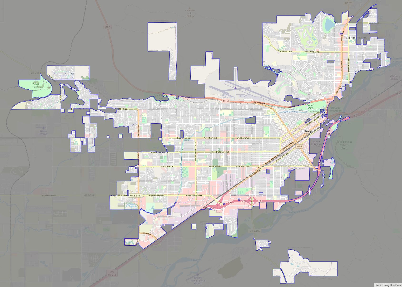
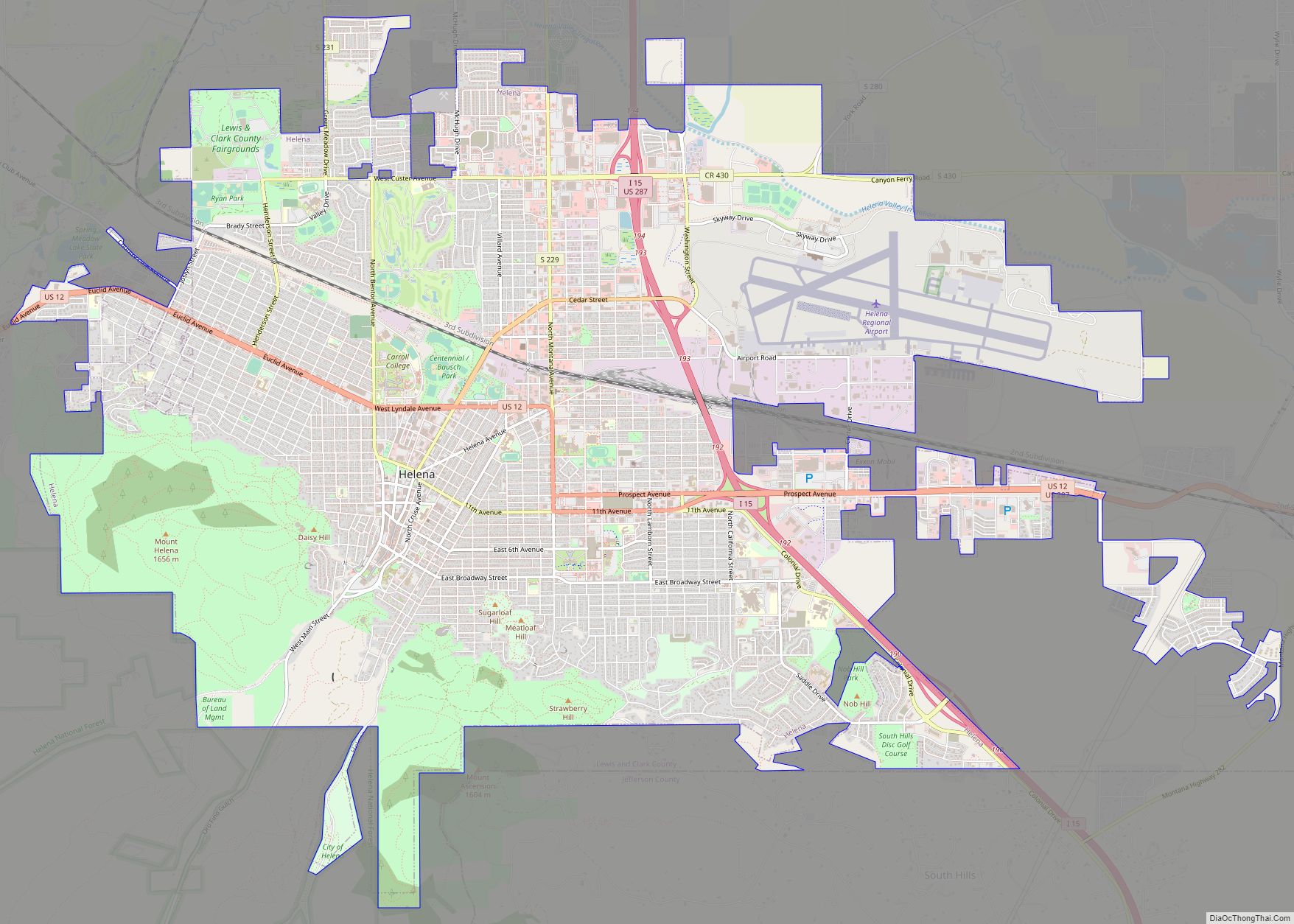
Map of Bozeman city

Map of Bozeman city

Bozeman (/ˈboʊzmən/ BOHZ-mən) is a city and the county seat of Gallatin County, Montana, United States. Located in southwest Montana, the 2020 census put Bozeman’s population at 53,293 making it the fourth-largest city in Montana. It is the principal city of the Bozeman, MT Micropolitan Statistical Area, consisting of all of Gallatin County with a … Read more

Map of Missoula city

Map of Missoula city

Missoula (/mɪˈzuːlə/ (listen) miz-OO-lə; Séliš: Nłʔay, lit. ‘Place of the Small Bull Trout’; Kutenai: Tuhuⱡnana) is a city in the U.S. state of Montana; it is the county seat of Missoula County. It is located along the Clark Fork River near its confluence with the Bitterroot and Blackfoot Rivers in western Montana and at the convergence … Read more

Map of Helena city, Montana

Map of Helena city, Montana

Helena (listen; /ˈhɛlənə/) is the capital city of the U.S. state of Montana and the seat of Lewis and Clark County. Helena was founded as a gold camp during the Montana gold rush, and established on October 30, 1864. Due to the gold rush, Helena became a wealthy city, with approximately 50 millionaires inhabiting the … Read more

Map of Amsterdam CDP, Montana

Map of Amsterdam CDP, Montana

Amsterdam is a census-designated place (CDP) in Gallatin County, Montana, United States. The population was 180 at the 2010 census. It is part of the Bozeman, MT Micropolitan Statistical Area. It was formerly part of the Amsterdam-Churchill CDP. Amsterdam CDP overview: Name: Amsterdam CDP LSAD Code: 57 LSAD Description: CDP (suffix) State: Montana County: Gallatin … Read more

Map of Alzada CDP

Map of Alzada CDP

Alzada (also known as Stoneville and Telegraph Point) is a census-designated place in southern Carter County, Montana, United States. As of the 2010 census it had a population of 29. It is located at the intersection of U.S. Route 212 with Montana Secondary Highways 323 and 326, near the Wyoming and South Dakota borders. The … Read more

Map of Alder CDP

Map of Alder CDP, Montana

Alder is a census-designated place (CDP) in Madison County, Montana, United States. The population was 86 at the 2020 census. The community takes its name from Alder Creek (named by Henry Edgar in 1863), the site of the second major gold discovery in Montana. Alder CDP overview: Name: Alder CDP LSAD Code: 57 LSAD Description: … Read more

Map of Alberton town

Map of Alberton town

Alberton is a town in Mineral County, Montana, United States. The population was 452 at the 2020 census. Alberton was the location of a major chlorine chemical release in 1996. Alberton is the home of Northwest Indian Bible School, a Bible-training institution founded and operated by the Allegheny Wesleyan Methodist Connection (Original Allegheny Conference). Alberton … Read more

Map of Absarokee CDP

Map of Absarokee CDP

Absarokee (/əbzɔːrˈki/ ub-ZOR-kee) is a census-designated place (CDP) in Stillwater County, Montana, United States, approximately 14 miles (23 km) south of Columbus on Highway 78. It is named after the Crow Indians who formerly inhabited the land. The population was 1,234 at the 2000 census. The Stillwater Mine, operated by the Stillwater Mining Company, is located … Read more

Map of Augusta CDP, Montana

Map of Augusta CDP, Montana

Augusta is an unincorporated community and census-designated place (CDP) in Lewis and Clark County, Montana, United States. The population was 309 at the 2010 census and rose to 316 in the 2020 census. The most accepted version in the naming of this town is after Augusta Hogan, thought to be the first child born in … Read more

Map of Ashland CDP, Montana

Map of Ashland CDP, Montana

Ashland is a census-designated place (CDP) in Rosebud County, Montana, United States. The population was 464 at the 2000 census. Ashland is immediately east of the boundary of the Northern Cheyenne Indian Reservation and also along the Tongue River. It is the location of the St. Labre Indian Catholic High School, established in 1884 as … Read more