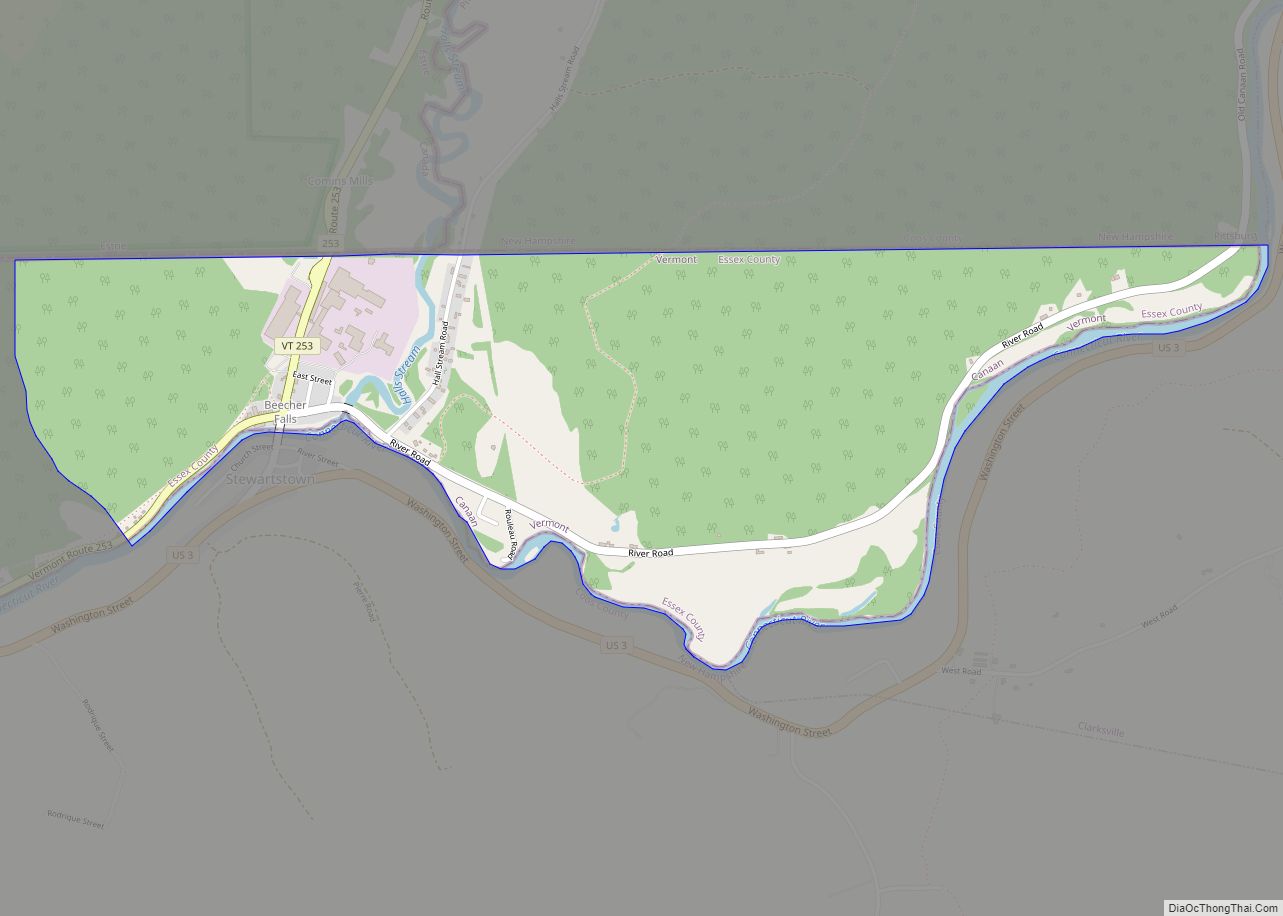
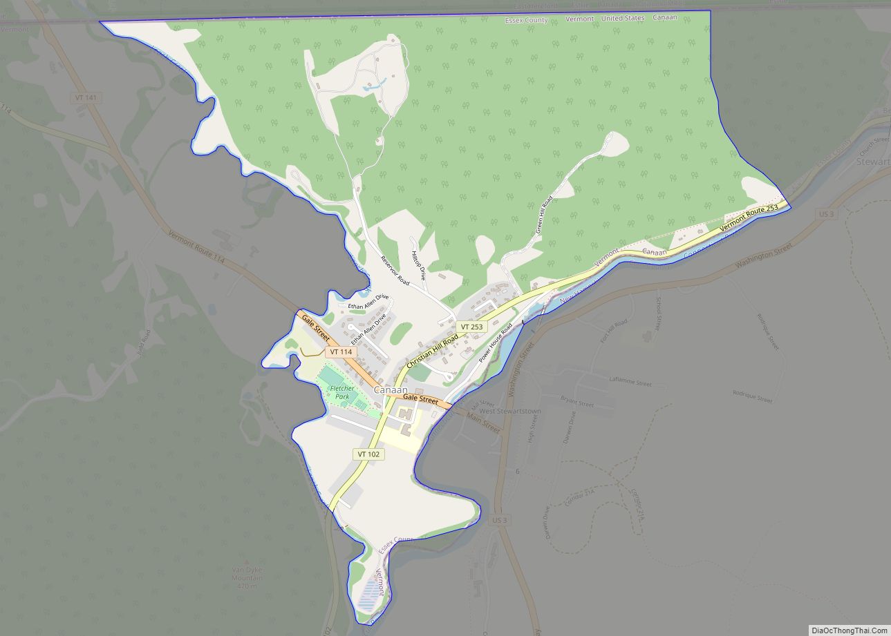
Map of Barnet CDP

Map of Barnet CDP

Barnet is the primary village and a census-designated place (CDP) in the town of Barnet, Caledonia County, Vermont, United States. As of the 2020 census, the CDP had a population of 127, out of 1,663 in the entire town of Barnet. The village is in southeastern Caledonia County, along the southeast edge of the town … Read more

Map of Ascutney CDP

Map of Ascutney CDP

Ascutney is an unincorporated village and census-designated place (CDP) in the town of Weathersfield, Windsor County, Vermont, United States. It is located in the northeastern section of Weathersfield, in the portion of that town adjacent to Mount Ascutney, after which the village is named. As of the 2010 census, the population of the CDP was … Read more

Map of Brandon CDP, Vermont

Map of Brandon CDP, Vermont

Brandon is an unincorporated village and census-designated place (CDP) in the town of Brandon, Rutland County, Vermont, United States. As of the 2020 census, the population was 1,727. Most of the village is listed on the National Register of Historic Places as the Brandon Village Historic District. Brandon CDP overview: Name: Brandon CDP LSAD Code: … Read more

Map of Chester CDP, Vermont

Map of Chester CDP, Vermont

Chester is a census-designated place (CDP) in Windsor County, Vermont, United States. The population was 1,005 at the 2010 census. The CDP is a statistical area encompassing three distinct places: the urbanized center of the town of Chester; a locale known as Chester Depot, which is separated from the town center by the tracks of … Read more

Map of Chelsea CDP, Vermont

Map of Chelsea CDP, Vermont

Chelsea is a town in and the shire town (county seat) of Orange County, Vermont, United States. The population was 1,233 at the 2020 census. Chelsea CDP overview: Name: Chelsea CDP LSAD Code: 57 LSAD Description: CDP (suffix) State: Vermont County: Orange County Elevation: 840 ft (256 m) Total Area: 39.9 sq mi (103.4 km²) Land Area: 39.9 sq mi (103.4 km²) Water … Read more

Map of Cavendish CDP

Map of Cavendish CDP

Cavendish is a census-designated place, the central village of the town of Cavendish, Windsor County, Vermont, United States. Until the mid–nineteenth century it was known as Duttonsville. As of the 2010 census, the population of the CDP was 179, compared to 1,367 for the entire town of Cavendish. Cavendish is the site of the 1848 … Read more

Map of Castleton CDP

Map of Castleton CDP

Castleton is the primary village and a census-designated place (CDP) in the town of Castleton, Rutland County, Vermont, United States. As of the 2020 census, it had a population of 1,337, out of 4,458 in the entire town. A large portion of the village is part of the Castleton Village Historic District, listed on the … Read more

Map of Canaan CDP, Vermont

Map of Canaan CDP, Vermont

Canaan is a census-designated place comprising the main settlement in the town of Canaan, Essex County, Vermont, United States. As of the 2010 census, it had a population of 392, out of a total town population of 972. The Canaan CDP is in the northeast part of the town of Canaan and is bordered by … Read more

Map of Cambridge village, Vermont

Map of Cambridge village, Vermont

Cambridge is a town in Lamoille County, Vermont, United States. The population was 3,839 at the 2020 United States Census. Cambridge includes the villages of Jeffersonville and Cambridge. Cambridge village overview: Name: Cambridge village LSAD Code: 47 LSAD Description: village (suffix) State: Vermont County: Lamoille County Elevation: 758 ft (231 m) Total Area: 63.69 sq mi (164.95 km²) Land Area: … Read more

Map of Cabot CDP, Vermont

Map of Cabot CDP, Vermont

Cabot is a New England town located in the northeast corner of Washington County, Vermont, United States. The population was 1,443 at the 2020 census. It contains the unincorporated villages of Cabot Village, Cabot Plains, South Cabot, East Cabot, Molly’s Pond (named after Molly, the wife of Indian Joe), and Lower Cabot. Cabot contains several … Read more

Map of Bristol CDP, Vermont

Map of Bristol CDP, Vermont

Bristol is the main settlement in the town of Bristol in Addison County, Vermont, United States, and a census-designated place (CDP). The population was 1,936 at the 2020 census, out of a total population of 3,782 in the town of Bristol. Bristol CDP overview: Name: Bristol CDP LSAD Code: 57 LSAD Description: CDP (suffix) State: … Read more

Map of Brattleboro CDP

Map of Brattleboro CDP

Brattleboro is a census-designated place (CDP) corresponding to the densely populated core of the town of Brattleboro in Windham County, Vermont, United States. The population was 8,289 at the 2000 census. Brattleboro CDP overview: Name: Brattleboro CDP LSAD Code: 57 LSAD Description: CDP (suffix) State: Vermont County: Windham County Elevation: 223 ft (68 m) Total Area: 10.0 sq mi … Read more