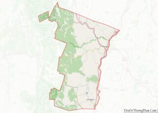
Ascutney is an unincorporated village and census-designated place (CDP) in the town of Weathersfield, Windsor County, Vermont, United States. It is located in the northeastern section of Weathersfield, in the portion of that town adjacent to Mount Ascutney, after which the village is named. As of the 2010 census, the population of the CDP was 540.
| Name: | Ascutney CDP |
|---|---|
| LSAD Code: | 57 |
| LSAD Description: | CDP (suffix) |
| State: | Vermont |
| County: | Windsor County |
| Elevation: | 413 ft (126 m) |
| Total Area: | 1.7 sq mi (4.3 km²) |
| Land Area: | 1.7 sq mi (4.3 km²) |
| Water Area: | 0.0 sq mi (0.0 km²) |
| Total Population: | 540 |
| Population Density: | 330/sq mi (130/km²) |
| ZIP code: | 05030 |
| Area code: | 802 |
| FIPS code: | 5001750 |
| GNISfeature ID: | 1456178 |
Online Interactive Map
Click on ![]() to view map in "full screen" mode.
to view map in "full screen" mode.
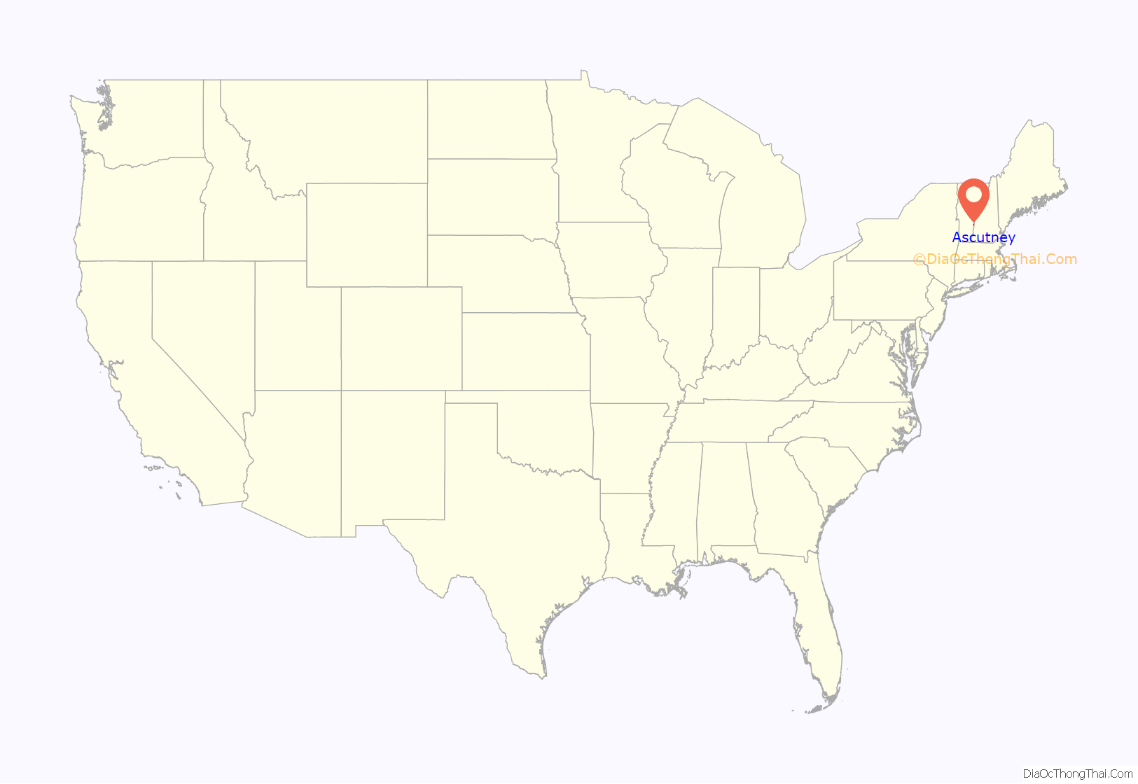
Ascutney location map. Where is Ascutney CDP?

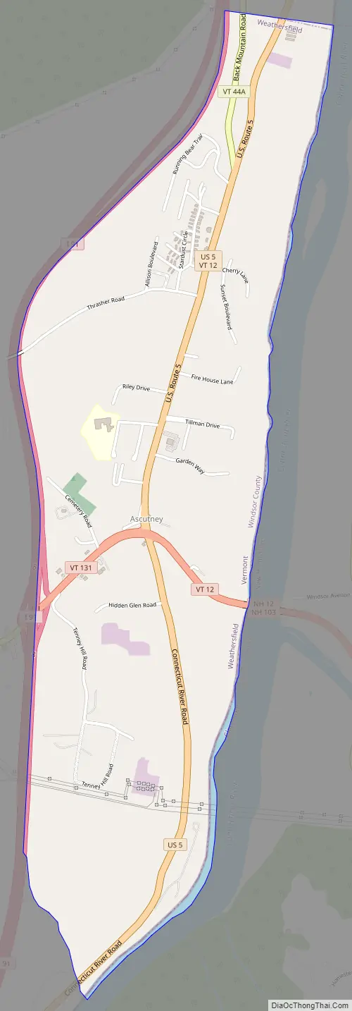
Ascutney Road Map
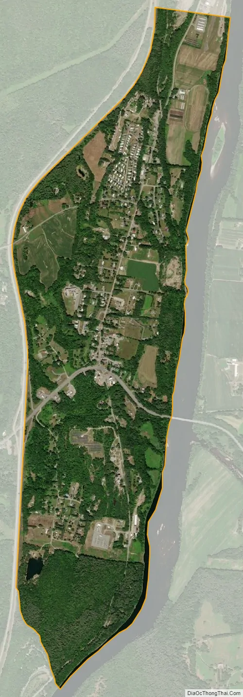
Ascutney city Satellite Map
Geography
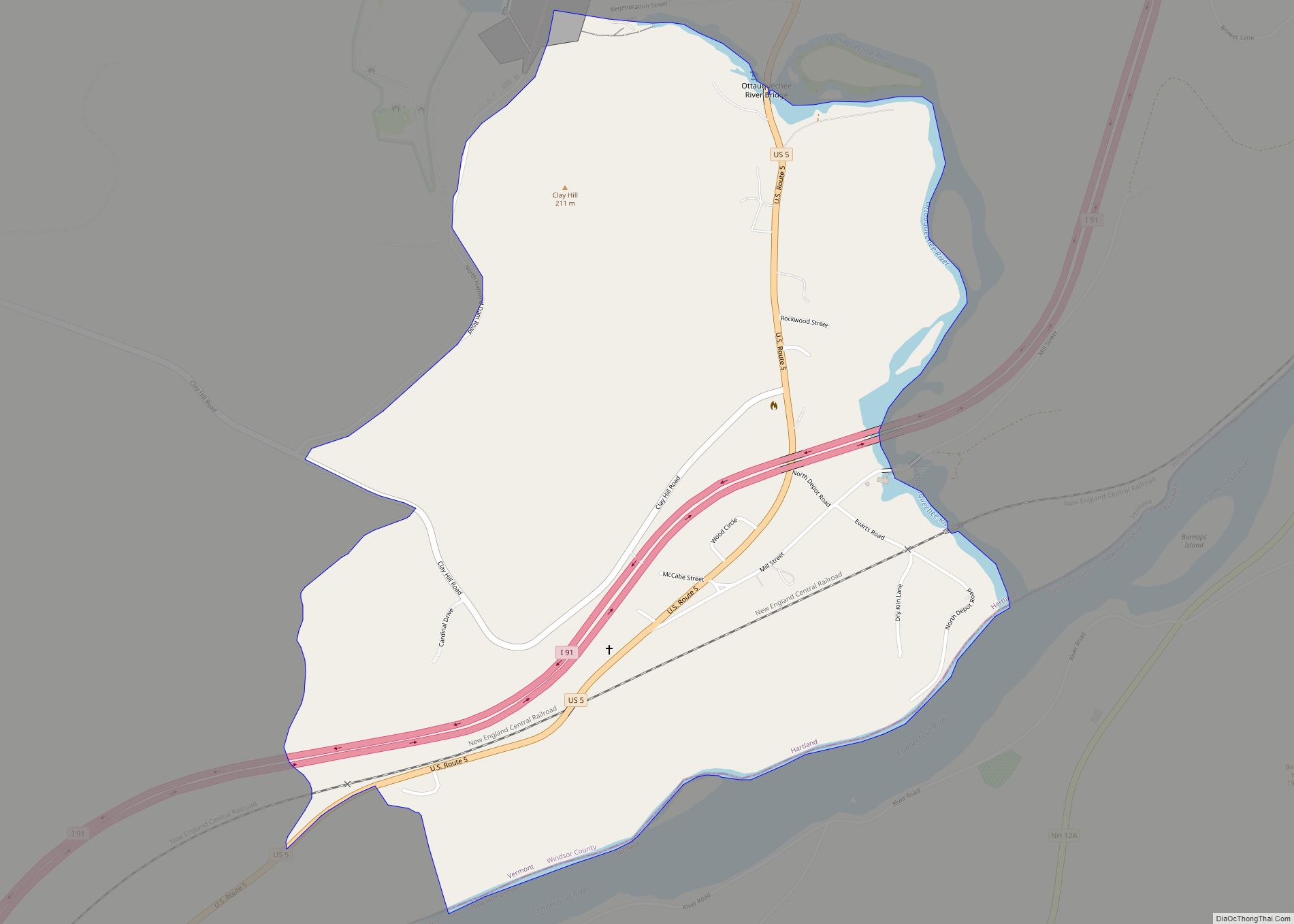
Ascutney is located at geographical coordinates 43° 24′ 25″ North, 72° 24′ 27″ West (43.407059, -72.407562). The southern flanks of Mount Ascutney rise to the north of the CDP, with its summit in the neighboring towns of Windsor and West Windsor.
U.S. Route 5 runs north–south through Ascutney, intersected by Vermont routes 12 and 131 at the center of the CDP. Interstate 91 forms the western boundary of the CDP and serves Ascutney by Exit 8. From Ascutney, Route 12 crosses the Connecticut River into Claremont, New Hampshire.
See also
Map of Vermont State and its subdivision: Map of other states:- Alabama
- Alaska
- Arizona
- Arkansas
- California
- Colorado
- Connecticut
- Delaware
- District of Columbia
- Florida
- Georgia
- Hawaii
- Idaho
- Illinois
- Indiana
- Iowa
- Kansas
- Kentucky
- Louisiana
- Maine
- Maryland
- Massachusetts
- Michigan
- Minnesota
- Mississippi
- Missouri
- Montana
- Nebraska
- Nevada
- New Hampshire
- New Jersey
- New Mexico
- New York
- North Carolina
- North Dakota
- Ohio
- Oklahoma
- Oregon
- Pennsylvania
- Rhode Island
- South Carolina
- South Dakota
- Tennessee
- Texas
- Utah
- Vermont
- Virginia
- Washington
- West Virginia
- Wisconsin
- Wyoming