Map of Bac Giang province

Map of Bac Giang province

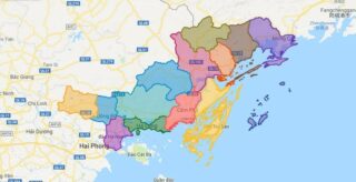
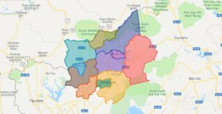
Bac Giang is a province of Vietnam. It is located in the Northeast region of the country, being situated to the east of Hanoi. The province covers an area of 3827.45 square kilometres and, as of 2008, it had a population of 1,628,400. Bac Giang’s history is traced to the Hung Kings who established the … Read more

Map of Quang Ninh province

Map of Quang Ninh province

Quang Ninh is a province along the northeastern coast of Vietnam. It is 153 km (95 mi) east of Hanoi. The province is home to Ha Long Bay, a World Heritage Site. The provincial capital is Ha Long. Nearly 80% of the province is mountainous with abundant land, forest water and mineral resources. Nearly 90% … Read more

Map of Binh Phuoc province

Map of Binh Phuoc province

Binh Phuoc is a province of Vietnam. It is located in the Southeast region of the country, to the north of Ho Chi Minh City. It shares a border with Cambodia. Political Map of Binh Phuoc province Interactive online map of Binh Phuoc Click on to view map in “full screen” mode. Source: Database of … Read more

Map of Binh Duong province

Map of Binh Duong province

Binh Duong is a province of Vietnam. It is located in the Southeast region of the country, immediately to the north of Ho Chi Minh City. The province was created from Song Be Province on January 1, 1997. Political Map of Binh Duong province Interactive online map of Binh Duong Click on to view map … Read more

Map of Tay Ninh province

Map of Tay Ninh province

Tay Ninh is a province in the Southeast region of Vietnam. Its capital is the town of Tay Ninh. Tay Ninh Province has a population of 989,800 and an area of 4,028 km². Political Map of Tay Ninh province Interactive online map of Tay Ninh Click on to view map in “full screen” mode. Source: … Read more

Map of Dong Thap province

Map of Dong Thap province

Dong Thap is a province in the Mekong Delta and Dong Thap Muoi region of southern Vietnam. Dong Thap is 165 km from Ho Chi Minh City, bordered by Pray Veng Province (Cambodia) in the north with a length of more than 48 km; Vinh Long and Can Tho in the south; An Giang in … Read more

Map of Lam Dong province

Map of Lam Dong province

Lam Dong is a province located in the Central Highlands (Tay Nguyen) region of Vietnam. Its capital is Da Lat. Lam Dong borders Khanh Hoa Province and Ninh Thuan Province to the east, Dong Nai Province to the southwest, Binh Thuan Province to the southeast, Dak Lak Province to the north, and Dak Nong Province … Read more

Map of Hai Phong city

Map of Hai Phong city

Haiphong (Hai Phong, ) is a major industrial city, the second largest city in the northern part of Vietnam, and third largest city overall in Vietnam. Hai Phong is also the center of technology, economy, culture, medicine, education, science and trade in the northern coast of Vietnam. Hai Phong city traces its origin to its … Read more

Map of Ninh Thuan province

Map of Ninh Thuan province

Ninh Thuan is a province in the South Central Coast region of Vietnam (sometimes seen as part of the Southeast region). Political Map of Ninh Thuan province Interactive online map of Ninh Thuan Click on to view map in “full screen” mode. Source: Database of Global Administrative Areas, Global Map of Vietnam ©ISCGM, Ministry of … Read more

Map of Kien Giang province

Map of Kien Giang province

Kien Giang is a province of Vietnam, located in the Mekong Delta region of southern Vietnam. It is known for fishing and rice farming. The provincial capital is Rach Gia, 250 km from the Ho Chi Minh City. Kien Giang’s dimension is about 6,299 km² and its population is about 1,634,043, of which 22 percent … Read more

Map of Binh Dinh province

Map of Binh Dinh province

Binh Dinh is a province of Vietnam. It is located in Vietnam’s South Central Coast region. Political Map of Binh Dinh province Interactive online map of Binh Dinh Click on to view map in “full screen” mode. Source: Database of Global Administrative Areas, Global Map of Vietnam ©ISCGM, Ministry of Nutural Resources and Environment -Vietnam.Base … Read more

Map of Hai Duong province

Map of Hai Duong province

Hai Duong is a province in the Red River Delta of northern Vietnam. Its name derives from Sino-Vietnamese “ocean sun”, though the modern province is in fact landlocked. Nowadays, Hai Duong is among the most industrialized and developed provinces in Vietnam. The province is located in the Red River Delta of north-eastern Vietnam, about mid-distance … Read more