Map of Vinh Phuc province

Map of Vinh Phuc province

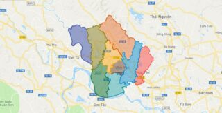
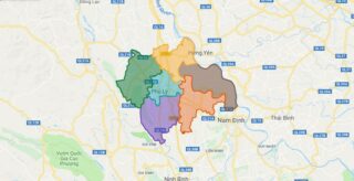
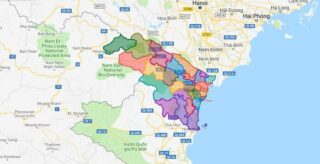
Vinh Phuc is a province in the Red River Delta of northern Vietnam. Vinh Phuc is subdivided into 8 district-level sub-divisions: * 7 districts: * Binh Xuyen * Lap Thach * Tam Dao * Tam Duong * Vinh Tuong * Yen Lac * 2 provincial city: * Vinh Yen (capital) Political Map of Vinh Phuc … Read more

Map of Tuyen Quang province

Map of Tuyen Quang province

Tuyen Quang is a province of Vietnam, located in the northeastern part of the country to the northwest of Hanoi, at the centre of Lo River valley, a tributary of the Red River. The delta formation in the province is called the Tonkin Delta. Its capital is Tuyen Quang township. The province had a population … Read more

Map of Ba Ria – Vung Tau province

Map of Ba Ria – Vung Tau province

Ba Ria-Vung Tau (Hanoi accent:, Saigon accent: ) is a province of Vietnam. It is located on the coast of the country’s Southeast region. It also includes the Con Dao islands, located some distance off Vietnam’s southeastern coast. From 1954 to 1975, this province belonged to South Vietnam with the name Phuoc Tuy. With the … Read more

Map of Phu Yen province

Map of Phu Yen province

Phu Yen is a coastal province in the South Central Coast of Vietnam. It is the easternmost province of Vietnam’s mainland. Political Map of Phu Yen province Interactive online map of Phu Yen Click on to view map in “full screen” mode. Source: Database of Global Administrative Areas, Global Map of Vietnam ©ISCGM, Ministry of … Read more

Map of Thai Binh province

Map of Thai Binh province

Thai Binh is a coastal eastern province in the Red River Delta region of northern Vietnam, named after the Vietnamese name for the Pacific Ocean: Thai Binh Duong. It is about 18 km from Nam Dinh, 70 km from Haiphong, and 110 km from Hanoi. Political Map of Thai Binh province Interactive online map of … Read more

Map of Bac Kan province

Map of Bac Kan province

Bac Kan, also spelt as Bac Can, is a province of Vietnam. It is located in the northeastern part of the country, due north of the capital Hanoi. Bac Kan is the only town of the province which is the capital of the province and is a municipality. The province covers an area of 4859.4 … Read more

Map of Ha Nam province

Map of Ha Nam province

Ha Nam is a province of northern Vietnam, in the Red River Delta. Political Map of Ha Nam province Interactive online map of Ha Nam Click on to view map in “full screen” mode. Source: Database of Global Administrative Areas, Global Map of Vietnam ©ISCGM, Ministry of Nutural Resources and Environment -Vietnam.Base Map Layer: Open … Read more

Map of Kon Tum province

Map of Kon Tum province

Kon Tum province lies in the Central Highlands region of Vietnam and shares borders with Laos and Cambodia. It has an area of 9,934 square km and a population of approximately 330,000. The economy is primarily agricultural. Political Map of Kon Tum province Interactive online map of Kon Tum Click on to view map in … Read more

Map of Lai Chau province

Map of Lai Chau province

Lai Chau is a province in the Northwest region of Vietnam. Lai Chau Province is the most sparsely populated in Vietnam. It shares a border with China. It once was a semi-independent White Tai confederation known as Sipsongchuthai, but was absorbed by France into French Indochina in the 1880s and subsequently became part of Vietnam … Read more

Map of Nam Dinh province

Map of Nam Dinh province

Nam Dinh is a province in the Red River Delta region of northern Vietnam. Political Map of Nam Dinh province Interactive online map of Nam Dinh Click on to view map in “full screen” mode. Source: Database of Global Administrative Areas, Global Map of Vietnam ©ISCGM, Ministry of Nutural Resources and Environment -Vietnam.Base Map Layer: … Read more

Map of Thanh Hoa province

Map of Thanh Hoa province

Thanh Hoa is a province in the North Central Coast region of Vietnam. This is a relatively large province, which ranks as fifth in area and as third in population among 63 central administrative subdivisions. Its capital and largest city is Thanh Hoa City. The province is widely called Xu Thanh which means Thanh Hoa … Read more

District Map of Ha Noi

District Map of Ha Noi

Political Map of Ha Noi city Interactive online map of Ha Noi Click on to view map in “full screen” mode. Source: Database of Global Administrative Areas, Global Map of Vietnam ©ISCGM, Ministry of Nutural Resources and Environment -Vietnam.Base Map Layer: Open Street Map (OSM), Arcgisonline, Google Map, Wmflabs. Large scale maps of Ha Noi … Read more