Map of Worth village

Map of Worth village, Illinois

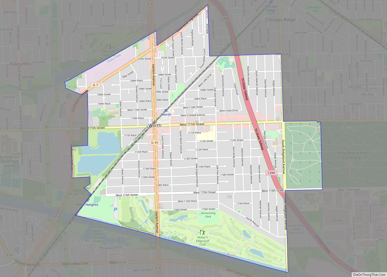
Worth is a village in Cook County, Illinois, United States, a suburb of Chicago. Per the 2020 census, the population was 10,970. Worth village overview: Name: Worth village LSAD Code: 47 LSAD Description: village (suffix) State: Illinois County: Cook County Incorporated: 1914 Total Area: 2.38 sq mi (6.17 km²) Land Area: 2.37 sq mi (6.13 km²) Water Area: 0.01 sq mi (0.03 km²)  0.42% … Read more

Map of Worden village

Map of Worden village, Illinois

Worden is a village in Madison County, Illinois, United States. The population was 1,096 at the 2020 census. Worden village overview: Name: Worden village LSAD Code: 47 LSAD Description: village (suffix) State: Illinois County: Madison County Elevation: 571 ft (174 m) Total Area: 0.72 sq mi (1.88 km²) Land Area: 0.71 sq mi (1.85 km²) Water Area: 0.01 sq mi (0.03 km²) Total Population: 1,096 Population … Read more

Map of Yale village, Illinois

Map of Yale village, Illinois

Yale is a village in Jasper County, Illinois, United States. The population was 86 at the 2010 census. Yale village overview: Name: Yale village LSAD Code: 47 LSAD Description: village (suffix) State: Illinois County: Jasper County Elevation: 554 ft (169 m) Total Area: 0.57 sq mi (1.49 km²) Land Area: 0.57 sq mi (1.49 km²) Water Area: 0.00 sq mi (0.00 km²) Total Population: 67 Population … Read more

Map of Xenia village

Map of Xenia village, Illinois

Xenia (/ˈziːniə/ ZEE-nee-ə) is a village in Clay County, Illinois, United States. The population was 380 at the 2020 census. Xenia village overview: Name: Xenia village LSAD Code: 47 LSAD Description: village (suffix) State: Illinois County: Clay County Elevation: 538 ft (164 m) Total Area: 0.49 sq mi (1.28 km²) Land Area: 0.49 sq mi (1.28 km²) Water Area: 0.00 sq mi (0.00 km²) Total Population: … Read more

Map of Wyoming city, Illinois

Map of Wyoming city, Illinois

Wyoming is a city in Stark County, Illinois, United States. The population was 1,429 at the 2010 census, up from 1,424 in 2000. It is the headquarters of the Rock Island Trail State Park. Wyoming is part of the Peoria, Illinois Metropolitan Statistical Area. The former CB&Q Railroad depot in town is the Rock Island … Read more

Map of Zeigler city

Map of Zeigler city

Zeigler is a city in Franklin County, Illinois, United States. The population was 1,801 at the 2010 census. The current mayor is Dennis Mitchell. Zeigler city overview: Name: Zeigler city LSAD Code: 25 LSAD Description: city (suffix) State: Illinois County: Franklin County Elevation: 417 ft (127 m) Total Area: 1.37 sq mi (3.54 km²) Land Area: 1.36 sq mi (3.52 km²) Water Area: … Read more

Map of Yorkville city

Map of Yorkville city, Illinois

Yorkville (officially the United City of Yorkville) is a city within the Chicago Metropolitan Area and is the county seat of Kendall County, Illinois, United States. It is a western suburb of Chicago, Illinois.The population was 22,594 as of the 2020 census. Yorkville city overview: Name: Yorkville city LSAD Code: 25 LSAD Description: city (suffix) … Read more

Map of Yates City village

Map of Yates City village

Yates City is a village in Knox County, Illinois, United States. The population was 642 at the 2020 census. It is part of the Galesburg Micropolitan Statistical Area. Yates City village overview: Name: Yates City village LSAD Code: 47 LSAD Description: village (suffix) State: Illinois County: Knox County Elevation: 673 ft (205 m) Total Area: 0.49 sq mi (1.28 km²) … Read more

Map of Zion city

Map of Zion city, Illinois

Zion is a city in Lake County, Illinois, United States. Per the 2020 census, the population was 24,655. Zion city overview: Name: Zion city LSAD Code: 25 LSAD Description: city (suffix) State: Illinois County: Lake County Founded: July 1901 Elevation: 615 ft (187 m) Total Area: 9.93 sq mi (25.72 km²) Land Area: 9.93 sq mi (25.72 km²) Water Area: 0.00 sq mi (0.00 km²) Total … Read more