Yorkville (officially the United City of Yorkville) is a city within the Chicago Metropolitan Area and is the county seat of Kendall County, Illinois, United States. It is a western suburb of Chicago, Illinois.The population was 22,594 as of the 2020 census.
| Name: | Yorkville city |
|---|---|
| LSAD Code: | 25 |
| LSAD Description: | city (suffix) |
| State: | Illinois |
| County: | Kendall County |
| Founded: | 1833 |
| Incorporated: | 1836 |
| Elevation: | 745 ft (227 m) |
| Total Area: | 20.09 sq mi (52.04 km²) |
| Land Area: | 20.00 sq mi (51.79 km²) |
| Water Area: | 0.10 sq mi (0.25 km²) |
| Total Population: | 22,594 |
| Population Density: | 1,076.81/sq mi (415.77/km²) |
| ZIP code: | 60560 |
| FIPS code: | 1784038 |
| GNISfeature ID: | 2397394 |
| Website: | www.yorkville.il.us |
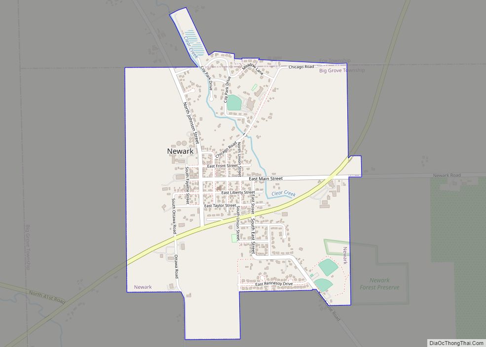
Online Interactive Map
Click on ![]() to view map in "full screen" mode.
to view map in "full screen" mode.
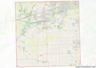
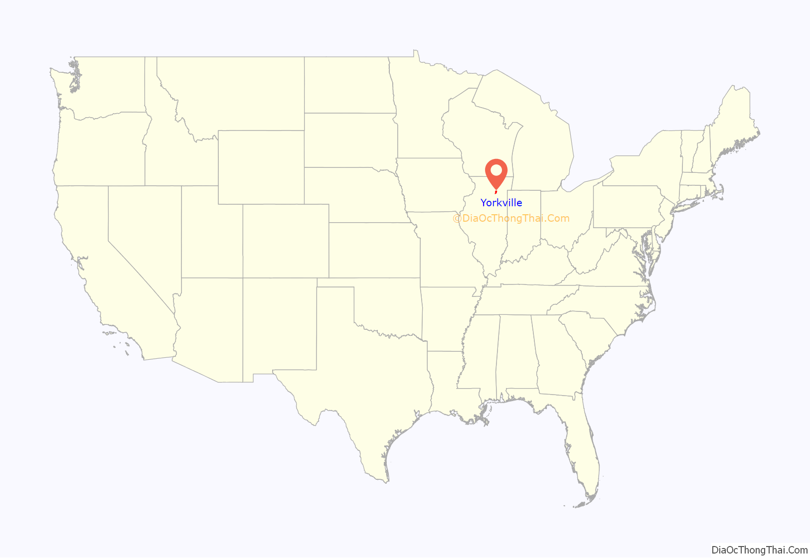
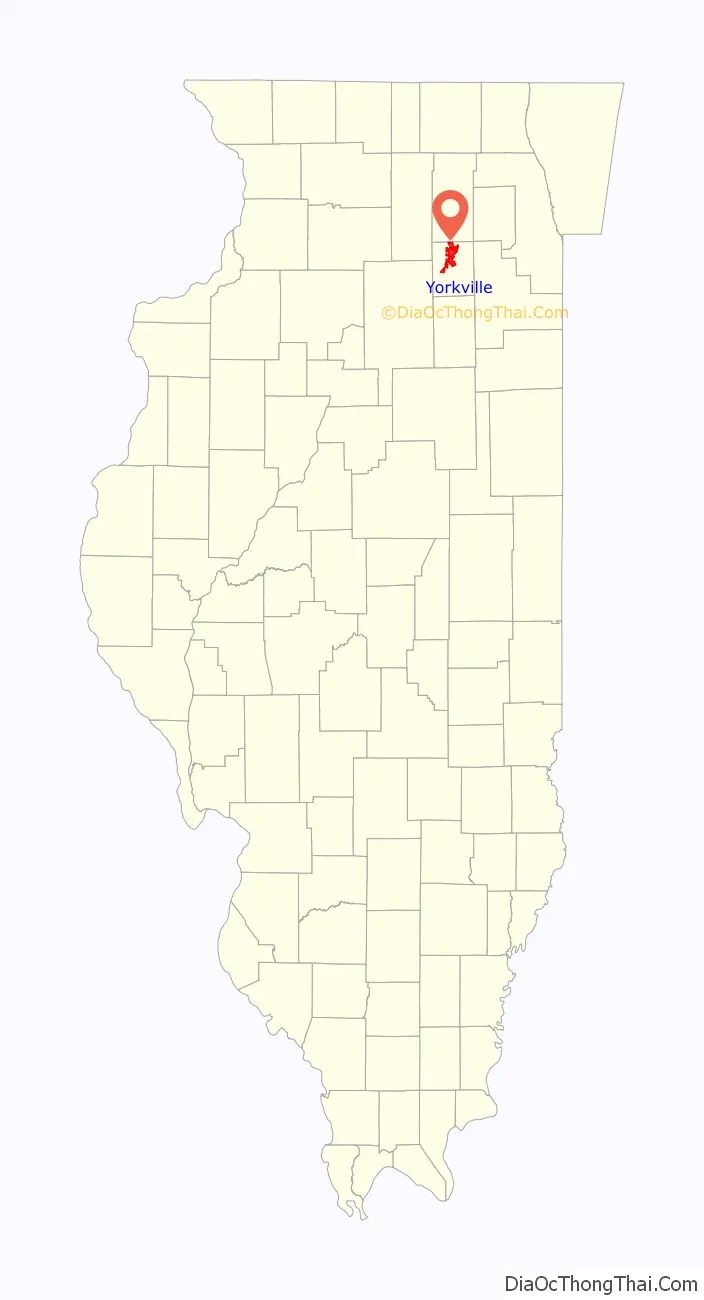
Yorkville location map. Where is Yorkville city?
History
In 1836, the city of Yorkville was settled by early pioneers. Originally, the city’s main thoroughfare of Bridge Street was designed for horse-drawn carriages and pedestrians. As time passed, Hydraulic Street, which runs parallel to the Fox River, boasted a trolley that ran from Ottawa to Aurora. This part is now operated by the Illinois Railway.
At the time, Yorkville’s central business district was on the south side of the Fox River and the public square was north of the river, a layout unique to the region. The public gathering place was near the river’s edge. The Kendall County Courthouse was next to the downtown commercial district. Many of the city’s remaining historic single-family homes are within walking distance of Bridge Street, the courthouse and Union Hall. Earl Adams was the first to settle what would become Yorkville when he built his cabin on Courthouse Hill on the south side of town in 1833. One year later, Lyman and Burr Bristol set up residency in neighboring Bristol, north of the river.
When the county of Kendall was formed in 1841, Yorkville was chosen as the county seat. After a 13-year period in which Oswego claimed that honor, voters chose to relocate the county government in 1859 to Yorkville, a more central location. The new courthouse was completed in 1864. Replaced in 1997 with a courthouse on the city’s north side, the 1864 building is used by the Kendall County Forest Preserve and other organizations. Yorkville was no exception to the railroad boom. Development began and businesses sprang up in 1870 along the tracks and included Squire Dingee’s pickle factory, the Yorkville Ice Cream Company and the Rehbehn Brothers button factory. A few of those buildings still remain.
The present city of Yorkville was originally two towns, Bristol to the north and the Yorkville south of the Fox River, with separate governments for more than 100 years. In 1957, Bristol and Yorkville merged, becoming the United City of Yorkville. Ellsworth Windett became the combined city’s first mayor. As a part of the consolidation, the residents of both towns agreed to a uniform school district. It was in that same year high school classes began in the downtown area at the northeast corner of Van Emmon and Bridge Streets. In 1888, a two-story brick school building on West Center Street was constructed. After the construction of Circle Center School in 1968, the two-story building was closed and the space was rented by the Yorkville School District to neighboring Waubonsee Community College. Due to rising enrollment in the early 1970s, the school was reopened and renamed as Parkview Christian Academy.
Yorkville Road Map
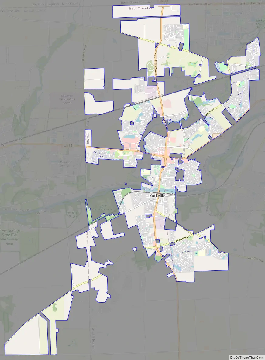
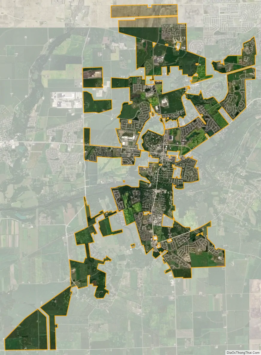
Yorkville city Satellite Map
Geography
Yorkville is in northern Kendall County and is bordered to the northeast by Montgomery, to the east by Oswego, and to the west by Plano. Its boundaries are located approximately 4 miles (6.4 km) southwest of Aurora, 13 miles (21 km) southwest of Naperville, and 47 miles (76 km) southwest of Chicago.
According to the 2020 census, Yorkville has an area of 20 square miles (51.80 km). The Fox River flows through downtown Yorkville. The city is in Bristol, Kendall, and Fox townships.
See also
Map of Illinois State and its subdivision:- Adams
- Alexander
- Bond
- Boone
- Brown
- Bureau
- Calhoun
- Carroll
- Cass
- Champaign
- Christian
- Clark
- Clay
- Clinton
- Coles
- Cook
- Crawford
- Cumberland
- De Kalb
- De Witt
- Douglas
- Dupage
- Edgar
- Edwards
- Effingham
- Fayette
- Ford
- Franklin
- Fulton
- Gallatin
- Greene
- Grundy
- Hamilton
- Hancock
- Hardin
- Henderson
- Henry
- Iroquois
- Jackson
- Jasper
- Jefferson
- Jersey
- Jo Daviess
- Johnson
- Kane
- Kankakee
- Kendall
- Knox
- La Salle
- Lake
- Lake Michigan
- Lawrence
- Lee
- Livingston
- Logan
- Macon
- Macoupin
- Madison
- Marion
- Marshall
- Mason
- Massac
- McDonough
- McHenry
- McLean
- Menard
- Mercer
- Monroe
- Montgomery
- Morgan
- Moultrie
- Ogle
- Peoria
- Perry
- Piatt
- Pike
- Pope
- Pulaski
- Putnam
- Randolph
- Richland
- Rock Island
- Saint Clair
- Saline
- Sangamon
- Schuyler
- Scott
- Shelby
- Stark
- Stephenson
- Tazewell
- Union
- Vermilion
- Wabash
- Warren
- Washington
- Wayne
- White
- Whiteside
- Will
- Williamson
- Winnebago
- Woodford
- Alabama
- Alaska
- Arizona
- Arkansas
- California
- Colorado
- Connecticut
- Delaware
- District of Columbia
- Florida
- Georgia
- Hawaii
- Idaho
- Illinois
- Indiana
- Iowa
- Kansas
- Kentucky
- Louisiana
- Maine
- Maryland
- Massachusetts
- Michigan
- Minnesota
- Mississippi
- Missouri
- Montana
- Nebraska
- Nevada
- New Hampshire
- New Jersey
- New Mexico
- New York
- North Carolina
- North Dakota
- Ohio
- Oklahoma
- Oregon
- Pennsylvania
- Rhode Island
- South Carolina
- South Dakota
- Tennessee
- Texas
- Utah
- Vermont
- Virginia
- Washington
- West Virginia
- Wisconsin
- Wyoming