Map of Winchester city, Kentucky

Map of Winchester city, Kentucky

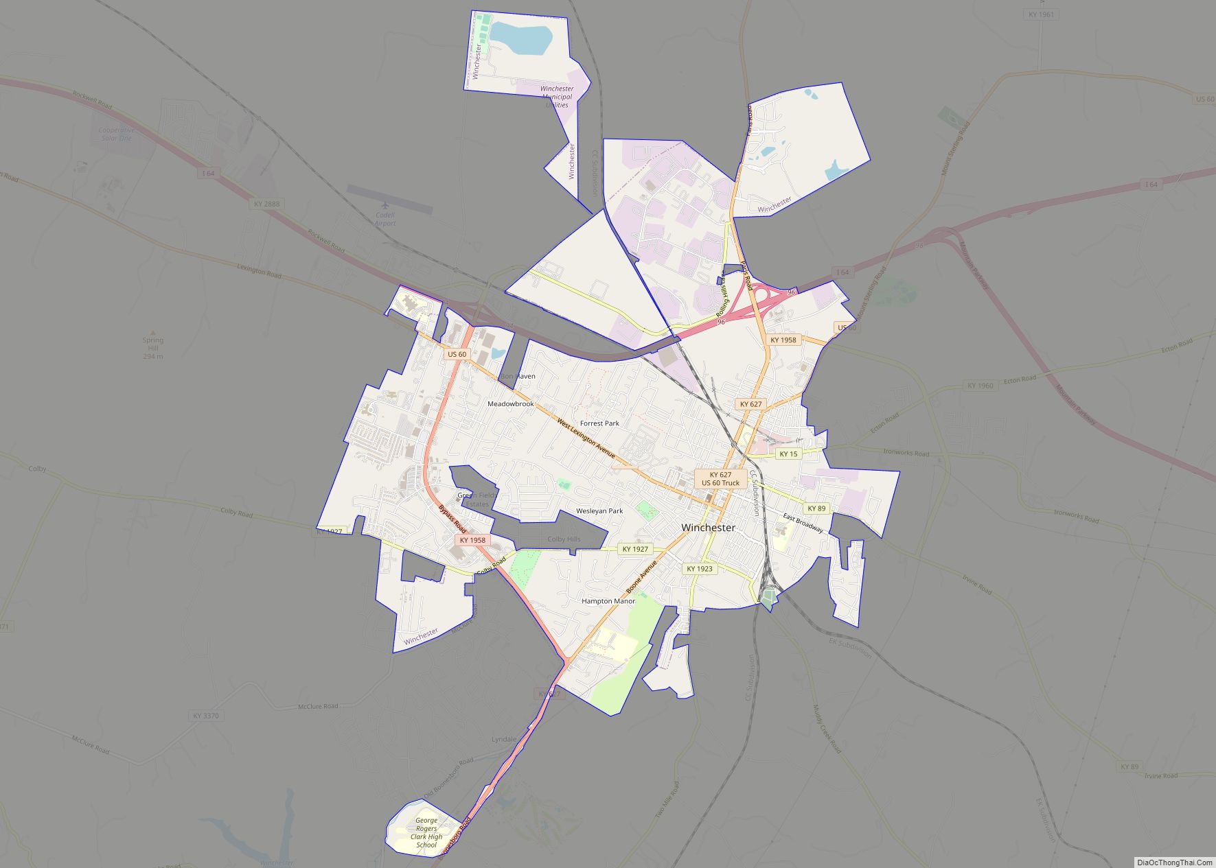
Winchester is a home rule-class city in and the county seat of Clark County, Kentucky, United States. The population was 18,368 at the 2010 census. It is part of the Lexington-Fayette, KY Metropolitan Statistical Area. Winchester is located roughly halfway between Lexington and Mt. Sterling. Winchester city overview: Name: Winchester city LSAD Code: 25 LSAD … Read more

Map of Woodland Hills city

Map of Woodland Hills city, Kentucky

Woodland Hills is a home rule-class city in Jefferson County, Kentucky, United States. The population was 696 at the 2010 census. Woodland Hills is an eastern suburb of Louisville and is entirely surrounded by the city of Middletown. Woodland Hills city overview: Name: Woodland Hills city LSAD Code: 25 LSAD Description: city (suffix) State: Kentucky … Read more

Map of Woodbury city, Kentucky

Map of Woodbury city, Kentucky

Woodbury is a home rule-class city in Butler County, Kentucky, United States. The population was 90 at the 2010 census. Woodbury city overview: Name: Woodbury city LSAD Code: 25 LSAD Description: city (suffix) State: Kentucky County: Butler County Elevation: 413 ft (126 m) Total Area: 0.14 sq mi (0.37 km²) Land Area: 0.14 sq mi (0.37 km²) Water Area: 0.00 sq mi (0.00 km²) Total Population: … Read more

Map of Woodburn city, Kentucky

Map of Woodburn city, Kentucky

Woodburn is a home rule-class city in Warren County, Kentucky, United States. The population was 323 at the 2000 census and 355 at the 2010 census. It is included in the Bowling Green, Kentucky Metropolitan Statistical Area. Woodburn city overview: Name: Woodburn city LSAD Code: 25 LSAD Description: city (suffix) State: Kentucky County: Warren County … Read more

Map of Worthington Hills city

Map of Worthington Hills city

City of Worthington Hills is a home rule-class city in Jefferson County, Kentucky, United States. The population was 1,446 at the 2010 census, down from 1,594 at the 2000 census. A suburb of Louisville, City of Worthington Hills was separately incorporated by the state legislature on January 31, 1980. Worthington Hills city overview: Name: Worthington … Read more

Map of Woodlawn city, Kentucky

Map of Woodlawn city, Kentucky

Woodlawn is a home rule-class city in Campbell County, Kentucky, United States. The population was 229 at the 2010 census. Woodlawn city overview: Name: Woodlawn city LSAD Code: 25 LSAD Description: city (suffix) State: Kentucky County: Campbell County Elevation: 548 ft (167 m) Total Area: 0.06 sq mi (0.15 km²) Land Area: 0.06 sq mi (0.15 km²) Water Area: 0.00 sq mi (0.00 km²) Total Population: … Read more

Map of Woodlawn Park city

Map of Woodlawn Park city, Kentucky

Woodlawn Park is a home rule-class city in Jefferson County, Kentucky, United States. The population was 942 at the 2010 census, down from 1,033 at the 2000 census. Woodlawn Park city overview: Name: Woodlawn Park city LSAD Code: 25 LSAD Description: city (suffix) State: Kentucky County: Jefferson County Elevation: 541 ft (165 m) Total Area: 0.24 sq mi (0.63 km²) … Read more

Map of Wurtland city

Map of Wurtland city

Wurtland is a home rule-class city in Greenup County, Kentucky, United States, along the Ohio River. The population was 995 at the 2010 census. Wurtland is a part of the Huntington–Ashland, WV–KY–OH, Metropolitan Statistical Area (MSA). As of the 2010 census, the MSA had a population of 287,702. The northern terminus of the Industrial Parkway … Read more

Map of Worthville city

Map of Worthville city, Kentucky

Worthville is a home rule-class city in Carroll County, Kentucky, United States. The population was 185 at the 2010 census. Worthville city overview: Name: Worthville city LSAD Code: 25 LSAD Description: city (suffix) State: Kentucky County: Carroll County Elevation: 482 ft (147 m) Total Area: 0.26 sq mi (0.66 km²) Land Area: 0.26 sq mi (0.66 km²) Water Area: 0.00 sq mi (0.00 km²) Total Population: … Read more

Map of Worthington city, Kentucky

Map of Worthington city, Kentucky

Worthington is a home rule-class city on the south bank of the Ohio River in Greenup County, Kentucky, in the United States. The population was 1,609 as of the 2010 U.S. census. Worthington is a part of the Huntington-Ashland-Ironton metropolitan area. As of the 2010 census, the MSA had a population of 287,702. Worthington city … Read more

Map of Louisville/Jefferson County metro government (balance), Kentucky

Map of Louisville/Jefferson County metro government (balance), Kentucky

Louisville/Jefferson County metro government (balance) overview: Name: Louisville/Jefferson County metro government (balance) LSAD Code: 00 LSAD Description: metro government State: Kentucky County: Jefferson County Elevation: 466 ft (142 m) Land Area: 324.94 sq mi (841.59 km²) Water Area: 16.50 sq mi (42.73 km²) Population Density: 1,900/sq mi (720/km²) Area code: 502 FIPS code: 2148006 GNISfeature ID: 0509453 Website: louisvilleky.gov Louisville is a vibrant city … Read more