Wurtland is a home rule-class city in Greenup County, Kentucky, United States, along the Ohio River. The population was 995 at the 2010 census. Wurtland is a part of the Huntington–Ashland, WV–KY–OH, Metropolitan Statistical Area (MSA). As of the 2010 census, the MSA had a population of 287,702.
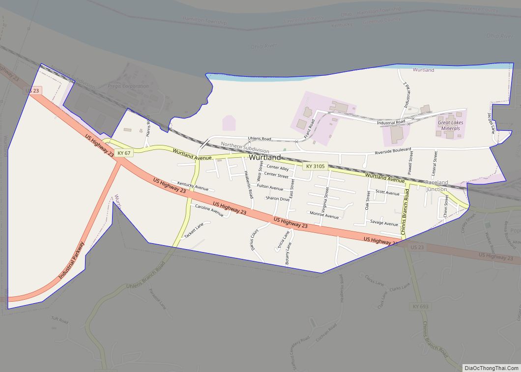
The northern terminus of the Industrial Parkway (Kentucky Route 67) is at U.S. Route 23 in Wurtland. This highway serves to connect Wurtland and the surrounding towns of Greenup and Flatwoods to the EastPark industrial park and Interstate 64, 14 miles (23 km) south of Wurtland.
| Name: | Wurtland city |
|---|---|
| LSAD Code: | 25 |
| LSAD Description: | city (suffix) |
| State: | Kentucky |
| County: | Greenup County |
| Incorporated: | September 15, 1970 |
| Elevation: | 551 ft (168 m) |
| Total Area: | 1.81 sq mi (4.68 km²) |
| Land Area: | 1.77 sq mi (4.58 km²) |
| Water Area: | 0.04 sq mi (0.10 km²) |
| Total Population: | 983 |
| Population Density: | 556.31/sq mi (214.80/km²) |
| ZIP code: | 41144 |
| Area code: | 606 |
| FIPS code: | 2185008 |
| GNISfeature ID: | 0507172 |
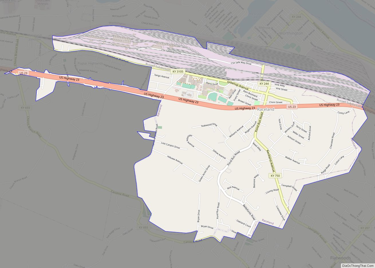
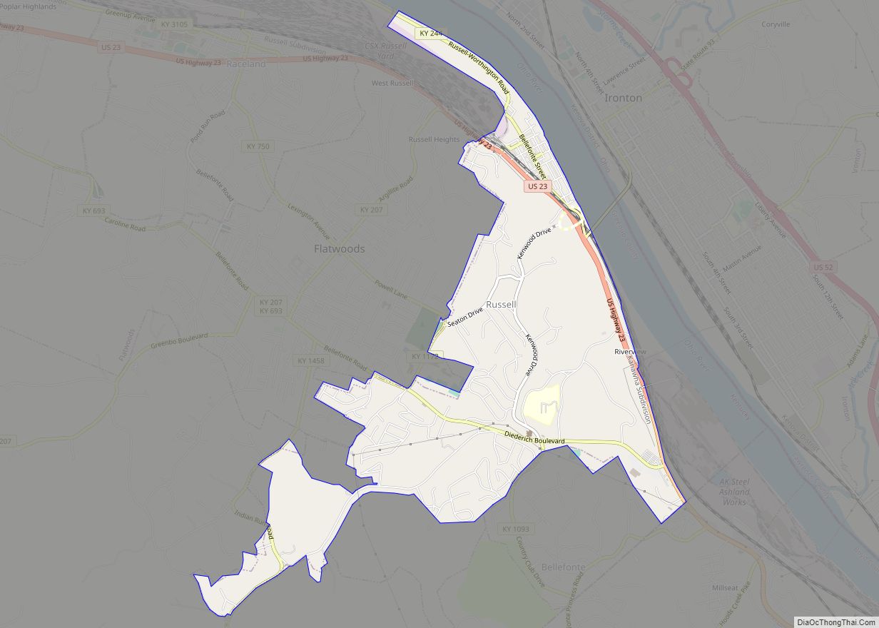
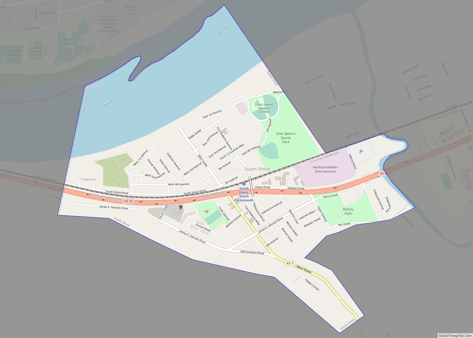
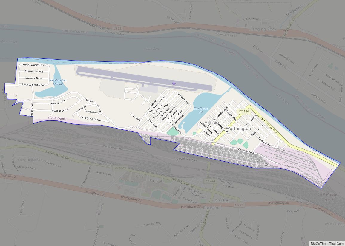
Online Interactive Map
Click on ![]() to view map in "full screen" mode.
to view map in "full screen" mode.
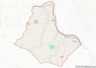
Wurtland location map. Where is Wurtland city?


History
The Wurtland vicinity was first settled by Alexander Fulton and his family circa 1830. The Fultons then established the Fulton’s Forge Works, and the community became known as “Fulton’s Forge”. In 1823, William Shreve and his family had built a steam furnace nearby, and they named their settlement (the) “Old Steam Furnace”. Because neither of the settlements had an acceptable name for a post office, the post office was named “Oil Works” after a local factory that made kerosene. Although the Oil Works post office was established on January 14, 1864, it was closed in 1871. On February 28, 1876, the post office was reestablished as “Wurtland”, named after George and Samuel Grandin Wurts who had founded the nearby Pennsylvania and Laurel Furnaces in 1848.
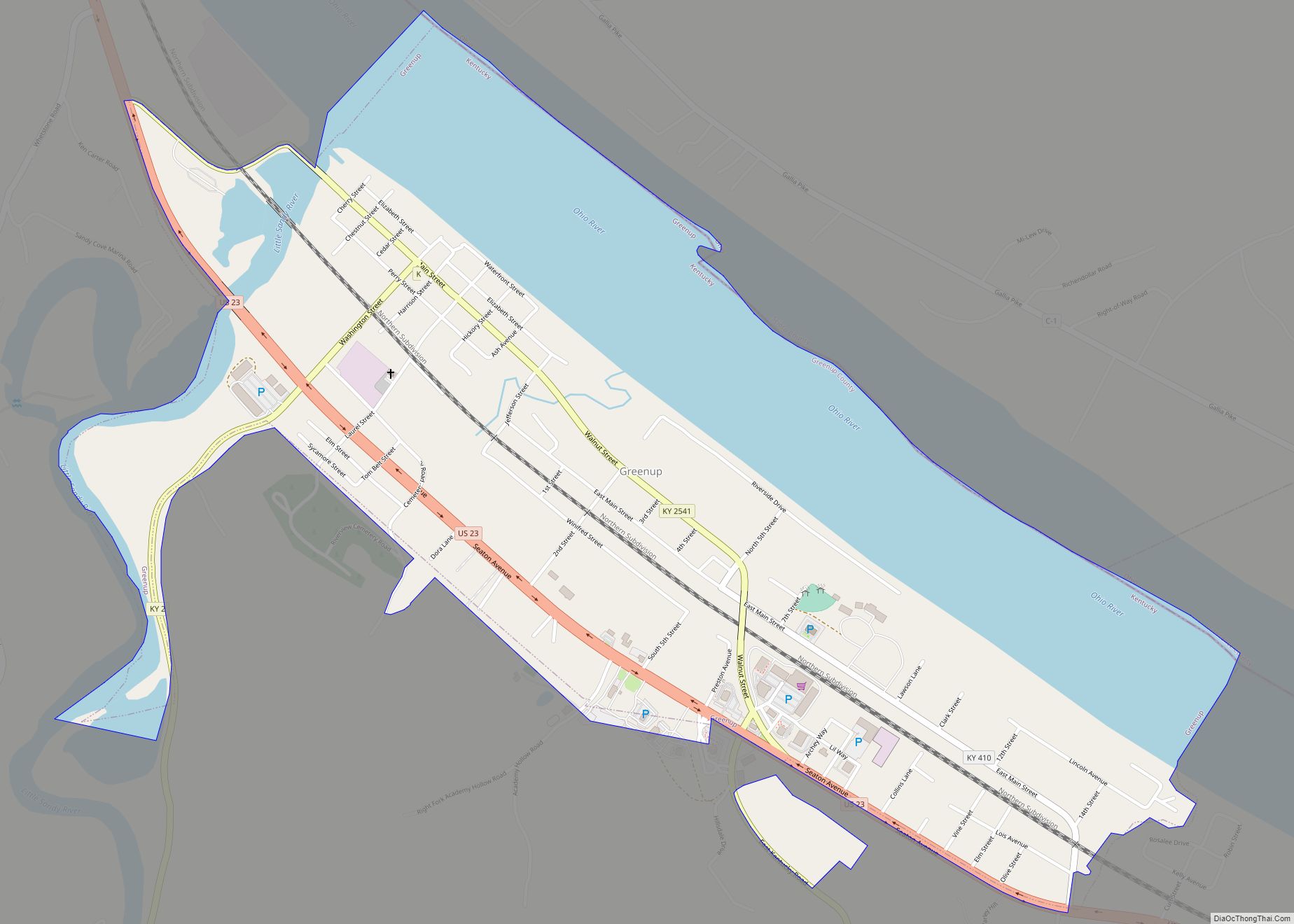
Wurtland Road Map

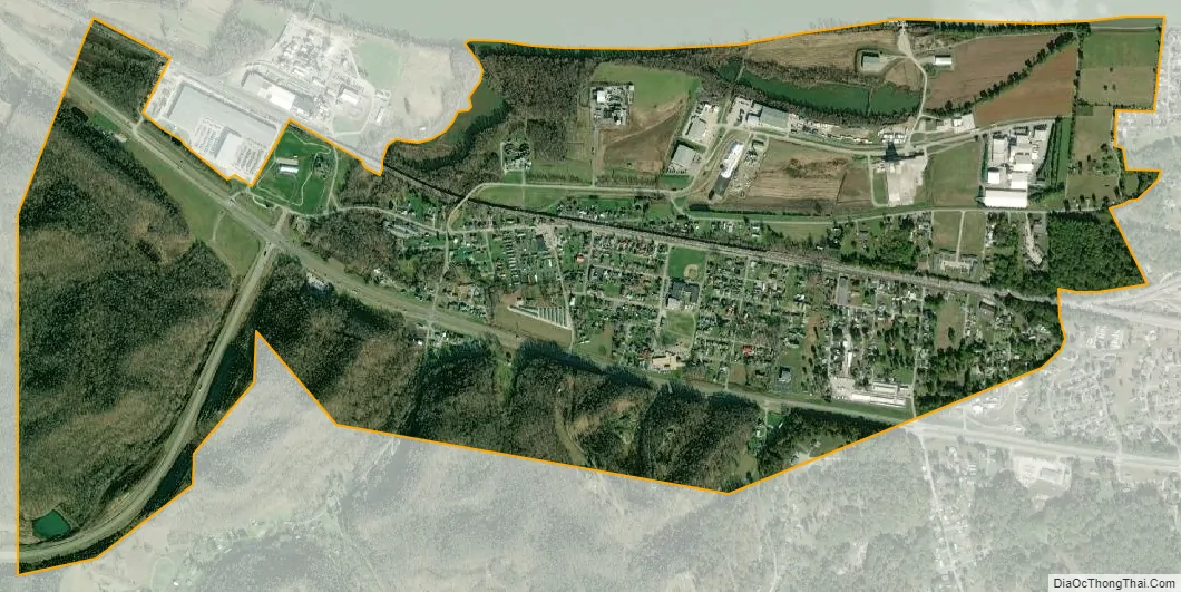
Wurtland city Satellite Map
Geography
Wurtland is located in eastern Greenup County at 38°32′58″N 82°46′29″W / 38.54944°N 82.77472°W / 38.54944; -82.77472 (38.549327, -82.774749), on the south bank of the Ohio River. It is bordered to the east by the cities of Worthington and Raceland, and Greenup, the county seat, is 3 miles (5 km) to the west. Directly across the river is Hamilton Township in Lawrence County, Ohio.
According to the United States Census Bureau, Wurtland has a total area of 1.8 square miles (4.7 km), of which 1.8 square miles (4.6 km) is land and 0.04 square miles (0.1 km), or 2.23%, is water.
See also
Map of Kentucky State and its subdivision:- Adair
- Allen
- Anderson
- Ballard
- Barren
- Bath
- Bell
- Boone
- Bourbon
- Boyd
- Boyle
- Bracken
- Breathitt
- Breckinridge
- Bullitt
- Butler
- Caldwell
- Calloway
- Campbell
- Carlisle
- Carroll
- Carter
- Casey
- Christian
- Clark
- Clay
- Clinton
- Crittenden
- Cumberland
- Daviess
- Edmonson
- Elliott
- Estill
- Fayette
- Fleming
- Floyd
- Franklin
- Fulton
- Gallatin
- Garrard
- Grant
- Graves
- Grayson
- Green
- Greenup
- Hancock
- Hardin
- Harlan
- Harrison
- Hart
- Henderson
- Henry
- Hickman
- Hopkins
- Jackson
- Jefferson
- Jessamine
- Johnson
- Kenton
- Knott
- Knox
- Larue
- Laurel
- Lawrence
- Lee
- Leslie
- Letcher
- Lewis
- Lincoln
- Livingston
- Logan
- Lyon
- Madison
- Magoffin
- Marion
- Marshall
- Martin
- Mason
- McCracken
- McCreary
- McLean
- Meade
- Menifee
- Mercer
- Metcalfe
- Monroe
- Montgomery
- Morgan
- Muhlenberg
- Nelson
- Nicholas
- Ohio
- Oldham
- Owen
- Owsley
- Pendleton
- Perry
- Pike
- Powell
- Pulaski
- Robertson
- Rockcastle
- Rowan
- Russell
- Scott
- Shelby
- Simpson
- Spencer
- Taylor
- Todd
- Trigg
- Trimble
- Union
- Warren
- Washington
- Wayne
- Webster
- Whitley
- Wolfe
- Woodford
- Alabama
- Alaska
- Arizona
- Arkansas
- California
- Colorado
- Connecticut
- Delaware
- District of Columbia
- Florida
- Georgia
- Hawaii
- Idaho
- Illinois
- Indiana
- Iowa
- Kansas
- Kentucky
- Louisiana
- Maine
- Maryland
- Massachusetts
- Michigan
- Minnesota
- Mississippi
- Missouri
- Montana
- Nebraska
- Nevada
- New Hampshire
- New Jersey
- New Mexico
- New York
- North Carolina
- North Dakota
- Ohio
- Oklahoma
- Oregon
- Pennsylvania
- Rhode Island
- South Carolina
- South Dakota
- Tennessee
- Texas
- Utah
- Vermont
- Virginia
- Washington
- West Virginia
- Wisconsin
- Wyoming