Winchester is a home rule-class city in and the county seat of Clark County, Kentucky, United States. The population was 18,368 at the 2010 census. It is part of the Lexington-Fayette, KY Metropolitan Statistical Area. Winchester is located roughly halfway between Lexington and Mt. Sterling.
| Name: | Winchester city |
|---|---|
| LSAD Code: | 25 |
| LSAD Description: | city (suffix) |
| State: | Kentucky |
| County: | Clark County |
| Elevation: | 994 ft (303 m) |
| Total Area: | 9.25 sq mi (23.97 km²) |
| Land Area: | 9.15 sq mi (23.70 km²) |
| Water Area: | 0.10 sq mi (0.27 km²) |
| Total Population: | 19,134 |
| Population Density: | 2,090.92/sq mi (807.31/km²) |
| ZIP code: | 40391-40392 |
| Area code: | 859 |
| FIPS code: | 2183676 |
| GNISfeature ID: | 0506924 |
| Website: | winchesterky.com |
Online Interactive Map
Click on ![]() to view map in "full screen" mode.
to view map in "full screen" mode.
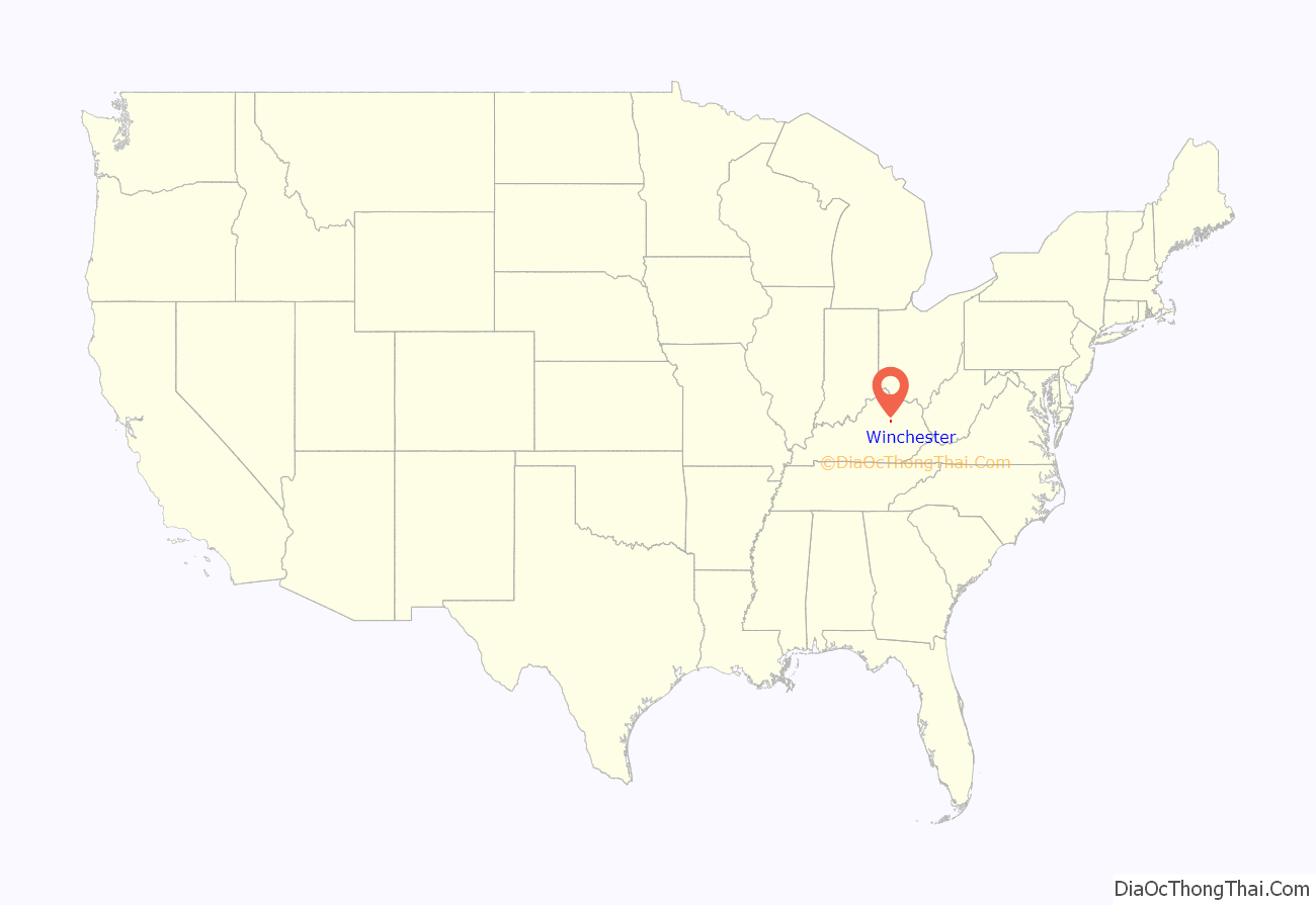
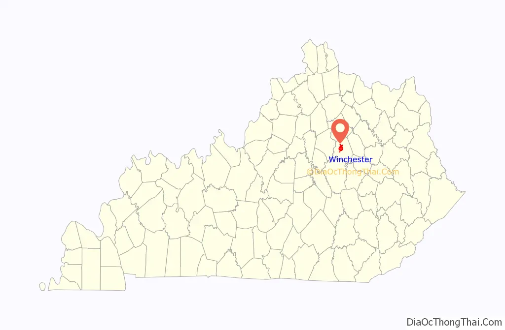
Winchester location map. Where is Winchester city?
History
It was named after Winchester, Virginia.
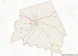
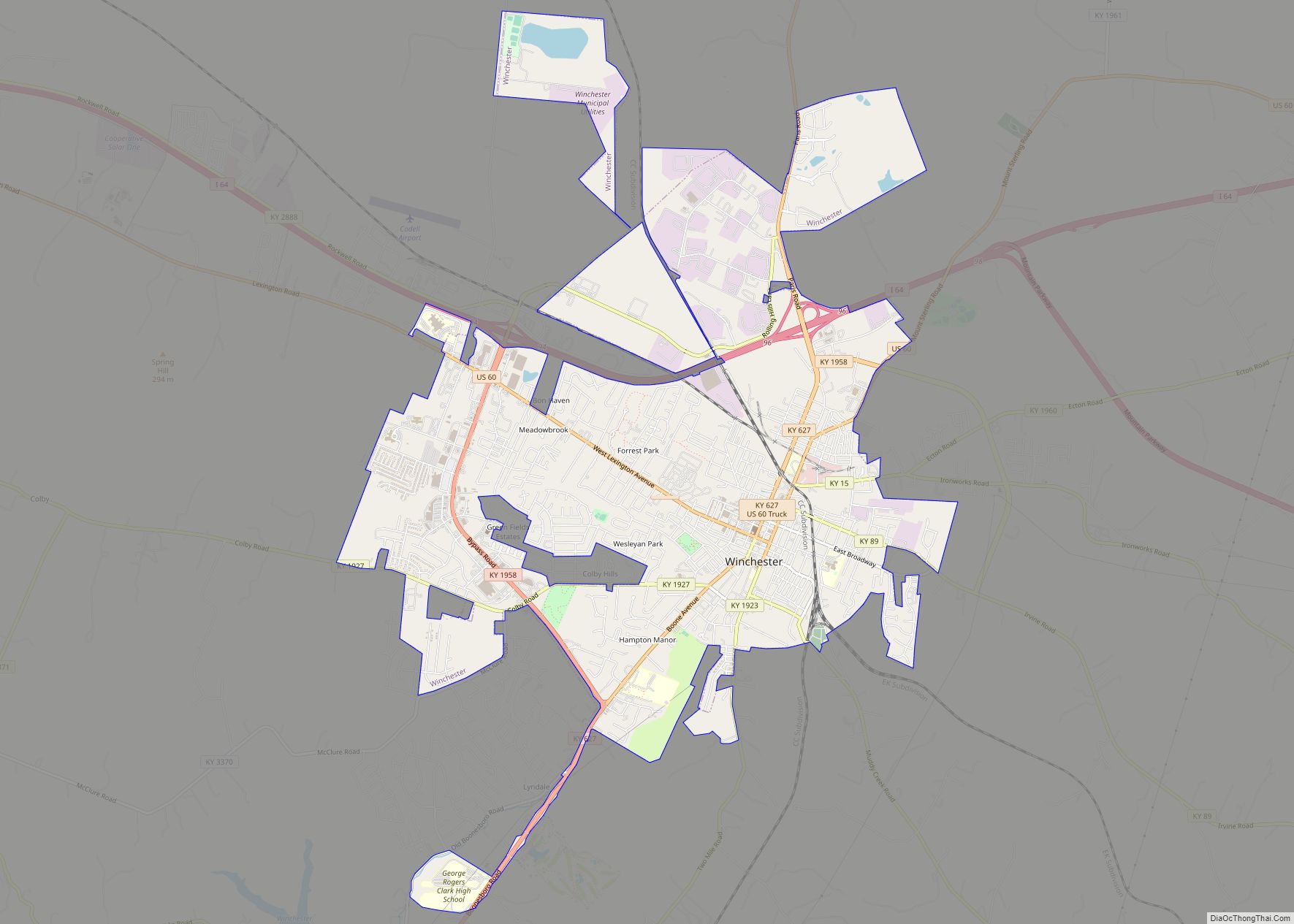
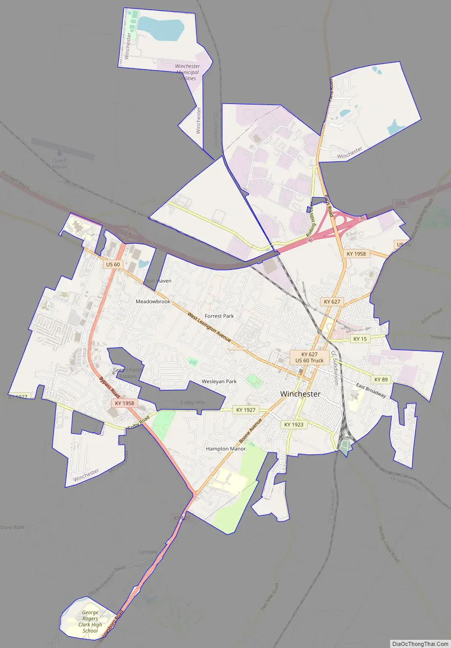
Winchester Road Map
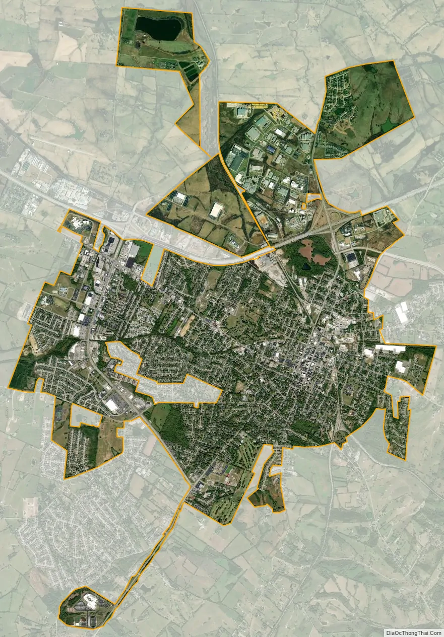
Winchester city Satellite Map
Geography
Winchester is located northwest of the center of Clark County, 18 miles (29 km) east of Lexington and 15 miles (24 km) west of Mt. Sterling. Kentucky Route 1958 (Bypass Road) is an outer loop around the town. Kentucky Route 627 (Boonesborough Road) leads towards Richmond, 21 miles (34 km) to the south and Paris to the north. U.S. Route 60 (Winchester-Lexington Road/Lexington Avenue) runs through downtown Winchester. Interstate 64 passes through the northern part of the city, with access from exits 94 and 96. The Mountain Parkway turns off I-64 just northeast of Winchester and leads 75 miles (121 km) east to Salyersville.
According to the United States Census Bureau, Winchester has a total area of 7.9 square miles (20.4 km), of which 7.8 square miles (20.3 km) is land and 0.04 square miles (0.1 km), or 0.67%, is water.
Climate
The climate in this area is characterized by hot, humid summers and generally mild to cool winters. According to the Köppen Climate Classification system, Winchester has a humid subtropical climate, abbreviated “Cfa” on climate maps.
See also
Map of Kentucky State and its subdivision:- Adair
- Allen
- Anderson
- Ballard
- Barren
- Bath
- Bell
- Boone
- Bourbon
- Boyd
- Boyle
- Bracken
- Breathitt
- Breckinridge
- Bullitt
- Butler
- Caldwell
- Calloway
- Campbell
- Carlisle
- Carroll
- Carter
- Casey
- Christian
- Clark
- Clay
- Clinton
- Crittenden
- Cumberland
- Daviess
- Edmonson
- Elliott
- Estill
- Fayette
- Fleming
- Floyd
- Franklin
- Fulton
- Gallatin
- Garrard
- Grant
- Graves
- Grayson
- Green
- Greenup
- Hancock
- Hardin
- Harlan
- Harrison
- Hart
- Henderson
- Henry
- Hickman
- Hopkins
- Jackson
- Jefferson
- Jessamine
- Johnson
- Kenton
- Knott
- Knox
- Larue
- Laurel
- Lawrence
- Lee
- Leslie
- Letcher
- Lewis
- Lincoln
- Livingston
- Logan
- Lyon
- Madison
- Magoffin
- Marion
- Marshall
- Martin
- Mason
- McCracken
- McCreary
- McLean
- Meade
- Menifee
- Mercer
- Metcalfe
- Monroe
- Montgomery
- Morgan
- Muhlenberg
- Nelson
- Nicholas
- Ohio
- Oldham
- Owen
- Owsley
- Pendleton
- Perry
- Pike
- Powell
- Pulaski
- Robertson
- Rockcastle
- Rowan
- Russell
- Scott
- Shelby
- Simpson
- Spencer
- Taylor
- Todd
- Trigg
- Trimble
- Union
- Warren
- Washington
- Wayne
- Webster
- Whitley
- Wolfe
- Woodford
- Alabama
- Alaska
- Arizona
- Arkansas
- California
- Colorado
- Connecticut
- Delaware
- District of Columbia
- Florida
- Georgia
- Hawaii
- Idaho
- Illinois
- Indiana
- Iowa
- Kansas
- Kentucky
- Louisiana
- Maine
- Maryland
- Massachusetts
- Michigan
- Minnesota
- Mississippi
- Missouri
- Montana
- Nebraska
- Nevada
- New Hampshire
- New Jersey
- New Mexico
- New York
- North Carolina
- North Dakota
- Ohio
- Oklahoma
- Oregon
- Pennsylvania
- Rhode Island
- South Carolina
- South Dakota
- Tennessee
- Texas
- Utah
- Vermont
- Virginia
- Washington
- West Virginia
- Wisconsin
- Wyoming