| Name: | Louisville/Jefferson County metro government (balance) |
|---|---|
| LSAD Code: | 00 |
| LSAD Description: | metro government |
| State: | Kentucky |
| County: | Jefferson County |
| Elevation: | 466 ft (142 m) |
| Land Area: | 324.94 sq mi (841.59 km²) |
| Water Area: | 16.50 sq mi (42.73 km²) |
| Population Density: | 1,900/sq mi (720/km²) |
| Area code: | 502 |
| FIPS code: | 2148006 |
| GNISfeature ID: | 0509453 |
| Website: | louisvilleky.gov |
Louisville is a vibrant city located in northern Kentucky and south of the Ohio River. With its rich history, vibrant culture, and beautiful parks, it’s no wonder why Louisville is one of the most popular tourist destinations in the US. From historical sites and museums to sports stadiums and parks, Louisville has something for everyone. To help you explore this amazing city, we’ve put together a collection of Louisville maps.
The maps in this collection feature roads, highways, places, and things to do in Louisville. Whether you’re looking for a map of downtown Louisville or a detailed map of the entire city, you’ll find it here. Plus, our interactive map of Louisville allows you to explore the city in a new way. So, take a look and start planning your next visit to the Gateway to the South.
Online Interactive Map
Click on ![]() to view map in "full screen" mode.
to view map in "full screen" mode.
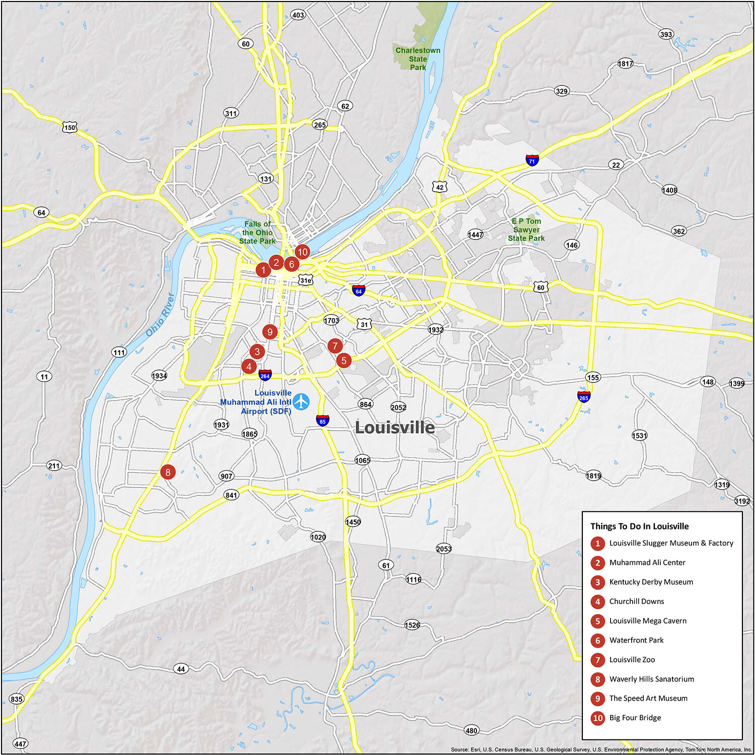
Did you know that Louisville is the birthplace of bourbon whiskey? But there’s much more to this city than bourbon. Louisville is a proud home of the Kentucky Derby, the Louisville Slugger Museum, Muhammad Ali Center, and it’s just west of the Appalachian Mountain range. Louisville has a lot to offer with mountains, trails, and rivers. This interactive map is a great way to explore the city and all it has to offer.
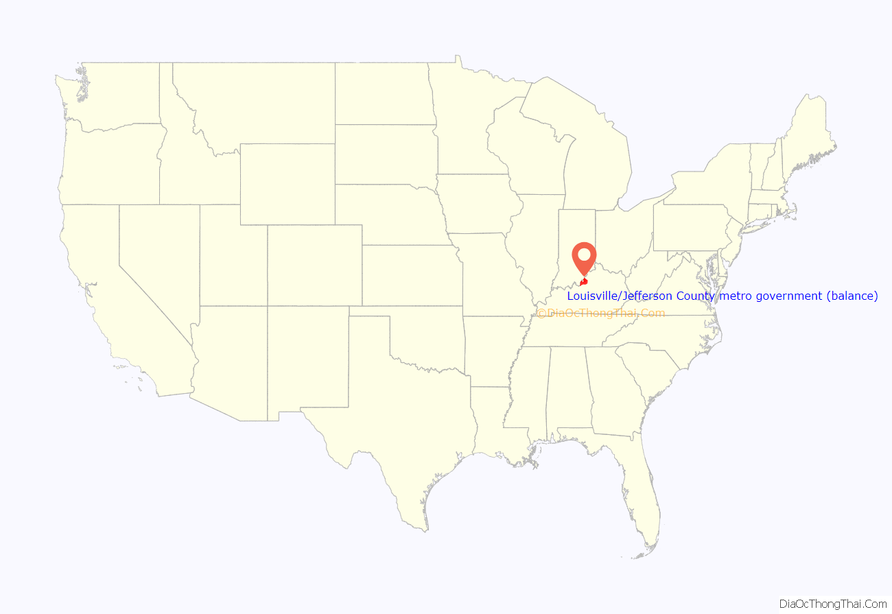
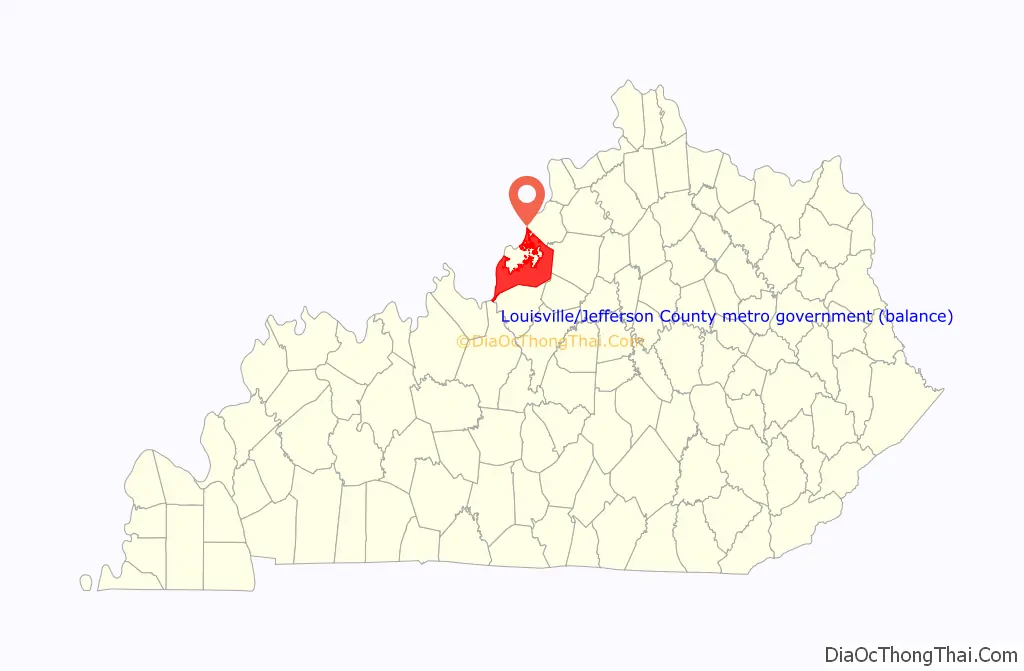
Louisville city location map. Where is Louisville city?
History
The history of Louisville spans hundreds of years, and has been influenced by the area’s geography and location at the head of the Falls of the Ohio River.
Early history and founding
The rapids at the Falls of the Ohio created a barrier to river travel, as a result, settlements grew up at this stopping point. The first European settlement in the vicinity of modern-day Louisville was on Corn Island in 1778 by Col. George Rogers Clark, credited as the founder of Louisville. Several landmarks in the community are named after him.
Two years later, in 1780, the Virginia General Assembly approved the town charter of Louisville. The city was named in honor of King Louis XVI of France, whose soldiers were then aiding Americans in the Revolutionary War. Early residents lived in forts to protect themselves from raids from the local indigenous population, but moved out by the late 1780s. In 1803, explorers Meriwether Lewis and William Clark organized their expedition across America in the town of Clarksville, Indiana at the present-day Falls of the Ohio opposite Louisville, Kentucky.
19th century
The city’s early growth was influenced by the fact that river boats had to be unloaded and moved downriver before reaching the falls. By 1828, the population had grown to 7,000 and Louisville became an incorporated city.
Early Louisville was a major shipping port and enslaved African Americans worked in a variety of associated trades. The city was often a point of escape for fugitive slaves to the north, as Indiana was a free state.
During this point in the 1850s, the city was growing and vibrant, but that also came with negativity. It was the center of planning, supplies, recruiting, and transportation for numerous campaigns, especially in the Western Theater. Ethnic tensions rose, and on August 6, 1855, known as “Bloody Monday”, Protestant mobs attacked German and Irish Catholic neighborhoods on election day, resulting in 22 deaths and widespread property damage. Then by 1861, the civil war had broken out. During the Civil War, Louisville was a major stronghold of Union forces, which kept Kentucky firmly in the Union. By the end of the war, the city of Louisville itself had not been attacked, although skirmishes and battles, including the battles of Perryville and Corydon, took place nearby. After Reconstruction, returning Confederate veterans largely took political control of the city, leading to the jibe that Louisville joined the Confederacy after the war was over.
The first Kentucky Derby was held on May 17, 1875, at the Louisville Jockey Club track (later renamed Churchill Downs). The Derby was originally shepherded by Meriwether Lewis Clark, Jr., the grandson of William Clark of the Lewis and Clark Expedition, and grandnephew of the city’s founder George Rogers Clark. Horse racing had a strong tradition in Kentucky, whose Inner Bluegrass Region had been a center of breeding high-quality livestock throughout the 19th century. Ten thousand spectators watched the first Derby, which Aristides won.
On March 27, 1890, the city was devastated and its downtown nearly destroyed when what scientists now estimate was an F4 tornado tore through as part of the middle Mississippi Valley tornado outbreak. It is estimated that between 74 and 120 people were killed and 200 were injured. The damage cost the city $2.5 million (equivalent to $69 million in 2019). Established in 1896, Neighborhood House Louisville was the first settlement movement house in the state.
20th and 21st centuries
The moniker “Gateway to the South” comes from the large number of African Americans that moved to Louisville during the period of the Great Migration in the beginning of the 20th century. Settling in an area of the city known as Needmore in 1870, it would later be known under the moniker of Little Africa as migration intensified, reaching its height in the 1920s. After urban renewal programs demolished many of the existing neighborhood structures in the 1950s, it came to be known today as the Park DuValle neighborhood.
In 1914, the City of Louisville passed a racially-based residential zoning code, following Baltimore, Atlanta, and a handful of cities in the Carolinas. The NAACP challenged the ordinance in two cases. Two weeks after the ordinance enacted, an African-American named Arthur Harris moved into a house on a block designated for whites. He was prosecuted and found guilty. The second case was planned to create a test case. William Warley, the president of the local chapter of the NAACP, tendered a purchase offer on a white block from Charles Buchanan, a white real estate agent. Warley also wrote a letter declaring his intention to build a house on that lot and reside there. With the understanding that the Louisville ordinance made it illegal for him to live there, Warley withheld payment, setting in motion a breach of contract suit by Buchanan. By 1917 the US Supreme Court agreed to hear the case of Buchanan v. Warley. The court struck down the Louisville residential segregation ordinance, ruling that it violated the Fourteenth Amendment’s due process clause.
In 1917, shortly after the United States’ entry into World War I, Louisville was selected as the site of Camp Zachary Taylor. Camp Taylor was one of the country’s largest World War I training camps. It was home of the 84th Infantry Division and trained over 150,000 men by the end of war, including F. Scott Fitzgerald. The camp was closed in 1921. Many of the buildings and infrastructure in the Camp Taylor neighborhood of Louisville are there as a result of the training camp.
In 1929, Louisville completed the lock and dam in the Falls of the Ohio and the city began referring to itself as “where Northern enterprise and Southern hospitality meet”. Between the industrial boom of that year and through the Great Depression, Louisville gained 15,000 new residents, about three percent of them black(450), most fleeing poverty in rural areas.
Throughout January 1937, 19.17 inches (48.7 cm) of rain fell in Louisville, and by January 27, the Ohio River crested at a record 57.15 feet (17.42 m), almost 30 feet (9.1 m) above flood stage. These events triggered the “Great Flood of 1937”, which lasted into early February. The flood submerged 60–70 percent of the city, caused complete loss of power for four days, and forced the evacuation of 175,000 or 230,000 residents, depending on sources. Ninety people died as a result of the flood. It led to dramatic changes in where residents lived. Today, the city is protected by numerous flood walls. After the flood, the areas of high elevation in the eastern part of the city had decades of residential growth.
Louisville was a center for factory war production during World War II. In May 1942, the U.S. government assigned the Curtiss-Wright Aircraft Company, a war plant located at Louisville’s air field, for wartime aircraft production. The factory produced the C-46 Commando cargo plane, among other aircraft. In 1946, the factory was sold to International Harvester, which began large-scale production of tractors and agricultural equipment. In 1950, the Census Bureau reported Louisville’s population as 84.3% white and 15.6% black.
Throughout the 1940s, there were more black police officers than any other Southern city, though they were allowed to patrol only black districts. This, in part, made Louisville seem like a more racially progressive city than other Southern cities, although only when black citizens accepted a lower status than white citizens. Many historians have referred to this “veil” of segregation as a “polite” racism. Historian George Wright stated that polite racism “often deluded both blacks and well-meaning whites into believing that real progress was being made in their city”. For example, in the city Jim Crow practices were not maintained by law so much as by custom.
Similar to many other older American cities, Louisville began to experience a movement of people and businesses to the suburbs in the 1960s and 1970s. Middle class residents used newly built freeways and interstate highways to commute to work, moving into more distant but newer housing. Because of tax laws, businesses found it cheaper to build new rather than renovate older buildings. Economic changes included a decline in local manufacturing. The West End and older areas of the South End, in particular, began to decline economically as many local factories closed.
In 1974, a major (F4) tornado hit Louisville as part of the 1974 Super Outbreak of tornadoes that struck 13 states. It covered 21 miles (34 km) and destroyed several hundred homes in the Louisville area, causing two deaths.
Since the 1980s, many of the city’s urban neighborhoods have been revitalized into areas popular with young professionals and college students. The greatest change has occurred along the Bardstown Road/Baxter Avenue and Frankfort Avenue corridors as well as the Old Louisville neighborhood. In recent years, such change has also occurred in the East Market District (NuLu).
Since the late 1990s, Downtown has experienced significant residential, tourist and retail growth, including the addition of major sports complexes KFC Yum! Center, Lynn Family Stadium and Louisville Slugger Field, conversion of waterfront industrial sites into Waterfront Park, openings of varied museums (see Museums, galleries and interpretive centers below), and the refurbishing of the former Galleria into the bustling entertainment complex Fourth Street Live!, which opened in 2004.
On March 13, 2020, four plainclothed officers from Louisville Metro Police Department executed a “no-knock” search warrant which led to the killing of Breonna Taylor, a 26-year-old African-American woman. For months afterward, Taylor’s family, members of the local community, and people around the world protested to demand that officers involved in the shooting be fired and criminally charged. These protests and demonstrations coincided and intertwined with the international George Floyd protests, as well as the Black Lives Matter movement and a broader movement of racial unrest. As a result of the incident, the police chief was fired and four officers received federal charges, but no significant systemic changes were made.
On April 10, 2023, a mass shooting occurred at the Old National Bank, killing five people, and injuring nine others. The suspect, who was a bank employee and who officials said was livestreaming the rampage, was killed by the police after exchanging fire with them.
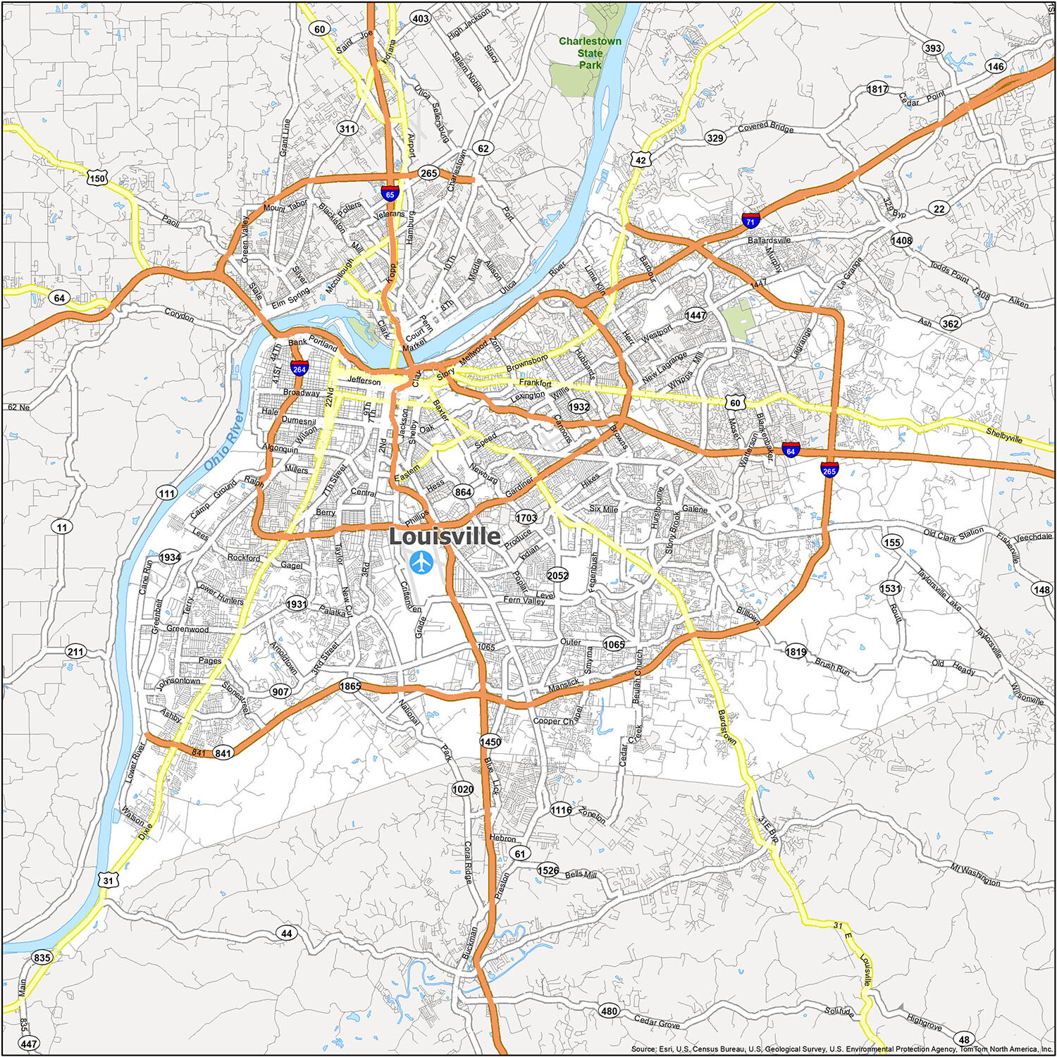
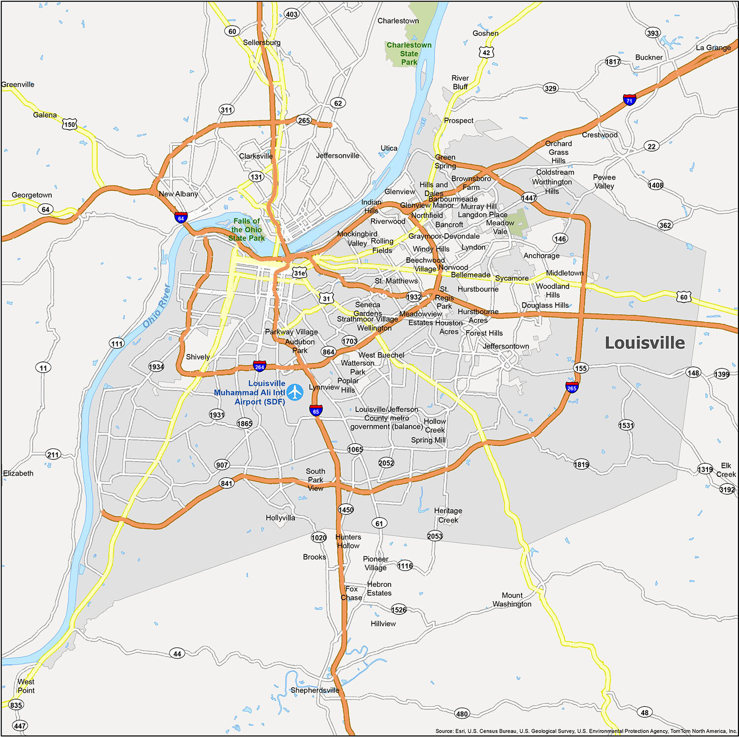
Louisville city Road Map
Louisville is a big city, with a lot of things to see and do. But it all boils down to how you want to get around. Whether you’re in town for a few days or for the week, we’ve got a road map to show you the best ways to get around town. This road map was designed to help you discover Louisville Kentucky and all its major highways and roads.
If you are traveling within the city, the following are the major highways and roads you’ll need to familiarize yourself with:
- Interstate Highways: I-64, I-65, I-71, I-264, I-265
- US Highways: 22, 31, 31E, 31W, 42, 44, 60, 61, 146, 150, 155, 362, 841, 864, 1934, Buechel Byp, Greenbelt Hwy
- Freeways/Parkways: Algonquin Pky, Cherokee Pky, Eastern Pky, Hurstbourne Pky, Northwestern Pky, Smyrna Pky, Southern Pky, Southside Dr, Southwestern Pky
- Major Roads: 1st St, 21st St, 22nd St, 2n St, Arthur St, Ballardsville Rd, Bardstown Rd, Baxter Ave, Brandeis Ave, Broadway, Brownsboro Rd, Campbell St, Cane Run Rd, Chestnut St, Dixie Hwy, Finzer St, Frankfort Ave, Grade Ln, Jackson St, Lagrange Rd, Logan St, Lynn St, Main St, Market St, Mellwood Ave, Muhammad Ali Blvd, Preston Hwy, Preston St, Shelby St, Shelbyville Rd, Story Ave, Taylorsville Lake Rd, Taylorsville Rd
For travel outside the city, you can refer to the Kentucky road map to learn about its interstates and highways.
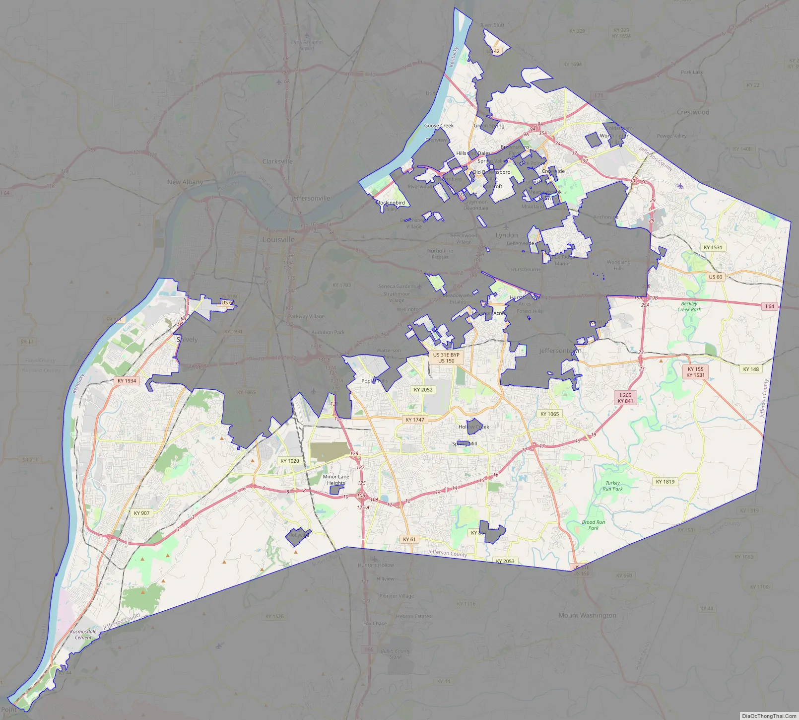
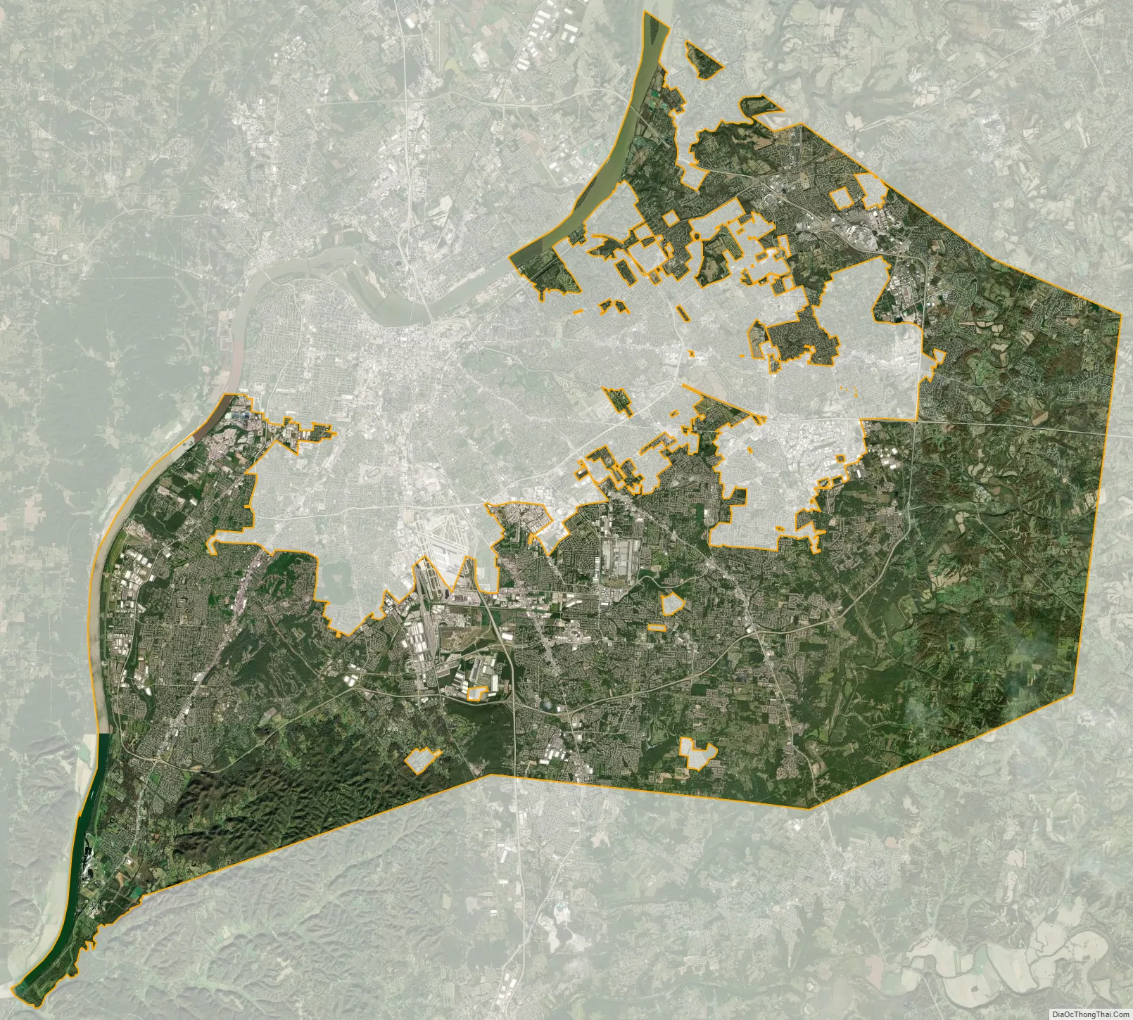
Louisville is a city full of diversity and rich culture. From historic landmarks to award-winning restaurants and attractions, there are plenty of places to explore. For those looking to plan a vacation or make Louisville their home, this reference map of the city and surrounding areas provides an overview of the airports, census-designated places (CDPs), towns, and cities that make up this vibrant metropolis.
10 things to do in Louisville city
Did you know that Louisville is the birthplace of bourbon whiskey? But there’s much more to this city than bourbon. Louisville is a proud home of the Kentucky Derby, the Louisville Slugger Museum, Muhammad Ali Center, and it’s just west of the Appalachian Mountain range. Louisville has a lot to offer with mountains, trails, and rivers. This interactive map is a great way to explore the city and all it has to offer.
Louisville city Satellite Map
Geography
Louisville and Jefferson County have a combined area of 397.68 square miles (1,030.0 km), of which 380.46 square miles (985.4 km) is land and 17.23 square miles (44.6 km) (4.33%) is covered by water.
Louisville is southeasterly situated along the border between Kentucky and Indiana, the Ohio River, in north-central Kentucky at the Falls of the Ohio. Louisville is an Upper South city located in a Southern state that is influenced by both Southern and Midwestern culture. It is sometimes referred to as either one of the northernmost Southern cities or as one of the southernmost Northern cities in the United States.
Louisville is located in Kentucky’s outer Bluegrass region. Its development has been influenced by its location on the Ohio River, which spurred Louisville’s growth from an isolated camp site into a major shipping port. Much of the city is located on a very wide and flat floodplain surrounded by hill country on all sides. Much of the area was swampland that had to be drained as the city grew. In the 1840s, most creeks were rerouted or placed in canals to prevent flooding and disease outbreaks.
Areas generally east of I-65 are above the flood plain, and are composed of gently rolling hills. The southernmost parts of Jefferson County are in the scenic and largely undeveloped Knobs region, which is home to Jefferson Memorial Forest.
The Louisville-Jefferson County, KY-IN Metropolitan Statistical Area (MSA), the 43rd largest in the United States, includes the Kentucky county of Jefferson (coterminous with Louisville Metro), plus twelve outlying counties—seven in Kentucky and five in Southern Indiana. Louisville’s MSA is included in the Louisville–Elizabethtown–Madison, KY–IN Combined Statistical Area (CSA), which also includes the Elizabethtown, KY MSA, as well as the Madison, IN Micropolitan Statistical Area.
The Louisville area is near several other urban areas, especially Frankfort, Kentucky (the state’s capital); Cincinnati, Ohio (the two cities’ metropolitan statistical areas almost border each other); Lexington, Kentucky; Bowling Green, Kentucky; Nashville, Tennessee; and the Indianapolis, Indiana area (especially Columbus, Indiana, to the north of Southern Indiana).
Cityscape
The downtown business district of Louisville is located immediately south of the Ohio River and southeast of the Falls of the Ohio. Major roads extend outwards from the downtown area in all directions. The airport is about 6.75 miles (10.86 km) south of the downtown area. The industrial sections of town are to the south and west of the airport, while most of the residential areas of the city are to the southwest, south, and east of downtown. In 2010, the 22,000-seat KFC Yum! Center was completed. Twelve of the 15 buildings in Kentucky over 300 feet (91 m) are located in downtown Louisville.
Another primary business and industrial district is located in the suburban area east of the city on Hurstbourne Parkway.
Louisville’s late 19th- and early 20th-century development was spurred by three large suburban parks built at the edges of the city in 1890.
The city’s architecture contains a blend of old and new. The Old Louisville neighborhood is the largest historic preservation district solely featuring Victorian homes and buildings in the United States; it is also the third-largest district containing such architectural distinctions in the United States. The style, which originated in Great Britain, spread to the Commonwealth and eventually to the United States, including the rapidly growing city of Louisville. Many modern skyscrapers are located downtown, as well as older preserved structures, such as the Southern National Bank building. The buildings of West Main Street in downtown Louisville have the largest collection of cast iron facades of anywhere outside of New York’s SoHo neighborhood.
Since the mid-20th century, Louisville has in some ways been divided into three sides of town: the West End, the South End, and the East End. In 2003, Bill Dakan, a University of Louisville geography professor, said that the West End, west of 7th Street and north of Algonquin Parkway, is “a euphemism for the African American part of town” although he points out that this belief is not entirely true, and most African Americans no longer live in areas where more than 80% of residents are black. Nevertheless, he says the perception is still strong. The South End has long had a reputation as a white, working-class part of town, while the East End has been seen as middle and upper class.
According to the Greater Louisville Association of Realtors, the area with the lowest median home sales price is west of Interstate 65, in the West and South Ends. The middle range of home sales prices are between Interstates 64 and 65 in the South and East Ends, and the highest median home sales price are north of Interstate 64 in the East End. Immigrants from Southeast Asia tend to settle in the South End, while immigrants from Eastern Europe settle in the East End.
Climate
Louisville has a humid subtropical climate (Köppen Cfa), typical of the Upper South, and is located in USDA plant hardiness zones 6b and 7a. Springlike conditions typically begin in mid-to-late March, summer from mid-to-late-May to late September, with fall in the October–November period. Seasonal extremes in both temperature and precipitation are not uncommon during early spring and late fall; severe weather is not uncommon, with occasional tornado outbreaks in the region. Winter typically brings a mix of rain, sleet, and snow, with occasional heavy snowfall and icing. Louisville averages 4.5 days with low temperatures dipping to 10 °F (−12 °C); the first and last freezes of the season on average fall on November 2 and April 5, respectively. Summer is typically hazy, hot, and humid with long periods of 90–100 °F (32–38 °C) temperatures and drought conditions at times. Louisville averages 38 days a year with high temperatures at or above 90 °F (32 °C). The mean annual temperature is 58.2 °F (14.6 °C), with an average annual snowfall of 12.7 inches (32 cm) and an average annual rainfall of 44.9 inches (1,140 mm).
The wettest seasons are spring and summer, although rainfall is fairly constant year round. During the winter, particularly in January and February, several days of snow can be expected. January is the coldest month, with a mean temperature of 34.9 °F (1.6 °C). July is the average hottest month with a mean of 79.3 °F (26.3 °C). The highest recorded temperature was 107 °F (42 °C), which last occurred on July 14, 1936, and the lowest recorded temperature was −22 °F (−30 °C) on January 19, 1994. In 2012, Louisville had the fourth-hottest summer on record, with the temperature rising up to 106 °F (41 °C) in July and the June all-time monthly record high temperature being broken on two consecutive days. As the city exemplifies the urban heat island effect, temperatures in commercial areas and in the industrialized areas along interstates are often higher than in the suburbs, often as much as 5 °F (2.8 °C).
Time zone
Louisville is in the Eastern Time Zone. Some distance to the west, in both Kentucky and Indiana, is the border where the Central Time Zone starts.
See also
Map of Kentucky State and its subdivision:- Adair
- Allen
- Anderson
- Ballard
- Barren
- Bath
- Bell
- Boone
- Bourbon
- Boyd
- Boyle
- Bracken
- Breathitt
- Breckinridge
- Bullitt
- Butler
- Caldwell
- Calloway
- Campbell
- Carlisle
- Carroll
- Carter
- Casey
- Christian
- Clark
- Clay
- Clinton
- Crittenden
- Cumberland
- Daviess
- Edmonson
- Elliott
- Estill
- Fayette
- Fleming
- Floyd
- Franklin
- Fulton
- Gallatin
- Garrard
- Grant
- Graves
- Grayson
- Green
- Greenup
- Hancock
- Hardin
- Harlan
- Harrison
- Hart
- Henderson
- Henry
- Hickman
- Hopkins
- Jackson
- Jefferson
- Jessamine
- Johnson
- Kenton
- Knott
- Knox
- Larue
- Laurel
- Lawrence
- Lee
- Leslie
- Letcher
- Lewis
- Lincoln
- Livingston
- Logan
- Lyon
- Madison
- Magoffin
- Marion
- Marshall
- Martin
- Mason
- McCracken
- McCreary
- McLean
- Meade
- Menifee
- Mercer
- Metcalfe
- Monroe
- Montgomery
- Morgan
- Muhlenberg
- Nelson
- Nicholas
- Ohio
- Oldham
- Owen
- Owsley
- Pendleton
- Perry
- Pike
- Powell
- Pulaski
- Robertson
- Rockcastle
- Rowan
- Russell
- Scott
- Shelby
- Simpson
- Spencer
- Taylor
- Todd
- Trigg
- Trimble
- Union
- Warren
- Washington
- Wayne
- Webster
- Whitley
- Wolfe
- Woodford
- Alabama
- Alaska
- Arizona
- Arkansas
- California
- Colorado
- Connecticut
- Delaware
- District of Columbia
- Florida
- Georgia
- Hawaii
- Idaho
- Illinois
- Indiana
- Iowa
- Kansas
- Kentucky
- Louisiana
- Maine
- Maryland
- Massachusetts
- Michigan
- Minnesota
- Mississippi
- Missouri
- Montana
- Nebraska
- Nevada
- New Hampshire
- New Jersey
- New Mexico
- New York
- North Carolina
- North Dakota
- Ohio
- Oklahoma
- Oregon
- Pennsylvania
- Rhode Island
- South Carolina
- South Dakota
- Tennessee
- Texas
- Utah
- Vermont
- Virginia
- Washington
- West Virginia
- Wisconsin
- Wyoming


