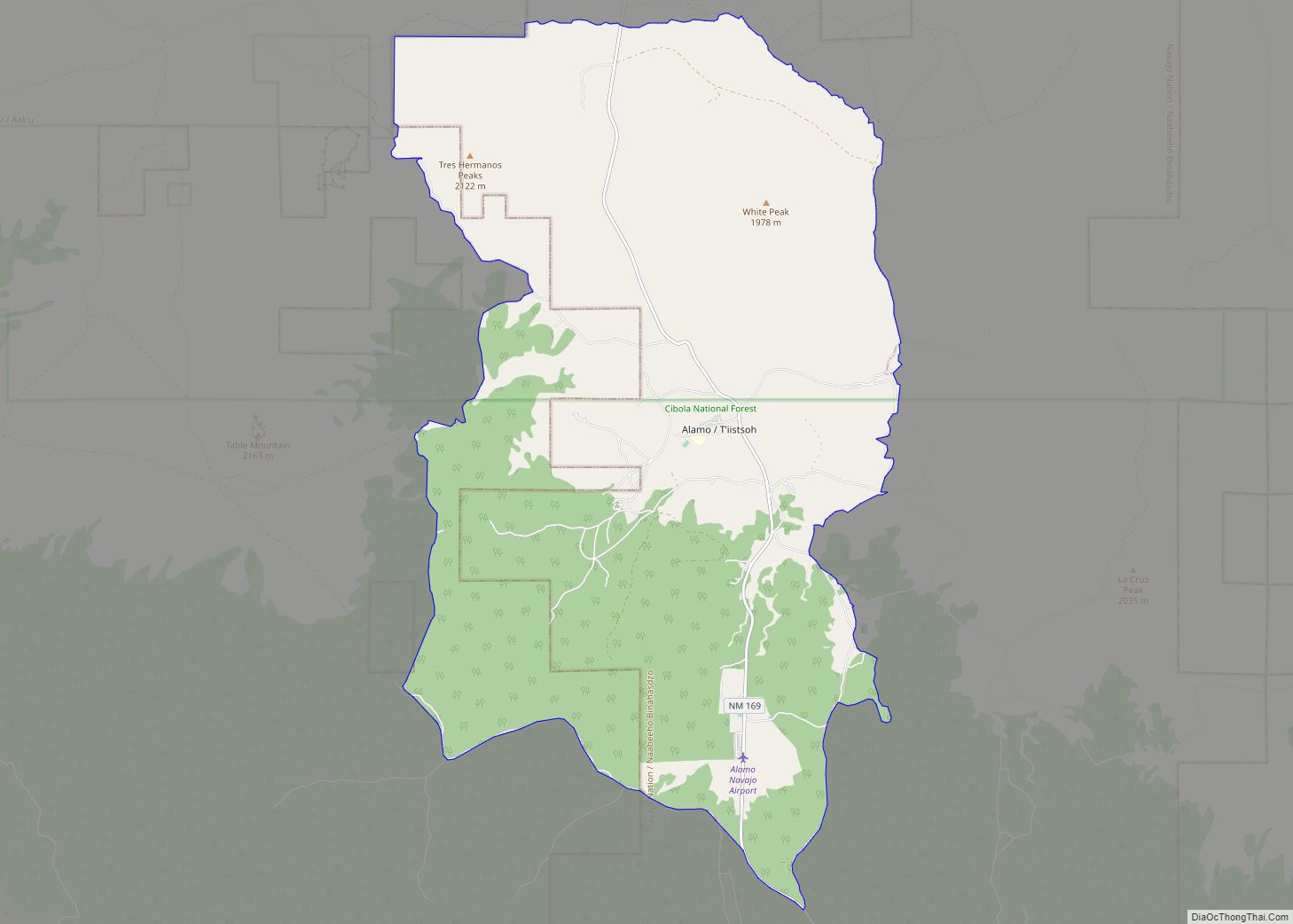
Map of Alamillo CDP

Map of Alamillo CDP

Alamillo is an unincorporated community and census-designated place in Socorro County, New Mexico, United States. Its population was 102 as of the 2010 census. Interstate 25 passes through the community. Alamillo CDP overview: Name: Alamillo CDP LSAD Code: 57 LSAD Description: CDP (suffix) State: New Mexico County: Socorro County Elevation: 4,678 ft (1,426 m) Total Area: 1.20 sq mi … Read more

Map of Agua Fria CDP

Map of Agua Fria CDP

Agua Fria (Spanish for “cold water”) is a census-designated place (CDP) in Santa Fe County, New Mexico, United States. It is part of the Santa Fe, New Mexico Metropolitan Statistical Area. The population was 2,800 at the 2010 census. Agua Fria Village is a “Traditional Historic Community” (THC) as designated by the Santa Fe Board … Read more

Map of Adelino CDP

Map of Adelino CDP

Adelino is a census-designated place in Valencia County, New Mexico, United States. Its population was 783 as of the 2020 census. The Adelino CDP was first made in the 2010 census when it had a population of 823. Prior to 2010, the community was part of the Tome-Adelino CDP. Adelino contains the historic Miguel E. … Read more

Map of Anthony city, New Mexico

Map of Anthony city, New Mexico

Anthony is a city in Doña Ana County, New Mexico, United States. The population was 9,360 at the 2010 census. It is located on the New Mexico–Texas state line in the Upper Mesilla Valley (immediately north of Anthony, Texas), and on Interstate 10, 24 miles south of Las Cruces and 18 miles north of El … Read more

Map of Animas CDP

Map of Animas CDP, New Mexico

Animas is an unincorporated community and census-designated place (CDP) in west-central Hidalgo County, New Mexico, United States, in the southwestern corner of the state. As of the 2010 census it had a population of 237. It lies at the intersection of State Roads 9 and 338, at an elevation of 4,406 feet (1,343 m) approximately 30 … Read more

Map of Angel Fire village

Map of Angel Fire village

Angel Fire is a village in Colfax County, New Mexico, United States. The population was 1,216 at the 2010 census. It is a popular ski resort destination, with over 500 acres (2.0 km) of slopes. Angel Fire and nearby communities experience cold winter temperatures and mild temperatures in the summer. To the north, off U.S. Route … Read more

Map of Atoka CDP

Map of Atoka CDP, New Mexico

Atoka is a census-designated place in Eddy County, New Mexico, United States. Its population was 1,077 as of the 2010 census. U.S. Route 285 passes through the community. The name was derived from an Indian word, probably Choctaw, whose meaning is unknown. It is within the Artesia Public Schools school district. Artesia High School is … Read more

Map of Artesia city, New Mexico

Map of Artesia city, New Mexico

Artesia is a city in Eddy County, New Mexico, centered at the intersection of U.S. routes 82 and 285; the two highways serve as the city’s Main Street and First Street, respectively. As of the 2010 census, the city population was 11,301. Artesia city overview: Name: Artesia city LSAD Code: 25 LSAD Description: city (suffix) … Read more

Map of Arroyo Seco CDP

Map of Arroyo Seco CDP

Arroyo Seco is a census-designated place in Taos County near Taos, New Mexico. Arroyo Seco’s economy is based on tourism and services to residents of retirement and vacation homes. Arroyo Seco has a post office, with the ZIP code 87514. The 87514 ZIP Code Tabulation Area had a population of 1,310 at the 2000 census, … Read more

Map of Arroyo Hondo CDP

Map of Arroyo Hondo CDP

Arroyo Hondo is a census-designated place in Taos County near Taos, New Mexico, United States. As of the 2010 census it had a population of 474. It is historically notable as the site of the killing of six to eight employees by a force of allied Native Americans at Simeon Turley’s mill and distillery trading … Read more

Map of Arrey CDP

Map of Arrey CDP

Arrey is a census-designated place in Sierra County, New Mexico, United States. It lies about 22 miles (35.4 km) south of Truth or Consequences. As of the 2010 census, its population was 232. In 1890, the town was founded as Bonito when several Hispanic families made a deal with a cattle agent to settle here. … Read more

Map of Arenas Valley CDP

Map of Arenas Valley CDP

Arenas Valley is a census-designated place in Grant County, New Mexico, United States. Its population was 1,522 as of the 2010 census. Arenas Valley had a post office from December 20, 1944, to April 20, 1987; it still has its own ZIP code, 88022. It was named because it was in the valley of the … Read more