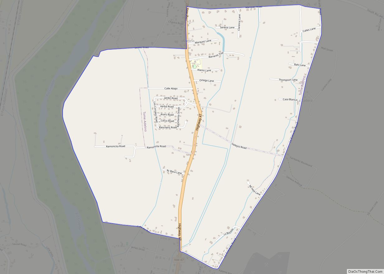
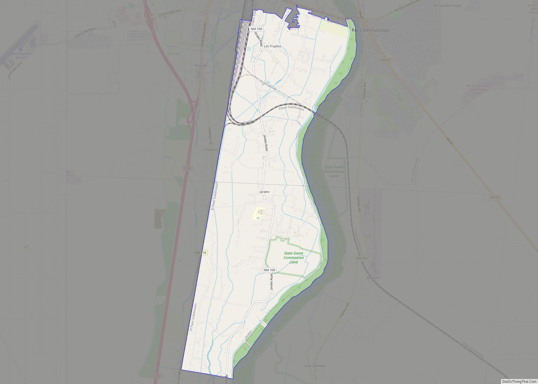
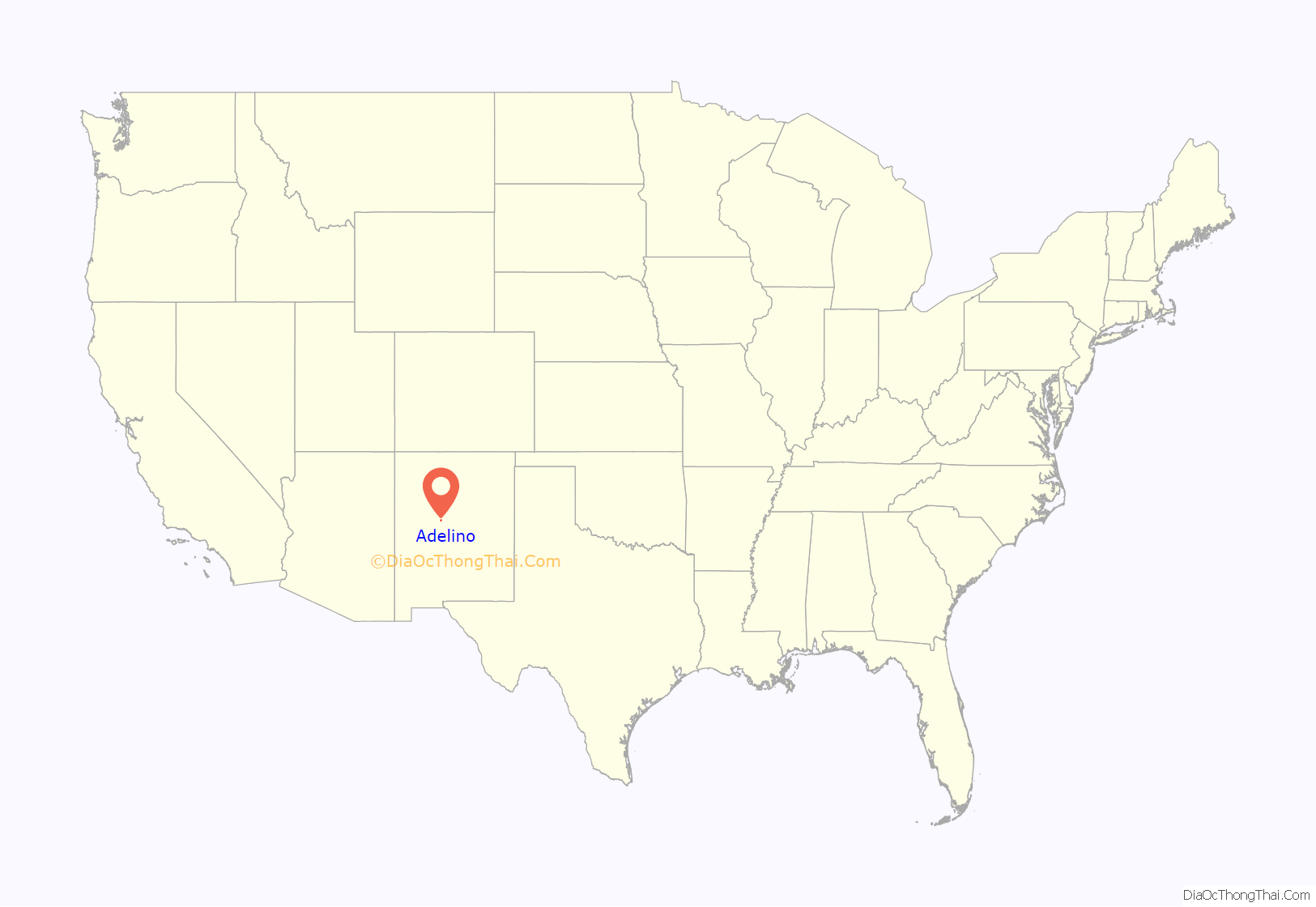
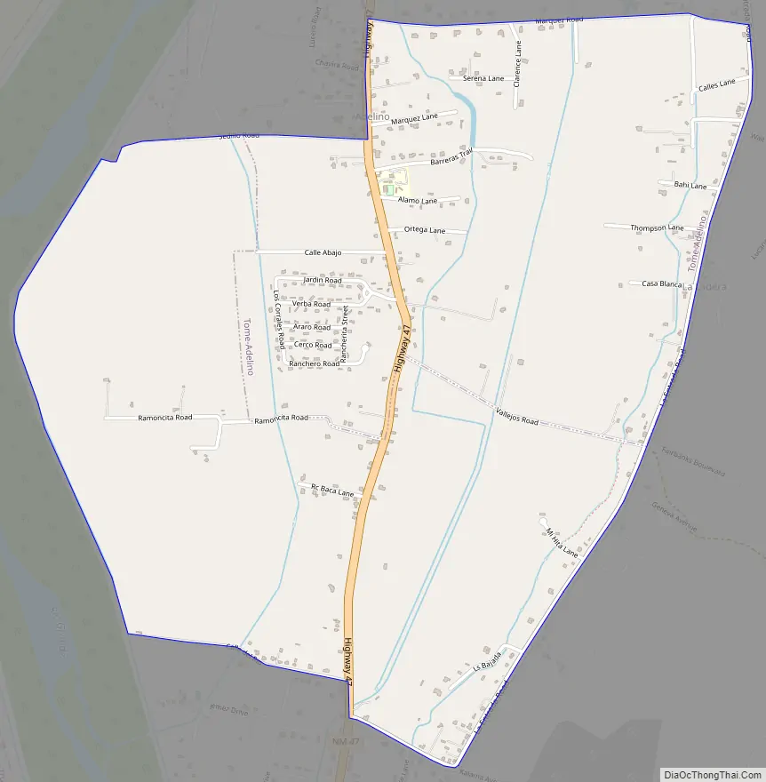
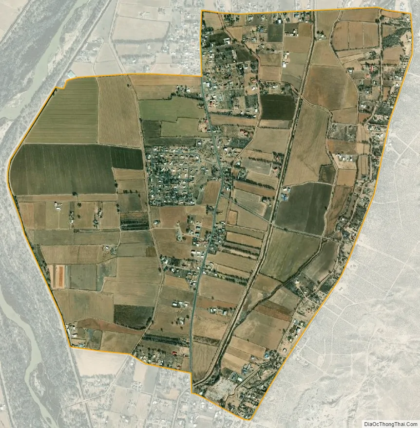
Adelino is a census-designated place in Valencia County, New Mexico, United States. Its population was 783 as of the 2020 census. The Adelino CDP was first made in the 2010 census when it had a population of 823. Prior to 2010, the community was part of the Tome-Adelino CDP.
Adelino contains the historic Miguel E. Baca House, listed on the National Register of Historic Places.
| Name: | Adelino CDP |
|---|---|
| LSAD Code: | 57 |
| LSAD Description: | CDP (suffix) |
| State: | New Mexico |
| County: | Valencia County |
| Elevation: | 4,823 ft (1,470 m) |
| Total Area: | 2.98 sq mi (7.73 km²) |
| Land Area: | 2.98 sq mi (7.73 km²) |
| Water Area: | 0.00 sq mi (0.00 km²) |
| Total Population: | 735 |
| Population Density: | 246.31/sq mi (95.10/km²) |
| Area code: | 505 |
| FIPS code: | 3500940 |
| GNISfeature ID: | 923551 |
Online Interactive Map
Click on ![]() to view map in "full screen" mode.
to view map in "full screen" mode.
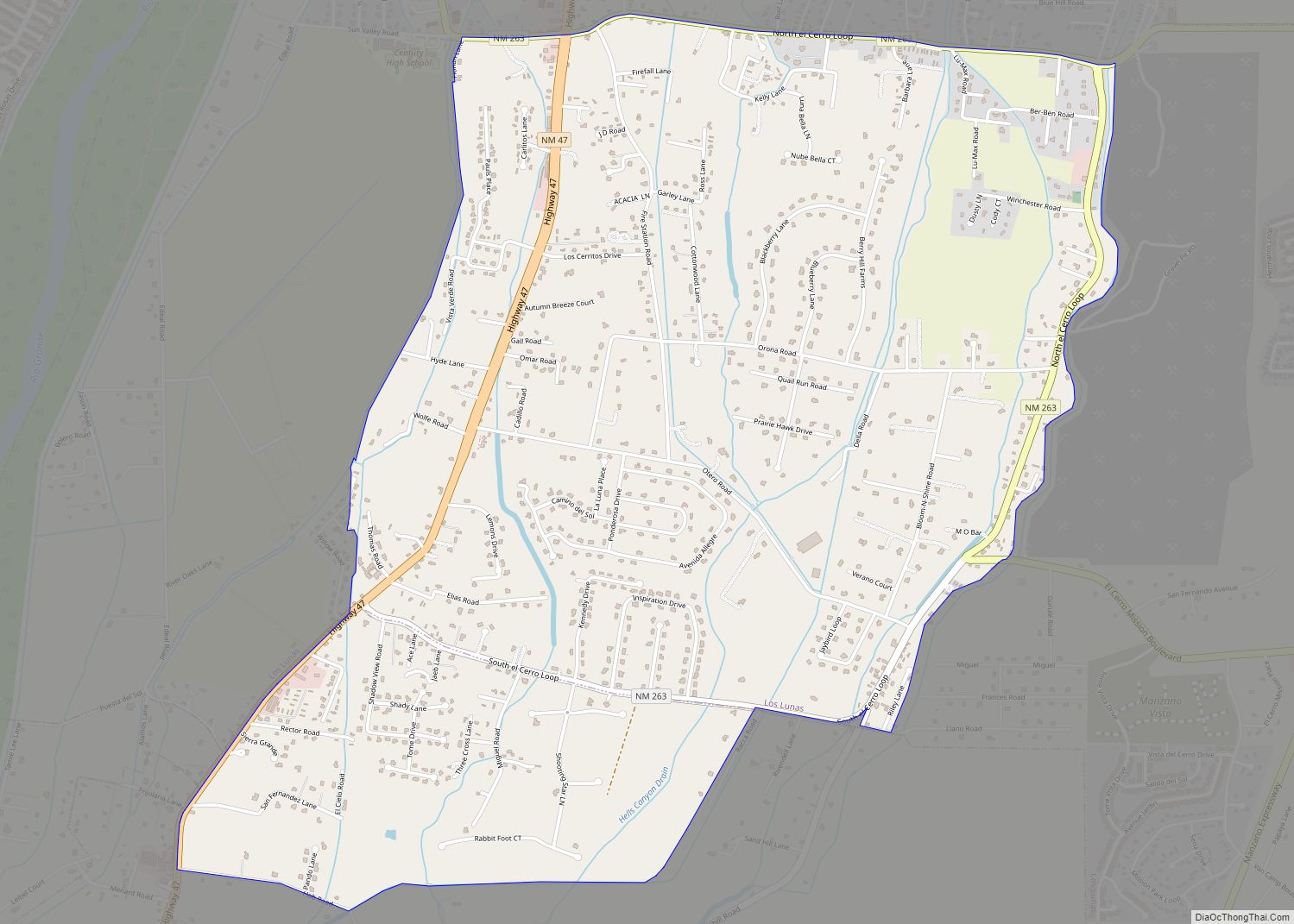
Adelino location map. Where is Adelino CDP?

Adelino Road Map
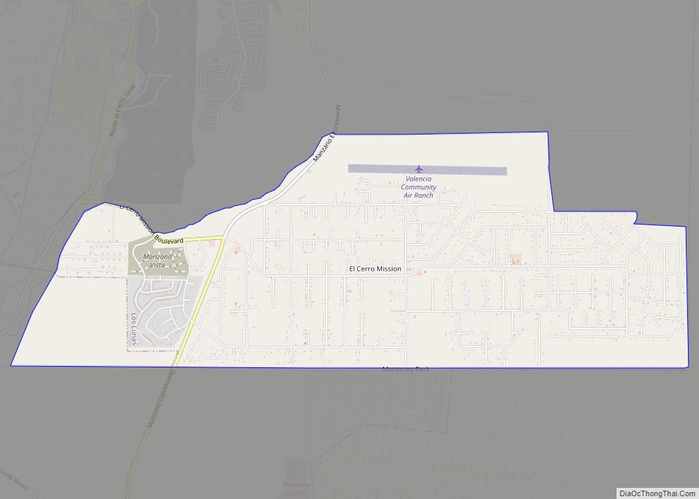
Adelino city Satellite Map
See also
Map of New Mexico State and its subdivision: Map of other states:- Alabama
- Alaska
- Arizona
- Arkansas
- California
- Colorado
- Connecticut
- Delaware
- District of Columbia
- Florida
- Georgia
- Hawaii
- Idaho
- Illinois
- Indiana
- Iowa
- Kansas
- Kentucky
- Louisiana
- Maine
- Maryland
- Massachusetts
- Michigan
- Minnesota
- Mississippi
- Missouri
- Montana
- Nebraska
- Nevada
- New Hampshire
- New Jersey
- New Mexico
- New York
- North Carolina
- North Dakota
- Ohio
- Oklahoma
- Oregon
- Pennsylvania
- Rhode Island
- South Carolina
- South Dakota
- Tennessee
- Texas
- Utah
- Vermont
- Virginia
- Washington
- West Virginia
- Wisconsin
- Wyoming