Map of Campbell County

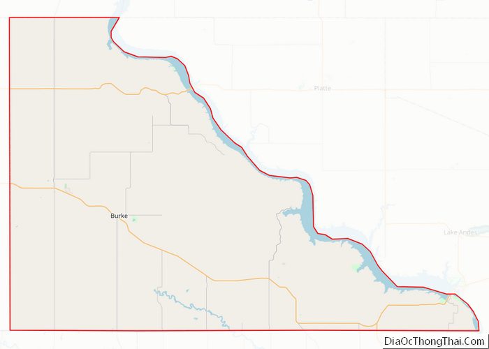
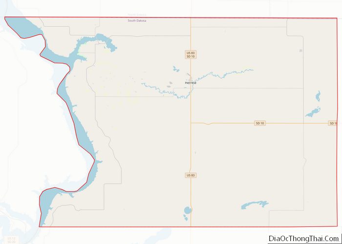
Map of Campbell County, South Dakota

Campbell County is a county in the U.S. state of South Dakota. As of the 2020 census, the population was 1,377, making it the fourth-least populous county in South Dakota. Its county seat is Mound City. The county was created in 1873 and organized in 1884. It was named for Norman B. Campbell, a Dakota … Read more

Map of Gregory County

Map of Gregory County, South Dakota

Gregory County is a county in the U.S. state of South Dakota. As of the 2020 census, the population was 3,994. Its county seat is Burke. The county was created in 1862 and organized in 1898. It was named for the politician J. Shaw Gregory. Gregory County overview: Name: Gregory County FIPS code: 46-053 State: … Read more

Map of Lyman County

Map of Lyman County, South Dakota

Lyman County is a county located in the U.S. state of South Dakota. As of the 2020 census, the population was 3,718. Its county seat is Kennebec. Lyman County was created by the Dakota Territorial Legislature on January 8, 1873, but was not organized until May 21, 1893. Its boundaries were altered in 1891, 1897, … Read more

Map of Stanley County

Map of Stanley County, South Dakota

Stanley County is a county in the U.S. state of South Dakota. As of the 2020 census, the population was 2,980. Its county seat is Fort Pierre. The county was created in 1873, and was organized in 1890. It is named for David S. Stanley, a commander at Fort Sully from 1866 to 1874, which … Read more

Map of Cannon County

Map of Cannon County, Tennessee

Cannon County is a county located in the U.S. state of Tennessee. As of the 2020 census, the population was 14,506. Its county seat is Woodbury. Cannon County is part of the Nashville–Davidson–Murfreesboro–Franklin, TN Metropolitan Statistical Area. Cannon County overview: Name: Cannon County FIPS code: 47-015 State: Tennessee Founded: January 31, 1836 Named for: Newton … Read more

Map of Fayette County

Map of Fayette County, Tennessee

Fayette County is a county located in the U.S. state of Tennessee. As of the 2020 census, the population was 41,990. Its county seat is Somerville. The county was named after the Marquis de la Fayette, French hero of the American Revolution. A part of the Memphis, TN-MS-AR Metropolitan Statistical Area, Fayette County is culturally … Read more

Map of Henry County

Map of Henry County, Tennessee

Henry County is a county located on the northwestern border of the U.S. state of Tennessee, and is considered part of West Tennessee. As of the 2020 census, the population was 32,199. Its county seat is Paris. The county is named for the Virginia orator and American Founding Father Patrick Henry. Henry County comprises the … Read more

Map of Marion County

Map of Marion County, Tennessee

Marion County is a county located in the U.S. state of Tennessee. It is located in East Tennessee. As of the 2020 census, the population was 28,837. Its county seat is Jasper. Marion County is part of the Chattanooga, AL–TN–GA Metropolitan Statistical Area. Marion County is in the Central time zone, while Chattanooga proper is … Read more

Map of Rhea County

Map of Rhea County, Tennessee

Rhea County (pronounced ray /reɪ/) is a county located in the U.S. state of Tennessee. As of the 2020 census, the population was 32,870. Its county seat is Dayton. Rhea County comprises the Dayton, TN Micropolitan Statistical Area, which is also included in the Chattanooga–Cleveland–Dalton, TN–GA–AL Combined Statistical Area. Rhea County overview: Name: Rhea County … Read more

Map of Van Buren County

Map of Van Buren County, Tennessee

Van Buren County is a county located in the U.S. state of Tennessee. As of the 2020 census, the population was 6,168, making it the second-least populous county in Tennessee. Its county seat is Spencer. Van Buren County overview: Name: Van Buren County FIPS code: 47-175 State: Tennessee Founded: January 3, 1840 Named for: Martin … Read more

Map of Bailey County

Map of Bailey County, Texas

Bailey County is a county located in the U.S. state of Texas. It is in West Texas and its county seat is Muleshoe. As of the 2020 census, its population was 6,904. Bailey County overview: Name: Bailey County FIPS code: 48-017 State: Texas Founded: 1919 Named for: Peter James Bailey Seat: Muleshoe Largest city: Muleshoe … Read more

Map of Brown County

Map of Brown County, Texas

Brown County is a county in west-central Texas. As of the 2020 census, the population was 38,095. Its county seat is Brownwood. The county was founded in 1856 and organized in 1858. It is named for Henry Stevenson Brown, a commander at the Battle of Velasco, an early conflict between Texians and Mexicans. The Brownwood, … Read more