Rhea County (pronounced ray /reɪ/) is a county located in the U.S. state of Tennessee. As of the 2020 census, the population was 32,870. Its county seat is Dayton. Rhea County comprises the Dayton, TN Micropolitan Statistical Area, which is also included in the Chattanooga–Cleveland–Dalton, TN–GA–AL Combined Statistical Area.
| Name: | Rhea County |
|---|---|
| FIPS code: | 47-143 |
| State: | Tennessee |
| Founded: | 1807 |
| Named for: | John Rhea |
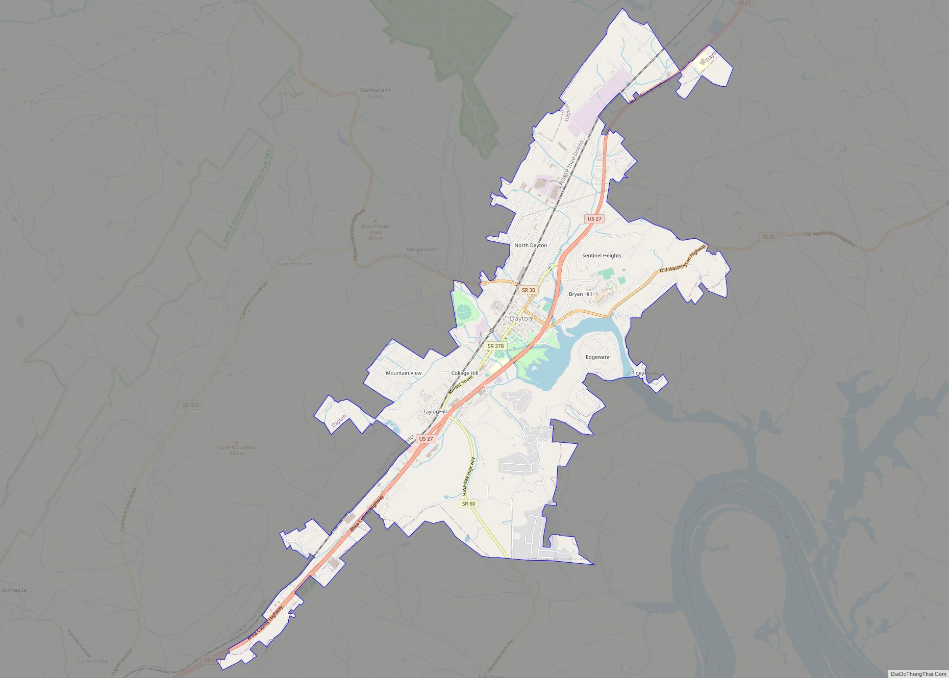
| Seat: | Dayton |
| Largest city: | Dayton |
| Total Area: | 336 sq mi (870 km²) |
| Land Area: | 315 sq mi (820 km²) |
| Total Population: | 32,870 |
| Population Density: | 101/sq mi (39/km²) |
| Time zone: | UTC−5 (Eastern) |
| Summer Time Zone (DST): | UTC−4 (EDT) |
| Website: | www.rheacountytn.com |
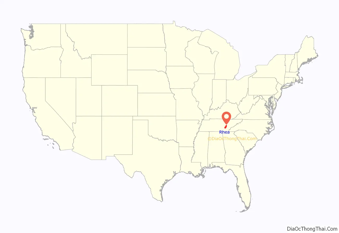
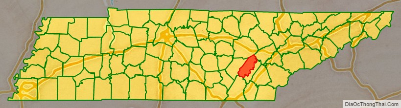
Rhea County location map. Where is Rhea County?
History
Rhea County is named for the Tennessee politician and Revolutionary War veteran John Rhea.
A portion of the Trail of Tears ran through the county as part of the United States government’s removal of the Cherokee in the 1830s.
During the American Civil War, Rhea County was one of the few counties in East Tennessee that was heavily sympathetic to the cause of the Confederate States of America. It was the only East Tennessee county that did not send a delegate to the pro-Union East Tennessee Convention in 1861. The county voted in favor of Tennessee’s June 1861 Ordinance of Secession, 360 votes to 202. Rhea raised seven companies for the Confederate Army, compared to just one company for the Union.
Rhea had the only female cavalry company on either side during the Civil War. It was made up of young women in their teens and their twenties from Rhea County and was formed in 1862. Their unit was named the Rhea County Spartans. Until 1863, the Spartans simply visited loved ones in the military and delivered the equivalent of modern-day care packages. After Union troops entered Rhea in 1863, the Spartans may have engaged in some spying for Confederate forces. The members of the Spartans were arrested in April 1865 under orders of a Rhea County Unionist and were forced to march to the Tennessee River. From there they were transported to Chattanooga aboard the USS Chattanooga. Once in Chattanooga, Union officers realized the women were not a threat and ordered them released and returned to Rhea County. They first were required to take the oath of allegiance to the United States government. The Spartans were not an officially recognized unit of the Confederate Army.
In 1890, the county seat was moved from the Washington community to its present location in Dayton. This was a result of several causes such as the completion of the Cincinnati-Chattanooga Railroad in Smith’s Crossroads, the rapid growth of Chattanooga, the detrimental effects of the American Civil War, and the emigration of its prominent citizens.
The Scopes Trial, which resulted from the teaching of evolution being banned in Tennessee public schools under the Butler Act, took place in Rhea County in 1925. The trial was one of the first to be referred to as the “Trial of the century”. William Jennings Bryan played a role as prosecutor in trial, and he died in Dayton shortly after the trial ended. A statue of Bryan was recently erected on the grounds of the Rhea County Courthouse.
In 1956, the State Supreme Court upheld a “regular and customary practice among certain of the teachers, during the regular school hours and in the classrooms, to read, or have some pupil read from, the Bible; to ask questions of the pupils concerning the content of such passages; to repeat prayers, usually that prayer known as the Lord’s Prayer as it appears in the sixth Chapter of the Book of Matthew in the King James version of the Bible; to sing hymns and other religious songs; and to inquire of the pupils as to their attendance or non-attendance at Sunday School,” where Sunday School attendance remained compulsory in Tennessee at the time, though that law was apparently—to some teachers chagrin—no longer being enforced. The court there held that precluding teachers from doing so violated the State Constitution, Article 1, § 3:
The court then held that it exceeded the Equal Protection guarantees of the 14th Amendment of the U.S. Constitution “to have their children taught what they desire … subject to qualification that teachers and places must be reputable and things taught not immoral or inimical to public welfare,” a reading of that Amendment that has since been overruled as to religious teaching in schools by both the Colorado court which provided the quotation, and by the U.S. Supreme Court. But at the time, the State Supreme Court reasoned: “complainants, we feel that they have taken a rather narrow and dogmatic view of these constitutional inhibitions. In their commendable zeal in behalf of liberty of conscience, and of religious worship, they have overlooked the broader concept that religion per se is something which transcends all man-made creeds.” On June 8, 2004, a federal appeals court upheld a ruling banning further Bible instructions as a violation of the First Amendment principle of “Separation of church and state”.
On March 16, 2004, Rhea County commissioner J.C. Fugate prompted a vote on a ban on homosexuals in Tennessee, allowing the county to charge them with “crimes against nature”. The measure passed, 8–0. Several of the commissioners who voted for the resolution chose not to run for reelection or were voted out of office. The resolution was withdrawn on March 18. In protest, a “Gay Day in Rhea” was held on May 8, 2004, with about 400 participants.
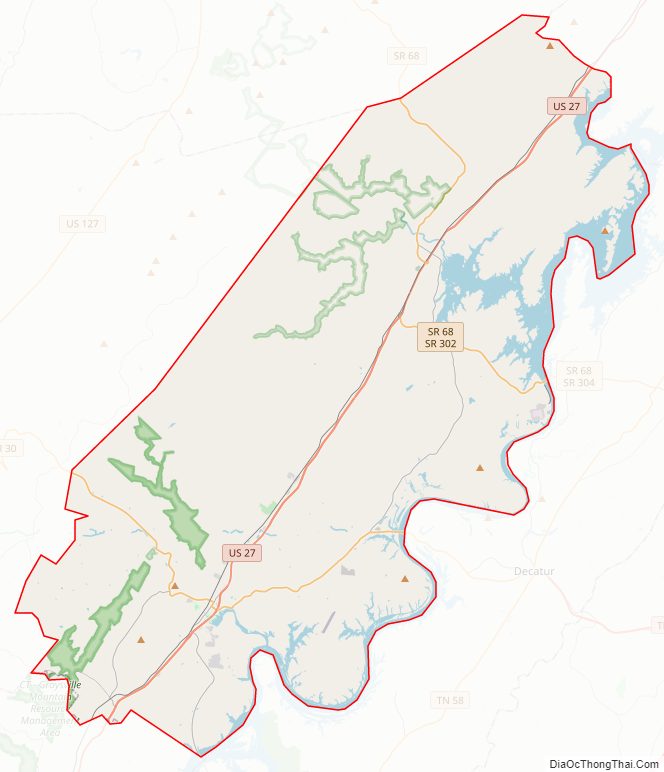
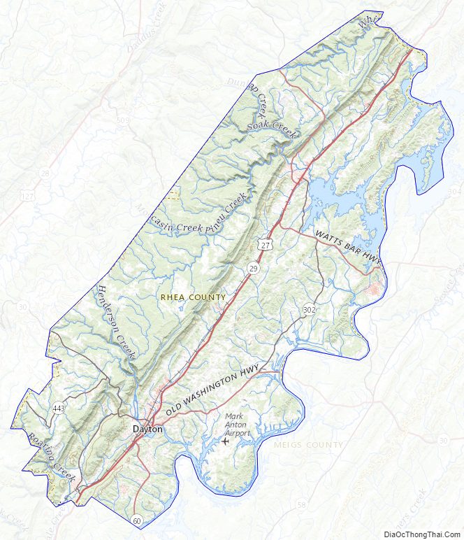
Rhea County Road Map
Geography
According to the U.S. Census Bureau, the county has a total area of 336 square miles (870 km), of which 315 square miles (820 km) is land and 21 square miles (54 km) (6.3%) is water.
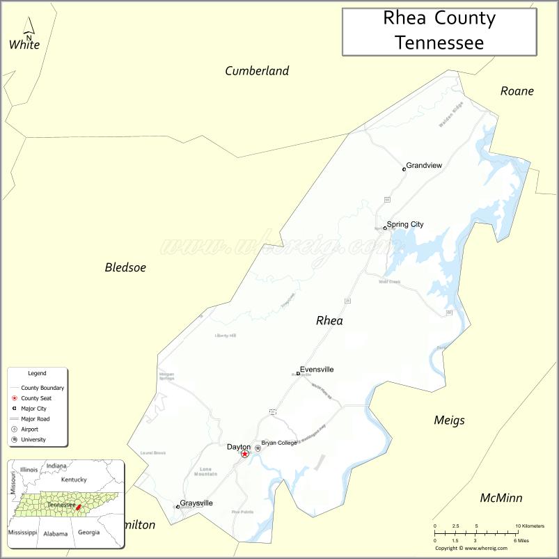
Walden Ridge, part of the Cumberland Plateau, provides Rhea County’s border with Bledsoe County to the west. The Tennessee River forms Rhea’s border with Meigs County to the east. Whites Creek, a tributary of the Tennessee River, forms Rhea’s border with Roane County to the north. Watts Bar Dam straddles the Tennessee River near Spring City. The section of the river upstream from the dam is part of Watts Bar Lake, and the section downstream is part of Chickamauga Lake. A nuclear power plant, Watts Bar Nuclear Generating Station, is located near Watts Bar Dam.
The major north–south road in Rhea County is U.S. Route 27. Major east–west roads include State Route 30, which intersects US-27 in Dayton, and State Route 68, which connects Spring City with Madisonville and Crossville.
Adjacent counties
- Cumberland County (northwest/CST Border)
- Roane County (northeast)
- Meigs County (east)
- Hamilton County (south)
- Bledsoe County (west/CST Border)
State protected areas
- Chickamauga Wildlife Management Area (part)
- Cumberland Trail (part)
- Hiwassee Refuge (part)
- Laurel-Snow State Natural Area
- Piney Falls State Natural Area
- Stringing Fork Falls State Natural Area
- Yuchi Refuge
Rhea County Topographic Map
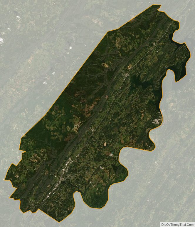
Rhea County Satellite Map
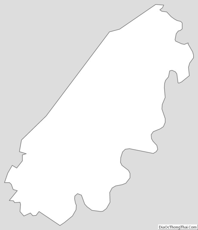
Rhea County Outline Map