Fayette County is a county located in the U.S. state of Tennessee. As of the 2020 census, the population was 41,990. Its county seat is Somerville. The county was named after the Marquis de la Fayette, French hero of the American Revolution. A part of the Memphis, TN-MS-AR Metropolitan Statistical Area, Fayette County is culturally alike to the Mississippi Delta and was a major area of cotton plantations dependent on slave labor in the nineteenth century.
| Name: | Fayette County |
|---|---|
| FIPS code: | 47-047 |
| State: | Tennessee |
| Founded: | September 29, 1824 |
| Named for: | Marquis de Lafayette |
| Seat: | Somerville |
| Largest town: | Oakland |
| Total Area: | 706 sq mi (1,830 km²) |
| Land Area: | 705 sq mi (1,830 km²) |
| Total Population: | 41,990 |
| Population Density: | 56.8/sq mi (21.9/km²) |
| Time zone: | UTC−6 (Central) |
| Summer Time Zone (DST): | UTC−5 (CDT) |
| Website: | fayettetn.us |
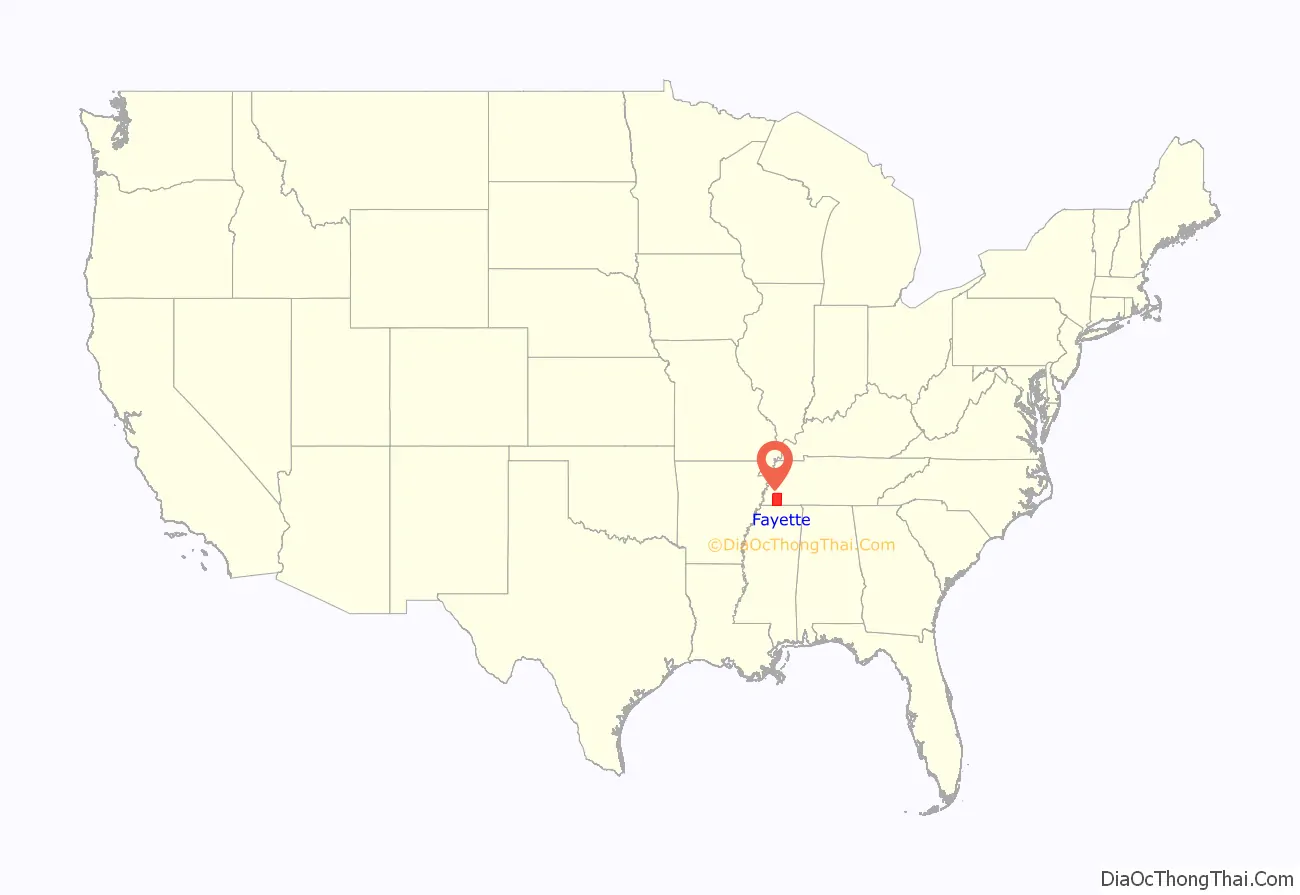
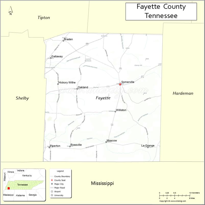
Fayette County location map. Where is Fayette County?
History
Fayette County was established by Tennessee General Assembly in 1824 from the neighboring counties of Shelby and Hardeman. The same year, Somerville was selected as its county seat. The first churches in the county were the First Presbyterian Church in Somerville, established in 1829, and Immanuel Parish, established in 1832.
Herb Parsons 1908–1959) of Somerville, Tennessee, was Winchester’s “Showman Shooter” for 30 years.
Following the emancipation of slaves on plantations, many of Fayette County’s African-American residents worked as sharecroppers. In the 1960s and 1970s, civil rights activists fought for school integration and voting rights; and created tent cities to house displaced tenant farmers who had tried to register to vote.
In recent years, Fayette County has been transitioning from a rural area to accommodate the suburban sprawl from Memphis.
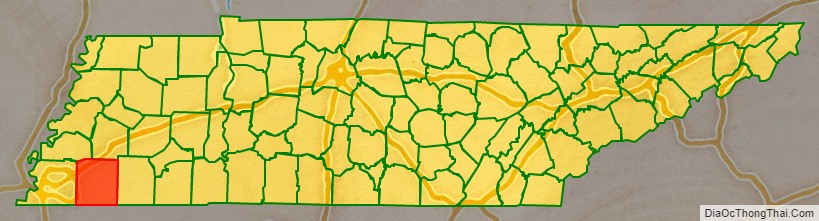
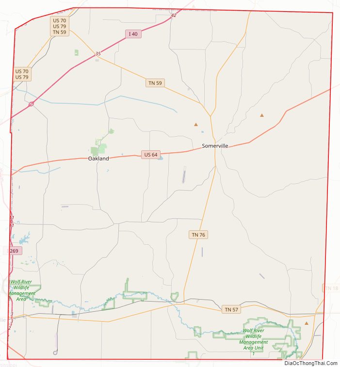
Fayette County Road Map
Geography
According to the U.S. Census Bureau, the county has a total area of 706 square miles (1,830 km), of which 705 square miles (1,830 km) is land and 1.5 square miles (3.9 km) (0.2%) is water. It is the third-largest county in Tennessee by area. The county is, roughly, the same size as Marshall County, Mississippi.
Adjacent counties
- Haywood County (north)
- Hardeman County (east)
- Benton County, Mississippi (southeast)
- Marshall County, Mississippi (south)
- Shelby County (west)
- Tipton County (northwest)
State protected areas
- William B. Clark Conservation Area
- Ghost River State Natural Area
- Piperton Wetland Complex Wildlife Management Area (part)
- Wolf River Wildlife Management Area
- WMA Briggs Tract
- Herb Parsons Lake
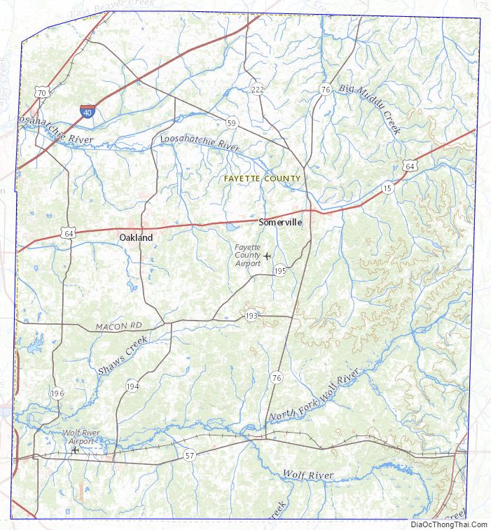
Fayette County Topographic Map
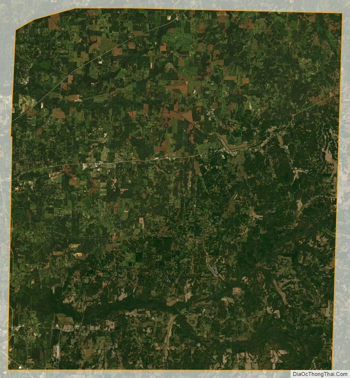
Fayette County Satellite Map
Fayette County Outline Map