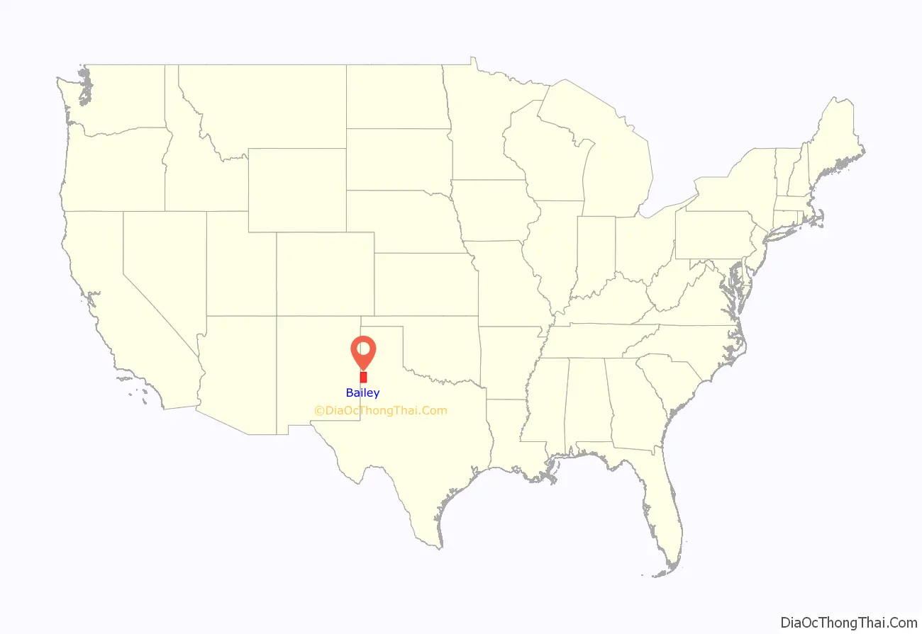
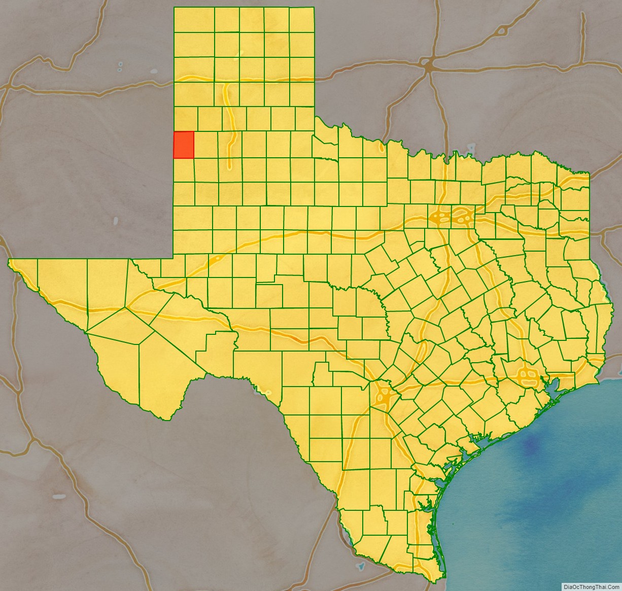
Bailey County is a county located in the U.S. state of Texas. It is in West Texas and its county seat is Muleshoe.
As of the 2020 census, its population was 6,904.
| Name: | Bailey County |
|---|---|
| FIPS code: | 48-017 |
| State: | Texas |
| Founded: | 1919 |
| Named for: | Peter James Bailey |
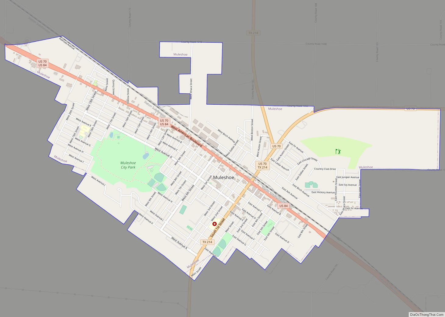
| Seat: | Muleshoe |
| Largest city: | Muleshoe |
| Total Area: | 827 sq mi (2,140 km²) |
| Land Area: | 827 sq mi (2,140 km²) |
| Total Population: | 6,904 |
| Population Density: | 8.3/sq mi (3.2/km²) |
| Time zone: | UTC−6 (Central) |
| Summer Time Zone (DST): | UTC−5 (CDT) |
| Website: | www.co.bailey.tx.us |
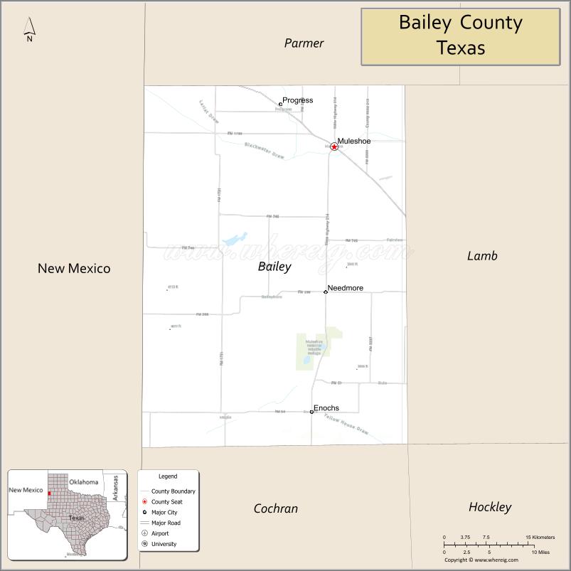
Bailey County location map. Where is Bailey County?
History
In 1876, the Texas Legislature established Bailey County from portions of Bexar County, naming it for Peter James Bailey, a defender of the Alamo. (See List of Texas county name etymologies.) The county organized in 1919.
Bailey County history is highlighted in the Muleshoe Heritage Center located off U.S. Highways 70 and 64 in Muleshoe. The Muleshoe National Wildlife Refuge was founded in 1935 and is the oldest such refuge in Texas.
Bailey County once was one of 30 prohibition or entirely dry counties in Texas, but is now a wet county.
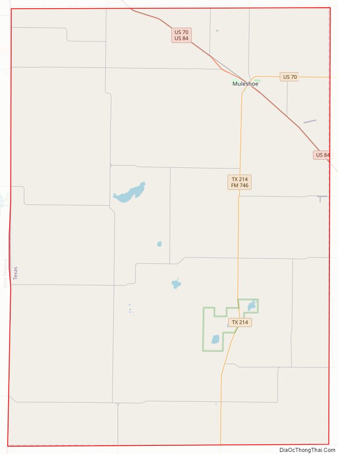
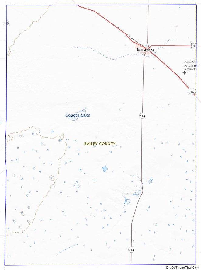
Bailey County Road Map
Geography
According to the U.S. Census Bureau, the county has a total area of 827 sq mi (2,140 km), of which 0.7 sq mi (1.8 km) (0.08%) is covered by water.
Major highways
- U.S. Highway 70
- U.S. Highway 84
- State Highway 214
Adjacent counties
- Parmer County (north)
- Lamb County (east)
- Hockley County (southeast)
- Cochran County (south)
- Roosevelt County, New Mexico (west/Mountain Time Zone)
- Curry County, New Mexico (northwest/Mountain Time Zone)
National protected areas
- Grulla National Wildlife Refuge (part)
- Muleshoe National Wildlife Refuge
Bailey County Topographic Map
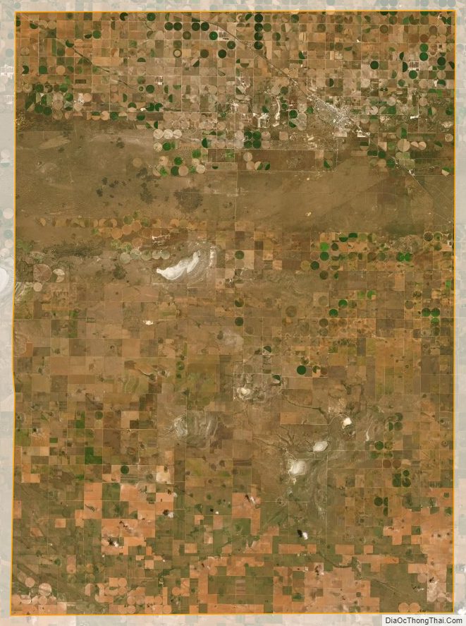
Bailey County Satellite Map
Bailey County Outline Map