Brown County is a county in west-central Texas. As of the 2020 census, the population was 38,095. Its county seat is Brownwood. The county was founded in 1856 and organized in 1858. It is named for Henry Stevenson Brown, a commander at the Battle of Velasco, an early conflict between Texians and Mexicans.
The Brownwood, TX Micropolitan Statistical Area includes all of Brown County.
| Name: | Brown County |
|---|---|
| FIPS code: | 48-049 |
| State: | Texas |
| Founded: | 1858 |
| Named for: | Henry Stevenson Brown |
| Seat: | Brownwood |
| Largest city: | Brownwood |
| Total Area: | 957 sq mi (2,480 km²) |
| Land Area: | 944 sq mi (2,440 km²) |
| Total Population: | 38,095 |
| Population Density: | 40/sq mi (15/km²) |
| Time zone: | UTC−6 (Central) |
| Summer Time Zone (DST): | UTC−5 (CDT) |
| Website: | www.browncountytx.org |
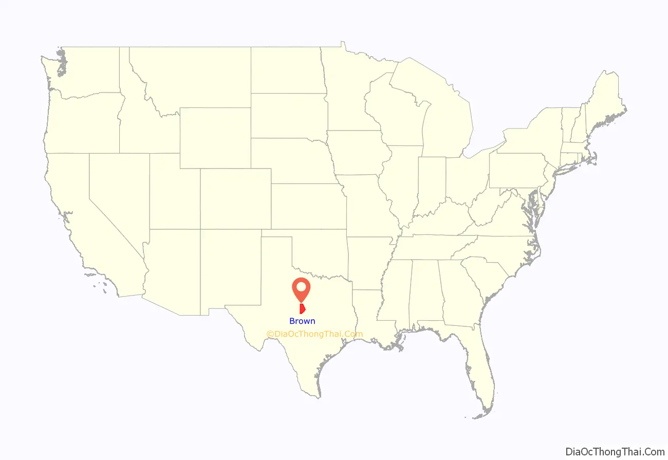
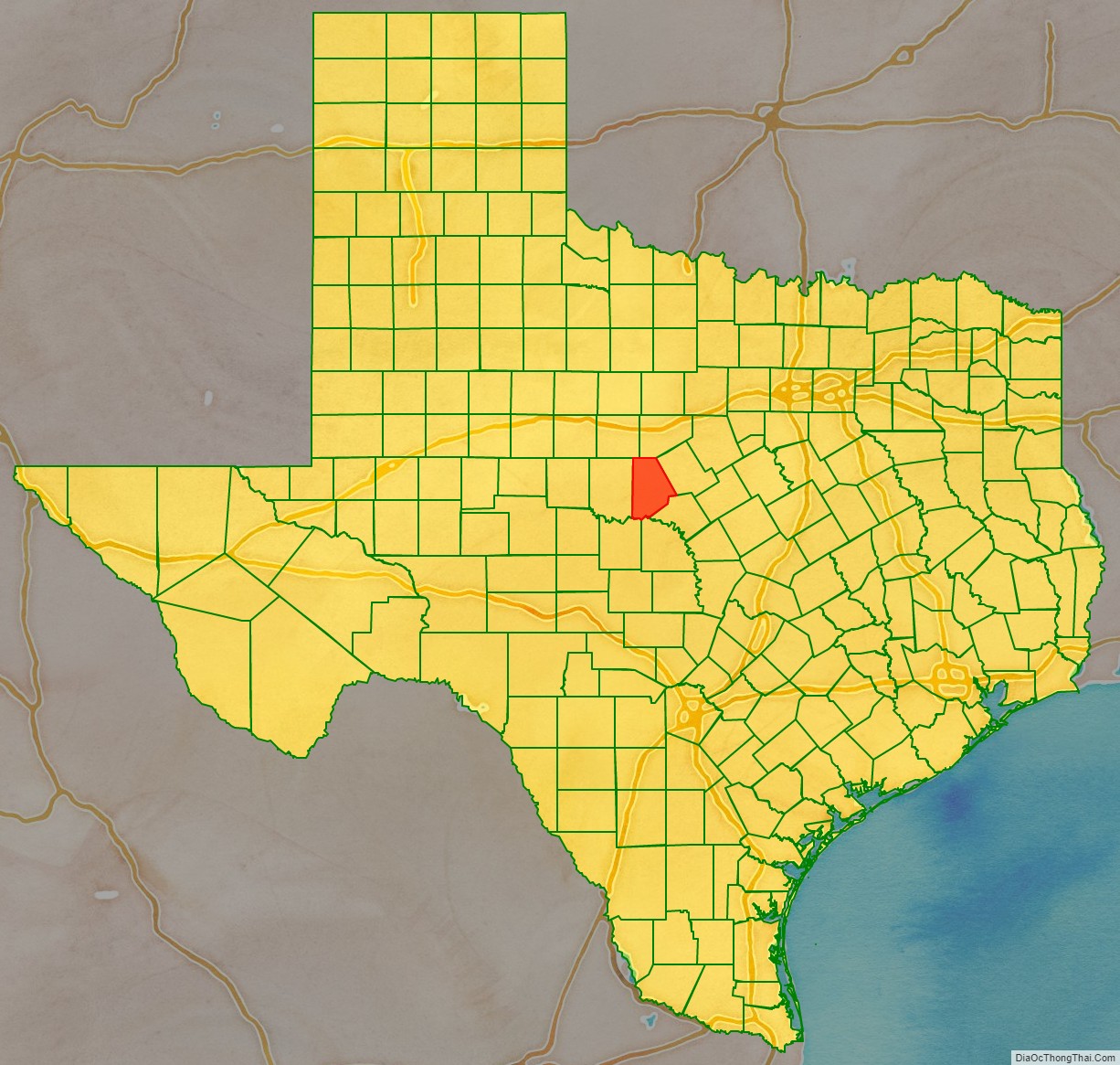
Brown County location map. Where is Brown County?
History
Indigenous peoples lived here for thousands of years before Europeans entered the area. The historic inhabitants were the Penteka (also known to the Europeans as Comanche), who occupied this area at the time of European colonization. In 1721, the Marqués de San Miguel de Aguayo expedition is said to have passed through the county.
In 1838, land surveys were made of the area. In 1856, Welcome W. Chandler from Mississippi became the first settler, arriving with his family, John H. Fowler, and seven slaves. They built a log cabin on Pecan Bayou. The county was formed from Comanche and Travis Counties. It is named after Henry Stevenson Brown, an American pioneer from Kentucky. In 1858, the county was formally organized. Brownwood was designated as the county seat.
In 1874, John Wesley Hardin and gang celebrated his 21st birthday in Brown and Comanche Counties. Deputy Charles Webb drew his gun, provoking a gunfight that ended Webb’s life. A lynch mob was formed, but Hardin and his family were put into protective custody. The mob broke into the jail and hanged his brother Joe and two cousins. Hardin fled. The Fort Worth-Brownwood stage was robbed five times in two months of 1875. Oil was discovered on the H. M. Barnes farm near Grosvenor in 1879. Texas Rangers killed two fence cutters in 1886, in the ongoing battle between farmers and ranchers over fencing open range. By the next year, cotton had become the county’s most important crop. Pulitzer-Prize winner Katherine Ann Porter was born in 1890 at Indian Creek. The Fort Worth and Rio Grande Railway was built to the county in 1892. The Gulf, Colorado and Santa Fe Railway was built into Brownwood in 1895. In 1903, the GC&SF extended the line to Menard.
Also in 1903, the county voted itself a dry county. Alcohol did not become legal again until the 1950s.
In 1909, the boll weevil moved into the county, destroying the cotton economy. The first commercial production of oil came from the efforts of Jack Pippen at Brownwood in 1917. The first large field began producing from a depth of 1,100 feet (340 m) in 1919 near Cross Cut. In 1926, an oil boom followed the success of the White well on Jim Ned Creek; some 600 wells were drilled in several fields in the county during this time. By 1991, more than 50,561,000 barrels (8,038,600 m) of oil had been taken from Brown County lands since 1917.
In 1940, work began on Camp Bowie. The first German prisoners of war arrived in 1943; many had been members of Erwin Rommel’s Afrika Korps.
In 1889, Howard Payne College and Daniel Baker College were established in Brownwood. They combined under the name Howard Payne College in 1953.
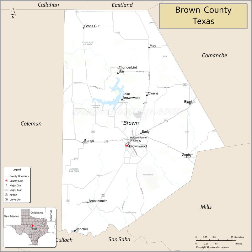
Brown County Road Map

Geography
According to the U.S. Census Bureau, the county has a total area of 957 sq mi (2,480 km), of which 13 sq mi (34 km) (1.3%) are covered by water.
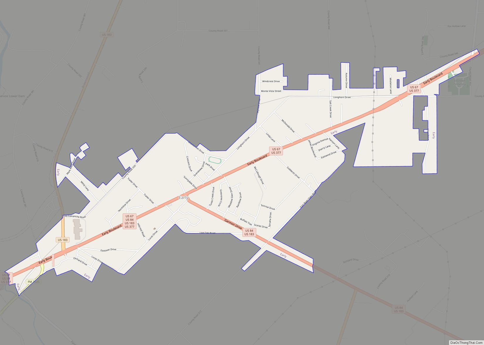
Major highways
- U.S. Highway 67
- U.S. Highway 84
- U.S. Highway 183
- U.S. Highway 377
- State Highway 279
- Farm to Market Road 45
Adjacent counties
- Eastland County (north)
- Comanche County (northeast)
- Mills County (southeast)
- San Saba County (south)
- McCulloch County (southwest)
- Coleman County (west)
- Callahan County (northwest)
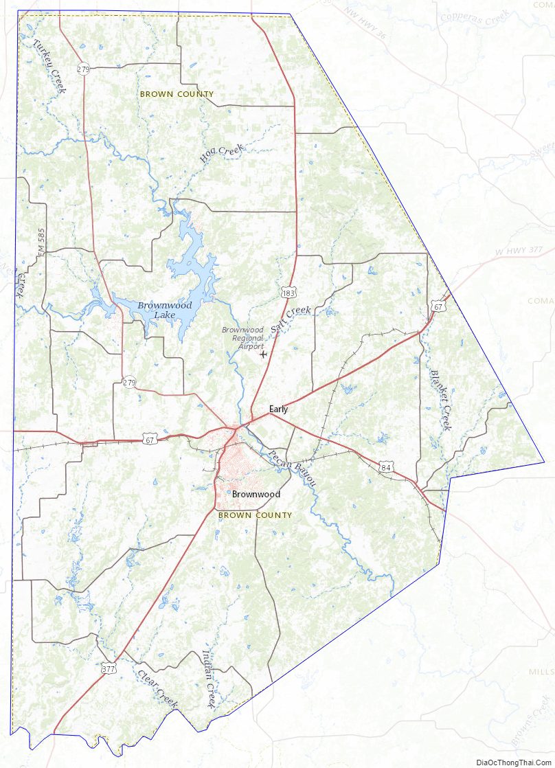
Brown County Topographic Map
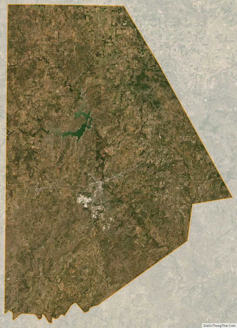
Brown County Satellite Map
Brown County Outline Map