Map of Albion town, Indiana

Map of Albion town, Indiana

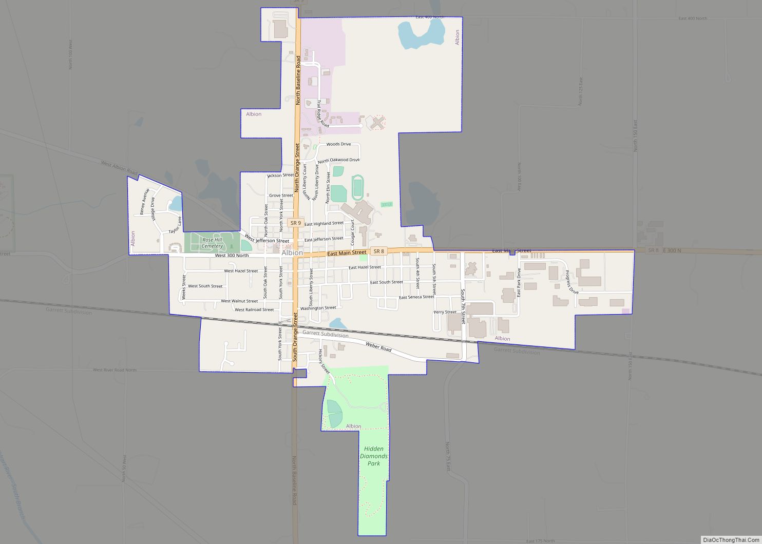
Albion is a town in Albion and Jefferson townships, Noble County, in the U.S. state of Indiana. The population was 2,349 at the 2010 census. The city is the county seat of Noble County. Albion town overview: Name: Albion town LSAD Code: 43 LSAD Description: town (suffix) State: Indiana County: Noble County Elevation: 955 ft (291 m) … Read more

Map of Ambia town

Map of Ambia town

Ambia is a town in Hickory Grove Township, Benton County, Indiana, United States. The population was 239 at the 2010 census. It is part of the Lafayette, Indiana Metropolitan Statistical Area. Ambia town overview: Name: Ambia town LSAD Code: 43 LSAD Description: town (suffix) State: Indiana County: Benton County Founded: 1875 Elevation: 738 ft (225 m) Total … Read more

Map of Altona town, Indiana

Map of Altona town, Indiana

Altona is a town in Keyser Township, DeKalb County, Indiana, United States. The population was 197 at the 2010 census. Altona town overview: Name: Altona town LSAD Code: 43 LSAD Description: town (suffix) State: Indiana County: DeKalb County Elevation: 899 ft (274 m) Total Area: 0.20 sq mi (0.53 km²) Land Area: 0.20 sq mi (0.53 km²) Water Area: 0.00 sq mi (0.00 km²) Total Population: … Read more

Map of Alton town, Indiana

Map of Alton town, Indiana

Alton is a town in Boone Township, Crawford County, Indiana, United States. The population was 29 at the 2020 census. Alton town overview: Name: Alton town LSAD Code: 43 LSAD Description: town (suffix) State: Indiana County: Crawford County Elevation: 427 ft (130 m) Total Area: 0.20 sq mi (0.51 km²) Land Area: 0.17 sq mi (0.45 km²) Water Area: 0.03 sq mi (0.06 km²) Total Population: … Read more

Map of Amo town

Map of Amo town

Amo is a town in Clay Township, Hendricks County, Indiana, United States. The population was 401 at the 2010 census. Amo town overview: Name: Amo town LSAD Code: 43 LSAD Description: town (suffix) State: Indiana County: Hendricks County Elevation: 823 ft (251 m) Total Area: 0.61 sq mi (1.58 km²) Land Area: 0.61 sq mi (1.58 km²) Water Area: 0.00 sq mi (0.00 km²) Total Population: … Read more

Map of Americus CDP, Indiana

Map of Americus CDP, Indiana

Americus is a small census-designated place in Washington Township, Tippecanoe County, in the U.S. state of Indiana. The community is part of the Lafayette, Indiana Metropolitan Statistical Area. Americus CDP overview: Name: Americus CDP LSAD Code: 57 LSAD Description: CDP (suffix) State: Indiana County: Tippecanoe County Elevation: 558 ft (170 m) Total Area: 1.29 sq mi (3.35 km²) Land Area: … Read more

Map of Amboy town, Indiana

Map of Amboy town, Indiana

Amboy is a town in Jackson Township, Miami County, in the U.S. state of Indiana. The population was 317 at the 2020 census, down from 384 in 2010. Amboy town overview: Name: Amboy town LSAD Code: 43 LSAD Description: town (suffix) State: Indiana County: Miami County Elevation: 817 ft (249 m) Total Area: 0.34 sq mi (0.87 km²) Land Area: … Read more

Map of Andrews town, Indiana

Map of Andrews town, Indiana

Andrews is a town in Dallas Township, Huntington County, Indiana, United States. The population was 1,048 at the 2020 census. Andrews town overview: Name: Andrews town LSAD Code: 43 LSAD Description: town (suffix) State: Indiana County: Huntington County Elevation: 712 ft (217 m) Total Area: 0.64 sq mi (1.66 km²) Land Area: 0.63 sq mi (1.64 km²) Water Area: 0.01 sq mi (0.02 km²) Total Population: … Read more

Map of Anderson city, Indiana

Map of Anderson city, Indiana

Anderson is a city in Madison County, Indiana, United States. Named after Chief William Anderson, it is the county seat of Madison County. The city is the headquarters of the Church of God (Anderson) and home of Anderson University, which is affiliated with the Church of God. Highlights of the city include the historic Paramount … Read more

Map of Angola city

Map of Angola city, Indiana

Angola is a city in Pleasant Township, Steuben County, Indiana, United States. The population was 8,612 at the 2010 census. The city is the county seat of Steuben County. Angola was founded by Thomas Gale and Cornelius Gilmore on June 28, 1838, and is home to Trine University. The town is served by I-69 and … Read more

Map of Arlington CDP, Indiana

Map of Arlington CDP, Indiana

Arlington is an unincorporated community in Posey Township, in the northwestern part of Rush County, Indiana, United States. It lies just south of the B&O Railroad, on U.S. Route 52, 8 miles west of Rushville. The elevation is 922 feet (281 m). Arlington CDP overview: Name: Arlington CDP LSAD Code: 57 LSAD Description: CDP (suffix) State: … Read more

Map of Argos town

Map of Argos town

Argos is a town in Green and Walnut townships, Marshall County, Indiana, United States. The population was 1,777 at the 2020 census. Argos town overview: Name: Argos town LSAD Code: 43 LSAD Description: town (suffix) State: Indiana County: Marshall County Elevation: 728 ft (222 m) Total Area: 1.30 sq mi (3.36 km²) Land Area: 1.29 sq mi (3.33 km²) Water Area: 0.01 sq mi (0.03 km²) … Read more