Ambia is a town in Hickory Grove Township, Benton County, Indiana, United States. The population was 239 at the 2010 census. It is part of the Lafayette, Indiana Metropolitan Statistical Area.
| Name: | Ambia town |
|---|---|
| LSAD Code: | 43 |
| LSAD Description: | town (suffix) |
| State: | Indiana |
| County: | Benton County |
| Founded: | 1875 |
| Elevation: | 738 ft (225 m) |
| Total Area: | 0.15 sq mi (0.39 km²) |
| Land Area: | 0.15 sq mi (0.39 km²) |
| Water Area: | 0.00 sq mi (0.00 km²) |
| Total Population: | 227 |
| Population Density: | 1,503.31/sq mi (580.60/km²) |
| ZIP code: | 47917 |
| Area code: | 765 |
| FIPS code: | 1801342 |
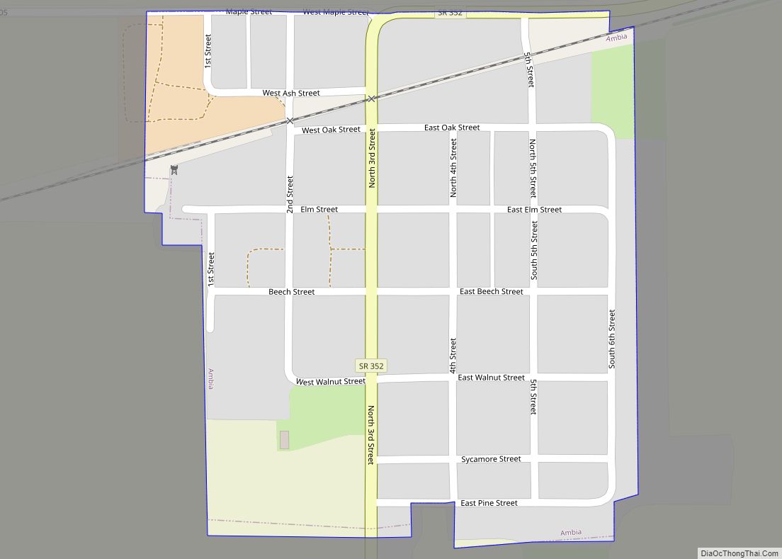
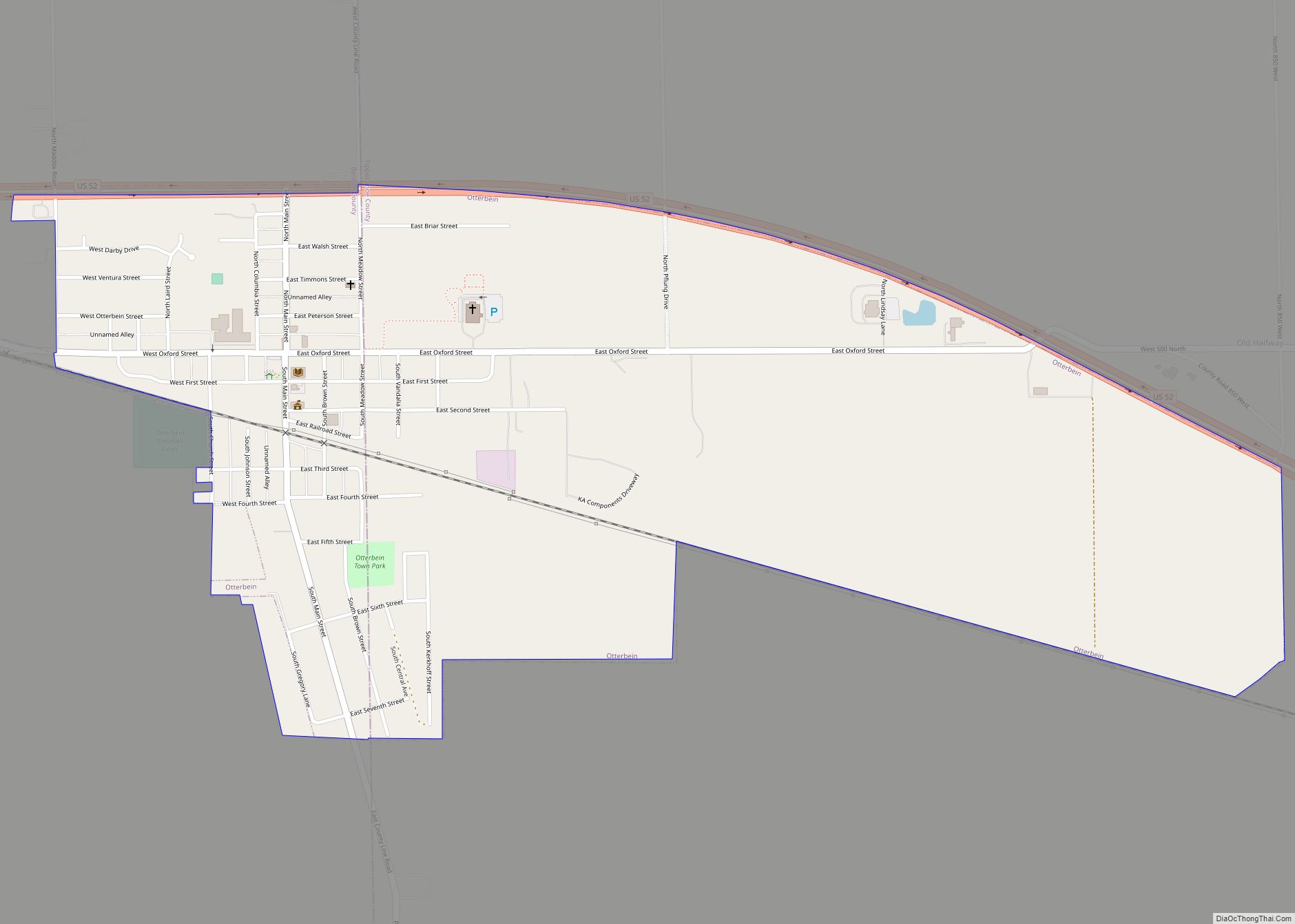
Online Interactive Map
Click on ![]() to view map in "full screen" mode.
to view map in "full screen" mode.
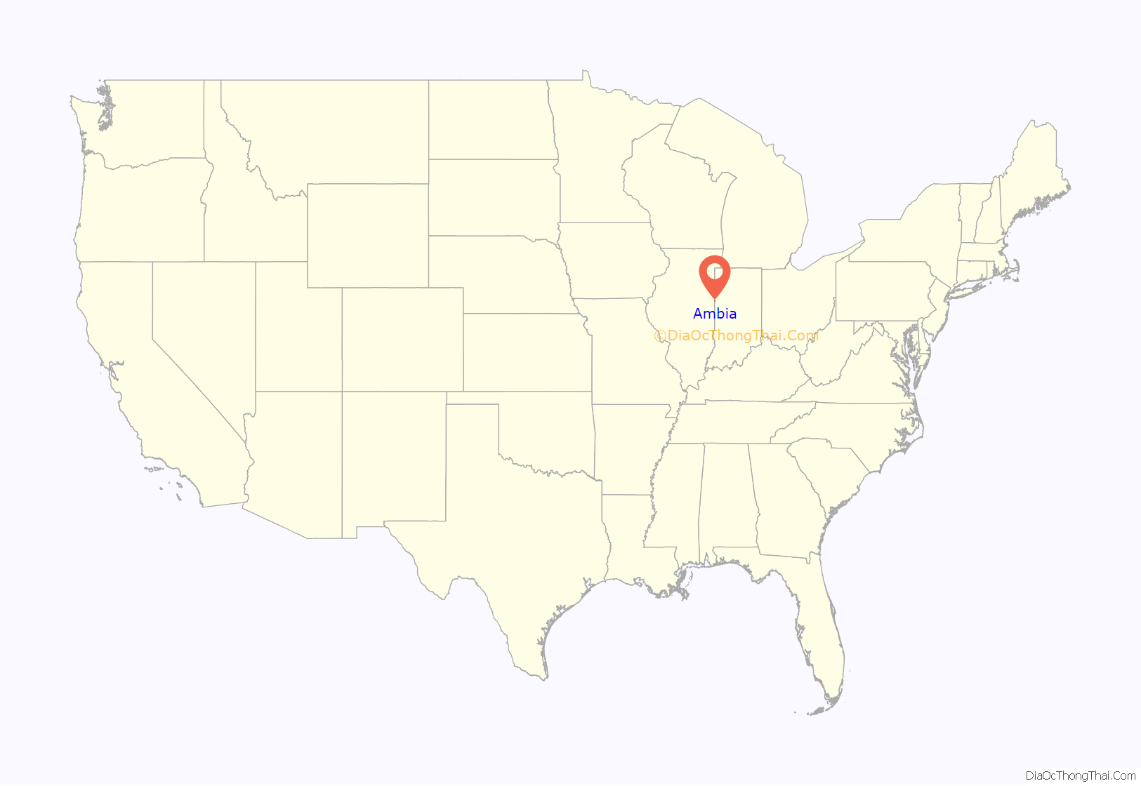
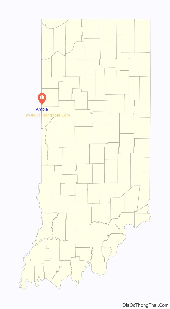
Ambia location map. Where is Ambia town?
History
Ambia was laid out by Ezekiel M. Talbot and his wife Marietta on February 22, 1875, and named for their daughter Ambia Talbot. (The couple had two years earlier planned the nearby town of Talbot.) Its first building was a house erected by James C. Pugh which was soon joined by a grain elevator, general store and blacksmith. A drug store, hardware store, hotel, physician and a variety of other establishments followed.
Ambia was a stop on the Lafayette, Muncie and Bloomington Railroad (later the Lake Erie and Western) which ran between Lafayette and Hoopeston. The Wabash Railway Company, which built a stretch of the LM&B through Illinois, originally wanted to construct a railway switch at a site known as Weaver City, a small town just west of Ambia in Vermilion County, Illinois; the owner of the property, however, refused to grant land for it. In response, the railway officials sent a force of men without notice to move the station house from Weaver City half a mile east across the state border, which they did on the Sunday morning of March 10, 1873. The town’s businesses and residents followed and Weaver City faded from existence while Ambia sprang up near the station’s new site.
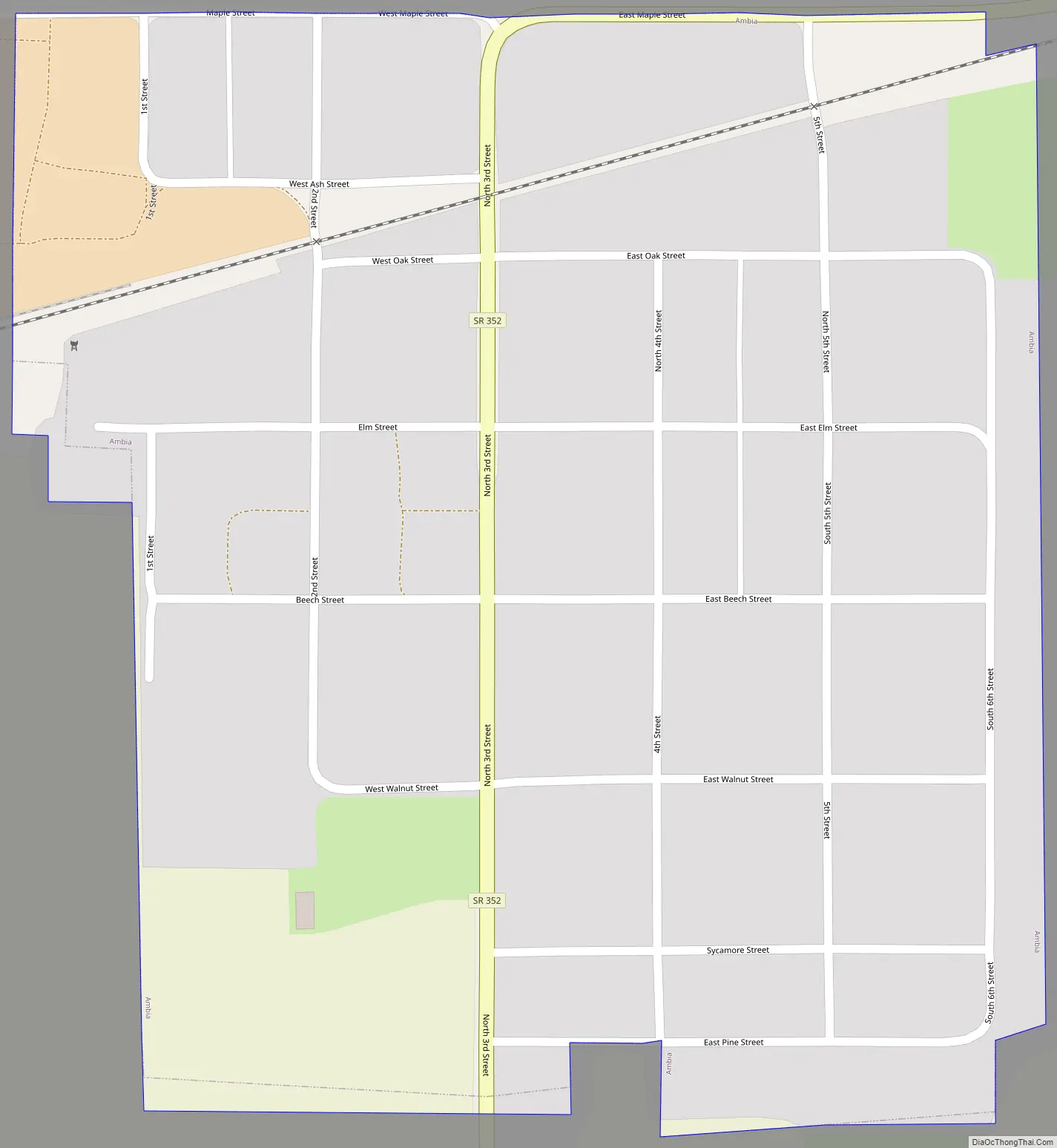
Ambia Road Map
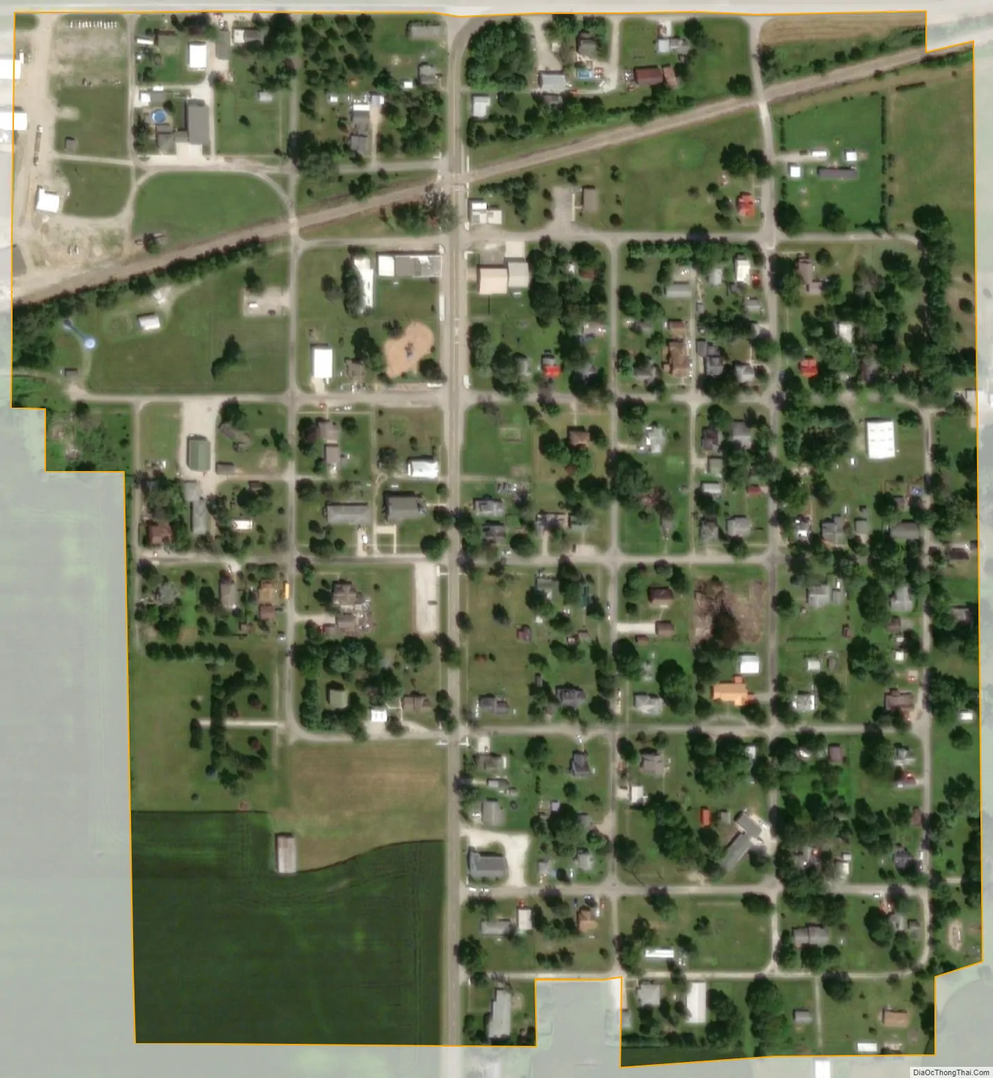
Ambia city Satellite Map
Geography
Ambia is located in the extreme southwest corner of the county, in Hickory Grove Township. The Kankakee, Beaverville and Southern Railroad and Indiana State Road 352 pass through the town, and the upper end of the North Fork of the Vermilion River flows past one mile to the north.
According to the 2010 census, Ambia has a total area of 0.15 square miles (0.39 km), all land.
See also
Map of Indiana State and its subdivision:- Adams
- Allen
- Bartholomew
- Benton
- Blackford
- Boone
- Brown
- Carroll
- Cass
- Clark
- Clay
- Clinton
- Crawford
- Daviess
- De Kalb
- Dearborn
- Decatur
- Delaware
- Dubois
- Elkhart
- Fayette
- Floyd
- Fountain
- Franklin
- Fulton
- Gibson
- Grant
- Greene
- Hamilton
- Hancock
- Harrison
- Hendricks
- Henry
- Howard
- Huntington
- Jackson
- Jasper
- Jay
- Jefferson
- Jennings
- Johnson
- Knox
- Kosciusko
- LaGrange
- Lake
- Lake Michigan
- LaPorte
- Lawrence
- Madison
- Marion
- Marshall
- Martin
- Miami
- Monroe
- Montgomery
- Morgan
- Newton
- Noble
- Ohio
- Orange
- Owen
- Parke
- Perry
- Pike
- Porter
- Posey
- Pulaski
- Putnam
- Randolph
- Ripley
- Rush
- Saint Joseph
- Scott
- Shelby
- Spencer
- Starke
- Steuben
- Sullivan
- Switzerland
- Tippecanoe
- Tipton
- Union
- Vanderburgh
- Vermillion
- Vigo
- Wabash
- Warren
- Warrick
- Washington
- Wayne
- Wells
- White
- Whitley
- Alabama
- Alaska
- Arizona
- Arkansas
- California
- Colorado
- Connecticut
- Delaware
- District of Columbia
- Florida
- Georgia
- Hawaii
- Idaho
- Illinois
- Indiana
- Iowa
- Kansas
- Kentucky
- Louisiana
- Maine
- Maryland
- Massachusetts
- Michigan
- Minnesota
- Mississippi
- Missouri
- Montana
- Nebraska
- Nevada
- New Hampshire
- New Jersey
- New Mexico
- New York
- North Carolina
- North Dakota
- Ohio
- Oklahoma
- Oregon
- Pennsylvania
- Rhode Island
- South Carolina
- South Dakota
- Tennessee
- Texas
- Utah
- Vermont
- Virginia
- Washington
- West Virginia
- Wisconsin
- Wyoming